
Stanfords
United Kingdom
- Ancash
- One of the titles in a series of maps of the administrative departments of Peru, with topography shown by altitude colouring and spot heights. Most maps also indicate cultivated areas. Scales vary considerably, given different sizes of the departments. Railways and four different types of roads and dirt tracks are shown, as well as local... Read more
Stanfords
United Kingdom
- Huanuco
- One of the titles in a series of maps of the administrative departments of Peru, with topography shown by altitude colouring and spot heights. Most maps also indicate cultivated areas. Scales vary considerably, given different sizes of the departments. Railways and four different types of roads and dirt tracks are shown, as well as local... Read more
Stanfords
United Kingdom
- Tacna
- One of the titles in a series of maps of the administrative departments of Peru, with topography shown by altitude colouring and spot heights. Most maps also indicate cultivated areas. Scales vary considerably, given different sizes of the departments. Railways and four different types of roads and dirt tracks are shown, as well as local... Read more

Stanfords
United Kingdom
- Admiralty Chart 3084 - Ports on the Coast of Peru
- Plans included:Bahia Pisco 1:100,000Matarani 1:10,000Admiralty standard nautical charts comply with Safety of Life at Sea (SOLAS) regulations and are ideal for professional, commercial and recreational use. Charts within the series consist of a range of scales, useful for passage planning, ocean crossings, coastal navigation and entering... Read more
Stanfords
United Kingdom
- Ayacucho
- One of the titles in a series of maps of the administrative departments of Peru, with topography shown by altitude colouring and spot heights. Most maps also indicate cultivated areas. Scales vary considerably, given different sizes of the departments. Railways and four different types of roads and dirt tracks are shown, as well as local... Read more
Stanfords
United Kingdom
- Junin
- One of the titles in a series of maps of the administrative departments of Peru, with topography shown by altitude colouring and spot heights. Most maps also indicate cultivated areas. Scales vary considerably, given different sizes of the departments. Railways and four different types of roads and dirt tracks are shown, as well as local... Read more
Stanfords
United Kingdom
- Tumbes
- One of the titles in a series of maps of the administrative departments of Peru, with topography shown by altitude colouring and spot heights. Most maps also indicate cultivated areas. Scales vary considerably, given different sizes of the departments. Railways and four different types of roads and dirt tracks are shown, as well as local... Read more
Stanfords
United Kingdom
- Lima
- One of the titles in a series of maps of the administrative departments of Peru, with topography shown by altitude colouring and spot heights. Most maps also indicate cultivated areas. Scales vary considerably, given different sizes of the departments. Railways and four different types of roads and dirt tracks are shown, as well as local... Read more
Stanfords
United Kingdom
- La Libertad
- One of the titles in a series of maps of the administrative departments of Peru, with topography shown by altitude colouring and spot heights. Most maps also indicate cultivated areas. Scales vary considerably, given different sizes of the departments. Railways and four different types of roads and dirt tracks are shown, as well as local... Read more
Stanfords
United Kingdom
- Ucayali
- One of the titles in a series of maps of the administrative departments of Peru, with topography shown by altitude colouring and spot heights. Most maps also indicate cultivated areas. Scales vary considerably, given different sizes of the departments. Railways and four different types of roads and dirt tracks are shown, as well as local... Read more

Stanfords
United Kingdom
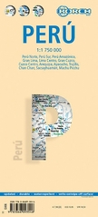
- Peru Borch
- Laminated, waterproof tourist map of Peru with street plans of Lima, Cuzco, Arequipa, Ayacucho and Trujillo, plus plans of the main archaeological sites. The map is double-sided, dividing the main part of the country north/south at 1:1,750,000, with the Amazon region shown at 1:2,500,000. Bold hill-shading indicates the relief, with selected... Read more
De Zwerver
Netherlands
- Wegenkaart - landkaart Peru | Borch
- Laminated, waterproof tourist map of Peru with street plans of Lima, Cuzco, Arequipa, Ayacucho and Trujillo, plus plans of the main archaeological sites. The map is double-sided, dividing the main part of the country north/south at 1:1,750,000, with the Amazon region shown at 1:2,500,000. Bold hill-shading indicates the relief, with selected... Read more
Stanfords
United Kingdom
- Cusco
- One of the titles in a series of maps of the administrative departments of Peru, with topography shown by altitude colouring and spot heights. Most maps also indicate cultivated areas. Scales vary considerably, given different sizes of the departments. Railways and four different types of roads and dirt tracks are shown, as well as local... Read more
Stanfords
United Kingdom
- Lambayeque
- One of the titles in a series of maps of the administrative departments of Peru, with topography shown by altitude colouring and spot heights. Most maps also indicate cultivated areas. Scales vary considerably, given different sizes of the departments. Railways and four different types of roads and dirt tracks are shown, as well as local... Read more

Stanfords
United Kingdom
- Peru - Ecuador IGN 86170
- Un grand nombre d?informations touristiques et routières, pour une carte que vous trouverez très vite indispensable lors de votre voyage. Read more
Stanfords
United Kingdom
- Arequipa
- One of the titles in a series of maps of the administrative departments of Peru, with topography shown by altitude colouring and spot heights. Most maps also indicate cultivated areas. Scales vary considerably, given different sizes of the departments. Railways and four different types of roads and dirt tracks are shown, as well as local... Read more