
Italy
Description

Italy is a country of enormous diversity and contrast. Most famous are the Alps. Coming from the efficient neatness of Switzerland or Austria, the Italian Alps are wilder and at the same time more tranquil, like stepping back in time. The most beautiful and popular areas are Gran Paradiso, Val Grande, Stelvio and the Dolomites.
In addition there are countless national parks, all very much worth hiking through. A series of mountain ranges runs from north to south like a backbone, starting from the hills of Tuscany, to the Apennines and Abruzzo to Italy's toe, Calabria. Southern Italy, too far for many tourists, has several attractive hiking regions, like Pollino and Aspromonte.
In the Alps you can walk from hut to hut, elsewhere you can do day hikes, such is the rule in general. However some genuine long distance hiking trails are under construction. European long distance trail E10 in the Alps, which coincides with the 1000km long Grande Alpine Trail and the international Via Alpina. The second large project is the E1, which coincides with the Grand Apennine Mountains Trail and the Ligurian Mountains High Trail. If this trail is ever completed, you can start from Como passing Genova and continue all the way to Reggio di Calabria and Palermo or Siracuse on Sicily. The third large project means to join all these trails into one 6000km long Sentiero Italia. Last but not least, there is the Alta Via in the Dolomites: splendid walking.
Mountain huts abound in the Alps. Hiking can be done all summer, from June until well into October. Further south spring is the best hiking season. In April you will still get stuck in the snow up in the mountains. Autumn is supposed to be fine as well, but alas, as one hiker put it: "you wake up to the sounds of church bells and gunfire". As hunters, Italians are best avoided.
Map


Trails
- Alta Via dei GigantiGPX
- Alta Via dei Monti LiguriGPX
- Alta Via Della Valle d'Aosta No 1
- Alta Via Della Valle d'Aosta No 2
- Alta Via Dolomiti 1GPX
- Alta Via Dolomiti 10
- Alta Via Dolomiti 2GPX
- Alta Via Dolomiti 3GPX
- Alta Via Dolomiti 4GPX
- Alta Via Dolomiti 5
- Alta Via Dolomiti 6GPX
- Alta Via Dolomiti 7
- Alta Via Dolomiti 8
- Alta Via Dolomiti 9
- Bassa Via del GardaGPX
- Cinque Terre
- E1GPX
- E10GPX
- E12GPX
- E5GPX
- E7GPX
- Florence - Siena
- GoethewegGPX
- GR58 - Tour du QueyrasGPX
- Grande Escursione AppenninicaGPX
- Grande Traversata del Gran Paradiso
- Grande Traversata delle AlpiGPX
- Meraner HöhenwegGPX
- Pfunderer HöhenwegGPX
- Santiago de Compostela Pilgrims WayGPX
- Südalpenweg - 3GPX
- SeealpentourGPX
- Sentiero della PaceGPX
- Sentiero ItaliaGPX
- Sentiero Roma
- Tiroler Höhenweg
- TMB - Tour du Mont BlancGPX
- Tour des CombinsGPX
- Tour des Grands Barrages
- Tour du MatterhornGPX
- Tour Monte RosaGPX
- Traumpfad München-VenedigGPX
- Via AlpinaGPX
- Via FrancigenaGPX
- Via SacraGPX
- Via SbrinzGPX
- Via SplugaGPX
- Via ValtellinaGPX
Regions
- Abruzzi
- Adamello
- Aeolian Islands
- Alpi Biellesi e Cusiane
- Alpi di Livigno
- Alpi Liguri
- Alpi Marittime
- Alpi Oróbie e Bergamasche
- Alpi Sarentini
- Alpi Vicentine
- Alps
- Amalfi Coast
- Appennini
- Apulia
- Ötztal
- Bernina
- Brenta
- Calabria
- Cilento
- Defereggengebirge
- Dolomiti
- Dolomiti di Fiemme
- Elba
- Friuli
- Garda
- Gran Paradiso
- Grand Combin
- Julische Alpen
- Karawanken
- Karnischer Alpen
- Lago di Como
- Lago Maggiore
- Liguria
- Lombardia
- Matterhorn
- Moncenisio
- Monginevro
- Mont Blanc
- Monte Leone
- Monte Rosa
- Monti Sibillini
- Monviso
- Nonstaler Alpen
- Ortler
- Paganella
- Platta Gruppe
- Presanella
- Rieserfernergruppe
- Sardinia
- Südtirol
- Sesvenna Gruppe
- Sicilia
- Sobretta
- Stelvio
- Stubai
- Texelgruppe
- Tirol
- Toscana
- Trentino
- Umbria
- Val d'Aosta
- Val Grande
- Val Venosta
- Valle d'Aosta
- Veneto
- Vinschgau
- Zillertal
Mountains


Links
Facts
Reports
Guides and maps
Lodging
Organisations
Tour operators
GPS
Other
Books

United Kingdom
2015
- Italian Lakes Walking: Garda, Maggiore, Como and Iseo
- This guidebook describes 50 walks around Lakes Como, Iseo, Garda and Maggiore in Northern Italy. The picturesque routes are accessible by public transport from popular centres including Bellagio, Riva, Stresa and Cannero, and range from 2 to 14km in length. There are gentle lakeside strolls, and numerous ridge routes and traverses as well as... Read more

United Kingdom
- Touring the Italian Front 1917-1919
- The guide describes the ground and operations covered by the British, French and US Expeditionary Forces deployed from France to the area north of Venice between November 1917 and Spring 1919. These forces supported the Italians after their disastrous defeat at Caporetto and helped stem the Austrian and German onslaught. This is the first guide... Read more

United Kingdom
- Grove
- An unnamed narrator, recently bereaved, travels to Olevano, a small village southeast of Rome. It is winter, and from her temporary residence on a hill between village and cemetery, she embarks on walks and outings, exploring the banal and the sublime with equal dedication and intensity. She recalls her travels in 1970s Italy, which she often... Read more

United Kingdom
- Walking in Italy
- Walking in Italy is a unique guide written for those who want to experience the delights of Italy’s finest towns cities and landscapes. The best way to appreciate Italy is undoubtedly on foot, whether you are visiting a city for the first time or venturing out into the Italian countryside. You don’t need to be an athlete to enjoy a... Read more

United Kingdom
- Bolzano and Environs Kompass 54
- Map No. 54, Bolzano and Environs, from Kompass, printed on waterproof and tear-resistant synthetic paper in a series of walking maps of selected areas of Italy at 1:50,000, with hiking routes on a topographic base, various types of accommodation, recreational facilities, places of interest, etc. Kompass are Europe’s largest publishers of... Read more

United Kingdom
- Cortina d`Ampezzo Kompass 55
- Map No. 55, Cortina d`Ampezzo - with a panorama map on the reverse, from Kompass, printed on sturdy, waterproof and tear-resistant synthetic paper in their series of walking maps of selected areas of Italy at 1:50,000, with hiking routes on a topographic base, various types of accommodation, recreational facilities, places of interest, etc.... Read more

United Kingdom
- Pale di San Martino - Primiero San Martino di Castrozza - Paneveggio - Valle del Vanoi Kompass 622
- Pale di S.Martino - Fiera di Primiero - Panaveggio - Valle del Vanoi area at 1:25,000 on a durable, waterproof and tear-resistant map from Kompass in their series of detailed maps of the Dolomites.CARTOGRAPHY: Kompass maps of the Dolomites at 1:25,000 have contours at 25-m intervals. An overprint shows local and long-distance footpaths,... Read more


United Kingdom
2021
- Lonely Planet Best Day Walks Italy
- Lonely Planet`s Best Day Walks Italy is your passport to 60 easy escapes into nature. Stretch your legs outside the city by picking a hike that works for you, from just a couple of hours to a full day, from easy to hard. Hike the Dolomites, explore the Italian Lakes, and stroll Sardinia`s coast. Get to the heart of Italy and begin your journey... Read more
- Also available from:
- The Book Depository, United Kingdom
- De Zwerver, Netherlands


United Kingdom
2018
- Florence Walks
- Explore Florence on foot with these wonderful and insightful routes. Plan your time with the unique bird`s-eye view illustrations that capture the spirit of this amazing city. Following these walks is like being shown around the city by an exceptionally knowledgeable friend. They`re fun and they`ll help you fit it all together. And you`ll... Read more
- Also available from:
- The Book Depository, United Kingdom
- De Zwerver, Netherlands


United Kingdom
2015
- The Way of St Francis
- Via di Francesco: From Florence to Assisi and Rome Read more
- Also available from:
- De Zwerver, Netherlands

Netherlands
2019
- Wandelgids - Pelgrimsroute The Way of St Francis - Via Francigena | Cicerone
- Guidebook to walking the Way of St Francis, Via di Francesco. 550km pilgrimage from Florence, through Assisi to Rome through Central Italy visiting key sites from the saint's life. Described in 28 stages, the guide to the month-long route includes detailed maps, profiles and information about all the shrines, churches and towns along the way. Read more
Netherlands
2021
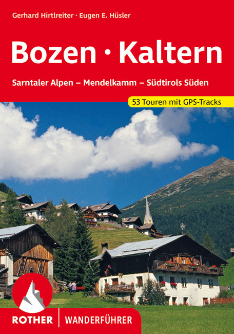
- Wandelgids Bozen - Bolzano - Kaltern | Rother Bergverlag
- Uitstekende wandelgids met een groot aantal dagtochten in dal en hooggebergte. Met praktische informatie en beperkt kaartmateriaal! Wandelingen in verschillende zwaarte weergegeven in rood/blauw/zwart. 53 Wanderungen und Bergtouren rund um Bozen und Kaltern - zwischen Penser Joch und Brixen, Eppan im Überetsch und Salurn im Unterland Bozen ist... Read more

Netherlands
2017
- Time to momo - Venetië
- Dit is de vernieuwde versie van de 100% Venetië-gids! Je gaat het bijzondere Venetië ontdekken. Natuurlijk wil je naar het San Marcoplein, het Dogepaleis en de Rialtobrug, en een tochtje maken over het Canal Grande. Net als kunst bewonderen in het Peggy Guggenheimmuseum of de vele kerken bezoeken. Maar we laten je ook genieten van heerlijke... Read more
- Also available from:
- Bol.com, Belgium
Belgium
2017
- Time to momo - Venetië
- Dit is de vernieuwde versie van de 100% Venetië-gids! Je gaat het bijzondere Venetië ontdekken. Natuurlijk wil je naar het San Marcoplein, het Dogepaleis en de Rialtobrug, en een tochtje maken over het Canal Grande. Net als kunst bewonderen in het Peggy Guggenheimmuseum of de vele kerken bezoeken. Maar we laten je ook genieten van heerlijke... Read more
Netherlands
2015
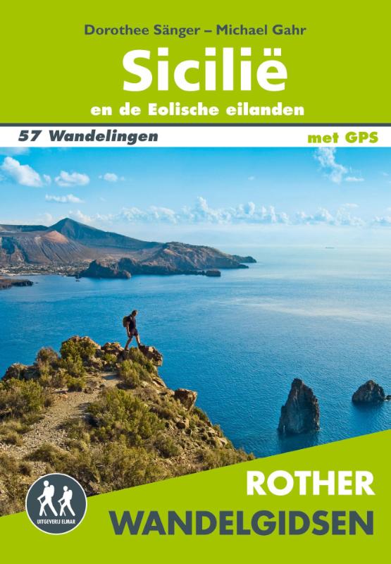
- Wandelgids Sicilië en de Eolische eilanden | Uitgeverij Elmar
- 57 wandelingen op Sicilië en de Eolische eilanden Read more
Maps

United Kingdom
- Regglberg - Latemar - Val d`Ega / Eggental Kompass 630
- Regglberg - Latemar - Val d`Ega/Eggental area of the Dolomites a waterproof and tear-resistant, contoured and GPS compatible map at 1:25,000 from Kompass. Contour interval is 25m, with extensive overprint for hiking trails, cycle routes including mountain bike trails, accommodation and recreational facilities, etc.To see the list of Kompass... Read more

United Kingdom
- Carso Triestino e Isontino Tabacco 047
- Carso Triestino e Isontino area in a series of Tabacco maps at 1:25,000 covering the Dolomites and the mountains of north-eastern Italy - Stanfords’ most popular coverage for this region, with excellent cartography and extensive overprint for hiking routes and other recreational activities, local bus stops, etc. An inset at 1:12,500 shows the... Read more

United Kingdom
- Monti Nebrodi
- Parco Naturale dei Monti Nebrodi on the northern coast of Sicily on a contoured and GPS compatible map at 1:50,000 from Litografia Artistica Cartografica in their Global Map imprint, highlighting hiking trails plus various facilities and/or places of interest in and around the park.Topography is shown by contours at 25m intervals with light... Read more

United Kingdom
- Porto Rotondo to Capo Comino
- Porto Rotondo - Capo Comino area in a series of contoured, GPS compatible maps at 1:60,000 from Ed. Abies, with extensive tourist information including special recreational routes plus additional coverage at more detailed scales of selected popular areas. *Main series at 1:60,000 (Nos. 1 to 12)*The maps have contours at 100m intervals and... Read more

United Kingdom
- Parco delle Madonie
- Parco delle Madonie on the north coast of Sicily just south of Cefalù on a detailed, GPS compatible map at 1:50,000 from LAC in their Globalmap imprint. An overprint highlights hiking trails, including the local section of Sentiero Italia, and indicates more strenuous sections.Topography of this interesting area is very well presented by... Read more

United Kingdom
- Lake Bracciano - Monti della Tolfa - Civitavecchia Global Map Tourist Map
- Lake Bracciano - Monti della Tolfa – Civitavecchia area of Lazio north-west of Rome presented at 1:50,000 on a double-sided, detailed, contoured map from LAC in their GlobalMap imprint, highlighting sightseeing itineraries and various places of interest.Topography is shown by contours and relief shading, plus numerous spot heights and colouring... Read more

United Kingdom
- Laces / Latsch - Val Martello / Martell - Silandro / Schlanders Tabacco 045
- Laces/Latsch - Val Martello/Martell - Silandro/Schlanders area in a series of Tabacco maps at 1:25,000 covering the Dolomites and the mountains of north-eastern Italy - Stanfords’ most popular coverage for this region, with excellent cartography and extensive overprint for hiking routes and other recreational activities, local bus stops, etc.... Read more

United Kingdom
- Slovenia Kartografija Road Atlas
- Slovenia at 1:75,000 presented in an A4, paperback road atlas from the Ljubljana-based Kartografija with very detailed GPS-compatible mapping at 1:75,000, including vivid presentation of the topography, extensive tourist overprint, plus 11 indexed street plans, a distance table, etc. Coverage includes the border areas of Italy around Trieste... Read more

United Kingdom
- Po Valley Cycle Route: Milan to the Adriatic (595km) Bikeline Map-Guide
- The Po Valley Cycle Route, a 595-km long cycle trail linking Milan to the Adriatic, presented by the Verlag Esterbauer in guide with maps at 1:75,000 showing the route and its variants. Extensive information is conveyed by symbols, indicating road surface, campsites and other accommodation, repair workshops, recreational facilities, places of... Read more

United Kingdom
- Urzulei
- Urzulei area at 1:25,000 in a series of contoured maps from Ed. Abies. Overprint highlights 19 hiking paths from three hours long to a two-day route. Symbols show viewpoints, caves, archaeological sites, exceptional trees and other landscape features of particular interest. This title has no UTM grid.*Main series at 1:60,000 (Nos. 1 to 12)*The... Read more

United Kingdom
- Ponte di Legno - Alta Val Camonica - Passo del Tonale Kompass 107
- Ponte di Legno - Alta Val Camonica area of northern Italy on a GPS compatible hiking and recreational map at 1:50,000 from Kompass, printed on durable, waterproof and tear-resistant synthetic paper.KOMPASS HIKING MAPS OF ITALY:This title is part of an extensive series of walking maps from Kompass covering selected areas of Italy at mainly... Read more

United Kingdom
- Sorrento Peninsula - Amalfi Coast - Vesuvius - Pompeii - Salerno - Sorrento Kompass 682
- Sorrento Peninsula on a hiking and recreational map at 1:50,000 from Kompass on durable, waterproof and tear-resistant synthetic paper. Coverage includes Vesuvius and Pompeii and separate panels provide street plans of Sorrento, Positano, Amalfi, Ravello, Salerno and Castellammarte di Stabia. Accompanying booklet includes 16 pages in English... Read more

United Kingdom
- Colli Euganei - Abano e Montegrotto Terme Tabacco 060
- Colli Euganei - Abano & Montegrotto Terme area in a series of Tabacco maps at 1:25,000 covering the Dolomites and the mountains of north-eastern Italy - Stanfords’ most popular coverage for this region, with excellent cartography and extensive overprint for hiking routes and other recreational activities, local bus stops, etc. Additional... Read more

United Kingdom
- Valmalenco
- Valmalenco on a double-sided, contoured and GPS compatible map at 1:25,000 from Litografia Artistica Cartografica in their Global Map imprint. Coverage extends from Sondrio and the Adda River northwards to beyond the Swiss border and includes Monte Disgrazia, Pizzo Scalino and the peak of Bernina with the surrounding glaciers.The map has... Read more

United Kingdom
- Italy Road Atlas OUT OF PRINT
- Italy Road Atlas from Insight, indexed and to a scale of 1:300,000 features, in addition to the main country wide road mapping, 24 city street plans to a scale of 1:15,000, overview maps of the surrounding area at a scale of 1:100,000, and a general European route planning map at a scale of 1:4,000,000.Distance indicators and motorway junction... Read more