
Cataluña
Description
Autonomous region in the northeast of Spain, bordering the Pyrenees and the Mediterranean.
Trails in this state
Links
Facts
Reports
Guides and maps
Lodging
Organisations
Tour operators
GPS
Other
Books

Stanfords
United Kingdom
United Kingdom
- Mallorca 4-Map Set Kompass 2230
- Mallorca on a set of four double-sided, contoured and GPS compatible maps at 1:35,000 from Kompass with exceptionally detailed presentation of the topography, extensive overprint for hiking trails and cycling routes, accommodation and places of interest, etc, plus street plans of central Palma de Mallorca, Platja de Palma, Sóller, Alcúdia/Port... Read more


Stanfords
United Kingdom
2021
United Kingdom
2021
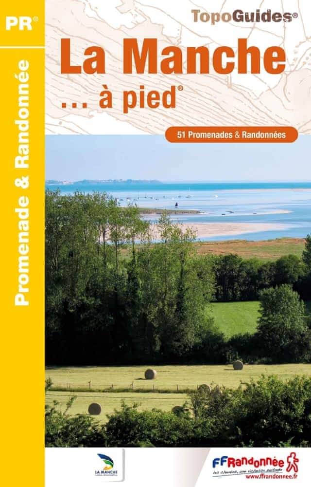
- La Manche à pied
- La Manche à pied, FFRP topo-guide Ref. No. D050, with 51 day walks of varying length and difficulty in the department of La Manche. Coverage extends from Avranches to the tip of the Cotentin Peninsula and includes a walk along the Utah D-Day Beach. Each walk is presented on a separate colour extract from IGN’s topographic survey of France at... Read more
- Also available from:
- The Book Depository, United Kingdom
- De Zwerver, Netherlands


- Also available from:
- De Zwerver, Netherlands


The Book Depository
United Kingdom
United Kingdom

The Book Depository
United Kingdom
United Kingdom
More books…

Maps

Stanfords
United Kingdom
United Kingdom
- Segarra
- Topographic survey of Catalonia at 1:50,000 from the Institut Cartogràfic de Catalunya, with vivid presentation of the terrain and an overprint for long-distance GR hiking trails. The series provides an excellent alternative to the much smaller sheets in the civilian or military surveys produced for the whole of Spain. The Catalan 50K series... Read more

Stanfords
United Kingdom
United Kingdom
- Alt Empordà ICGC 02
- Topographic survey of Catalonia at 1:50,000 from the Institut Cartogràfic de Catalunya, with vivid presentation of the terrain and an overprint for long-distance GR hiking trails. The series provides an excellent alternative to the much smaller sheets in the civilian or military surveys produced for the whole of Spain. The Catalan 50K series... Read more

Stanfords
United Kingdom
United Kingdom
- Baix Ebre ICGC 09
- Topographic survey of Catalonia at 1:50,000 from the Institut Cartogràfic de Catalunya, with vivid presentation of the terrain and an overprint for long-distance GR hiking trails. The series provides an excellent alternative to the much smaller sheets in the civilian or military surveys produced for the whole of Spain. The Catalan 50K series... Read more
Stanfords
United Kingdom
United Kingdom
- Baix Penedès
- Topographic survey of Catalonia at 1:50,000 from the Institut Cartogràfic de Catalunya, with vivid presentation of the terrain and an overprint for long-distance GR hiking trails. The series provides an excellent alternative to the much smaller sheets in the civilian or military surveys produced for the whole of Spain. The Catalan 50K series... Read more

Stanfords
United Kingdom
United Kingdom
- Terres de l`Ebre
- Terres de l`Ebre map at 1:100,000 in the topographic survey of Catalonia published by the Institut Cartogràfic de Catalunya, with very detailed coverage of a large area and an excellent representation of the region’s topography. Maps in this series have relief presented by contours at 40m intervals, enhanced by additional hill-shading and spot... Read more

Stanfords
United Kingdom
United Kingdom
- El Pont de Suert
- Topographic survey of Catalonia at 1:25,000 from the Institut Cartogràfic i Geològic de Catalunya, an attractive alternative to Spain’s national topographic survey at this scale, offering a much larger area per sheet with extensive tourist information and vivid presentation of vegetation and land use.These large, detailed maps have contours at... Read more

Stanfords
United Kingdom
United Kingdom
- Els Ports Natural Park: Vall-de-roures - Arnes
- Topographic survey of Catalonia at 1:25,000 from the Institut Cartogràfic i Geològic de Catalunya, an attractive alternative to Spain’s national topographic survey at this scale, offering a much larger area per sheet with extensive tourist information and vivid presentation of vegetation and land use.These large, detailed maps have contours at... Read more
Stanfords
United Kingdom
United Kingdom
- Montsec d’Ares - Congost de Mont-rebei
- Topographic survey of Catalonia at 1:25,000 from the Institut Cartogràfic i Geològic de Catalunya, an attractive alternative to Spain’s national topographic survey at this scale, offering a much larger area per sheet with extensive tourist information and vivid presentation of vegetation and land use.These large, detailed maps have contours at... Read more
Stanfords
United Kingdom
United Kingdom
- Comarques Centrales
- Comarques Centrales, the foothills of the Catalan Pyrenees including Ripoll, Olot, Berga, Vic, Solsona, etc, at 1:100,000 in the topographic survey of Catalonia published by the Institut Cartogràfic de Catalunya, with very detailed coverage of a large area and an excellent representation of the region’s topography.Maps in this series have... Read more
Stanfords
United Kingdom
United Kingdom
- Segria
- Topographic survey of Catalonia at 1:50,000 from the Institut Cartogràfic de Catalunya, with vivid presentation of the terrain and an overprint for long-distance GR hiking trails. The series provides an excellent alternative to the much smaller sheets in the civilian or military surveys produced for the whole of Spain. The Catalan 50K series... Read more

Stanfords
United Kingdom
United Kingdom
- Barcelona and Environs ICGC 13
- Topographic survey of Catalonia at 1:50,000 from the Institut Cartogràfic de Catalunya, with vivid presentation of the terrain and an overprint for long-distance GR hiking trails. The series provides an excellent alternative to the much smaller sheets in the civilian or military surveys produced for the whole of Spain. The Catalan 50K series... Read more
Stanfords
United Kingdom
United Kingdom
- Conca de Barberà
- Topographic survey of Catalonia at 1:50,000 from the Institut Cartogràfic de Catalunya, with vivid presentation of the terrain and an overprint for long-distance GR hiking trails. The series provides an excellent alternative to the much smaller sheets in the civilian or military surveys produced for the whole of Spain. The Catalan 50K series... Read more

Stanfords
United Kingdom
United Kingdom
- Ripollès ICGC 31
- Topographic survey of Catalonia at 1:50,000 from the Institut Cartogràfic de Catalunya, with vivid presentation of the terrain and an overprint for long-distance GR hiking trails. The series provides an excellent alternative to the much smaller sheets in the civilian or military surveys produced for the whole of Spain. The Catalan 50K series... Read more
Stanfords
United Kingdom
United Kingdom
- Alt Penedès
- Topographic survey of Catalonia at 1:50,000 from the Institut Cartogràfic de Catalunya, with vivid presentation of the terrain and an overprint for long-distance GR hiking trails. The series provides an excellent alternative to the much smaller sheets in the civilian or military surveys produced for the whole of Spain. The Catalan 50K series... Read more
Stanfords
United Kingdom
United Kingdom
- Pallars Sobirà ICGC 26
- Topographic survey of Catalonia at 1:50,000 from the Institut Cartogràfic de Catalunya, with vivid presentation of the terrain and an overprint for long-distance GR hiking trails. The series provides an excellent alternative to the much smaller sheets in the civilian or military surveys produced for the whole of Spain. The Catalan 50K series... Read more