
Alabama
Description
State in the South, bordering on the Gulf of Mexico. Mainly plains, with mountains in the north. Two main trails: The 250 mile Pinhoti Trail (also in Georgia) and the 1600 mile Great Eastern Trail. Several National Forests with good hiking opportunities.
Map

Trails in this state
Links
Facts
Reports
Guides and maps
Lodging
Organisations
Tour operators
GPS
Other
Books

Stanfords
United Kingdom
2016
United Kingdom
2016
- Lonely Planet Bilbao and San Sebastian Pocket Guide
- The Lonely Planet Pocket Guide to Bilbao and San Sebastian offers frank and informal advice on an extensive range of sights, activities, accommodation, restaurants and nightlife. Gawk at the Museo Guggenheim in Bilbao, soak in the history at Guernica and explore the perfect city beach.Written and researched by a team of experts, this book is... Read more

Stanfords
United Kingdom
United Kingdom
- Tenerife 8/2012 – REMOVED FROM WEBSITE BECAUSE OF DISTRIBUTION PROBLEMS
- About this series:Landmark Visitors Guides present the reader with a detailed, wide-ranging, and easy-to-read overview of an area, making them not only useful guides while on a trip, but also an ideal way to get acquainted with an area before you go.Each guide offers a wide array of information on history & culture, local colour & character,... Read more

Stanfords
United Kingdom
2021
United Kingdom
2021
- DK Eyewitness New Zealand
- Welcome to New Zealand, the land of the long white cloudWhether you`re seeking your next adrenaline-fix, the best places to learn more about Maori culture, or the perfect geothermal pool to unwind in, your DK Eyewitness travel guide makes sure you experience all that New Zealand has to offer.An explosion of dramatic scenery, this far-flung... Read more
Stanfords
United Kingdom
United Kingdom
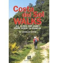
- Costa Del Sol Walks
- Full-color guide to thirty-four walks all within a short distance from the coast, from Nerja to Manilva. With easy-to-follow route notes, full-color maps and clear instructions on how to get to the start of each walk. Read more

Stanfords
United Kingdom
2019
United Kingdom
2019
- DK Eyewitness Travel Guide Caribbean
- Take in the dizzying views from the top of Jamaica`s Blue Mountains, stroll the cobbled colonial plazas of Habana Vieja, or marvel at the majesty of St. Lucia`s volcanic spires - DK Eyewitness Travel Guide Caribbean covers the must-see sights and idyllic islands, so you won`t miss a thing.- Gorgeous, all-new colour photography so you can... Read more

Stanfords
United Kingdom
United Kingdom
- DK Eyewitness Travel Guide London
- Find your corner of London with this essential travel guide to this great city, designed to help you create your own unique trip and to transport you there before you`ve even packed your case - step back in time at the Tower of London and the British Museum, get a bird`s eye view of London from the Shard, or relax in Hyde Park. The DK... Read more

Stanfords
United Kingdom
2013
United Kingdom
2013
- Sicily: Car Tours and Walks
- Sicily is the Sunflower Landscapes guide to exploring the best walking and touring possibilities on the island. The guide covers a range of routes including walks around Mount Etna, Mount Soro, Cefalù, Mount Pellegrino and the Gran Cratere on Vulcano. A double-sided, fold-out touring map at the back of the book shows the whole island, with the... Read more

Stanfords
United Kingdom
United Kingdom
- Rick Steves Best of France (Third Edition)
- Hit France`s can`t-miss art, sights, and bites in two weeks or less with Rick Steves Best of France! Inside you`ll find:Strategic advice from Rick Steves on what`s worth your time and moneyShort itineraries covering the best of Paris, Normandy, the Loire, Dordogne, Provence, the French Riviera, and Burgundy, including Versailles, Nice, the... Read more

Stanfords
United Kingdom
United Kingdom
- DK Eyewitness Travel Guide Switzerland
- Marvel at the iconic Matterhorn, explore the fascinating art galleries and museums of Basel or stroll around the historic town of Lausanne on Lake Geneva. The DK Eyewitness Guide to Switzerland covers the must-see sights and the hidden backstreets, so you won`t miss a thing.- See Switzerland from a different angle - 14 pages of fresh ideas for... Read more

Stanfords
United Kingdom
United Kingdom
- The Brooklyn Nobody Knows: An Urban Walking Guide
- Bill Helmreich walked every block of New York City--6,000 miles in all--to write the award-winning `The New York Nobody Knows`. Now he has re-walked Brooklyn--some 816 miles--to write this one-of-a-kind walking guide to the city`s hottest borough. Drawing on hundreds of conversations he had with residents during his block-by-block journeys,... Read more

Stanfords
United Kingdom
2015
United Kingdom
2015
- Sorrento, Amalfi Coast and Capri: Car Tours and Walks
- Sorrento, Amalfi and Capri is the Sunflower Landscapes guide to exploring the best walking and touring possibilities in the region. The guide covers a range of routes including walks in Amalfi/Ravello, Positano/Praiano, Conca dei Marini, Maiori/Minori, Sorrento and Capri. A double-sided, fold-out touring map at the back of the book shows the... Read more

Stanfords
United Kingdom
United Kingdom
- DK Eyewitness Seville and Andalucia
- Discover diverse landscapes, romantic cities and vibrant traditions.Whether you want to tour the magical Moorish palace of Alhambra, learn the art of tapas bar hopping in Granada or spot wildlife at Parque Nacional de Donana, your DK Eyewitness travel guide makes sure you experience all that Seville and Andalucia have to offer.With undulating... Read more

Stanfords
United Kingdom
2019
United Kingdom
2019
- DK Eyewitness Travel Guide Peru
- Discover Peru with this essential travel guide, designed to help you create your own unique trip and to transport you to this beautiful country before you`ve even packed your case - see Machu Picchu at dawn, explore the stunning Inca Heartland, tuck into traditional Peruvian cuisine in Cusco or ride the rapids through Colca Canyon. The DK... Read more

Stanfords
United Kingdom
United Kingdom
- DK Eyewitness Germany
- Discover Germany - a haven for art aficionados and outdoor enthusiasts alike.Whether you want to hike the Bavarian Alps, discover health resorts and beautiful beaches on the Baltic coast, or seek out the coolest districts in Berlin, your DK Eyewitness travel guide makes sure you experience all that Germany has to offer.Synonymous with art and... Read more

Stanfords
United Kingdom
United Kingdom
- Tokyo Style Guide
- Tokyo Style Guide is an indispensable companion for those looking for a unique insight into the city of Tokyo.While Tokyo pulsates like no other city, its true heart can be easily overlooked. It is found where the locals live, wander, shop, are entertained, eat and drink. Tokyo Style Guide offers style-savvy visitors a starting point for... Read more
Maps

Stanfords
United Kingdom
United Kingdom
- Somdan
- Somdan, sheet no. 2885-13, in the topographic survey of Nepal at 1:50,000 published by the Nepali Government in the late 1990s and early 2000s and produced from remote sensing data by Finnish cartographers as part of that country’s international aid program. The maps cover 15’ x 15’ quadrangles.IMPORTANT – PLEASE NOTE BEFORE ORDERING:... Read more
Stanfords
United Kingdom
United Kingdom
- Dhaina
- Dhaina, sheet no. 2981-08, in the topographic survey of Nepal at 1:50,000 published by the Nepali Government in the late 1990s and early 2000s and produced from remote sensing data by Finnish cartographers as part of that country’s international aid program. The maps cover 15’ x 15’ quadrangles.IMPORTANT – PLEASE NOTE BEFORE ORDERING:... Read more
Stanfords
United Kingdom
United Kingdom
- Khiji Phalate
- Khiji Phalate, sheet no. 2786-10, in the topographic survey of Nepal at 1:50,000 published by the Nepali Government in the late 1990s and early 2000s and produced from remote sensing data by Finnish cartographers as part of that country’s international aid program. The maps cover 15’ x 15’ quadrangles.IMPORTANT – PLEASE NOTE BEFORE ORDERING:... Read more
Stanfords
United Kingdom
United Kingdom
- Chainpur
- Chainpur, sheet no. 2981-05, in the topographic survey of Nepal at 1:50,000 published by the Nepali Government in the late 1990s and early 2000s and produced from remote sensing data by Finnish cartographers as part of that country’s international aid program. The maps cover 15’ x 15’ quadrangles.IMPORTANT – PLEASE NOTE BEFORE ORDERING:... Read more
Stanfords
United Kingdom
United Kingdom
- Nile
- Nile, sheet no. 2885-05, in the topographic survey of Nepal at 1:50,000 published by the Nepali Government in the late 1990s and early 2000s and produced from remote sensing data by Finnish cartographers as part of that country’s international aid program. The maps cover 15’ x 15’ quadrangles.IMPORTANT – PLEASE NOTE BEFORE ORDERING:... Read more
Stanfords
United Kingdom
United Kingdom
- Dattu
- Dattu, sheet no. 2980-02, in the topographic survey of Nepal at 1:50,000 published by the Nepali Government in the late 1990s and early 2000s and produced from remote sensing data by Finnish cartographers as part of that country’s international aid program. The maps cover 15’ x 15’ quadrangles.IMPORTANT – PLEASE NOTE BEFORE ORDERING:... Read more
Stanfords
United Kingdom
United Kingdom
- Gamaar
- Gamaar, sheet no. 2984-09, in the topographic survey of Nepal at 1:50,000 published by the Nepali Government in the late 1990s and early 2000s and produced from remote sensing data by Finnish cartographers as part of that country’s international aid program. The maps cover 15’ x 15’ quadrangles.IMPORTANT – PLEASE NOTE BEFORE ORDERING:... Read more
Stanfords
United Kingdom
United Kingdom
- Dhunche (2885 14)
- Upper Langtang Valley, sheet no. 2885-15, in the topographic survey of Nepal at 1:50,000 published by the Nepali Government in the late 1990s and early 2000s and produced from remote sensing data by Finnish cartographers as part of that country’s international aid program. The maps cover 15’ x 15’ quadrangles.IMPORTANT – PLEASE NOTE BEFORE... Read more

Stanfords
United Kingdom
United Kingdom
- London High 5 Edition Street Plan
- The first water-resistant “Comfort Map“ with direct access to useful additional information from the InternetLondon in a scale of 1:20,000 including tourist destinations (Hampstead Heath, Olympic Park and Greenwich) presented on a practical map; inclusive of the High 5 Edition app technology for calling up additional travel information and many... Read more
Stanfords
United Kingdom
United Kingdom
- Koban
- Koban, sheet no. 2883-07, in the topographic survey of Nepal at 1:50,000 published by the Nepali Government in the late 1990s and early 2000s and produced from remote sensing data by Finnish cartographers as part of that country’s international aid program. The maps cover 15’ x 15’ quadrangles.IMPORTANT – PLEASE NOTE BEFORE ORDERING:... Read more
Stanfords
United Kingdom
United Kingdom
- Hongu Khola - Chheskam
- Hongu Khola - Chheskam, sheet no. 2786-08, in the topographic survey of Nepal at 1:50,000 published by the Nepali Government in the late 1990s and early 2000s and produced from remote sensing data by Finnish cartographers as part of that country’s international aid program. The maps cover 15’ x 15’ quadrangles.IMPORTANT – PLEASE NOTE BEFORE... Read more
Stanfords
United Kingdom
United Kingdom
- Bhijer
- Bhijer, sheet no. 2982-12, in the topographic survey of Nepal at 1:50,000 published by the Nepali Government in the late 1990s and early 2000s and produced from remote sensing data by Finnish cartographers as part of that country’s international aid program. The maps cover 15’ x 15’ quadrangles.IMPORTANT – PLEASE NOTE BEFORE ORDERING:... Read more
Stanfords
United Kingdom
United Kingdom
- Lower Dudh Kosi - Okhaldhunga
- Lower Dudh Kosi - Okhaldhunga, sheet no. 2786-11, in the topographic survey of Nepal at 1:50,000 published by the Nepali Government in the late 1990s and early 2000s and produced from remote sensing data by Finnish cartographers as part of that country’s international aid program. The maps cover 15’ x 15’ quadrangles.IMPORTANT – PLEASE NOTE... Read more

Stanfords
United Kingdom
2021
United Kingdom
2021
- Belgium NGI Long-Distance Trails Map
- Belgium: Long-distance Footpaths Map at 1:300,000 from Nationaal Geografisch Instituut/Institut Géographique National, the country’s national survey organization, showing the network of the waymarked long-distance GR routes.The map uses as its base a road map of the country, with an overprint highlighting the network of Belgium’s long-distance... Read more
Stanfords
United Kingdom
United Kingdom
- Khin
- Khin, sheet no. 2981-12, in the topographic survey of Nepal at 1:50,000 published by the Nepali Government in the late 1990s and early 2000s and produced from remote sensing data by Finnish cartographers as part of that country’s international aid program. The maps cover 15’ x 15’ quadrangles.IMPORTANT – PLEASE NOTE BEFORE ORDERING:... Read more