
Bretagne
Description

Popular region in the west of France. Brittany reaches far into the Atlantic Ocean. The coastline is rugged and varied. The main hiking attraction is the 1.800 km long coastal trail, the GR34, coinciding with the E9. The countryside is one of fields and hedges and historic little villages.
Map

Trails in this region
Links
Facts
Reports
Guides and maps
Lodging
Organisations
Tour operators
GPS
Other
Books

Stanfords
United Kingdom
2019
United Kingdom
2019
- Le Pays d`Iroise à pied
- Le Pays d`Iroise à pied, FFRP topo-guide Ref. No. P295, with 34 walks in north-western Brittany. Each walk is presented on a separate colour extract from IGN’s topographic survey of France at 1:25,000 with its description cross-referenced to the map. Current edition of this title was published in May 2012.To see the list of other FFRP guides... Read more

Stanfords
United Kingdom
2020
United Kingdom
2020
- Les Abers - le Chemin de Phares GR34/GR34F
- Les Abers - le chemin de phares, FFRP topoguide Ref. no. 347, covering the coastal route in north-western Brittany between Morlaix, Brest, and le Fau, plus 4 walks on the Ile d`Ouessant. Current edition of this title was published in September 2017.Between Morlaix and Brest, where the sea has dug deep furrows in the land. More than 20 days of... Read more

Stanfords
United Kingdom
2007
United Kingdom
2007
- Le Centre: Val de Loire à pied FFRP Topo-guide No. RE11
- Le Centre: Val de Loire à pied, FFRP topo-guide ref. no. RE08, one of the titles in an extensive series of light, A5-size, high quality paperback guides published by the Fédération Française de la Randonnée Pédestre in association with local authorities, ramblers’ clubs, etc. The guides have *colour extracts from the French topographic survey... Read more

Stanfords
United Kingdom
2016
United Kingdom
2016
- Le Parc d`Armorique à pied FFRP Topo-guide No. PN12
- Le Parc d`Armorique à pied, FFRP topo-guide Ref. No. PN12, with 43 day walks of varying length and difficulty in western Brittany. Current edition of this title was published in March 2016.To see the list of other FFRP guides with day walks please click on the series link.ABOUT THE FFRP (Fédération française de la randonnée pédestre)... Read more
Stanfords
United Kingdom
2019
United Kingdom
2019
- Mézenc - meygal et haute vallee de le Loire
- Le Pays de la Loire Sauvage et du Mézenc à pied, FFRP topo-guide Ref. No.P435, with 26 day walks of varying length and difficulty in the region south-east of Le Puy-en-Velay. Each walk is presented on a separate colour extract from IGN’s topographic survey of France at 1:25,000, with its description cross-referenced to the map. Current edition... Read more
Stanfords
United Kingdom
2020
United Kingdom
2020
- De Concarneau à Quimperlé - terre et mer... à pied P297
- De Concarneau a Quimperlé, terre et mer... à pied, FFRP topo-guide Ref. No. P297, with 25 day walks of varying length and difficulty in southern Brittany. Each walk is presented on a separate colour extract from IGN’s topographic survey of France at 1:25,000 and/or 1:50,000, with its description cross-referenced to the map. Current edition of... Read more
Stanfords
United Kingdom
2020
United Kingdom
2020
- Finistere a pied 47PR
- Finistère à pied, FFRP topo-guide Ref. No. D029, with 47 day walks of varying length and difficulty in the Department of Finistère on the western tip of Brittany. Coverage includes walks on the nearby islands including Ile d’Ouessant, as well as sightseeing routes in Brest and Quimper highlighted on street plans. Each walk is presented on a... Read more

Stanfords
United Kingdom
2021
United Kingdom
2021
- DK Eyewitness France
- Discover France`s special je ne sais quoiWhether you want to visit fairytale chateaux, stroll amid rolling fields of blossoming lavender or learn what makes a noble vintage, your DK Eyewitness travel guide makes sure you experience all that France has to offer.Few countries capture the imagination quite like France. The world-famous cuisine is... Read more

Stanfords
United Kingdom
United Kingdom
- GR3: Les Monts du Forez FFRP Topo-guide No. 334
- Les Monts du Forez, FFRP topoguide Ref. No. 334, covering in all 259kms along the GR3 and its variant, with additional descriptions of 21 day walks in the region. Current edition of this title was published in April 2016.ABOUT THE FFRP (Fédération française de la randonnée pédestre) TOPOGUIDES: published in a handy A5 paperback format, the... Read more

Stanfords
United Kingdom
2019
United Kingdom
2019
- Broceliande a Pied
- Le Pays de Brocéliande à pied, FFRP topo-guide Ref. No. P353, with 31 day walks of varying length and difficulty in central Brittany west of Rennes, plus GR and GR de Pays long-distance footpaths and circuits between Médréac and Ploërmel. Each walk is presented on a separate colour extract from IGN’s topographic survey of France at 1:25,000... Read more

Stanfords
United Kingdom
United Kingdom
- Eastbourne, Hastings, Crowborough, Battle & Heathfield OS Landranger Active Map 199 (waterproof)
- Eastbourne and Hastings area, including the Seven Sisters and sections of the South Downs Way and the E9 European Long-distance Path, on a waterproof and tear-resistant OS Active version of map No. 199 from the Ordnance Survey’s Landranger series at 1:50,000, with contoured and GPS compatible topographic mapping plus tourist information.MOBILE... Read more

Stanfords
United Kingdom
United Kingdom
- Bournemouth, Purbeck, Wimborne Minster & Ringwood OS Landranger Active Map 195 (waterproof)
- Bournemouth and the Isle of Purbeck area, including part of the New Forest National Park and a section of the South West Coast Path / E9 European Long-distance Path, on a waterproof and tear-resistant OS Active version of map No. 195 from the Ordnance Survey’s Landranger series at 1:50,000, with contoured and GPS compatible topographic mapping... Read more

Stanfords
United Kingdom
2009
United Kingdom
2009
- GR40: Tour des Volcans du Velay FFRP Topo-guide No. 425
- GR40: Tour des Volcans du Velay, FFRP topo-guide ref. no. 425, one of the titles from an extensive series of light, high quality, A5 paperback guides to the Sentiers de Grande Randonnée, the GR routes, a dense network of long-distance footpaths across the French countryside. Each topo-guide covers either a circular route, or part of a longer... Read more

Stanfords
United Kingdom
United Kingdom
- The Solent, Isle of Wight, Southampton & Portsmouth OS Landranger Active Map 196 (waterproof)
- Isle of Wight with the Southampton - Portsmouth area, including part of the New Forest National Park and a section of the E9 European Long-distance Path, on a waterproof and tear-resistant OS Active version of map No. 196 from the Ordnance Survey’s Landranger series at 1:50,000, with contoured and GPS compatible topographic mapping plus tourist... Read more
Maps

Stanfords
United Kingdom
United Kingdom
- Chateaulin - Douarnenez IGN 0518OT
- Topographic survey of France at 1:25,000 in IGN`s excellent TOP25 / Série Bleue series. All the maps are GPS compatible, with a 1km UTM grid plus latitude and longitude lines at 5’ intervals. Contours are at 5m intervals except for mountainous areas where the maps have contours at 10m intervals, vividly enhanced by hill shading and graphics for... Read more

Stanfords
United Kingdom
United Kingdom
- Finistère Sud - Quimper – Douarnenez – Pont-l’Abbé Rando Editions
- Finistère Sud, the south-western corner of Brittany with Quimper, Douarnenez and Pont-l’Abbé, in a series of GPS compatible hiking and cycling maps at 1:50,000 from Rando Editions, publishers of similar series for the French Alps and the Pyrenees.The map has cartography from the IGN with contour lines at 10m intervals, enhanced by relief... Read more

Stanfords
United Kingdom
United Kingdom
- FR4 Les Sept Iles a Douarnenez
- Passage ChartsC1 France · Atlantique 1:1.750.000 C2 Bretagne · Ouest 1: 350.000 Coastal Charts C3 Douarnenez à l‘Ile d’Ouessant 1: 150.000 C4 Ile d’Ouessant à la Pte. de Beg Pol 1: 150.000 C5 Pte. de Beg Pol aux Sept Iles 1: 150.000 C6 Baie de Douarnenez 1: 45.000 C7 Approches du Port de Brest 1: 45.000 C8 Rade de Brest 1: 45.000 C9 St. Mathieu... Read more

Stanfords
United Kingdom
United Kingdom
- Pont-l`Abbe - Pointe de Penmarc`h IGN 0519OT
- Topographic survey of France at 1:25,000 in IGN`s excellent TOP25 / Série Bleue series. All the maps are GPS compatible, with a 1km UTM grid plus latitude and longitude lines at 5’ intervals. Contours are at 5m intervals except for mountainous areas where the maps have contours at 10m intervals, vividly enhanced by hill shading and graphics for... Read more
Stanfords
United Kingdom
United Kingdom
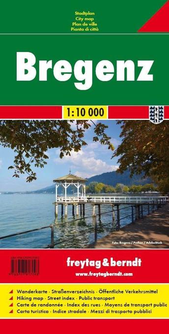
- Bregenz F&B
- Indexed street plan of Bregenz extending north along the Bodensee coast to Lochau and Unter Hochsteg. Detail includes pedestrianised areas, railways, bus routes and cycle paths. Notable buildings are highlighted in red, and symbols indicate post offices, hostels, campsites and car parks.On the reverse is a 1:50,000 contoured map of the... Read more

Stanfords
United Kingdom
United Kingdom
- Plougastel - Daoulas - le Faou - PNR d`Armorique IGN 0517OT
- Topographic survey of France at 1:25,000 in IGN`s excellent TOP25 / Série Bleue series. All the maps are GPS compatible, with a 1km UTM grid plus latitude and longitude lines at 5’ intervals. Contours are at 5m intervals except for mountainous areas where the maps have contours at 10m intervals, vividly enhanced by hill shading and graphics for... Read more

Stanfords
United Kingdom
United Kingdom
- Quimper - Concarneau - Iles de Glenan IGN 0519ET
- Topographic survey of France at 1:25,000 in IGN`s excellent TOP25 / Série Bleue series. All the maps are GPS compatible, with a 1km UTM grid plus latitude and longitude lines at 5’ intervals. Contours are at 5m intervals except for mountainous areas where the maps have contours at 10m intervals, vividly enhanced by hill shading and graphics for... Read more

Stanfords
United Kingdom
United Kingdom
- 2510 North Brittany Chart Pack - 2015 edition
- A brand new pack for North Brittanty, consisting of 7 double-sided sheets covering the coast from St-Malo to Rade de Brest. The pack consists of the following: The pack consists of the following:1. The Channel Islands, Cherbourg Peninsula & North Brittany (1:550 000)2. Approaches to St-Malo & St-Cast (1:120 000)3. Cap Fréhel to Paimpol (1:110... Read more

Stanfords
United Kingdom
United Kingdom
- France Chamina Edition Greenways and Cycle Routes Atlas
- Guarantee of quality and reliability, the Atlas France of greenways & cycle routes Chamina is enriched this year by more than 1,000 km of cycle route: 2 new cycle routes (The Flow Vélo and the EuroVelo 4 - Tour de Manche) , as well as the updating of the extensive routes such as the ViaRhôna, the Vélo Francette, the EuroVelo 6 and the... Read more

Stanfords
United Kingdom
United Kingdom
- Questembert - la Roche-Bernard IGN 1021SB
- Topographic survey of France at 1:25,000 in IGN`s excellent TOP25 / Série Bleue series. All the maps are GPS compatible, with a 1km UTM grid plus latitude and longitude lines at 5’ intervals. Contours are at 5m intervals except for mountainous areas where the maps have contours at 10m intervals, vividly enhanced by hill shading and graphics for... Read more

Stanfords
United Kingdom
United Kingdom
- Le Tour de la Bretagne à vélo: Mont-Saint-Michel - Roscoff
- Le Tour de la Bretagne à vélo: Mont-Saint-Michel - Roscoff, a spiral-bound guide from Rando Editions, covers the first part of the coastal cycling route around Brittany, with maps overprinted with the route, detailed instructions, information on accommodation facilities and descriptions of places of interest. Each guide in this series divides... Read more

Stanfords
United Kingdom
United Kingdom
- Brittany IGN Regional NR06
- IGN publishes its new collection of regional maps including the official division of the 13 new regions. The largest regions are well represented on a single map. These maps are double sided and in 6 languages. Read more

Stanfords
United Kingdom
United Kingdom
- Ile d`Ouessant - Le Conquet IGN 0317OT
- Topographic survey of France at 1:25,000 in IGN`s excellent TOP25 / Série Bleue series. All the maps are GPS compatible, with a 1km UTM grid plus latitude and longitude lines at 5’ intervals. Contours are at 5m intervals except for mountainous areas where the maps have contours at 10m intervals, vividly enhanced by hill shading and graphics for... Read more

Stanfords
United Kingdom
United Kingdom
- Mayenne - le Horps IGN 1517SB
- Topographic survey of France at 1:25,000 in IGN`s excellent TOP25 / Série Bleue series. All the maps are GPS compatible, with a 1km UTM grid plus latitude and longitude lines at 5’ intervals. Contours are at 5m intervals except for mountainous areas where the maps have contours at 10m intervals, vividly enhanced by hill shading and graphics for... Read more
Stanfords
United Kingdom
United Kingdom
- Le Tour de la Bretagne à vélo: Roscoff - Quimperlé
- Le Tour de la Bretagne à vélo: Roscoff - Quimperlé, a spiral-bound guide from Rando Editions, covers the second part of the coastal cycling route around Brittany, with maps overprinted with the route, detailed instructions, information on accommodation facilities and descriptions of places of interest. Each guide in this series divides the... Read more