Stanfords
United Kingdom
United Kingdom
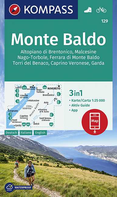
- Monte Baldo - Altipiano di Brentonico - Malcesine Kompass 129
- Map No. 129, Monte Baldo, at 1:25,000 on a double-sided map from Kompass, printed on sturdy waterproof and tear-resistant synthetic paper and covering an area to the east of the northern part of Lake Garda.This title is part of a series of Kompass maps providing detailed coverage of the Dolomites and Lake Garda area, supplementing their main... Read more