
Stanfords
United Kingdom
- Andalucía East: Granada - Almería - Murcia 500K CNIG Regional Map No. 12
- The eastern part of Andalucía with Granada and Sierra Nevada, extending along the Mediterranean coast from Velez-Malága to Cartagena and Mar Menor, at 1:500,000 in a series of regional road maps from the country’s civilian survey organization IGN-CNIG (Instituto Geográfico Nacional - Centro Nacional de Información Geográfica), vividly... Read more

Stanfords
United Kingdom
- Val d`Aran by UTMB Editorial Alpina Trail running race Map
- Val d`Aran in an extensive and very popular series of walking maps from Editorial Alpina covering the Pyrenees, Catalonia and other selected hiking areas in Spain, including Picos de Europa, Sierra Nevada and parts of Andalucía, Majorca, etc. Scales vary from 1:50,000 to 1:10,000, with the majority of the titles at 1:25,000. The maps have... Read more

Stanfords
United Kingdom

Stanfords
United Kingdom
- Málaga Province 200K CNIG Map No. 31
- Contoured, GPS-compatible, indexed road map at 1:200,000 from CNIG - Spain’s civilian survey organization, with exceptionally informative presentation of the landscape and highlighting for facilities and places of interest including campsites and paradors.Maps in CNIG’s 200K Provincial Series provide an excellent picture the topography through... Read more

Stanfords
United Kingdom
- Aragón Autonomous Region 300K CNIG Physical Road Map
- Aragón Autonomous Region of Spain at 1:300,000 on a large physical map from the IGN/CNIG - country’s civilian survey organization providing an excellent picture of the region’s topography, from the peaks of the highest part of the Pyrenees, across the valley of the Ebro, to the sierras of southern Teruel province. Icons prominently highlight... Read more

Stanfords
United Kingdom
- Valles de Belagua y Roncal Editorial Alpina
- Valles de Belagua & Roncal in an extensive and very popular series of walking maps from Editorial Alpina covering the Pyrenees, Catalonia and other selected hiking areas in Spain, including Picos de Europa, Sierra Nevada and parts of Andalucía, Majorca, etc. Scales vary from 1:50,000 to 1:10,000, with the majority of the titles at 1:25,000. The... Read more

Stanfords
United Kingdom
- La Roda de Andalucia CNIG Topographic Map 1006-III
- Topographic coverage of mainland Spain at 1:25,000 published by the Centro Nacional de Información Geograficá, the country’s civilian survey organization. The maps have contours at 10m intervals and colouring and/or graphics to show different types of vegetation or land use. Boundaries of national parks and other protected areas are marked. In... Read more

Stanfords
United Kingdom
- Marismas del Odiel Natural Park CNIG Map
- Marismas del Odiel Natural Park on the coast of western Andalucía around Huelva on a large, contoured and GPS compatible map at 1:25,000 from IGN/CNIG using cartography of their civilian topographic survey of Spain. Boundaries of various reserves in this area of wetlands popular with bird watchers are prominently marked. Contours are 10m... Read more

Stanfords
United Kingdom
- Catalonia Auotomous Community CNIG Physical Road Map
- Catalonia Autonomous Region of Spain at 1:300,000 on a large physical map from the IGN/CNIG - country’s civilian survey organization providing an excellent picture of the region’s topography, from the peaks of the highest part of the Pyrenees, across the valley of the Ebro, to the sierras of southern Teruel province. Icons prominently highlight... Read more

Stanfords
United Kingdom
- Mora
- Topographic survey of Portugal at 1:50,000 from the Instituto Geográfico Português, the country’s civilian survey organisation. The maps have contours at 25m intervals and in addition to the standard features shown on topographic mapping at this scale also indicate various types of vegetation (vineyards, olive groves, etc). Each sheet covers an... Read more

Stanfords
United Kingdom
- Mora
- Topographic survey of Portugal at 1:50,000 from the Instituto Geográfico do Exército, the country’s military survey organisation. The maps have contours at 20m intervals and in addition to the standard features shown on topographic mapping at this scale also indicate various types of terrain or vegetation (sand, terraces, rocks, woodlands,... Read more

Stanfords
United Kingdom
- Sierra de María-Los Vélez Natural Park Editorial Piolet Hiking Map
- Sierra de María – Los Vélez Natural Park at 1:40,000 on a detailed, GPS compatible topographic map from the Instituto de Cartografia de Andalucía, the region’s official survey organization, printed on light, waterproof and tear-resistant synthetic paper. The map has contours at 20m intervals plus relief shading, with colours and symbols... Read more

Stanfords
United Kingdom
- Sierra Nevada - the Traverse at 3000m Editorial Piolet Hiking Map
- Sierra Nevada: The Traverse at 3000m Altitude map at 1:25,000 in a series of GPS compatible maps from Editorial Piolet with cartography based on Spain’s civilian topographic survey overprinted with hiking routes and other tourist information. The map highlights the course of “La Integral de los 3000” route across the highest part of the Sierra... Read more
Stanfords
United Kingdom
- Fuentes de Andalucia CNIG Topo 986
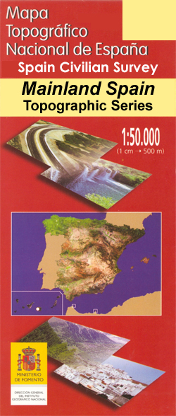
- Topographic coverage of mainland Spain at 1:50,000 in the MTN50 (Mapa Topográfico Nacional) series from the Centro Nacional de Información Geografica, the country’s civilian survey organization. The maps have contours at 20m intervals, enhanced by relief shading, plus colouring and/or graphics to show different types of terrain, vegetation or... Read more

Stanfords
United Kingdom
- GR 240: Tour of the Sierra Nevada (Sendero Sulayr)
- A tour around the Sierra Nevada presented in an English language guide from Editorial Penibética, with contoured mapping at 1:40,000, detailed descriptions of each stage, route profiles, numerous colour photographs, etc.The guide divides the route into 19 stages of between 2h 30’ and 7h 30’, covering it in an anti-clockwise direction starting... Read more

Stanfords
United Kingdom
- Andalusia Autonomous Community CNIG Physical Road Map
- Andalucía Autonomous Region of Spain at 1:400,000 on a large physical map from the IGN/CNIG - country’s civilian survey organization providing an excellent picture of the region’s topography, from the peaks of Sierra Nevada to the marshes of the Doñana National Park.Relief shading is enhanced by bright altitude colouring, with plenty of names... Read more