Stanfords
United Kingdom
- Becerra CNIG Topo 99
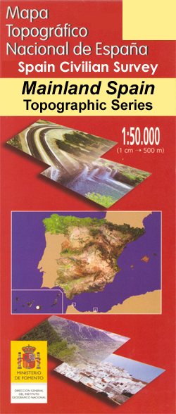
- Topographic coverage of mainland Spain at 1:50,000 in the MTN50 (Mapa Topográfico Nacional) series from the Centro Nacional de Información Geografica, the country’s civilian survey organization. The maps have contours at 20m intervals, enhanced by relief shading, plus colouring and/or graphics to show different types of terrain, vegetation or... Read more

Stanfords
United Kingdom
- El Cerro de Andevalo CNIG Topo 937
- Topographic coverage of mainland Spain at 1:50,000 in the MTN50 (Mapa Topográfico Nacional) series from the Centro Nacional de Información Geografica, the country’s civilian survey organization. The maps have contours at 20m intervals, enhanced by relief shading, plus colouring and/or graphics to show different types of terrain, vegetation or... Read more

Stanfords
United Kingdom
- Camporrendondo de Alba CNIG Topo 106
- Topographic coverage of mainland Spain at 1:50,000 in the MTN50 (Mapa Topográfico Nacional) series from the Centro Nacional de Información Geografica, the country’s civilian survey organization. The maps have contours at 20m intervals, enhanced by relief shading, plus colouring and/or graphics to show different types of terrain, vegetation or... Read more

Stanfords
United Kingdom
- El Rocio CNIG Topo 1018
- Topographic coverage of mainland Spain at 1:50,000 in the MTN50 (Mapa Topográfico Nacional) series from the Centro Nacional de Información Geografica, the country’s civilian survey organization. The maps have contours at 20m intervals, enhanced by relief shading, plus colouring and/or graphics to show different types of terrain, vegetation or... Read more

Stanfords
United Kingdom
- Guardamar del Segura CNIG Topo 914
- Topographic coverage of mainland Spain at 1:50,000 in the MTN50 (Mapa Topográfico Nacional) series from the Centro Nacional de Información Geografica, the country’s civilian survey organization. The maps have contours at 20m intervals, enhanced by relief shading, plus colouring and/or graphics to show different types of terrain, vegetation or... Read more

Stanfords
United Kingdom
- León CNIG Topo 161
- Topographic coverage of mainland Spain at 1:50,000 in the MTN50 (Mapa Topográfico Nacional) series from the Centro Nacional de Información Geografica, the country’s civilian survey organization. The maps have contours at 20m intervals, enhanced by relief shading, plus colouring and/or graphics to show different types of terrain, vegetation or... Read more

Stanfords
United Kingdom
- Castañar de Ibor CNIG Topo 681
- Topographic coverage of mainland Spain at 1:50,000 in the MTN50 (Mapa Topográfico Nacional) series from the Centro Nacional de Información Geografica, the country’s civilian survey organization. The maps have contours at 20m intervals, enhanced by relief shading, plus colouring and/or graphics to show different types of terrain, vegetation or... Read more

Stanfords
United Kingdom
- Jaca CNIG Topo 176
- Topographic coverage of mainland Spain at 1:50,000 in the MTN50 (Mapa Topográfico Nacional) series from the Centro Nacional de Información Geografica, the country’s civilian survey organization. The maps have contours at 20m intervals, enhanced by relief shading, plus colouring and/or graphics to show different types of terrain, vegetation or... Read more

Stanfords
United Kingdom
- Bedmar CNIG Topo 948
- Topographic coverage of mainland Spain at 1:50,000 in the MTN50 (Mapa Topográfico Nacional) series from the Centro Nacional de Información Geografica, the country’s civilian survey organization. The maps have contours at 20m intervals, enhanced by relief shading, plus colouring and/or graphics to show different types of terrain, vegetation or... Read more

Stanfords
United Kingdom
- Carbajales de Alba CNIG Topo 368
- Topographic coverage of mainland Spain at 1:50,000 in the MTN50 (Mapa Topográfico Nacional) series from the Centro Nacional de Información Geografica, the country’s civilian survey organization. The maps have contours at 20m intervals, enhanced by relief shading, plus colouring and/or graphics to show different types of terrain, vegetation or... Read more

Stanfords
United Kingdom
- Zuriza CNIG Topo 118
- Topographic coverage of mainland Spain at 1:50,000 in the MTN50 (Mapa Topográfico Nacional) series from the Centro Nacional de Información Geografica, the country’s civilian survey organization. The maps have contours at 20m intervals, enhanced by relief shading, plus colouring and/or graphics to show different types of terrain, vegetation or... Read more
Stanfords
United Kingdom
- Campillos CNIG Topo 1022
- Topographic coverage of mainland Spain at 1:50,000 in the MTN50 (Mapa Topográfico Nacional) series from the Centro Nacional de Información Geografica, the country’s civilian survey organization. The maps have contours at 20m intervals, enhanced by relief shading, plus colouring and/or graphics to show different types of terrain, vegetation or... Read more

Stanfords
United Kingdom
- Vigo - Cies CNIG Topo 222/223
- Topographic coverage of mainland Spain at 1:50,000 in the MTN50 (Mapa Topográfico Nacional) series from the Centro Nacional de Información Geografica, the country’s civilian survey organization. The maps have contours at 20m intervals, enhanced by relief shading, plus colouring and/or graphics to show different types of terrain, vegetation or... Read more

Stanfords
United Kingdom
- Burgos CNIG Topo 200
- Topographic coverage of mainland Spain at 1:50,000 in the MTN50 (Mapa Topográfico Nacional) series from the Centro Nacional de Información Geografica, the country’s civilian survey organization. The maps have contours at 20m intervals, enhanced by relief shading, plus colouring and/or graphics to show different types of terrain, vegetation or... Read more

Stanfords
United Kingdom
- Horta de Sant Joan CNIG Topo 496
- Topographic coverage of mainland Spain at 1:50,000 in the MTN50 (Mapa Topográfico Nacional) series from the Centro Nacional de Información Geografica, the country’s civilian survey organization. The maps have contours at 20m intervals, enhanced by relief shading, plus colouring and/or graphics to show different types of terrain, vegetation or... Read more