Stanfords
United Kingdom
- Val Brembana - Valsassina - Le Grigne: Lecco - Bergamo 50K IGC Map No. 22
- Val Brembana - Valsassina - Le Grigne area including Lecco and Bergamo in a series contoured hiking maps at 1:50,000 with local trails, long-distance footpaths, mountain accommodation, etc. from the Turin based Istituto Geografico Centrale.Maps in this series have contours at 50m intervals, enhanced by shading and graphic relief. An overprint... Read more

Stanfords
United Kingdom
Stanfords
United Kingdom
- Zermatt - Matterhorn K+F Hiking 13
- The Mattertal and the lower part of the Saastal valleys, the Mischabel group with Dom, and the upper part of the Val d`Anniviers presented at 1:50,000 on a waterproof and tear-resistant, contoured and GPS compatible map from the Hallwag/Kümmerly + Frey group, with route profiles, grading for the severity of the terrain and the degree of fitness... Read more

Stanfords
United Kingdom
- Saas Fee - Saastal - Simplon
- Saas-Fee area including the Saastal, the eastern slopes of the Mischabel range with Dom, the Simplon Pass, Grächen, Brig and Visp at 1:50,000 in a series from Hallwag covering Switzerland’s popular hiking regions on light, waterproof and tear-resistant maps highlighting long-distance paths: the nine national routes plus special regional routes,... Read more

Stanfords
United Kingdom
- Lanzo - Viù - Chialamberto - Locana 25K IGC Map No. 110
- Lanzo - Viù - Chialamberto - Locana – Cirié – Basse Valli di Lanzo area at 1:25,000 in a series of contoured, GPS compatible walking maps from the Turin based Istituto Geografico Centrale, highlighting hiking trails including long-distance routes, ski routes and alpine accommodation. Maps in this series have contours at 25m intervals, enhanced... Read more

Stanfords
United Kingdom

Stanfords
United Kingdom
- Il Monferrato: Asti - Casale Monferrato 50K IGC Map No. 20
- The Monferrato region of Piedmont east of Turin, between Asti and Casale Monferrato, in a series contoured hiking maps at 1:50,000 with local trails, long-distance footpaths, mountain accommodation, etc. from the Turin based Istituto Geografico Centrale. This title also shows local cycle routes.Maps in this series have contours at 50m... Read more

Stanfords
United Kingdom
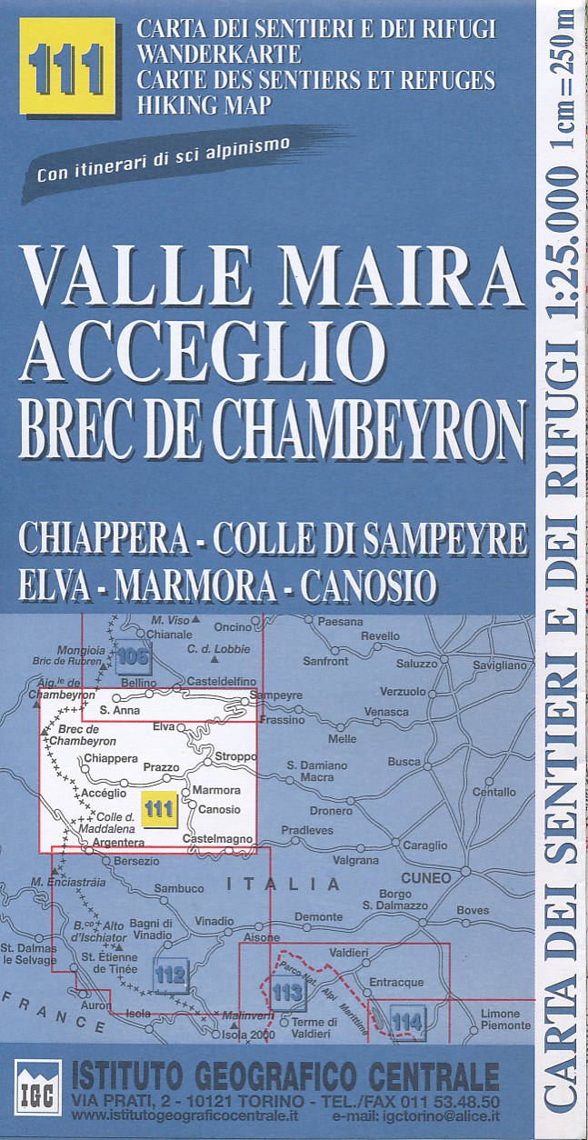
- Valle Maira - Acceglio 25K IGC Map No. 111
- Valle Maira - Acceglio area at 1:25,000 in a series of contoured, GPS compatible walking maps from the Turin based Istituto Geografico Centrale, highlighting hiking trails including long-distance routes, ski routes and alpine accommodation. Maps in this series have contours at 25m intervals, enhanced by shading and graphic relief for very clear... Read more

Stanfords
United Kingdom
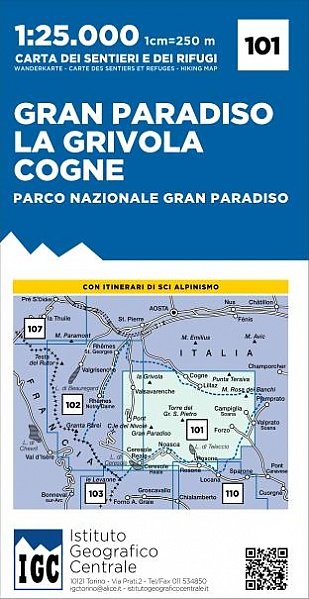
- Gran Paradiso - La Grivola - Cogne IGC 101
- Gran Paradiso - La Grivola - Cogne area of the Italian Alps at 1:25,000 in a series of contoured, GPS compatible walking maps from the Turin based Istituto Geografico Centrale, highlighting hiking trails including long-distance routes, ski routes and alpine accommodation. Maps in this series have contours at 25m intervals, enhanced by shading... Read more

Stanfords
United Kingdom
- Langhe Meridionali IGC 18
- The southern part of the Langhe region of Piedmont, famous for its wines, cheeses, and truffles, in a series contoured hiking maps at 1:50,000 with local trails, long-distance footpaths, mountain accommodation, etc. from the Turin based Istituto Geografico Centrale.Maps in this series have contours at 50m intervals, enhanced by shading and... Read more

Stanfords
United Kingdom
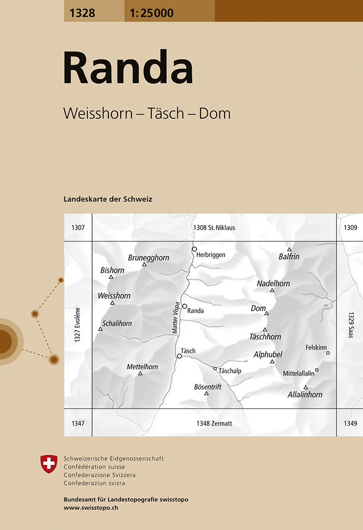
- Randa Swisstopo 1328
- Map No. 1328, Randa, in the topographic survey of Switzerland at 1:25,000 from Swisstopo. The map covers the central section of the Mattertal from just north of Zermatt to Herbriggen, and extends west to include Weisshorn and eastwards across the Mischabel range with Dom to outskirts of Saas Fee.Swiss topographic survey at 1:25,000 covers the... Read more
De Zwerver
Netherlands
- Wandelkaart - Topografische kaart 1328 Randa | Swisstopo
- Map No. 1328, Randa, in the topographic survey of Switzerland at 1:25,000 from Swisstopo. The map covers the central section of the Mattertal from just north of Zermatt to Herbriggen, and extends west to include Weisshorn and eastwards across the Mischabel range with Dom to outskirts of Saas Fee.Swiss topographic survey at 1:25,000 covers the... Read more

Stanfords
United Kingdom
- Mont Blanc Massif IGC 4
- The Mont Blanc Massif in a series contoured hiking maps at 1:50,000 with local trails, long-distance footpaths, mountain accommodation, etc, from the Turin based Istituto Geografico Centrale. The map highlights, among other routes, the Alta Via 1 and the northern section of the Alta Via 2, both of which join up with TMB, as well as the local... Read more

Stanfords
United Kingdom
- Il Canavese: Ivrea to Chiavasso 50K IGC Map No. 21
- Il Canavesea area including Ivrea and Chiavasso in a series contoured hiking maps at 1:50,000 with local trails, long-distance footpaths, mountain accommodation, etc. from the Turin based Istituto Geografico Centrale. This title also shows cycle routes.Maps in this series have contours at 50m intervals, enhanced by shading and graphic relief.... Read more

Stanfords
United Kingdom
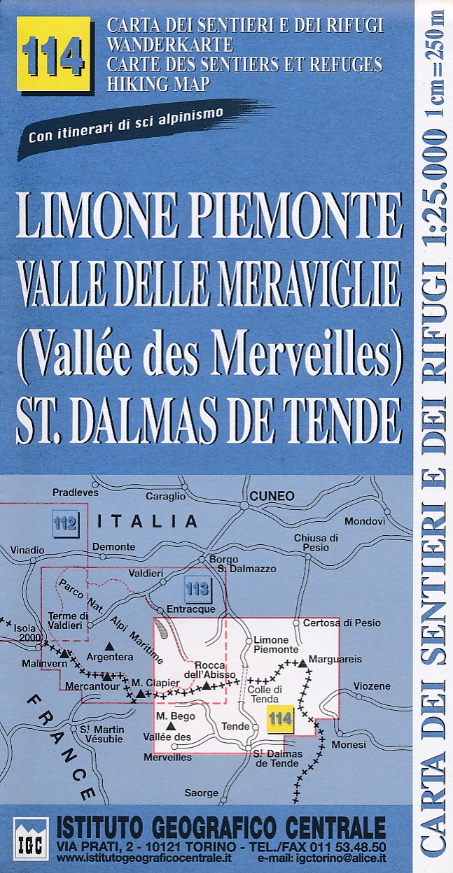
- Limone Piemonte - Vallée des Merveilles 25K IGC Map No. 114
- Limone Piemonte - Vallée des Merveilles area at 1:25,000 in a series of contoured, GPS compatible walking maps from the Turin based Istituto Geografico Centrale, highlighting hiking trails including long-distance routes, ski routes and alpine accommodation. Maps in this series have contours at 25m intervals, enhanced by shading and graphic... Read more

Stanfords
United Kingdom
- Finale Ligure - Alassio - Savona IGC 15
- The coast of the Italian Riviera around Albenga, Alassio and Savona in a series contoured hiking maps at 1:50,000 with local trails, long-distance footpaths, mountain accommodation, etc. from the Turin based Istituto Geografico Centrale.Maps in this series have contours at 50m intervals, enhanced by shading and graphic relief. An overprint... Read more