
Stanfords
United Kingdom
- Mölltal - Kreuzeckgruppe - Drautal F&B WK225
- Mölltal - Kreuzeckgruppe - Drautal area of Carinthia presented at 1:50,000 in a series of contoured and GPS compatible outdoor leisure map from Freytag & Berndt with hiking and cycling routes, mountain huts, campsites and youth hostels, local bus stops, plus other tourist information.To see the list of currently available titles in this series... Read more

Stanfords
United Kingdom
- Goms - Aletsch
- Goms - Aletsch area of the Bernese Oberland at 1:50,000 in a series from Hallwag covering Switzerland’s popular hiking regions on light, waterproof and tear-resistant maps highlighting long-distance paths: the nine national routes plus special regional routes, as well as other local hiking trails.Cartography is similar to that used both in... Read more

Stanfords
United Kingdom

Stanfords
United Kingdom
- Styrian Winelands - Southwest Styria F&B WK411
- Styrian Winelands area south-eastern Austria presented at 1:50,000 in a series of contoured and GPS compatible outdoor leisure map from Freytag & Berndt with hiking and cycling routes, mountain huts, campsites and youth hostels, local bus stops, plus other tourist information. To see the list of currently available titles in this series please... Read more
Stanfords
United Kingdom
- Haslital: Grindelwald - Engelberg 50K Hallwag Outdoor Map No. 5
- Haslital area, from Grindelwald to Engelberg, at 1:50,000 in a series from Hallwag covering Switzerland’s popular hiking regions on light, waterproof and tear-resistant maps highlighting long-distance paths: the nine national routes plus special regional routes, as well as other local hiking trails.Cartography is similar to that used both in... Read more
Stanfords
United Kingdom
- Montreux
- Montreux - Col du Pillon area at 1:50,000 in a series from Hallwag covering Switzerland’s popular hiking regions on light, waterproof and tear-resistant maps highlighting long-distance paths: the nine national routes plus special regional routes, as well as other local hiking trails.Cartography is similar to that used both in Hallwag’s hiking... Read more
Stanfords
United Kingdom
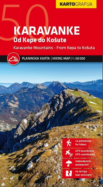
- Karavanke Mountains - Kep to Kosuta Kartografija WATERPROOF Hiking Map
- Karavanke Mountains between the peaks of Kepe and Košutenikov Turn at 1:50,000 on a waterproof and tear-resistant, contoured and GPS compatible walking and cycling map from Kartografija in Ljubljana, with on the reverse information about local mountain huts.Coverage, including the overprint for hiking trails, cycle routes and other tourist... Read more

Stanfords
United Kingdom
- Karavanke - Central Area
- The central area of the Karavanke range at 1:50,000 in a series of contoured, GPS compatible recreational maps from Planinska zveza Slovenie - Slovenian Alpine Club, with on the reverse full details of 24 alpine huts including number of beds, seasonal opening months, etc, plus QR codes for further information.Maps at 1:50,000 in the Planinska... Read more

Stanfords
United Kingdom
- Val Venosta / Vinschgau K+F Outdoor Map 1
- Val Venosta / Vinschgau area in the Dolomites at 1:50,000 in a series of waterproof and tear-resistant, GPS compatible and contoured recreational maps from Kümmerly + Frey with both local and long-distance hiking and cycling trails, ski routes, sites for other outdoor pursuits, accommodation, bus stops, etc. Coverage includes the Ortles/Ortler... Read more

Stanfords
United Kingdom
- Lake Maggiore - Lake Orta - Lake Varese K+F Outdoor Map 8
- Lake Maggiore - Lake Orta - Lake Varese area at 1:50,000 in a series of waterproof and tear-resistant, GPS compatible and contoured recreational maps from Kümmerly + Frey with both local and long-distance hiking and cycling trails, ski routes, sites for other outdoor pursuits, accommodation, bus stops, etc. An inset provides a small road map of... Read more

Stanfords
United Kingdom
- Klopeiner See - Karawanken East - Steiner Alps Kompass 65
- Klopeiner See - Karawanken East - Steiner Alps, spanning the border of Austria and Slovenia, on a detailed, GPS compatible map at 1:50,000 from Kompass with local and long-distance footpaths, cycling routes, accommodation, etc, printed on durable, waterproof and tear-resistant synthetic paper. On the reverse is a panorama map of the... Read more

Stanfords
United Kingdom
- Lake Como K+F Outdoor Map 9
- Lake Como area at 1:50,000 on a double-sided, waterproof and tear-resistant, GPS compatible and contoured recreational maps from Kümmerly + Frey with both local and long-distance hiking and cycling trails, ski routes, sites for other outdoor pursuits, accommodation, bus stops, etc. Coverage includes the northern part of Lake Lugano and extends... Read more

Stanfords
United Kingdom
- Heidiland - UNESCO Tectonic Arena Sardona 50K K+F Hiking Map No. 33
- Heidiland, including the Swiss Tectonic Arena Sardona – a UNESCO World Heritage Site, at 1:50,000 in Kümmerly + Frey’s hiking series of Switzerland printed on light, waterproof and tear-resistant plastic paper. Coverage includes Walensee, Flumserberg, Pizol, Weisstannental, Sarganserland and Taminatal. Hiking trails highlighted on the map... Read more

Stanfords
United Kingdom
- Val Brembana - Valsassina - Le Grigne: Lecco - Bergamo 50K IGC Map No. 22
- Val Brembana - Valsassina - Le Grigne area including Lecco and Bergamo in a series contoured hiking maps at 1:50,000 with local trails, long-distance footpaths, mountain accommodation, etc. from the Turin based Istituto Geografico Centrale.Maps in this series have contours at 50m intervals, enhanced by shading and graphic relief. An overprint... Read more
Stanfords
United Kingdom
- Adelboden - Lenk
- Adelboden - Lenk area of the western Bernese Oberland, from Gstaad to Frutigen and Leukerbad at 1:50,000 in a series from Hallwag covering Switzerland’s popular hiking regions on light, waterproof and tear-resistant maps highlighting long-distance paths: the nine national routes plus special regional routes, as well as other local hiking... Read more