
Sierra de Gredos
Description
East-West oriented mountain range, in central Spain, West of Madrid. The highest elevation is Pico Almanzor, at 2.592 metres.
Trails in this region
Links
Facts
Reports
Guides and maps
Lodging
Organisations
Tour operators
GPS
Other
Books

Stanfords
United Kingdom
United Kingdom
- GR3: Les Monts du Forez FFRP Topo-guide No. 334
- Les Monts du Forez, FFRP topoguide Ref. No. 334, covering in all 259kms along the GR3 and its variant, with additional descriptions of 21 day walks in the region. Current edition of this title was published in April 2016.ABOUT THE FFRP (Fédération française de la randonnée pédestre) TOPOGUIDES: published in a handy A5 paperback format, the... Read more

Stanfords
United Kingdom
2018
United Kingdom
2018
- Val d`Azun à pied ST10
- Val d`Azun à pied, FFRP topo-guide Ref. No. ST10, with 18 day walks of varying length and difficulty in the French Pyrenees south-west of Argelès-Gazost, plus a tour which includes part of the GR10 long-distance footpaths. Each walk is presented on a separate colour extract from IGN’s topographic survey of France at 1:25,000 and/or 1:50,000,... Read more

Stanfords
United Kingdom
2020
United Kingdom
2020
- Tour du Larzac, Templier - Hospitalier - Entre causses et vallées GR71C/GR71D
- Tour du Larzac - Templier et Hospitalier, FFRP topoguide Ref. No. 710, covering the 195kms of hiking circuits along the GR71C and GR71D south of Millau in the Causse du Larzac, plus 13 local day walks. Current edition of this title was published in December 2015.ABOUT THE FFRP (Fédération française de la randonnée pédestre) TOPOGUIDES:... Read more
Stanfords
United Kingdom
2020
United Kingdom
2020
- Les Abers - le Chemin de Phares GR34/GR34F
- Les Abers - le chemin de phares, FFRP topoguide Ref. no. 347, covering the coastal route in north-western Brittany between Morlaix, Brest, and le Fau, plus 4 walks on the Ile d`Ouessant. Current edition of this title was published in September 2017.Between Morlaix and Brest, where the sea has dug deep furrows in the land. More than 20 days of... Read more
Stanfords
United Kingdom
2020
United Kingdom
2020
- La Traversee der Alpes La Vanoise - PN de la Vanoise GR5/GR55
- 15 days in altitude from the Tarentaise to Modane, heart of the Maurienne. Description also of Via Alpina.La Vanoise (including Parc National de la Vanoise), FFRP topoguide Ref. no. 530, covering the second section of the GR5 in the French Alps between Landry and Modane, its lower variant on the GR5E along the river Arc, plus the traverse of... Read more
Stanfords
United Kingdom
2018
United Kingdom
2018
- Sentiers de St-Jacques via le Puy - Le Puy to Figeac GR65
- Chemins de St-Jacques: Le Puy - Figeac, FFRP topoguide Ref. no. 651, covering a 252km section of the Way of St. James across the Massif Central from Le Puy-en-Velay to Figeac along the GR 65. Current edition of this title was published in August 2014.ABOUT THE FFRP (Fédération française de la randonnée pédestre) TOPOGUIDES: published in a handy... Read more

Stanfords
United Kingdom
2019
United Kingdom
2019
- Du Léman à la Vanoise - par le Mont Blanc et le Beaufortain GR5
- The first, 206-km long Alpine section of the GR5 from Lake Geneva, past Mont Blanc and across the Col de la Croix-du-Bonhomme, to Landry north of the Vanoise Massif, FFRP topo-guide ref. no. 504, with colour maps from the IGN TOP25 series at 1:25,000. Also included is a tour of the Dents du Midi. Current edition of this title was published in... Read more
Stanfords
United Kingdom
2020
United Kingdom
2020
- Le Chemin de Saint-Guilhem-le-Desert - Lozere - Aveyron - Gard - Herault
- Le chemin de Saint-Guilhem-le Désert, FFRP topoguide Ref. No. 4834, covering the 340kms of hiking routes between Aumont-Aubrac in the Massif Central, across the Cevennes, to Saint-Guilhem-le-Désert near Montpellier. Current edition of this title was published in July 2018ABOUT THE FFRP (Fédération française de la randonnée pédestre) TOPOGUIDES:... Read more

Stanfords
United Kingdom
2015
United Kingdom
2015
- GR9/GR96/GRP: Tours et Traversées de Chartreuse FFRP Topo-guide No. 903
- Tours et Traversées de Chartreuse, FFRP topoguide Ref. no. 903, covering 385kms of routes along the GR9 and GR96 in the northern part of the French Alps between Culoz, Chambéry and Grenoble. Current edition of this title was published in May 2015.ABOUT THE FFRP (Fédération française de la randonnée pédestre) TOPOGUIDES: published in a handy A5... Read more

Stanfords
United Kingdom
2019
United Kingdom
2019
- La Traversée des Alpes de la Maurienne a l`Ubaye GR5/GR56
- 9 days from Modane to Larche by the GR5, as much for the tour of Ubaye.Grande Traversée des Alpes: de la Maurienne a l`Ubaye, FFRP topoguide Ref. No. 531, covering the third stage of the GR5 in the French Alps from Modane to Larche, plus the Tour de l`Ubaye at its southern end, in all 272km for hiking routes. Current edition of this title was... Read more

Stanfords
United Kingdom
2012
United Kingdom
2012
- GR62B/GR36/GR46 Le Chemin de Conques à Toulouse FFRP Topo-guide No. 3646
- Le Chemin de Conques à Toulouse, FFRP topoguide Ref. no. 3646, covering 563kms of various GR routes in the region of Quercy and the Gorges of the Aveyron between Conques and Cahors in the north and Toulouse and Albi in the south: le Chemin de Conques à Toulouse along the GR62B, 36 and 46; GR 36 from Cahors to Albi; GR46 along the Gorges of the... Read more
Stanfords
United Kingdom
2019
United Kingdom
2019
- Corse entre Mer et Montagne
- Corse entre Mer et Montagne, FFRP topoguide Ref. No. 065, covering various trails across the mountains of Corsica which provide shorter and/or easier alternatives to the popular but longer and more strenuous GR20. Current edition of this title was published in April 2016.ABOUT THE FFRP (Fédération française de la randonnée pédestre) TOPOGUIDES:... Read more
Stanfords
United Kingdom
2021
United Kingdom
2021
- Tour de l`Oisans et des Ecrins - Parc National des Ecrins GR54/GR541
- Tour de l`Oisans et des Ecrins, FFRP topoguide, Ref. No. 508, covering the 11 to 13 days long tour of the Ecrins massif along the GR54, including the local section of the GR5. Variants along GRs 54A, 54B, 54C, and 541 offer less demanding circuits of two to three days. Current edition of this title was published in April 2014.To see other... Read more

Stanfords
United Kingdom
2015
United Kingdom
2015
- GR59/GR59A/GR559/GR509: L`Echappée jurassienne FFRP Topo-guide No. 390
- L`Echappée jurassienne, FFRP topo-guide Ref. No. 390, covering 293km-long route which combines several hiking trails across the heart of the French Jura between Dole in the north and Saint-Claude in the south, along the.GR59, 59A, 559 and 509. The route includes many of the Jura’s best natural locations: Grande Saline and Saline Royale... Read more
Stanfords
United Kingdom
2019
United Kingdom
2019
- A Travers la Montagne Corse - PNR de Corse GR20
- À Travers la Montagne Corse, FFRP topoguide Ref. No. 067, covering one of Europe’s most popular and demanding long-distance hiking walking trails, the 200km/125 miles-long high-level route across the mountains of Corsica. Current edition of this title was published in March 2014.To see other titles in this series please click on the series... Read more
Maps
Stanfords
United Kingdom
2016
United Kingdom
2016
- Sur les Traces des Cathares GR107 FR et ES Plus de 10 Jours de Randonnee: FFR.1097: 2016
- Sur les traces des Cathares, Le Chemin des Bonshommes GR 10 Topo Guide FFRP ref 1097 Hiking guide for the French Pyrenees with description of a multi-day hike of 220 km for 10 days hiking through the Cathar country from Foix, Ariege along Andorra to Berga ( Pyrenees France and Spain).French-speaking hiking guide. Excellent description with... Read more
Stanfords
United Kingdom
United Kingdom
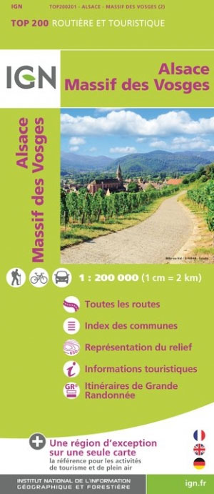
- Massif des Vosges - Plaine d`Alsace IGN Top200 201
- Pyrénées Ouest map from the IGN at 1:200,000, with excellent presentation of the terrain through contours and vivid relief shading, plenty of names of topographic features, long-distance GR hiking routes, places of interest, etc. The map is designed to provide convenient coverage of the western and central part of the Pyrenees, extending across... Read more

Stanfords
United Kingdom
2019
United Kingdom
2019
- Pyrénées Orientales et tours du Capcir, du Carlit et de Cerdagne GR10/GR36
- More than 30 days of hiking, including 12 to join Banyuls in Mérens-les-Vals.Pyrénées Orientales, FFRP topoguide, Ref. No. 1092, covering the fourth and last section of the GR10 along the Pyrenees from the Atlantic to the Mediterranean – a 196-km long walk from Mérens-les-Vals to Banyuls-sur-Mer. The guide also covers a 177-km trail along the... Read more
Stanfords
United Kingdom
United Kingdom
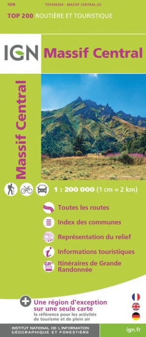
- Massif Central IGN Top200 204
- Pyrénées Ouest map from the IGN at 1:200,000, with excellent presentation of the terrain through contours and vivid relief shading, plenty of names of topographic features, long-distance GR hiking routes, places of interest, etc. The map is designed to provide convenient coverage of the western and central part of the Pyrenees, extending across... Read more

Stanfords
United Kingdom
United Kingdom
- Tour of the Canigó Hiking Circuit
- A 64-km long tour of Canigó (Canigou), the highest mountain in the eastern Pyrenees, presented by Editorial Alpina on a contoured, GPS compatible map at 1:25,000, with a booklet providing descriptions of its recommended stages.The map has contours at 20m intervals, enhanced by relief shading. The tour which follows sections of the GR10, the HRP... Read more

Stanfords
United Kingdom
2017
United Kingdom
2017
- Le Chemin du Piemont Pyreneen - vers Saint-Jacques-de-Compostell
- Le Chemin du Piémont Pyrénéen, FFRP topoguide, Ref. No. 780, covering the GR78 - the Way of St. James along the northern side of the Pyrenees from Carcassonne to Roncesvalles on the Spanish side, with an alternative variant to cross the mountains along the Col du Somport. Current edition of this title was published in May 2017.The route, the... Read more

Stanfords
United Kingdom
United Kingdom
- Salamanca - Sierra de Gredos - Madrid 500K CNIG Regional Map No. 5
- North-western part of central Spain with coverage extending from the Portuguese border to Madrid and north/south from Zamora and Valladolid to Toledo, at 1:500,000 in a series of regional road maps from the country’s civilian survey organization IGN-CNIG (Instituto Geográfico Nacional - Centro Nacional de Información Geográfica), vividly... Read more
Stanfords
United Kingdom
2019
United Kingdom
2019
- Tours et Traversées du Vercors - du Diois et les Baronnies GR9/GR91
- Tours et Traversées dans Vercors, le Diois et les Baronnies, FFRP topo-guide Ref. No. 904, covering in all over 1000 km of routes and circuits along the GR9, GR91, GR93, GR95, GR429 and GRs de Pays between Grenoble, Die and Brantes in Provence north of Mt Ventoux. Topographic mapping from the IGN is accompanied by detailed route descriptions,... Read more

Stanfords
United Kingdom
United Kingdom
- Macizo Central de Gredos CNIG
- The central section of the Sierra de Gredos on a contoured and GPS compatible map at 1:250,000 from IGN/CNIG using cartography of their civilian topographic survey of Spain. Coverage extends from El Arenal and Arenas se San Pedro westwards to Alisenda de Tormes, and north / south from Navacepeda de Tormes to Candelada.Contours are 10m... Read more

Stanfords
United Kingdom
United Kingdom
- Pays Basque West Rando Editions 1 SUPERCEDED
- The westernmost section of the French Pyrenees between the Atlantic coast and St-Jean-Pied-de-Port on a contoured and GPS compatible map at 1:50,000 from Rando Editions with topographic base provided by the IGN, highlighting local and long-distance hiking trails, cycle and mountain bike routes, etc. Coverage along the Atlantic coast starts at... Read more

Stanfords
United Kingdom
United Kingdom
- Canigou-Garrotxa Rando Editions 10
- Canigou Massif and the surrounding region of the French Pyrenees on a contoured and GPS compatible map at 1:50,000 from Rando Editions with topographic base provided by the IGN, highlighting local and long-distance hiking trails, mountain biking routes, etc. Topography is vividly presented by contours at 20m intervals enhanced by shading and... Read more
- Also available from:
- The Book Depository, United Kingdom
- De Zwerver, Netherlands


Stanfords
United Kingdom
United Kingdom
- High Jura - Northern Alps IGN Top200 202
- Pyrénées Ouest map from the IGN at 1:200,000, with excellent presentation of the terrain through contours and vivid relief shading, plenty of names of topographic features, long-distance GR hiking routes, places of interest, etc. The map is designed to provide convenient coverage of the western and central part of the Pyrenees, extending across... Read more
- Also available from:
- The Book Depository, United Kingdom

The Book Depository
United Kingdom
United Kingdom
- Haut-Jura / Alpes du Nord
- Pyrénées Ouest map from the IGN at 1:200,000, with excellent presentation of the terrain through contours and vivid relief shading, plenty of names of topographic features, long-distance GR hiking routes, places of interest, etc. The map is designed to provide convenient coverage of the western and central part of the Pyrenees, extending across... Read more

Stanfords
United Kingdom
United Kingdom
- Béarn - Aspe - Ossau - Pyrenees National Park Rando Editions 3
- French Pyrenees of the Béarn region, from Tardets-Sorholus to the western part of the Pyrenees National Park including the Ossau and Balaïtous massifs, on a contoured and GPS compatible map at 1:50,000 from Rando Editions with topographic base provided by the IGN, highlighting local and long-distance hiking trails, cycle and mountain bike... Read more
- Also available from:
- The Book Depository, United Kingdom
- De Zwerver, Netherlands

The Book Depository
United Kingdom
United Kingdom
- Bearn - Aspe - Ossau - Pyrenees NP
- Uitstekende wandelkaart met veel toeristische informatie en bijzonder gedetailleerd. Wandelroute en hutten / campings zijn ingetekend, met hoogtelijnen. Andere dorpen op deze kaart: Etsaut - Col du Somport - Fabrèges - Col du Pourtalet - la Pierre Saint Martin - Arette - Arudy - Laruns - Arrens Marsous - Argelès Gazost (Frankrijk - Pyreneeen)... Read more

De Zwerver
Netherlands
Netherlands
- Wandelkaart 03 Béarn - Bearn | Rando Editions
- Uitstekende wandelkaart met veel toeristische informatie en bijzonder gedetailleerd. Wandelroute en hutten / campings zijn ingetekend, met hoogtelijnen. Andere dorpen op deze kaart: Etsaut - Col du Somport - Fabrèges - Col du Pourtalet - la Pierre Saint Martin - Arette - Arudy - Laruns - Arrens Marsous - Argelès Gazost (Frankrijk - Pyreneeen)... Read more

Stanfords
United Kingdom
United Kingdom
- Southern Alps IGN Top200 203
- Pyrénées Ouest map from the IGN at 1:200,000, with excellent presentation of the terrain through contours and vivid relief shading, plenty of names of topographic features, long-distance GR hiking routes, places of interest, etc. The map is designed to provide convenient coverage of the western and central part of the Pyrenees, extending across... Read more
- Also available from:
- The Book Depository, United Kingdom

The Book Depository
United Kingdom
United Kingdom
- Alpes du Sud
- Pyrénées Ouest map from the IGN at 1:200,000, with excellent presentation of the terrain through contours and vivid relief shading, plenty of names of topographic features, long-distance GR hiking routes, places of interest, etc. The map is designed to provide convenient coverage of the western and central part of the Pyrenees, extending across... Read more
Stanfords
United Kingdom
2020
United Kingdom
2020
- Tours et Traversées du Massif des Bauges GR96
- Tours et Traversées du Massif des Bauges, FFRP topoguide Ref. no. 902, covering 500kms of routes in the French Alps between Annecy, Aix-les-Bains, Chambéry and Albertville. Current edition of this title was published in May 2015.ABOUT THE FFRP (Fédération française de la randonnée pédestre) TOPOGUIDES: published in a handy A5 paperback format,... Read more
- Also available from:
- The Book Depository, United Kingdom

The Book Depository
United Kingdom
2020
United Kingdom
2020
- Tour et travers�es du Massif des Bauges GR96/GRP
- Tours et Traversées du Massif des Bauges, FFRP topoguide Ref. no. 902, covering 500kms of routes in the French Alps between Annecy, Aix-les-Bains, Chambéry and Albertville. Current edition of this title was published in May 2015.ABOUT THE FFRP (Fédération française de la randonnée pédestre) TOPOGUIDES: published in a handy A5 paperback format,... Read more