
Stanfords
United Kingdom
- Dolomiti di Braies / Pragser Dolomiten - Marebbe / Ennberg Tabacco 031
- Dolomiti di Braies/Pragser Dolomiten - Marebbe/Ennberg area in a series of Tabacco maps at 1:25,000 covering the Dolomites and the mountains of north-eastern Italy - Stanfords’ most popular coverage for this region, with excellent cartography and extensive overprint for hiking routes and other recreational activities, local bus stops, etc.... Read more
Stanfords
United Kingdom
- Cortina d`Ampezzo - Dolomiti Ampezzane Kompass 617
- Map No. 617, Cortina d’Ampezzo and Dolomiti Ampezzane at 1:25,000 on a durable, waterproof and tear-resistant map from Kompass in their series of detailed maps of the Dolomites. The map is double-sided and includes sections of the ‘Alta Via’ high routes Nos. 1, 3, 4 and 5.CARTOGRAPHY: Kompass maps of the Dolomites at 1:25,000 have contours at... Read more

Stanfords
United Kingdom
- Cortina d`Ampezzo - Dolomiti Ampezzane Tabacco 03
- Cortina d`Ampezzo - Dolomiti Ampezzane area in a series of Tabacco maps at 1:25,000 covering the Dolomites and the mountains of north-eastern Italy - Stanfords’ most popular coverage for this region, with excellent cartography and extensive overprint for hiking routes and other recreational activities, local bus stops, etc. Additional overprint... Read more

Stanfords
United Kingdom
- Livigno and Environs
- Livigno and its environs on a detailed, contoured and GPS compatible map at 1:25,000 from Litografia Artistica Cartographical in their Global Map imprint, highlighting hiking trails, huts, ski lifts, etc. The map is double-sided, with a very generous overlap, and extends from the Swiss approaches to the Lago di Livigno Dam to Rifigio Dosde, and... Read more

Stanfords
United Kingdom
- Bolzano and Environs Kompass 154
- Map No. 154, Bolzano and Environs at 1:25,000 printed on sturdy waterproof and tear-resistant plastic paper. The map is part of Kompass series providing detailed coverage of the Dolomites and Lake Garda area and supplementing their main series of walking maps of Italy at 1:50,000. Maps in this series have a more detailed base and smaller... Read more

Stanfords
United Kingdom
- Bressanone / Brixen and Environs Kompass 050
- Map No. 050, Bressanone/Brixen and Environs - with a panorama map on the reverse, from Kompass in a series providing detailed coverage of the Dolomites and Lake Garda area and supplementing their main series of walking maps of Italy at 1:50,000. Maps in this series have a more detailed base and smaller contour interval than coverage at... Read more

Stanfords
United Kingdom
- Alta Badia / Hochabtai Kompass 624
- Map No. 624, Alta Badia/Hochabtai, at 1:25,000 from Kompass, printed on sturdy, waterproof and tear-resistant synthetic paper in a series providing detailed coverage of the Dolomites and the Lake Garda area. Maps in this series supplement the publishers` main series of walking maps of Italy at 1:50,000 and have a more detailed base and smaller... Read more

Stanfords
United Kingdom
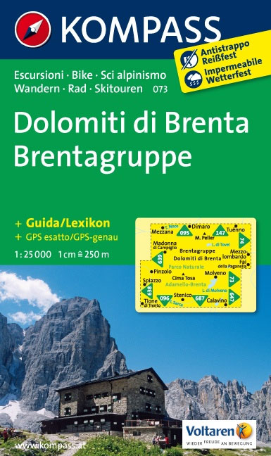
- Dolomiti di Brenta Kompass 073
- Map No. 073, Dolomiti di Brenta, from Kompass in a series providing detailed coverage of the Dolomites and Lake Garda area and supplementing their main series of walking maps of Italy at 1:50,000. Maps in this series have a more detailed base and smaller contour interval than coverage at 1:50,000.*Cartography:* maps at 1:25,000 have contours at... Read more
Stanfords
United Kingdom
- Texelgruppe NP - Merano High Route Kompass 043
- Map No. 043, Texelgruppe NP - Merano High Route, from Kompass, printed on strudy waterproof and tear-resistant plastic paper in a series providing detailed coverage of the Dolomites and Lake Garda area and supplementing their main series of walking maps of Italy at 1:50,000. Maps in this series have a more detailed base and smaller contour... Read more

Stanfords
United Kingdom
- Lana - Etschtal / Val d`Adige Kompass 054
- Map No. 054, Lana - with a panorama map on the reverse, from Kompass in a series providing detailed coverage of the Dolomites and Lake Garda area and supplementing their main series of walking maps of Italy at 1:50,000. Maps in this series have a more detailed base and smaller contour interval than coverage at 1:50,000.*Cartography:* maps at... Read more

Stanfords
United Kingdom
- Val Venosta / Vinschgau Kompass 52
- Val Venosta/Vinschgau area of the Dolomites on a GPS compatible hiking and recreational map at 1:50,000 from Kompass, printed on durable, waterproof and tear-resistant synthetic paper. KOMPASS HIKING MAPS OF ITALY: this title is part of an extensive series of walking maps from Kompass covering selected areas of Italy at mainly 1:50,000, with a... Read more
Stanfords
United Kingdom
- Val Venosta / Vinschgau 3-Map Set Kompass 670
- Val Venosta / Vinschgau in the South Tyrol on a set of three contoured and GPS compatible maps at 1:25,000 from Kompass in their series of detailed maps of the Dolomites. Coverage extends from Merano westwards to the Rèsia lake and pass in the north-west and includes the Stelvio / Stilfser Joch National Par, with the Ortles/Ortler group and... Read more

Stanfords
United Kingdom
- Alpi Bellunesi Kompass 77
- Belluno and Alpi Bellunesi in the southern Dolomites on a GPS compatible hiking and recreational map at 1:50,000 from Kompass. KOMPASS HIKING MAPS OF ITALY: this title is part of an extensive series of walking maps from Kompass covering selected areas of Italy at mainly 1:50,000, with a GPS compatible, contoured topographic base, extensive... Read more

Stanfords
United Kingdom
- Dolomiti di Sesto / Sextener Dolomiten Kompass 625
- Map No. 625, Dolomiti di Sesto/Sextener Dolomiten, at 1:25,000 from Kompass printed on sturdy, waterproof and tear-resistant synthetic paper in a series providing detailed coverage of the Dolomites and the Lake Garda area. Maps in this series supplement the publishers` main series of walking maps of Italy at 1:50,000 and have a more detailed... Read more

Stanfords
United Kingdom
- Val Gardena / Groden - Alpe di Siusi / Seiseralm Tabacco 05
- Val Gardena/Gröden - Alpe di Siusi/Seiseralm area in a series of Tabacco maps at 1:25,000 covering the Dolomites and the mountains of north-eastern Italy - Stanfords’ most popular coverage for this region, with excellent cartography and extensive overprint for hiking routes and other recreational activities, local bus stops, etc. Additional... Read more