Stanfords
United Kingdom
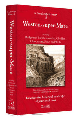
- Weston-super-Mare 1809-1922 (3-map set)
- Map No. 182, Weston-super-Mare 1809-1922 (3-map set), in the Cassini Historical Series of old Ordnance Survey mapping of England and Wales at 1:50,000 in a format designed to offer a convenient comparison with the present day coverage from the OS, and most locations in three different editions. Old historical maps have been combined so that the... Read more

Stanfords
United Kingdom
- Cambridge and Newmarket 1898-1901
- Map No. 154, Cambridge and Newmarket 1898-1901, in the Cassini Historical Series of old Ordnance Survey mapping of England and Wales at 1:50,000 in a format designed to offer a convenient comparison with the present day coverage from the OS, and most locations in three different editions. Old historical maps have been combined so that the sheet... Read more
Stanfords
United Kingdom
- Taunton and Lyme Regis 1899-1900
- Map No. 193, Taunton and Lyme Regis 1899-1900, in the Cassini Historical Series of old Ordnance Survey mapping of England and Wales at 1:50,000 in a format designed to offer a convenient comparison with the present day coverage from the OS, and most locations in three different editions. Old historical maps have been combined so that the sheet... Read more
Stanfords
United Kingdom
- Kidderminster and Wyre Forest 1831-1834
- Map No. 138, Kidderminster and Wyre Forest 1831-1834, in the Cassini Historical Series of old Ordnance Survey mapping of England and Wales at 1:50,000 in a format designed to offer a convenient comparison with the present day coverage from the OS, and most locations in three different editions. Old historical maps have been combined so that the... Read more
Stanfords
United Kingdom
- St David`s and Haverfordwest / Tyddewi a Hwlffordd 1922-1923
- Map No. 157, St David`s and Haverfordwest / Tyddewi a Hwlffordd 1922-1923, in the Cassini Historical Series of old Ordnance Survey mapping of England and Wales at 1:50,000 in a format designed to offer a convenient comparison with the present day coverage from the OS, and most locations in three different editions. Old historical maps have been... Read more
Stanfords
United Kingdom
- Barrow-in-Furness and South Lakeland 1903-1904
- Map No. 96, Barrow-in-Furness and South Lakeland 1903-1904, in the Cassini Historical Series of old Ordnance Survey mapping of England and Wales at 1:50,000 in a format designed to offer a convenient comparison with the present day coverage from the OS, and most locations in three different editions. Old historical maps have been combined so... Read more
Stanfords
United Kingdom
- Okehampton and North Dartmoor 1809-1919 (3-map set)
- Map No. 191, Okehampton and North Dartmoor 1809-1919 (3-map set), in the Cassini Historical Series of old Ordnance Survey mapping of England and Wales at 1:50,000 in a format designed to offer a convenient comparison with the present day coverage from the OS, and most locations in three different editions. Old historical maps have been combined... Read more
Stanfords
United Kingdom
- Lincoln and Newark-on-Trent 1902-1903
- Map No. 121, Lincoln and Newark-on-Trent 1902-1903, in the Cassini Historical Series of old Ordnance Survey mapping of England and Wales at 1:50,000 in a format designed to offer a convenient comparison with the present day coverage from the OS, and most locations in three different editions. Old historical maps have been combined so that the... Read more
Stanfords
United Kingdom
- Land`s End and Isles of Scilly 1900
- Map No. 203, Land`s End and Isles of Scilly 1900, in the Cassini Historical Series of old Ordnance Survey mapping of England and Wales at 1:50,000 in a format designed to offer a convenient comparison with the present day coverage from the OS, and most locations in three different editions. Old historical maps have been combined so that the... Read more

Stanfords
United Kingdom
- North Pembrokeshire OS Explorer Map OL35 (paper)
- The northern coast of Pembrokeshire between Cardigan and St Davids on a detailed topographic and GPS compatible map OL35, paper version, from the Ordnance Survey’s 1:25,000 Explorer series. Coverage includes Pembrokeshire Coast National Park, Goodwick, Fishguard, Llys-y-fran Reservoir, Ramsey Island, the Pembrokeshire Coast Path National Trail... Read more
Stanfords
United Kingdom
- Denbigh & Colwyn Bay / Dinbych a Bae Colwyn 1921-1924
- Map No. 116, Denbigh and Colwyn Bay / Dinbych a Bae Colwyn 1921-1924, in the Cassini Historical Series of old Ordnance Survey mapping of England and Wales at 1:50,000 in a format designed to offer a convenient comparison with the present day coverage from the OS, and most locations in three different editions. Old historical maps have been... Read more
Stanfords
United Kingdom
- Brecon Beacons / Bannau Brycheiniog 1901-1902
- Map No. 160, Brecon Beacons / Bannau Brycheiniog 1901-1902, in the Cassini Historical Series of old Ordnance Survey mapping of England and Wales at 1:50,000 in a format designed to offer a convenient comparison with the present day coverage from the OS, and most locations in three different editions. Old historical maps have been combined so... Read more
Stanfords
United Kingdom
- Newquay and Bodmin 1813-1919 (3-map set)
- Map No. 200, Newquay and Bodmin 1813-1919 (3-map set), in the Cassini Historical Series of old Ordnance Survey mapping of England and Wales at 1:50,000 in a format designed to offer a convenient comparison with the present day coverage from the OS, and most locations in three different editions. Old historical maps have been combined so that... Read more
Stanfords
United Kingdom
- Leicester, Coventry and Rugby 1901-1902
- Map No. 140, Leicester, Coventry and Rugby 1901-1902, in the Cassini Historical Series of old Ordnance Survey mapping of England and Wales at 1:50,000 in a format designed to offer a convenient comparison with the present day coverage from the OS, and most locations in three different editions. Old historical maps have been combined so that the... Read more
Stanfords
United Kingdom
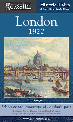
- London 1920
- London in 1920 in the Cassini Historical Series reproducing old Ordnance Survey mapping of England and Wales at 1:50,000. The four London maps cover roughly the area of the present day Greater London rather than following the format of rest of the series which is designed to correspond to the current Landranger maps. Mapping is identical to the... Read more