
Stanfords
United Kingdom
- Porthmadog and Dolgellau 1836-1841
- Map No. 124, Porthmadog and Dolgellau 1836-1841, in the Cassini Historical Series of old Ordnance Survey mapping of England and Wales at 1:50,000 in a format designed to offer a convenient comparison with the present day coverage from the OS, and most locations in three different editions. Old historical maps have been combined so that the... Read more
Stanfords
United Kingdom
- Snowdon / Yr Wyddfa 1840-1922 (3-map set)
- Map No. 115, Snowdon / Yr Wyddfa 1840-1922 (3-map set), in the Cassini Historical Series of old Ordnance Survey mapping of England and Wales at 1:50,000 in a format designed to offer a convenient comparison with the present day coverage from the OS, and most locations in three different editions. Old historical maps have been combined so that... Read more
Stanfords
United Kingdom
- Denbigh and Colwyn Bay / Dinbych a Bae Colwyn 1838-1924 (3-map set)
- Map No. 116, Denbigh and Colwyn Bay / Dinbych a Bae Colwyn 1838-1924 (3-map set), in the Cassini Historical Series of old Ordnance Survey mapping of England and Wales at 1:50,000 in a format designed to offer a convenient comparison with the present day coverage from the OS, and most locations in three different editions. Old historical maps... Read more
Stanfords
United Kingdom
- Bala and Lake Vyrnwy / Y Bala a Llyn Efyrnwy 1836-1840
- Map No. 125, Bala and Lake Vyrnwy / Y Bala a Llyn Efyrnwy 1836-1840, in the Cassini Historical Series of old Ordnance Survey mapping of England and Wales at 1:50,000 in a format designed to offer a convenient comparison with the present day coverage from the OS, and most locations in three different editions. Old historical maps have been... Read more
Stanfords
United Kingdom
- Porthmadog and Dolgellau 1836-1922 (3-map set)
- Map No. 124, Porthmadog and Dolgellau 1836-1922 (3-map set), in the Cassini Historical Series of old Ordnance Survey mapping of England and Wales at 1:50,000 in a format designed to offer a convenient comparison with the present day coverage from the OS, and most locations in three different editions. Old historical maps have been combined so... Read more
Stanfords
United Kingdom
- Aberystwyth and Machynlleth 1833-1923 (3-map set)
- Map No. 135, Aberystwyth and Machynlleth 1833-1923 (3-map set), in the Cassini Historical Series of old Ordnance Survey mapping of England and Wales at 1:50,000 in a format designed to offer a convenient comparison with the present day coverage from the OS, and most locations in three different editions. Old historical maps have been combined... Read more
Stanfords
United Kingdom
- Snowdon / Yr Wyddfa 1922
- Map No. 115, Snowdon / Yr Wyddfa 1922, in the Cassini Historical Series of old Ordnance Survey mapping of England and Wales at 1:50,000 in a format designed to offer a convenient comparison with the present day coverage from the OS, and most locations in three different editions. Old historical maps have been combined so that the sheet lines... Read more
Stanfords
United Kingdom
- Bala and Lake Vyrnwy / Y Bala a Llyn Efyrnwy 1836-1922 (3-map set)
- Map No. 125, Bala and Lake Vyrnwy / Y Bala a Llyn Efyrnwy 1836-1922 (3-map set), in the Cassini Historical Series of old Ordnance Survey mapping of England and Wales at 1:50,000 in a format designed to offer a convenient comparison with the present day coverage from the OS, and most locations in three different editions. Old historical maps... Read more
Stanfords
United Kingdom
- Denbigh and Colwyn Bay / Dinbych a Bae Colwyn 1838-1841
- Map No. 116, Denbigh and Colwyn Bay / Dinbych a Bae Colwyn 1838-1841, in the Cassini Historical Series of old Ordnance Survey mapping of England and Wales at 1:50,000 in a format designed to offer a convenient comparison with the present day coverage from the OS, and most locations in three different editions. Old historical maps have been... Read more
Stanfords
United Kingdom
- Porthmadog and Dolgellau 1921-1922
- Map No. 124, Porthmadog and Dolgellau 1921-1922, in the Cassini Historical Series of old Ordnance Survey mapping of England and Wales at 1:50,000 in a format designed to offer a convenient comparison with the present day coverage from the OS, and most locations in three different editions. Old historical maps have been combined so that the... Read more
Stanfords
United Kingdom
- Aberystwyth and Machynlleth 1833-1837
- Map No. 135, Aberystwyth and Machynlleth 1833-1837, in the Cassini Historical Series of old Ordnance Survey mapping of England and Wales at 1:50,000 in a format designed to offer a convenient comparison with the present day coverage from the OS, and most locations in three different editions. Old historical maps have been combined so that the... Read more

Stanfords
United Kingdom
Stanfords
United Kingdom
- Bala and Lake Vyrnwy / Y Bala a Llyn Efyrnwy 1921-1922
- Map No. 125, Bala and Lake Vyrnwy / Y Bala a Llyn Efyrnwy 1921-1922, in the Cassini Historical Series of old Ordnance Survey mapping of England and Wales at 1:50,000 in a format designed to offer a convenient comparison with the present day coverage from the OS, and most locations in three different editions. Old historical maps have been... Read more
Stanfords
United Kingdom
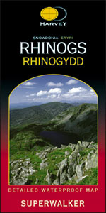
- Rhinogs / Rhinogydd - Snowdonia Harvey Superwalker
- The Rhinogs and the nearby peaks of Snowdonia at 1:25,000 on a waterproof and tear-resistant map from Harvey Map Services in their Superwalker series. Coverage extends from Harlech and Llanrair in the west to Trawsfynydd in the east, with Barmouth and Dolgellau on the southern edge of the map. Map legend and additional notes are also in Welsh.... Read more
Stanfords
United Kingdom
- Denbigh & Colwyn Bay / Dinbych a Bae Colwyn 1921-1924
- Map No. 116, Denbigh and Colwyn Bay / Dinbych a Bae Colwyn 1921-1924, in the Cassini Historical Series of old Ordnance Survey mapping of England and Wales at 1:50,000 in a format designed to offer a convenient comparison with the present day coverage from the OS, and most locations in three different editions. Old historical maps have been... Read more