
Stanfords
United Kingdom
- Taunton and Lyme Regis 1899-1900
- Map No. 193, Taunton and Lyme Regis 1899-1900, in the Cassini Historical Series of old Ordnance Survey mapping of England and Wales at 1:50,000 in a format designed to offer a convenient comparison with the present day coverage from the OS, and most locations in three different editions. Old historical maps have been combined so that the sheet... Read more
Stanfords
United Kingdom
- Presteigne and Hay-on-Wye / Llanandras a’r Gelli Gandryll 1831-1833
- Map No. 148, Presteigne and Hay-on-Wye / Llanandras a’r Gelli Gandryll 1831-1833, in the Cassini Historical Series of old Ordnance Survey mapping of England and Wales at 1:50,000 in a format designed to offer a convenient comparison with the present day coverage from the OS, and most locations in three different editions. Old historical maps... Read more
Stanfords
United Kingdom
- Hereford and Leominster 1831-1920 (3-map set)
- Map No. 149, Hereford and Leominster 1831-1920 (3-map set), in the Cassini Historical Series of old Ordnance Survey mapping of England and Wales at 1:50,000 in a format designed to offer a convenient comparison with the present day coverage from the OS, and most locations in three different editions. Old historical maps have been combined so... Read more
Stanfords
United Kingdom
- Minehead and Brendon Hills 1898-1900
- Map No. 181, Minehead and Brendon Hills 1898-1900, in the Cassini Historical Series of old Ordnance Survey mapping of England and Wales at 1:50,000 in a format designed to offer a convenient comparison with the present day coverage from the OS, and most locations in three different editions. Old historical maps have been combined so that the... Read more
Stanfords
United Kingdom
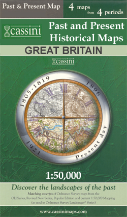
- Taunton and Wellington Past and Present
- Taunton and Wellington in the Cassini Past and Present map series which covers town and cities of England and Wales and offers a unique way of tracing their history and expansion by showing four different periods of their development using Ordnance Survey mapping from the mid-19th century, the late 19th century, the 1920s and the present day.... Read more
Stanfords
United Kingdom
- Hereford and Leominster 1831-1833
- Map No. 149, Hereford and Leominster 1831-1833, in the Cassini Historical Series of old Ordnance Survey mapping of England and Wales at 1:50,000 in a format designed to offer a convenient comparison with the present day coverage from the OS, and most locations in three different editions. Old historical maps have been combined so that the sheet... Read more

Stanfords
United Kingdom
- Exmoor & Taunton Cycling Map 84
- Exmoor and Taunton area of Devon and Somerset at 1:100,000 on a handy size, 50x35cm, double-sided contoured map from Croydecycle, printed on waterproof and tear-resistant synthetic paper and showing National Cycle routes and numerous local facilities, including campsites, pubs, etc. Coverage extends from Combe Martin, Barnstaple and South... Read more
Stanfords
United Kingdom
- Stafford and Telford 1902
- Map No. 127, Stafford and Telford 1902, in the Cassini Historical Series of old Ordnance Survey mapping of England and Wales at 1:50,000 in a format designed to offer a convenient comparison with the present day coverage from the OS, and most locations in three different editions. Old historical maps have been combined so that the sheet lines... Read more
Stanfords
United Kingdom
- Hereford and Leominster 1919-1920
- Map No. 149, Hereford and Leominster 1919-1920, in the Cassini Historical Series of old Ordnance Survey mapping of England and Wales at 1:50,000 in a format designed to offer a convenient comparison with the present day coverage from the OS, and most locations in three different editions. Old historical maps have been combined so that the sheet... Read more

Stanfords
United Kingdom
- Cape Town - Western Cape Towns Map Studio Street Atlas
- Cape Town and Western Cape Towns Street Atlas from Map Studio at 1:20,000, in an A4 spiral-bound format, with coverage extending well beyond the city’s outer suburbs to the towns of the Cape Winelands and South-Western Cape. The atlas includes an enlargement of central Cape Town and a route-planning map of main roads across the region with... Read more
Stanfords
United Kingdom
- Taunton and Lyme Regis 1809-1811
- Map No. 193, Taunton and Lyme Regis 1809-1811, in the Cassini Historical Series of old Ordnance Survey mapping of England and Wales at 1:50,000 in a format designed to offer a convenient comparison with the present day coverage from the OS, and most locations in three different editions. Old historical maps have been combined so that the sheet... Read more
Stanfords
United Kingdom
- Stafford and Telford 1833-1921 (3-map set)
- Map No. 127, Stafford and Telford 1833-1921 (3-map set), in the Cassini Historical Series of old Ordnance Survey mapping of England and Wales at 1:50,000 in a format designed to offer a convenient comparison with the present day coverage from the OS, and most locations in three different editions. Old historical maps have been combined so that... Read more
Stanfords
United Kingdom
- Presteigne and Hay-on-Wye / Llanandras a’r Gelli Gandryll 1919-1920
- Map No. 148, Presteigne and Hay-on-Wye / Llanandras a’r Gelli Gandryll 1819-1920, in the Cassini Historical Series of old Ordnance Survey mapping of England and Wales at 1:50,000 in a format designed to offer a convenient comparison with the present day coverage from the OS, and most locations in three different editions. Old historical maps... Read more

Stanfords
United Kingdom
- New Zealand Kiwimaps Travel & Touring Map
- New Zealand at 1:1,700,000 from Kiwimaps on a handy size, double-sided map with street plans of city centres in main towns. North and South Island are presented separately and accompanied by a distance table, a map showing driving times between various locations, plus the relevant street plans.The road network highlights state highways and... Read more
Stanfords
United Kingdom
- Minehead and Brendon Hills 1809
- Map No. 181, Minehead and Brendon Hills 1809, in the Cassini Historical Series of old Ordnance Survey mapping of England and Wales at 1:50,000 in a format designed to offer a convenient comparison with the present day coverage from the OS, and most locations in three different editions. Old historical maps have been combined so that the sheet... Read more