
Stanfords
United Kingdom
- Sheffield and Huddersfield 1903
- Map No. 110, Sheffield and Huddersfield 1903, in the Cassini Historical Series of old Ordnance Survey mapping of England and Wales at 1:50,000 in a format designed to offer a convenient comparison with the present day coverage from the OS, and most locations in three different editions. Old historical maps have been combined so that the sheet... Read more
Stanfords
United Kingdom
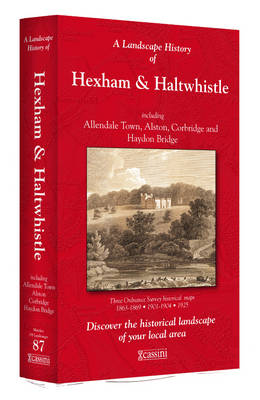
- Hexham and Haltwhistle 1863-1925 (3-map set)
- Map No. 87, Hexham and Haltwhistle 1983-1925 (3-map set), in the Cassini Historical Series of old Ordnance Survey mapping of England and Wales at 1:50,000 in a format designed to offer a convenient comparison with the present day coverage from the OS, and most locations in three different editions. Old historical maps have been combined so that... Read more
Stanfords
United Kingdom
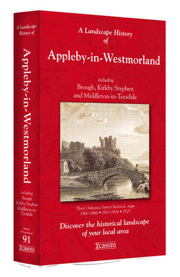
- Appleby-in-Westmorland 1860-1925 (3-map set)
- Map No. 91, Appleby-in-Westmorland 1860-1925 (3-map set), in the Cassini Historical Series of old Ordnance Survey mapping of England and Wales at 1:50,000 in a format designed to offer a convenient comparison with the present day coverage from the OS, and most locations in three different editions. Old historical maps have been combined so that... Read more
Stanfords
United Kingdom
- Sheffield and Huddersfield 1840-1841
- Map No. 110, Sheffield and Huddersfield 1840-1841, in the Cassini Historical Series of old Ordnance Survey mapping of England and Wales at 1:50,000 in a format designed to offer a convenient comparison with the present day coverage from the OS, and most locations in three different editions. Old historical maps have been combined so that the... Read more
Stanfords
United Kingdom
- Sheffield and Huddersfield 1923-1925
- Map No. 110, Sheffield and Huddersfield 1923-1925, in the Cassini Historical Series of old Ordnance Survey mapping of England and Wales at 1:50,000 in a format designed to offer a convenient comparison with the present day coverage from the OS, and most locations in three different editions. Old historical maps have been combined so that the... Read more
Stanfords
United Kingdom
- Berwick-upon-Tweed 1901
- Map No. 75, Berwick-upon-Tweed 1901, in the Cassini Historical Series of old Ordnance Survey mapping of England and Wales at 1:50,000 in a format designed to offer a convenient comparison with the present day coverage from the OS, and most locations in three different editions. Old historical maps have been combined so that the sheet lines... Read more
Stanfords
United Kingdom
- Wensleydale and Upper Wharfedale 1852-1925 (3-map set)
- Map No. 98, Wensleydale and Upper Wharfedale 1852-1925 (3-map set), in the Cassini Historical Series of old Ordnance Survey mapping of England and Wales at 1:50,000 in a format designed to offer a convenient comparison with the present day coverage from the OS, and most locations in three different editions. Old historical maps have been... Read more

Stanfords
United Kingdom
- Peak District - Dark Peak A-Z Adventure Atlas
- Peak District: Dark Peak Adventure Atlas at 1:25,000 in a series of handy A5 size Adventure Atlases from Geographers` A-Z Map Company with cartography from the Ordnance Survey’s Explorer series. Coverage includes Glossop, Hadfield, Stocksbridge, Chapel-en-le-Frith, Hope, Bamford, New Mills, Castleton, Bradwell, Hayfield, Tintwistle, Greenfield,... Read more
Stanfords
United Kingdom
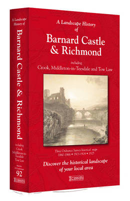
- Barnard Castle and Richmond 1860-1925 (3-map set)
- Map No. 92, Barnard Castle and Richmond 1860-1925 (3-map set), in the Cassini Historical Series of old Ordnance Survey mapping of England and Wales at 1:50,000 in a format designed to offer a convenient comparison with the present day coverage from the OS, and most locations in three different editions. Old historical maps have been combined so... Read more
Stanfords
United Kingdom
- Berwick-upon-Tweed 1865-1869
- Map No. 75, Berwick-upon-Tweed 1865-1869, in the Cassini Historical Series of old Ordnance Survey mapping of England and Wales at 1:50,000 in a format designed to offer a convenient comparison with the present day coverage from the OS, and most locations in three different editions. Old historical maps have been combined so that the sheet lines... Read more
Stanfords
United Kingdom
- Berwick-upon-Tweed 1926
- Map No. 75, Berwick-upon-Tweed 1926, in the Cassini Historical Series of old Ordnance Survey mapping of England and Wales at 1:50,000 in a format designed to offer a convenient comparison with the present day coverage from the OS, and most locations in three different editions. Old historical maps have been combined so that the sheet lines... Read more
Stanfords
United Kingdom
- Cheviot Hills and Kielder Water 1901
- Map No. 80, Cheviot Hills and Kielder Water 1901, in the Cassini Historical Series of old Ordnance Survey mapping of England and Wales at 1:50,000 in a format designed to offer a convenient comparison with the present day coverage from the OS, and most locations in three different editions. Old historical maps have been combined so that the... Read more
Stanfords
United Kingdom
- Blackburn and Burnley 1843-1925 (3-map set)
- Map No. 103, Blackburn and Burnley 1843-1925 (3-map set), in the Cassini Historical Series of old Ordnance Survey mapping of England and Wales at 1:50,000 in a format designed to offer a convenient comparison with the present day coverage from the OS, and most locations in three different editions. Old historical maps have been combined so that... Read more
Stanfords
United Kingdom
- Appleby-in-Westmorland 1860-1866
- Map No. 91, Appleby-in-Westmorland 1860-1866, in the Cassini Historical Series of old Ordnance Survey mapping of England and Wales at 1:50,000 in a format designed to offer a convenient comparison with the present day coverage from the OS, and most locations in three different editions. Old historical maps have been combined so that the sheet... Read more
Stanfords
United Kingdom
- Cheviot Hills and Kielder Water 1868-1869
- Map No. 80, Cheviot Hills and Kielder Water 1868-1869, in the Cassini Historical Series of old Ordnance Survey mapping of England and Wales at 1:50,000 in a format designed to offer a convenient comparison with the present day coverage from the OS, and most locations in three different editions. Old historical maps have been combined so that... Read more