
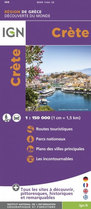
Crete
Description
Trails in this region
Links
Facts
Reports
Guides and maps
Lodging
Organisations
Tour operators
GPS
Other
Books

Stanfords
United Kingdom
United Kingdom
- DK Eyewitness Travel Guide The Greek Islands
- Discover the Greek Islands with this essential travel guide, designed to help you create your own unique trip and to transport you to this beautiful region of Greece before you`ve even packed your case - explore Corfu`s atmospheric Old Town, admire Santorini`s brilliant white-and-blue-washed houses, explore archaeological sites on Delos, wander... Read more

Stanfords
United Kingdom
United Kingdom
- Rick Steves Mediterranean Cruise Ports (Fifth Edition)
- Set sail and dive into Europe`s magnificent port cities with Rick Steves Mediterranean Cruise Ports! Inside you`ll find:*Rick`s expert advice on making the most of your time on a cruise and experiencing each city, with thorough coverage of 23 ports of call*Practical travel strategies including how to choose and book your cruise, adjusting to... Read more

Stanfords
United Kingdom
United Kingdom
- DK Eyewitness Top 10 Crete 14/5/20
- Picturesque Venetian ports, snow-capped mountains, awe-inspiring Minoan ruins, golden sands and glistening waters - Crete is an island paradise quite unlike any other. Your DK Eyewitness Top 10 travel guide ensures you`ll find your way around Crete with absolute ease.Our newly updated Top 10 travel guide breaks down the best of Crete into... Read more

Stanfords
United Kingdom
2015
United Kingdom
2015
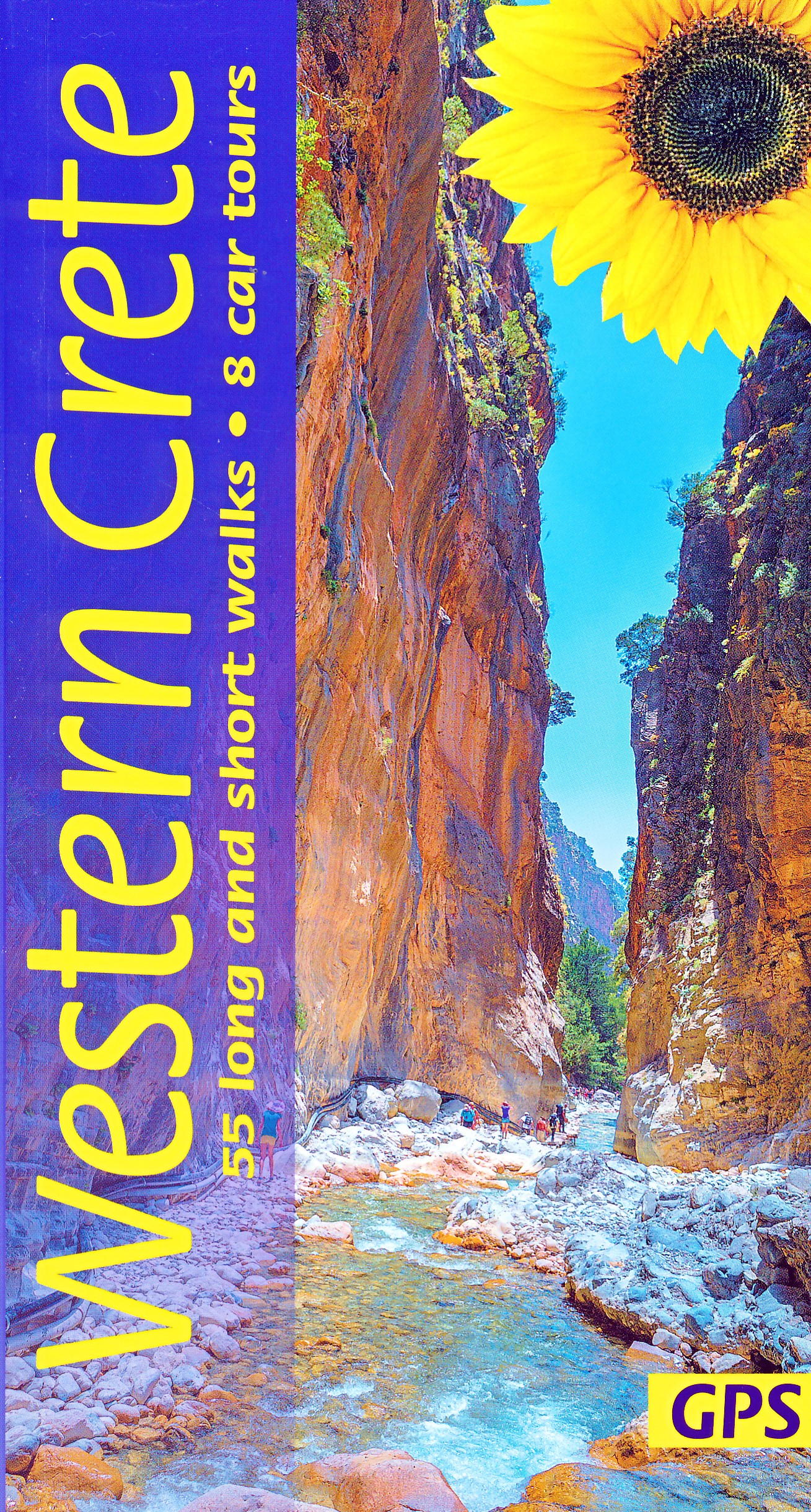
- Western Crete: Car Tours and Walks
- Western Crete is the Sunflower Landscapes guide to exploring the best walking and touring possibilities on the island. The guide covers a range of routes including walks in Kambi, Rodopos, Kallergi and the Samaria and Diktamos Gorges. A double-sided, fold-out touring map at the back of the book gives an overview of Crete and the location of... Read more

Stanfords
United Kingdom
2017
United Kingdom
2017
- Eastern Crete Sunflower Landscape Guide
- This new 5th edition of Eastern Crete was revised on the ground just a few months prior to publication. There are almost double the number of walks from the previous edition, and all the maps have been redrawn using OpenStreetMap source material with GPS tracking.Key features:50 long and short walks, colour-coded for grade1:50,000 topo maps... Read more

Stanfords
United Kingdom
2017
United Kingdom
2017
- Western Crete Sunflower Landscape Guide
- Portable guidebook of walks and car tours in the Sunflower/Landscapes series. Includes a pull-out map. Read more

The Book Depository
United Kingdom
2023
United Kingdom
2023
- Western Crete Sunflower Walking Guide
- 55 long and short walks, 8 car tours Read more
- Also available from:
- De Zwerver, Netherlands
De Zwerver
Netherlands
2023
Netherlands
2023
- Wandelgids Western Crete - Kreta west | Sunflower books
- 55 long and short walks, 8 car tours Read more

The Book Depository
United Kingdom
2023
United Kingdom
2023
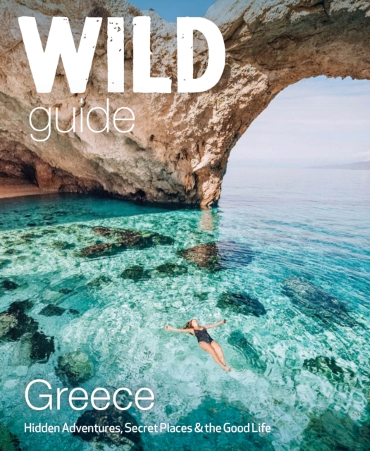
- Wild Guide Greece
- Hidden Places, Great Adventures and the Good Life (including the mainland, Crete, Corfu, Rhodes and over 20 other islands) Read more
- Also available from:
- De Zwerver, Netherlands
De Zwerver
Netherlands
2023
Netherlands
2023
- Reisgids Wild Guide Greece | Wild Things Publishing
- Hidden Places, Great Adventures and the Good Life (including the mainland, Crete, Corfu, Rhodes and over 20 other islands) Read more

The Book Depository
United Kingdom
United Kingdom
- Crete East walking guide
- This Rother Walking Guide to Crete East presents the hiker with a wide variety of 50 tour recommendations encompassing all regions of the eastern part of the island. The selections range from the bathing suit walk to hikes reaching hidden bays, excursions to picturesque villages and secluded monasteries, to tours of the alpine mountain terrain.... Read more
Bol.com
Netherlands
Netherlands
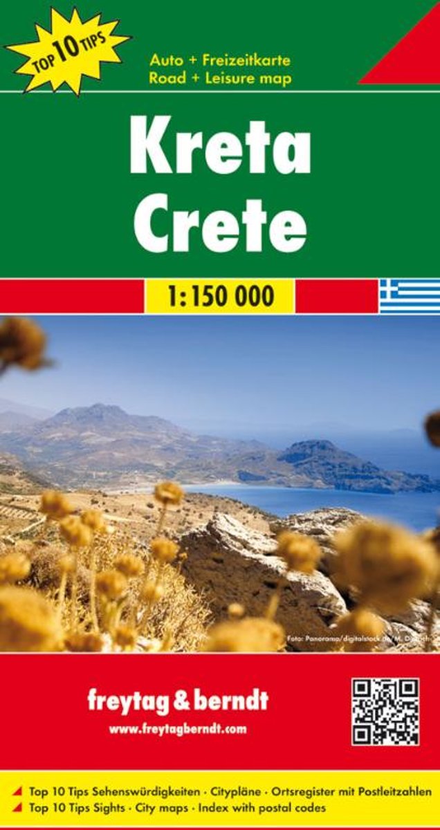
- Kreta
- Gedetailleerde wegenkaart, schaal 1:150 000, ideaal om uw reis te plannen en om ter plekke te gebruiken.Explore Crete with this Freytag & Berndt double-sided road map. The best way to plan your trip, prepare your itinerary, and to travel independently on this Greek island. As with all Freytag & Berndt maps the cartography is clear and detailed... Read more
- Also available from:
- Bol.com, Belgium
Bol.com
Belgium
Belgium
- Kreta
- Gedetailleerde wegenkaart, schaal 1:150 000, ideaal om uw reis te plannen en om ter plekke te gebruiken.Explore Crete with this Freytag & Berndt double-sided road map. The best way to plan your trip, prepare your itinerary, and to travel independently on this Greek island. As with all Freytag & Berndt maps the cartography is clear and detailed... Read more
Bol.com
Netherlands
Netherlands
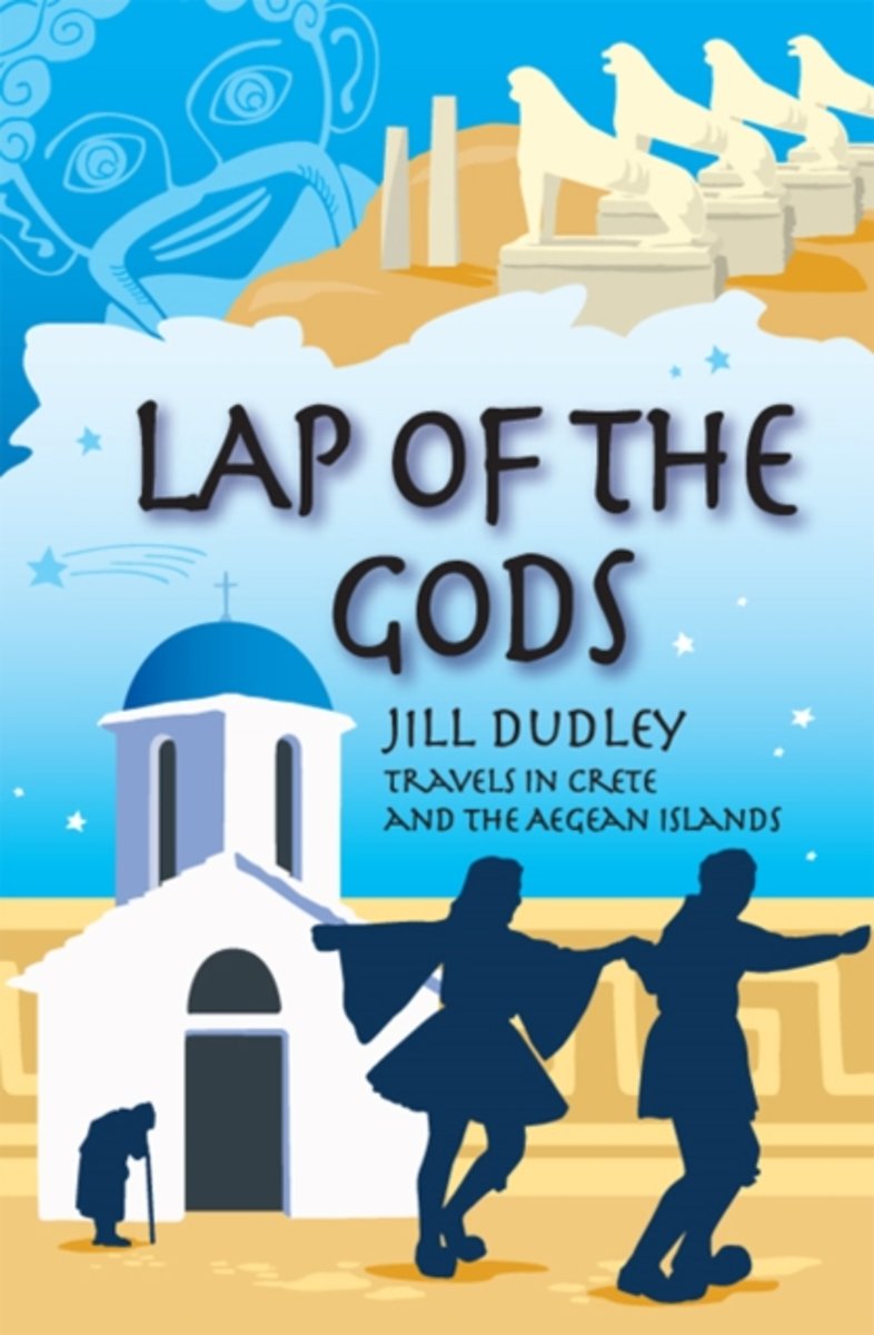
- Lap of the Gods
- In Lap of the Gods Jill Dudley explores the ancient Greek myths and legends of Crete and other Aegean islands, describing the landscape and the individuality of each as well as the characters she meets. With her customary light touch she traces the lives of such famous island figures as Hippocrates, Pythagoras, Homer, and Sappho who all... Read more
- Also available from:
- Bol.com, Belgium
Bol.com
Belgium
Belgium
- Lap of the Gods
- In Lap of the Gods Jill Dudley explores the ancient Greek myths and legends of Crete and other Aegean islands, describing the landscape and the individuality of each as well as the characters she meets. With her customary light touch she traces the lives of such famous island figures as Hippocrates, Pythagoras, Homer, and Sappho who all... Read more
Bol.com
Netherlands
Netherlands
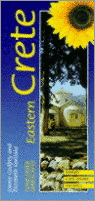
- CRETE EASTERN
- Designed to take visitors away from the tourist centres and out into the countryside, exploring by private or public transport, this guide to Eastern Crete includes a description of the Samaria Gorge walk as a day's excursion from the eastern part of the island. It also offers information on car tours, picnics, 22 main walks for all ages and... Read more
- Also available from:
- Bol.com, Belgium
Bol.com
Belgium
Belgium
- CRETE EASTERN
- Designed to take visitors away from the tourist centres and out into the countryside, exploring by private or public transport, this guide to Eastern Crete includes a description of the Samaria Gorge walk as a day's excursion from the eastern part of the island. It also offers information on car tours, picnics, 22 main walks for all ages and... Read more
De Zwerver
Netherlands
2018
Netherlands
2018
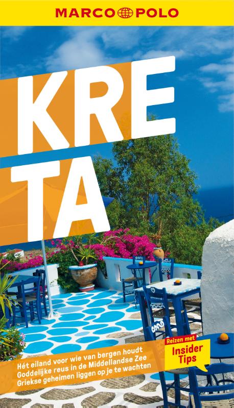
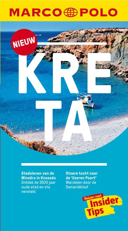
- Reisgids Marco Polo NL Kreta | 62Damrak
- Marco Polo reisgids voor Kreta! Handig pocket formaat, boordevol informatie, met uitneembare kaart van het hele land en 8 bladzijden met extra plattegronden. Met 'insider tips' om dit prachtige land op de Balkan écht te ontdekken, de TOP 15 van bezienswaardigheden in één oogopslag, up-to-date informatie in overzichtelijke hoofdstukken:... Read more
More books…
Maps

Stanfords
United Kingdom
United Kingdom
- Siena and Crete - Senesi West Edizioni Multigraphic 517
- Crete Senesi 1 - Val d`Arbia at 1:25,000 in a series of hiking maps from Edizioni Multigraphic covering Tuscany, parts of Umbria, and the adjoining areas. The cartography is rather old fashioned and sometimes not as clear as in the other map series but for many areas, especially for parts of Tuscany, these are the only hiking maps available.... Read more

Stanfords
United Kingdom
United Kingdom
- Eschenbach in der Oberpfalz E12
- Eschenbach i.d.OPf. in a series of GPS compatible recreational editions of the Bavarian topographic survey at 1:25,000, with waymarked hiking trails and cycling routes, campsites and youth hostels, etc. Coverage includes Creußen, Kirchenthumbach, Speichersdorf, Kemnath, Neustadt am Kulm, Grafenwöhr.Contours used in this map vary between 5 to... Read more

Stanfords
United Kingdom
United Kingdom
- Val d`Arbia, Ombrone and Orcia
- The valleys of Arbia, Ombrone and Orcia in Tuscany directly south of Siena on a detailed contoured map at 1:50,000 from Litografia Artistica Cartografica highlighting the course of La Via Francigena and other waymarked local trails.The map covers an area from Siena southwards to Castel del Piano including several nature reserves. Topography is... Read more

Stanfords
United Kingdom
United Kingdom
- Crete Senesi 2 - Crete Senesi 25K Ed. Multigraphic Map No. 518
- Crete Senesi 2 - Crete Senesi at 1:25,000 in a series of hiking maps from Edizioni Multigraphic covering Tuscany, parts of Umbria, and the adjoining areas. The cartography is rather old fashioned and sometimes not as clear as in the other map series but for many areas, especially for parts of Tuscany, these are the only hiking maps available.... Read more
Stanfords
United Kingdom
United Kingdom
- Crete Anavasi Adventure Atlas
- The new `Adventure Atlas of Crete` by Ananvasi is the ultimate tool to discover the island.Find all the information you need to go hiking, canyoning, climbing, swimming on beautiful beaches; explore abandoned villages, Minaon peak sanctuaries, cave-churches, Byzantine and Ottoman castles. Whatever you want to visit in Crete you will find it in... Read more

Stanfords
United Kingdom
United Kingdom
- Frangokastelo - Plakias Anavasi 11.17
- The Frangokastelo – Plakias area on the southern coast of Crete at 1:25,000 in a series of contoured, GPS compatible hiking maps of Crete from Anavasi, printed waterproof and tear-resistant paper. Annotations provide useful hints for walkers. Coverage extends from Imbros Gorge in the west to Plakias in the east.Topography is shown by contour... Read more
- Also available from:
- The Book Depository, United Kingdom
- De Zwerver, Netherlands

The Book Depository
United Kingdom
United Kingdom
- Fragokastelo - Plakias 2016
- Uitstekende topografische kaarten van een deel van Griekenland: zonder meer hele goede kaarten voor wandeltochten in een onbekend stuk Griekenland! Ze zijn gedrukt op scheurvast en watervast papier op een schaal van 1:25.000 met een UTM grid voor GPS gebruikers. Op de meeste kaarten is geven de hoogtelijnen een interval van 20m. aan. Met... Read more

De Zwerver
Netherlands
Netherlands
- Wandelkaart 11.17 Frangokastelo - Plakias - Kreta | Anavasi
- Uitstekende topografische kaarten van een deel van Griekenland: zonder meer hele goede kaarten voor wandeltochten in een onbekend stuk Griekenland! Ze zijn gedrukt op scheurvast en watervast papier op een schaal van 1:25.000 met een UTM grid voor GPS gebruikers. Op de meeste kaarten is geven de hoogtelijnen een interval van 20m. aan. Met... Read more

Stanfords
United Kingdom
United Kingdom
- Samaria - Sougia - Paliochora Anavasi 11.13
- Samaria – Sougia area of the White Mountains on Crete on a waterproof and tear-resistant, GPS compatible and contoured hiking map at 1:25,000 from Anavasi, extending from the famous Gorge of Samaria westwards to Azogyres and Plemeniana, and north past Omalos and the peaks of Troili and Kaimeni Kafala.Topography is shown by contour lines at 20m... Read more
- Also available from:
- The Book Depository, United Kingdom
- De Zwerver, Netherlands

The Book Depository
United Kingdom
United Kingdom
- Samaria - Sougia
- Uitstekende topografische kaarten van een deel van Griekenland: zonder meer hele goede kaarten voor wandeltochten in een onbekend stuk Griekenland! Ze zijn gedrukt op scheurvast en watervast papier op een schaal van 1:25.000 met een UTM grid voor GPS gebruikers. Op de meeste kaarten is geven de hoogtelijnen een interval van 20m. aan. Met... Read more

De Zwerver
Netherlands
Netherlands
- Wandelkaart 11.13 Samaria - Soughia - Kreta | Anavasi
- Uitstekende topografische kaarten van een deel van Griekenland: zonder meer hele goede kaarten voor wandeltochten in een onbekend stuk Griekenland! Ze zijn gedrukt op scheurvast en watervast papier op een schaal van 1:25.000 met een UTM grid voor GPS gebruikers. Op de meeste kaarten is geven de hoogtelijnen een interval van 20m. aan. Met... Read more

The Book Depository
United Kingdom
United Kingdom
- Crete West
- Western Crete on a double-sided, contoured and GPS compatible map at 1:100,000 from Harms Verlag, with highlighting for numerous places of interest and 20 recommended hiking trails, plus street plans of central Heraklion, Rethymnon and Chania and a plan of the archaeological site at Knossos. All place names are in both Greek and Latin alphabet.... Read more
- Also available from:
- De Zwerver, Netherlands

De Zwerver
Netherlands
Netherlands
- Wandelkaart Kreta west | Harms IC Verlag
- Western Crete on a double-sided, contoured and GPS compatible map at 1:100,000 from Harms Verlag, with highlighting for numerous places of interest and 20 recommended hiking trails, plus street plans of central Heraklion, Rethymnon and Chania and a plan of the archaeological site at Knossos. All place names are in both Greek and Latin alphabet.... Read more

The Book Depository
United Kingdom
United Kingdom
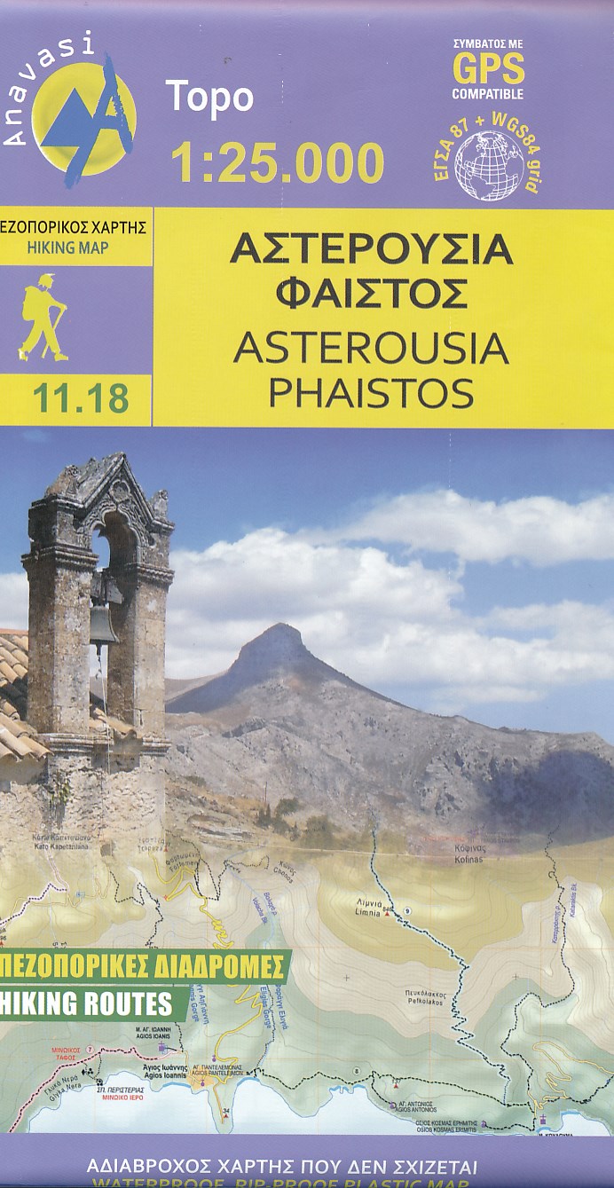
- Asterousia - Phaistos 2018
- Uitstekende topografische kaarten van een deel van Griekenland: zonder meer hele goede kaarten voor wandeltochten in een onbekend stuk Griekenland! Ze zijn gedrukt op scheurvast en watervast papier op een schaal van 1:25.000 met een UTM grid voor GPS gebruikers. Op de meeste kaarten is geven de hoogtelijnen een interval van 20m. aan. Met... Read more
- Also available from:
- De Zwerver, Netherlands
De Zwerver
Netherlands
Netherlands
- Wandelkaart 11.18 Asterousia - Phaistos, zuidkust Kreta | Anavasi
- Uitstekende topografische kaarten van een deel van Griekenland: zonder meer hele goede kaarten voor wandeltochten in een onbekend stuk Griekenland! Ze zijn gedrukt op scheurvast en watervast papier op een schaal van 1:25.000 met een UTM grid voor GPS gebruikers. Op de meeste kaarten is geven de hoogtelijnen een interval van 20m. aan. Met... Read more

The Book Depository
United Kingdom
United Kingdom
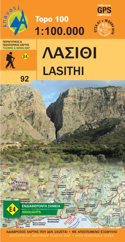
- Lasithi - Crete
- Topografische Landkarte Griechenland 92 Lasithi (Kreta) 1 : 100 000 ab 10.99 EURO new edition Read more
- Also available from:
- De Zwerver, Netherlands
De Zwerver
Netherlands
Netherlands
- Wegenkaart - landkaart 92 Kreta oost - Lasithi | Anavasi
- Topografische Landkarte Griechenland 92 Lasithi (Kreta) 1 : 100 000 ab 10.99 EURO new edition Read more

Stanfords
United Kingdom
United Kingdom
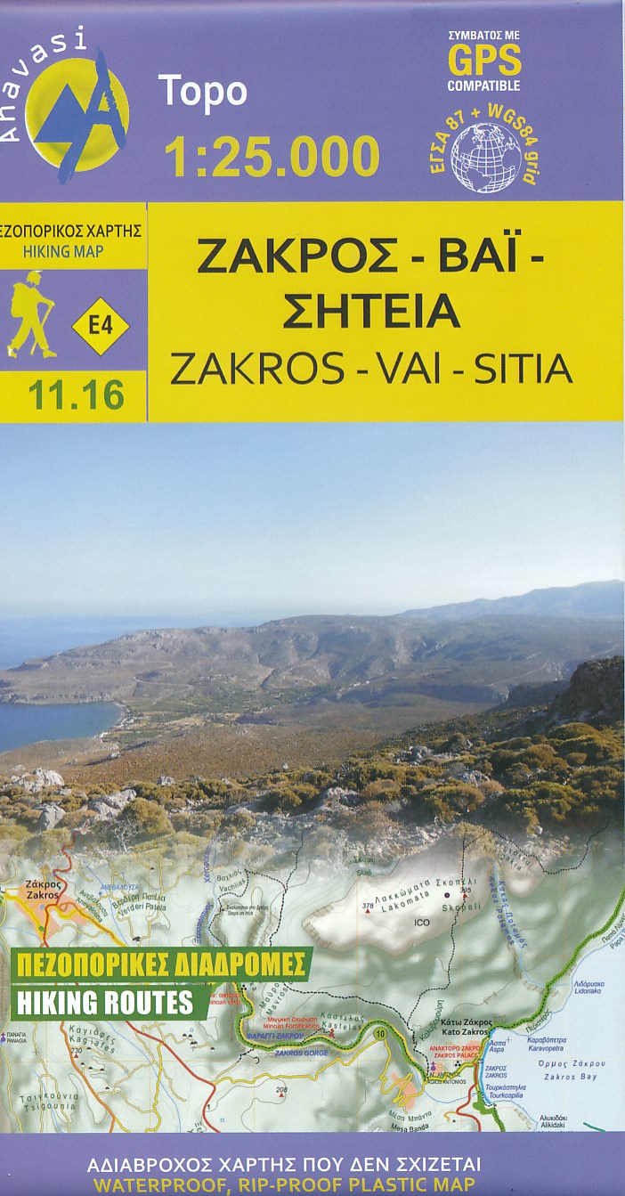
- Zakros - Vai - Sitia Anavasi 11.16
- Zakros - Vai - Sitia area on the easternmost tip of Crete on a light, waterproof and tear-resistant, GPS compatible and contoured, double-sided hiking map at 1:25,000 from Anavasi. Coverage along the northern coast starts at Sitia, extending south to cover the Zakros Mountains and the eastern coast south of Kato Zakros.Topography is shown by... Read more
- Also available from:
- The Book Depository, United Kingdom
- De Zwerver, Netherlands

The Book Depository
United Kingdom
United Kingdom
- Zakros - Vai - Sitia 2019
- Zakros - Vai - Sitia area on the easternmost tip of Crete on a light, waterproof and tear-resistant, GPS compatible and contoured, double-sided hiking map at 1:25,000 from Anavasi. Coverage along the northern coast starts at Sitia, extending south to cover the Zakros Mountains and the eastern coast south of Kato Zakros.Topography is shown by... Read more
De Zwerver
Netherlands
Netherlands
- Wandelkaart 11.16 Zakros - Vai - Kreta | Anavasi
- Zakros - Vai - Sitia area on the easternmost tip of Crete on a light, waterproof and tear-resistant, GPS compatible and contoured, double-sided hiking map at 1:25,000 from Anavasi. Coverage along the northern coast starts at Sitia, extending south to cover the Zakros Mountains and the eastern coast south of Kato Zakros.Topography is shown by... Read more

- Also available from:
- De Zwerver, Netherlands
De Zwerver
Netherlands
Netherlands

Stanfords
United Kingdom
United Kingdom
- White Mountains / Lefka Ori - Sfakia - Pahnes Anavasi 11.11/11.12
- Sfakia - Pahnes area of the White Mountains on Crete on a waterproof and tear-resistant, GPS compatible and contoured hiking map at 1:25,000 from Anavasi. Coverage is centered on Pahnes, Crete’s second highest mountain, and the surrounding peaks, extending west to the Eligia Gorge and east to Chora Sfakion on the coast.Topography is shown by... Read more
- Also available from:
- The Book Depository, United Kingdom
- De Zwerver, Netherlands

The Book Depository
United Kingdom
United Kingdom
- Lefka Ori: Sfakia - Pahnes
- Sfakia - Pahnes area of the White Mountains on Crete on a waterproof and tear-resistant, GPS compatible and contoured hiking map at 1:25,000 from Anavasi. Coverage is centered on Pahnes, Crete Read more
De Zwerver
Netherlands
Netherlands
- Wandelkaart 11.11-11.12 Lefka Ora, Sfakia - Pahnes - Kreta | Anavasi
- Sfakia - Pahnes area of the White Mountains on Crete on a waterproof and tear-resistant, GPS compatible and contoured hiking map at 1:25,000 from Anavasi. Coverage is centered on Pahnes, Crete Read more
De Zwerver
Netherlands
Netherlands
- Wandelkaart 501 Samaria Kloof - Samaria Gorge | Road Editions
- Zeer gedetailleerde wandelkaart van de beroemde Samaria Kloof op Kreta. Met alle topografische details als hoogtelijnen en waterlopen, maar ook veel toeristische informatie als picknickplekken, waterreservoirs, tunnels, bruggen en zelfs aanduidingen waar toiletvoorzieningen zijn. Read more