
Tuxer Alpen
Description
 The Tuxer Alpen - Tux Alps - is a mountain range of reasonable size in Tirol, sandwiched between two more famous regions, Karwendel in the north and the glacier capped Zillertal in the south. The Tux Alps therefore are not very well known. Yet it is a fine walking area for those who prefer less crowds. The highest mountain is Lizumer Reckner, 2.886 m There are over ten huts.
Map

Trails in this region
Links
Facts
Reports
Guides and maps
Lodging
Organisations
Tour operators
GPS
Other
Books

Bol.com
Netherlands
2017
Netherlands
2017
- The Swiss alpine pass route - Via Alpina route 1
- This guidebook presents the stunning Alpine Pass Route, now fully waymarked as Via Alpina 1. The 360km trail traverses Switzerland from east to west, from Sargans near the Liechtenstein border to Montreux on Lac Léman (Lake Geneva). Crossing sixteen Alpine passes, it showcases some of the country's most breathtaking mountain landscapes,... Read more
- Also available from:
- Bol.com, Belgium
Bol.com
Belgium
2017
Belgium
2017
- The Swiss alpine pass route - Via Alpina route 1
- This guidebook presents the stunning Alpine Pass Route, now fully waymarked as Via Alpina 1. The 360km trail traverses Switzerland from east to west, from Sargans near the Liechtenstein border to Montreux on Lac Léman (Lake Geneva). Crossing sixteen Alpine passes, it showcases some of the country's most breathtaking mountain landscapes,... Read more
Bol.com
Netherlands
2017
Netherlands
2017
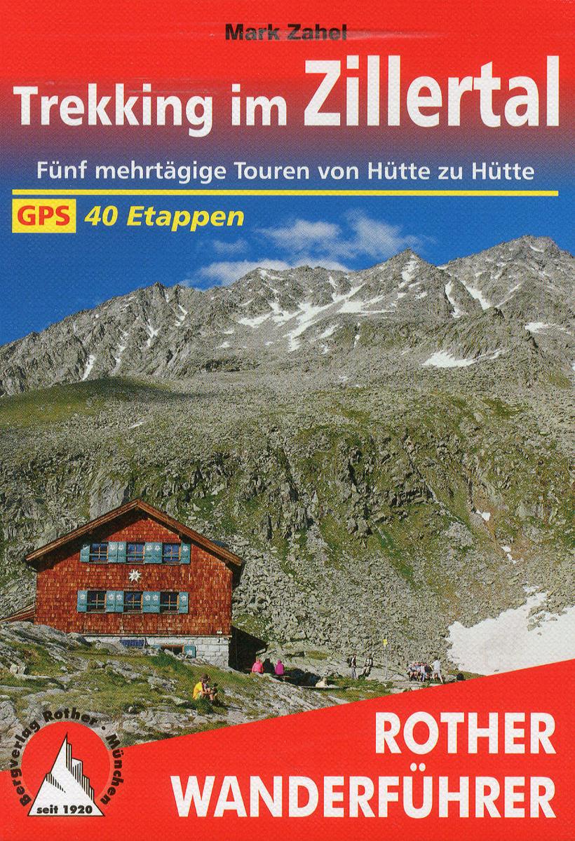
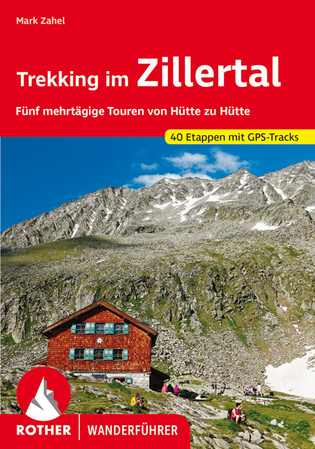
- Trekking im Zillertal
- Fünf mehrtägige Trekkings, darunter der Beliner Höhenweg, laden Wanderer zu hochalpinen Streifzügen von Hütte zu Hütte ein: eine ideale Möglichkeit, die großartige Bergwelt der Zillertaler und Tuxer Alpen zu erkunden. Read more
- Also available from:
- Bol.com, Belgium
- De Zwerver, Netherlands
Bol.com
Belgium
2017
Belgium
2017
- Trekking im Zillertal
- Fünf mehrtägige Trekkings, darunter der Beliner Höhenweg, laden Wanderer zu hochalpinen Streifzügen von Hütte zu Hütte ein: eine ideale Möglichkeit, die großartige Bergwelt der Zillertaler und Tuxer Alpen zu erkunden. Read more
De Zwerver
Netherlands
2021
Netherlands
2021
- Wandelgids Trekking im Zillertal | Rother Bergverlag
- Uitstekende wandelgids met een t aantal meerdaagse tochten in dal en hooggebergte. Met praktische informatie en beperkt kaartmateriaal! Wandelingen in verschillende zwaarte weergegeven in rood/blauw/zwart. 40 Höhenprofile; 40 Wanderkärtchen im Maßstab 1:75.000, zwei Übersichtskarten; GPS-Tracks zum Download Tagelang unterwegs sein, »oben«... Read more

De Zwerver
Netherlands
2021
Netherlands
2021
- Wandelgids Adlerweg - Adelaarsweg | Rother Bergverlag
- De Rother wandelgidsen beschrijven zeer goed de wandelingen in specifieke gebieden. In de gids vindt men kaarten, routebeschrijvingen en de nodige praktische informatie om van de wandelingen/trekkings een geslaagde onderneming te maken. 31 Höhenprofile; 32 Wanderkärtchen im Maßstab 1:75.000, zwei Übersichtskarten; GPS-Tracks zum Download »Auf... Read more

Bol.com
Netherlands
2019
Netherlands
2019
- WF5966 Julische Alpen mit Karte Kompass
- De Kompass wandelgids + kaart geeft een overzicht van alle wandelroutes in het gebied met nauwkeurige routeaanwijzingen en hoogteaanduidingen, De extra grote kaart, schaal 1:35 000, is ideaal om van te voren uw route uit te stippelen en om onderweg te gebruiken; naast de bekende bestemmingen, worden ook de minder bekende vermeld; openbaar... Read more
- Also available from:
- Bol.com, Belgium
Bol.com
Belgium
2019
Belgium
2019
- WF5966 Julische Alpen mit Karte Kompass
- De Kompass wandelgids + kaart geeft een overzicht van alle wandelroutes in het gebied met nauwkeurige routeaanwijzingen en hoogteaanduidingen, De extra grote kaart, schaal 1:35 000, is ideaal om van te voren uw route uit te stippelen en om onderweg te gebruiken; naast de bekende bestemmingen, worden ook de minder bekende vermeld; openbaar... Read more
Bol.com
Netherlands
Netherlands
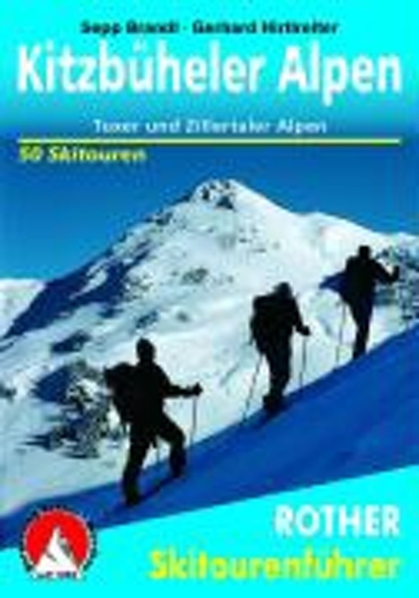
- Kitzb heler Alpen, Tuxer und Zillertaler Alpen. Skitourenf hrer
- Die Kitzb heler und die Tuxer Alpen mit ihren besonders skifreundlich geformten Schieferbergen sind eine Landschaft mit gro artigen M glichkeiten f r genussvolle Skitouren. Das Tourengel nde der Kitzb heler Alpen bietet vielfach bis in die Gipfelregion herrliche Almwiesen, f r Einsteiger wie geschaffen. F r Genie er besonders interessant sind... Read more
- Also available from:
- Bol.com, Belgium
Bol.com
Belgium
Belgium
- Kitzb heler Alpen, Tuxer und Zillertaler Alpen. Skitourenf hrer
- Die Kitzb heler und die Tuxer Alpen mit ihren besonders skifreundlich geformten Schieferbergen sind eine Landschaft mit gro artigen M glichkeiten f r genussvolle Skitouren. Das Tourengel nde der Kitzb heler Alpen bietet vielfach bis in die Gipfelregion herrliche Almwiesen, f r Einsteiger wie geschaffen. F r Genie er besonders interessant sind... Read more

The Book Depository
United Kingdom
2016
United Kingdom
2016
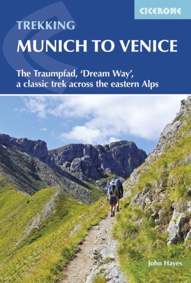
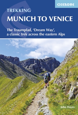
- Trekking Munich to Venice
- The Traumpfad, 'Dream Way', a classic trek across the eastern Alps Read more
- Also available from:
- Bol.com, Netherlands
- Bol.com, Belgium
- De Zwerver, Netherlands
Bol.com
Netherlands
2016
Netherlands
2016
- Trekking Munich to Venice
- This guidebook describes the 570km (354 mile) Traumpfad or 'Dream Way', an Alpine trek from Munich's Marienplatz to the Piazza San Marco in Venice. The route is broken into 30 stages of between 5hrs 30mins and 9hrs, graded according to difficulty, with 5 alternative stages and the option to spend a day traversing a section of via ferrata in the... Read more
Bol.com
Belgium
2016
Belgium
2016
- Trekking Munich to Venice
- This guidebook describes the 570km (354 mile) Traumpfad or 'Dream Way', an Alpine trek from Munich's Marienplatz to the Piazza San Marco in Venice. The route is broken into 30 stages of between 5hrs 30mins and 9hrs, graded according to difficulty, with 5 alternative stages and the option to spend a day traversing a section of via ferrata in the... Read more
De Zwerver
Netherlands
2016
Netherlands
2016
- Wandelgids Munich to Venice, The Traumpfad | Cicerone
- Guidebook to Der Traumpfad, 'Dream Way', through Germany and Italy, 570km from Munich to Venice across some of the best scenery in the Alps. Split into 30 stages, with 5 alternate stages and a day's via ferrata in the Dolomites, the guidebook has full information needed for the trek, including accommodation and points of interest. Read more

De Zwerver
Netherlands
2022
Netherlands
2022
- Wandelgids Munchen - Venetie, München - Venedig | Rother Bergverlag
- Beschrijving van een lange afstand pad dwars door de Alpen van Munchen naar Venetie: goede beschrijvingen van de etappes, kaarten redelijk. Die anspruchsvolle Alpenüberquerung von München nach Venedig verläuft auf einer der interessantesten aller möglichen Routen über das höchste Gebirge Europas. Im Herzen Münchens beginnt die Tour am... Read more

Bol.com
Netherlands
Netherlands
- Wanderland Schweiz 02. Trans Swiss Trail
- Das Wanderland Schweiz besteht aus 6 nationalen Routen und 51 mehrtägigenHighlights. Die Routen basieren auf dem bestehenden Wanderwegnetz und integrierenteilweise bereits bestehende Angebote wie beispielsweise Via Alpina, Jura Höhenweg,Via Jacobi oder Rheintaler Höhenweg.Alle 9 Führer sind mit Farbfotos, Karten und Höhenprofilen farbig reich... Read more
- Also available from:
- Bol.com, Belgium
Bol.com
Belgium
Belgium
- Wanderland Schweiz 02. Trans Swiss Trail
- Das Wanderland Schweiz besteht aus 6 nationalen Routen und 51 mehrtägigenHighlights. Die Routen basieren auf dem bestehenden Wanderwegnetz und integrierenteilweise bereits bestehende Angebote wie beispielsweise Via Alpina, Jura Höhenweg,Via Jacobi oder Rheintaler Höhenweg.Alle 9 Führer sind mit Farbfotos, Karten und Höhenprofilen farbig reich... Read more

Bol.com
Netherlands
2012
Netherlands
2012
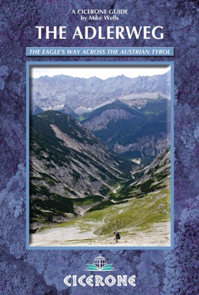
- The Adlerweg
- The Adlerweg (or Eagle's Way) is a well maintained and waymarked 300km path traversing the length of the Austrian Tyrol from St Johann in the east to St Anton in the west. It follows established mountain and valley tracks to traverse the length of the Austrian state of Tyrol from east to west. 6 low-level alternative stages and a challenging 8... Read more
- Also available from:
- Bol.com, Belgium
Bol.com
Belgium
2012
Belgium
2012
- The Adlerweg
- The Adlerweg (or Eagle's Way) is a well maintained and waymarked 300km path traversing the length of the Austrian Tyrol from St Johann in the east to St Anton in the west. It follows established mountain and valley tracks to traverse the length of the Austrian state of Tyrol from east to west. 6 low-level alternative stages and a challenging 8... Read more

- Also available from:
- Bol.com, Belgium


Bol.com
Netherlands
Netherlands
- Hiking in Switzerland
- This is the official guidebook to the Swiss section of the Via Alpina (National Route 1), published by the Swiss Hiking Federation. The Via Alpina is a network of five long-distance hiking routes which cross eight Alpine countries from Trieste to Monaco - over 5,000 kilometres of hiking trails in total. On Swiss soil, National Route 1 Via... Read more
- Also available from:
- Bol.com, Belgium
Bol.com
Belgium
Belgium
- Hiking in Switzerland
- This is the official guidebook to the Swiss section of the Via Alpina (National Route 1), published by the Swiss Hiking Federation. The Via Alpina is a network of five long-distance hiking routes which cross eight Alpine countries from Trieste to Monaco - over 5,000 kilometres of hiking trails in total. On Swiss soil, National Route 1 Via... Read more

Bol.com
Netherlands
Netherlands
- Un Jubilado En Los Alpes
- Se aproximaba el verano y era necesario decidirse. Entre unos pocos proyectos previstos hasta esos dias, que habian ido surgiendo en mi imaginacion durante el invierno, se fueron concretando a mitad de la primavera la posibilidad de caminar por el Himalaya, en Cachemira, recorrer algunos valles del Caucaso al norte de Georgia o atravesar los... Read more
- Also available from:
- Bol.com, Belgium
Bol.com
Belgium
Belgium
- Un Jubilado En Los Alpes
- Se aproximaba el verano y era necesario decidirse. Entre unos pocos proyectos previstos hasta esos dias, que habian ido surgiendo en mi imaginacion durante el invierno, se fueron concretando a mitad de la primavera la posibilidad de caminar por el Himalaya, en Cachemira, recorrer algunos valles del Caucaso al norte de Georgia o atravesar los... Read more
More books…

Maps

Stanfords
United Kingdom
United Kingdom
- Styrian Winelands - Southwest Styria F&B WK411
- Styrian Winelands area south-eastern Austria presented at 1:50,000 in a series of contoured and GPS compatible outdoor leisure map from Freytag & Berndt with hiking and cycling routes, mountain huts, campsites and youth hostels, local bus stops, plus other tourist information. To see the list of currently available titles in this series please... Read more

Stanfords
United Kingdom
United Kingdom
- Goms - Aletsch
- Goms - Aletsch area of the Bernese Oberland at 1:50,000 in a series from Hallwag covering Switzerland’s popular hiking regions on light, waterproof and tear-resistant maps highlighting long-distance paths: the nine national routes plus special regional routes, as well as other local hiking trails.Cartography is similar to that used both in... Read more

Stanfords
United Kingdom
United Kingdom
- Dachstein - Ausseerland - Filzmoos - Ramsau F&B WK281
- Dachstein - Ausseer Land - Filzmoos - Ramsau - Bad Ischl - Schladming area of the Austrian Alps presented at 1:50,000 in a series of contoured and GPS compatible outdoor leisure map from Freytag & Berndt with hiking and cycling routes, mountain huts, campsites and youth hostels, local bus stops, plus other tourist information. To see the list... Read more
- Also available from:
- The Book Depository, United Kingdom

The Book Depository
United Kingdom
United Kingdom
- Dachstein - Ausseerland - Filzmoos - Ramsau Hiking + Leisure Map 1:50 000
- Dachstein - Ausseer Land - Filzmoos - Ramsau - Bad Ischl - Schladming area of the Austrian Alps presented at 1:50,000 in a series of contoured and GPS compatible outdoor leisure map from Freytag & Berndt with hiking and cycling routes, mountain huts, campsites and youth hostels, local bus stops, plus other tourist information. To see the list... Read more

Stanfords
United Kingdom
United Kingdom
- Carinthian Alps - Gailtal - Gitschtal - Nassfeld - Lesachtal - Weissensee - Upper Drautal F&B WK223
- Naturarena Kärnten - Gailtal - Gitschtal -Lesachtal - Weissensee - Oberes Drautal area of Carinthia presented at 1:50,000 in a series of contoured and GPS compatible outdoor leisure map from Freytag & Berndt with hiking and cycling routes, mountain huts, campsites and youth hostels, local bus stops, plus other tourist information.To see the... Read more
- Also available from:
- The Book Depository, United Kingdom

The Book Depository
United Kingdom
United Kingdom

Stanfords
United Kingdom
United Kingdom
- Zillertal - Tuxer Alps - Jenbach - Schwaz F&B WK151
- Zillertal - Tuxer Alps - Jenbach – Schwaz - Mayrhofen area of the Austrian Alps presented at 1:50,000 in a series of contoured and GPS compatible outdoor leisure map from Freytag & Berndt with hiking and cycling routes, mountain huts, campsites and youth hostels, local bus stops, plus other tourist information.To see the list of currently... Read more
- Also available from:
- The Book Depository, United Kingdom

The Book Depository
United Kingdom
United Kingdom

Stanfords
United Kingdom
United Kingdom
- Bregenz Forest F&B WK364
- Bregenz - Bregenzerwald area of the Austrian Alps presented at 1:50,000 in a series of contoured and GPS compatible outdoor leisure map from Freytag & Berndt with hiking and cycling routes, mountain huts, campsites and youth hostels, local bus stops, plus other tourist information. To see the list of currently available titles in this series... Read more
- Also available from:
- The Book Depository, United Kingdom
- Bol.com, Netherlands
- Bol.com, Belgium

The Book Depository
United Kingdom
United Kingdom
- Bregenz Forest Hiking + Leisure Map 1:50 000
- Bregenz - Bregenzerwald area of the Austrian Alps presented at 1:50,000 in a series of contoured and GPS compatible outdoor leisure map from Freytag & Berndt with hiking and cycling routes, mountain huts, campsites and youth hostels, local bus stops, plus other tourist information. To see the list of currently available titles in this series... Read more

Bol.com
Netherlands
Netherlands
- FB WK364 Bregenzerwald
- Aufgrund der übersichtlichen und detailgetreuen, digitalen Kartographie sowie der ideal gewählten Maßstäbe sind freytag & berndt Wanderkarten der perfekte Begleiter beim Wandern und Bergsteigen. Sie werden regelmäßig überarbeitet und enthalten aktualisierte Informationen zu Wanderwegen, Rad- und Mountainbikestrecken, Hütten, Naturdenkmälern,... Read more
Bol.com
Belgium
Belgium
- FB WK364 Bregenzerwald
- Aufgrund der übersichtlichen und detailgetreuen, digitalen Kartographie sowie der ideal gewählten Maßstäbe sind freytag & berndt Wanderkarten der perfekte Begleiter beim Wandern und Bergsteigen. Sie werden regelmäßig überarbeitet und enthalten aktualisierte Informationen zu Wanderwegen, Rad- und Mountainbikestrecken, Hütten, Naturdenkmälern,... Read more

De Zwerver
Netherlands
Netherlands
- Wandelkaart 02 Valli di lanzo e Moncenisio | IGC - Istituto Geografico Centrale
- Lanzo and Moncenisio Valleys, map no. 2, in a series contoured hiking maps at 1:50,000 with local trails, long-distance footpaths, mountain accommodation, etc. from the Turin based Istituto Geografico Centrale covering the Italian Alps and Piedmont, the lakes and northern Lombardy, and the Italian Riviera.The maps have contours at 50m... Read more

De Zwerver
Netherlands
Netherlands
- Wandelkaart 16 Genova, Genua, Varazze, Ovada | IGC - Istituto Geografico Centrale
- Genoa - Varazze - Ovada, map no. 16, in a series contoured hiking maps at 1:50,000 with local trails, long-distance footpaths, mountain accommodation, etc. from the Turin based Istituto Geografico Centrale covering the Italian Alps and Piedmont, the lakes and northern Lombardy, and the Italian Riviera.The maps have contours at 50m intervals,... Read more
De Zwerver
Netherlands
2016
Netherlands
2016
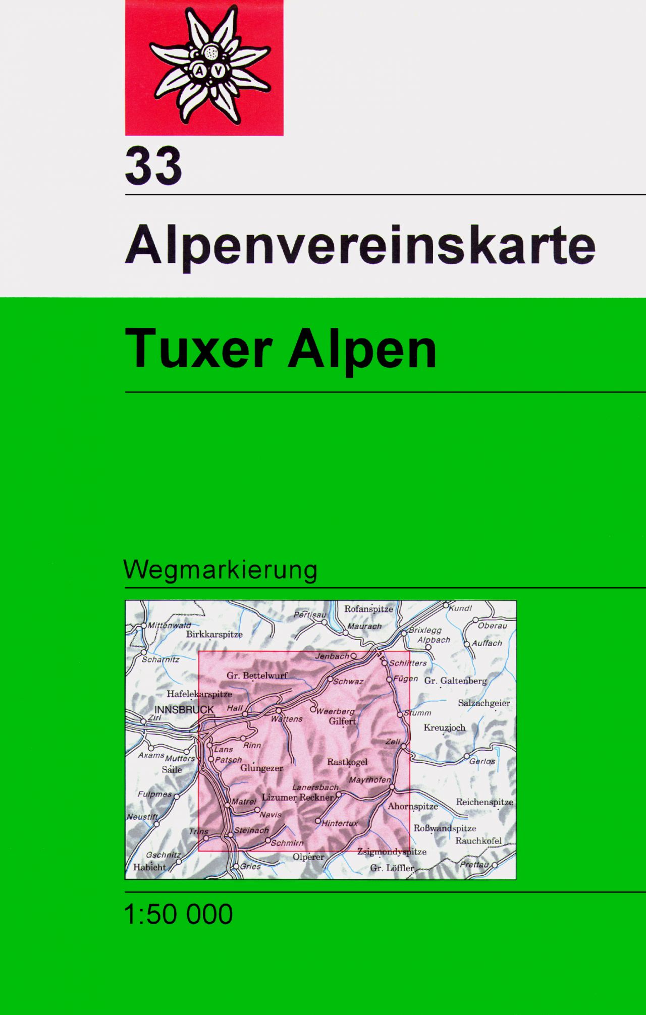
- Wandelkaart 33 Alpenvereinskarte Tuxer Alpen | Alpenverein
- De beste en meest gedetailleerde kaarten van met name de Oostenrijkse alpen: wandelroutes zijn naar zwaarte onderscheidend gemarkeerd, gletsjeroverschrijdingen staan aangegeven en de verschillende soorten hutten ingetekend. Met als ondergrond de topografische kaarten bieden ze een schat aan informatie voor elke beginnende en gevorderde... Read more

De Zwerver
Netherlands
Netherlands
- Wandelkaart 03 Il parco nazionale del Gran Paradiso | IGC - Istituto Geografico Centrale
- Gran Paradiso National Park in a series contoured hiking maps at 1:50,000 with local trails, long-distance footpaths, mountain accommodation, etc, from the Turin based Istituto Geografico Centrale. This new edition published in late 2013 highlights, among other routes, the GTA (Grande Traversata delle Alpi), Via Alpina and Alta Via 2. Coverage... Read more

De Zwerver
Netherlands
Netherlands
- Wandelkaart 17 Torino, Pinerolo e Bassa val di Susa | IGC - Istituto Geografico Centrale
- Turin - Pinerolo - Lower Susa Valley, map no. 17, in a series contoured hiking maps at 1:50,000 with local trails, long-distance footpaths, mountain accommodation, etc. from the Turin based Istituto Geografico Centrale covering the Italian Alps and Piedmont, the lakes and northern Lombardy, and the Italian Riviera.The maps have contours at 50m... Read more

De Zwerver
Netherlands
Netherlands
- Wandelkaart 19 Asti, Alba, Acqui terme | IGC - Istituto Geografico Centrale
- Asti - Alba - Acqui Terme area in a series contoured hiking maps at 1:50,000 with local trails, long-distance footpaths, mountain accommodation, etc. from the Turin based Istituto Geografico Centrale.Maps in this series have contours at 50m intervals, enhanced by shading and graphic relief. An overprint highlights local footpaths and... Read more

De Zwerver
Netherlands
Netherlands
- Wandelkaart 04 Massiccio del Monte Bianco | IGC - Istituto Geografico Centrale
- The Mont Blanc Massif in a series contoured hiking maps at 1:50,000 with local trails, long-distance footpaths, mountain accommodation, etc, from the Turin based Istituto Geografico Centrale. This new edition published in late 2013 highlights, among other routes, the Alta Via 1 and the northern section of the Alta Via 2, both of which join up... Read more

De Zwerver
Netherlands
Netherlands
- Wandelkaart 20 Il Monferrato da Asti a Casale Monferrato | IGC - Istituto Geografico Centrale
- Il Monferrato, map no. 20, in a series contoured hiking maps at 1:50,000 with local trails, long-distance footpaths, mountain accommodation, etc. from the Turin based Istituto Geografico Centrale covering the Italian Alps and Piedmont, the lakes and northern Lombardy, and the Italian Riviera.The maps have contours at 50m intervals, enhanced by... Read more
More maps…
