
Skåne
Description
Trails in this state
Links
Facts
Reports
Guides and maps
Lodging
Organisations
Tour operators
GPS
Other
Books
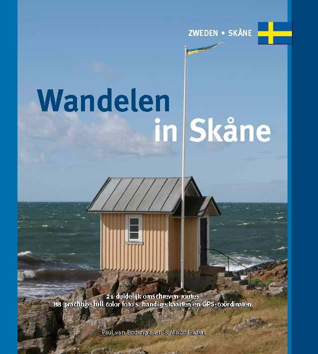
De Zwerver
Netherlands
2022
Netherlands
2022
Maps

Stanfords
United Kingdom
United Kingdom
- Central Rhodopes / Rodopi Geopsis 132
- Central Rhodopes Mountains on the border of north-eastern Greece and Bulgaria on a waterproof and tear-resistant, contoured and GPS compatible map from Geopsis highlighting nine recommended hiking trails and the local section of the E6 cross-Europe long-distance route. All place names are in both Greek and Latin alphabet, with several villages... Read more

Stanfords
United Kingdom
United Kingdom
- Eastern Rhodopes / Rodopi Geopsis 131
- Eastern Rhodopes Mountains on the border of north-eastern Greece and Bulgaria on a waterproof and tear-resistant, contoured and GPS compatible map from Geopsis highlighting nine recommended hiking trails and the local section of the E6 cross-Europe long-distance route. All place names are in both Greek and Latin alphabet, with several villages... Read more

Stanfords
United Kingdom
United Kingdom
- Western Rhodopes / Rodopi - Falakro Geopsis 133
- Central Rhodopes Mountains on the border of north-eastern Greece and Bulgaria on a waterproof and tear-resistant, contoured and GPS compatible map from Geopsis highlighting nine recommended hiking trails and the local section of the E6 cross-Europe long-distance route. All place names are in both Greek and Latin alphabet, with several villages... Read more

The Book Depository
United Kingdom
United Kingdom
- Prespa - Vitsi - Voras
- Uitstekende topografische kaarten van een deel van Griekenland: zonder meer hele goede kaarten voor wandeltochten in een onbekend stuk Griekenland! Ze zijn gedrukt op scheurvast en watervast papier op een schaal van 1:50.000 met een UTM grid voor GPS gebruikers. Op de meeste kaarten is geven de hoogtelijnen een interval van 20m. aan. Met... Read more
- Also available from:
- De Zwerver, Netherlands

De Zwerver
Netherlands
Netherlands
- Wandelkaart 6.2 Prespa - Vitsi - Voras | Anavasi
- Uitstekende topografische kaarten van een deel van Griekenland: zonder meer hele goede kaarten voor wandeltochten in een onbekend stuk Griekenland! Ze zijn gedrukt op scheurvast en watervast papier op een schaal van 1:50.000 met een UTM grid voor GPS gebruikers. Op de meeste kaarten is geven de hoogtelijnen een interval van 20m. aan. Met... Read more

De Zwerver
Netherlands
Netherlands
- Wandelkaart 2.4 Nafpaktos - Panaitoliko - Karpenisi | Anavasi
- Prespa - Vitsi – Voras area of northern Greece at 1:50,000 on a light, waterproof and tear-resistant, GPS compatible, contoured map from Anavasi, with recommendations for three hiking trails and notes on the E4 and E6 cross-European trails. The map is double-sided; coverage in the west starts from the Prespa Lake on the border with Albania and... Read more
De Zwerver
Netherlands
Netherlands
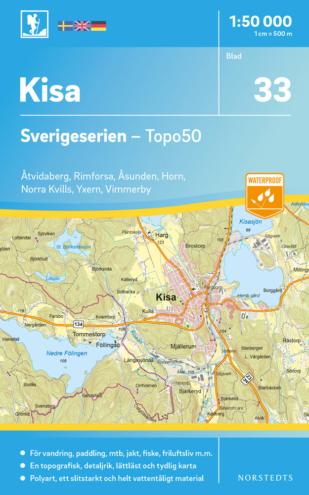
- Wandelkaart - Topografische kaart 33 Sverigeserien Kisa | Norstedts
- Sverigeserien is an outdoor map series consisting of 116 sheets with coverage of southern and central Sweden and the northern coastline. The map is suitable for outdoor activities such as hiking, excursions, trail running, hunting, fishing, riding, cycling, mountain biking, paddling, skating and much more. Every sheet covers an area of... Read more
De Zwerver
Netherlands
2017
Netherlands
2017
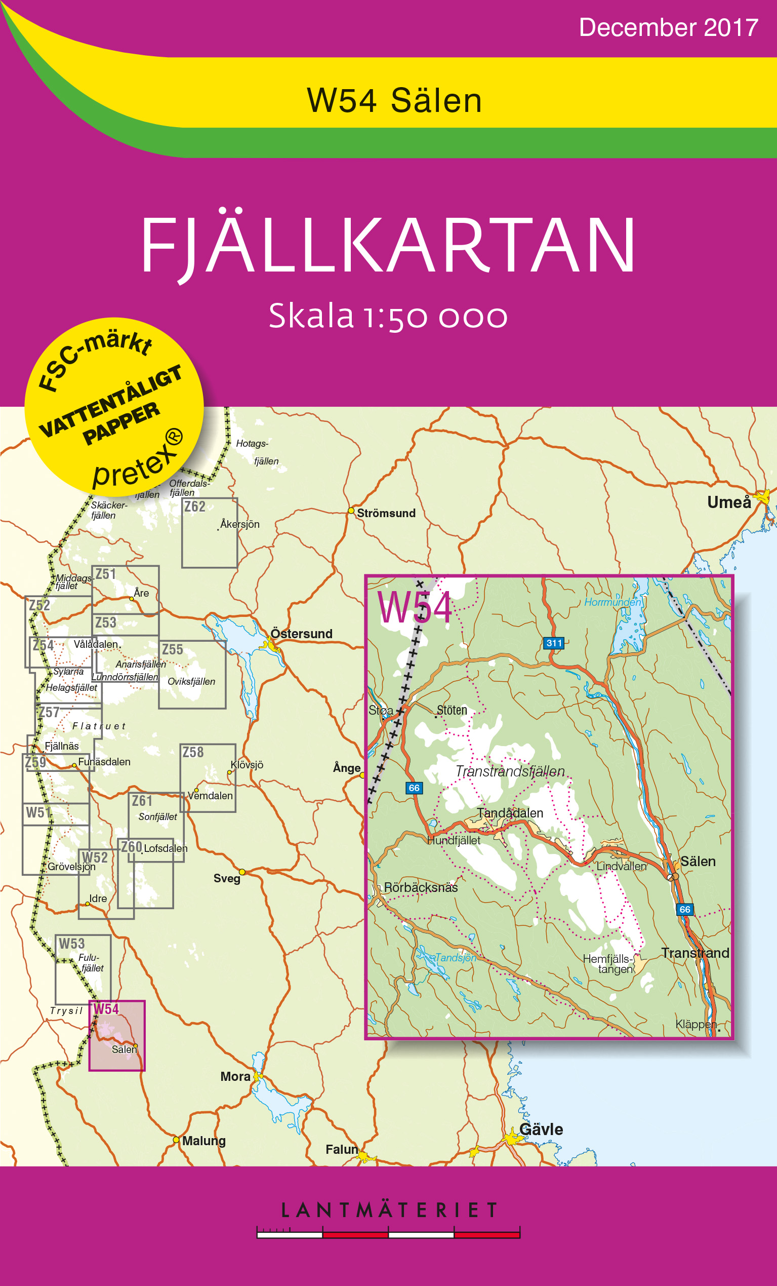
- Wandelkaart W54 Fjällkartan Salen | Lantmäteriet
- Mountain areas of central and northern Sweden on waterproof and tear-resistant, GPS compatible topographic �Fj�llkartan� maps at 1:100,000 and 1:50,000 from Lantm�teriet - the country�s national survey organization, with hiking and ski routes, campsites and youth hostels, etc. Relief is shown by contours at 20m intervals and enhanced by relief ... Read more
De Zwerver
Netherlands
Netherlands
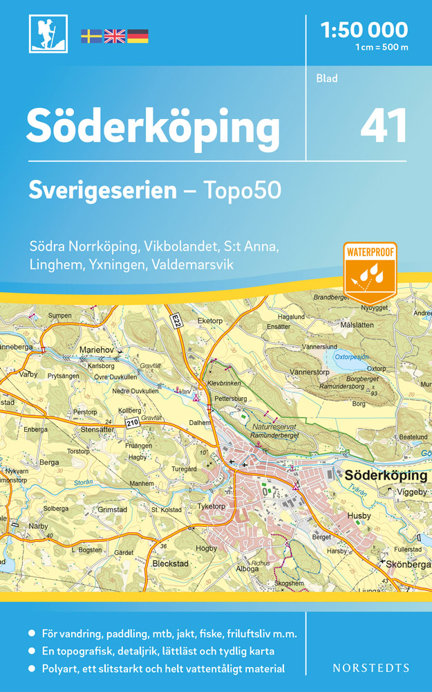
- Wandelkaart - Topografische kaart 41 Sverigeserien Söderköping | Norstedts
- Sverigeserien is an outdoor map series consisting of 116 sheets with coverage of southern and central Sweden and the northern coastline. The map is suitable for outdoor activities such as hiking, excursions, trail running, hunting, fishing, riding, cycling, mountain biking, paddling, skating and much more. Every sheet covers an area of... Read more
De Zwerver
Netherlands
Netherlands
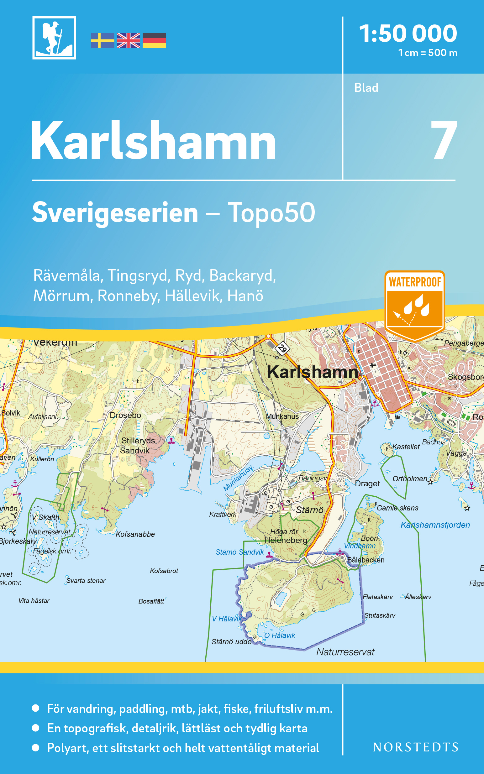
- Wandelkaart - Topografische kaart 07 Sverigeserien Karlshamn | Norstedts
- Sverigeserien is an outdoor map series consisting of 116 sheets with coverage of southern and central Sweden and the northern coastline. The map is suitable for outdoor activities such as hiking, excursions, trail running, hunting, fishing, riding, cycling, mountain biking, paddling, skating and much more. Every sheet covers an area of... Read more
De Zwerver
Netherlands
Netherlands
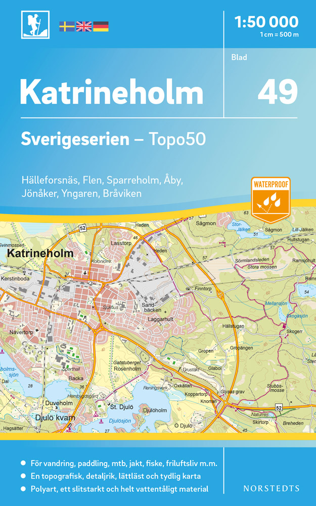
- Wandelkaart - Topografische kaart 49 Sverigeserien Katrineholm | Norstedts
- Sverigeserien is an outdoor map series consisting of 116 sheets with coverage of southern and central Sweden and the northern coastline. The map is suitable for outdoor activities such as hiking, excursions, trail running, hunting, fishing, riding, cycling, mountain biking, paddling, skating and much more. Every sheet covers an area of... Read more
De Zwerver
Netherlands
Netherlands
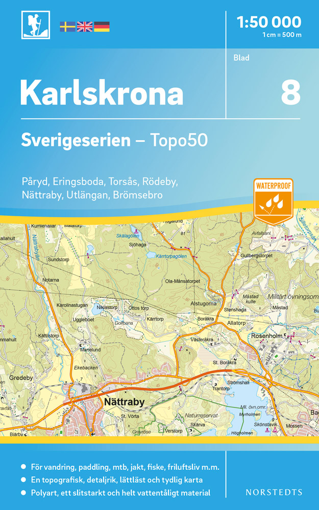
- Wandelkaart - Topografische kaart 08 Sverigeserien Karlskrona | Norstedts
- Sverigeserien is an outdoor map series consisting of 116 sheets with coverage of southern and central Sweden and the northern coastline. The map is suitable for outdoor activities such as hiking, excursions, trail running, hunting, fishing, riding, cycling, mountain biking, paddling, skating and much more. Every sheet covers an area of... Read more
De Zwerver
Netherlands
Netherlands
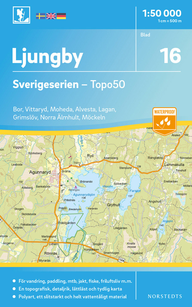
- Wandelkaart - Topografische kaart 16 Sverigeserien Ljungby | Norstedts
- Sverigeserien is an outdoor map series consisting of 116 sheets with coverage of southern and central Sweden and the northern coastline. The map is suitable for outdoor activities such as hiking, excursions, trail running, hunting, fishing, riding, cycling, mountain biking, paddling, skating and much more. Every sheet covers an area of... Read more
De Zwerver
Netherlands
Netherlands
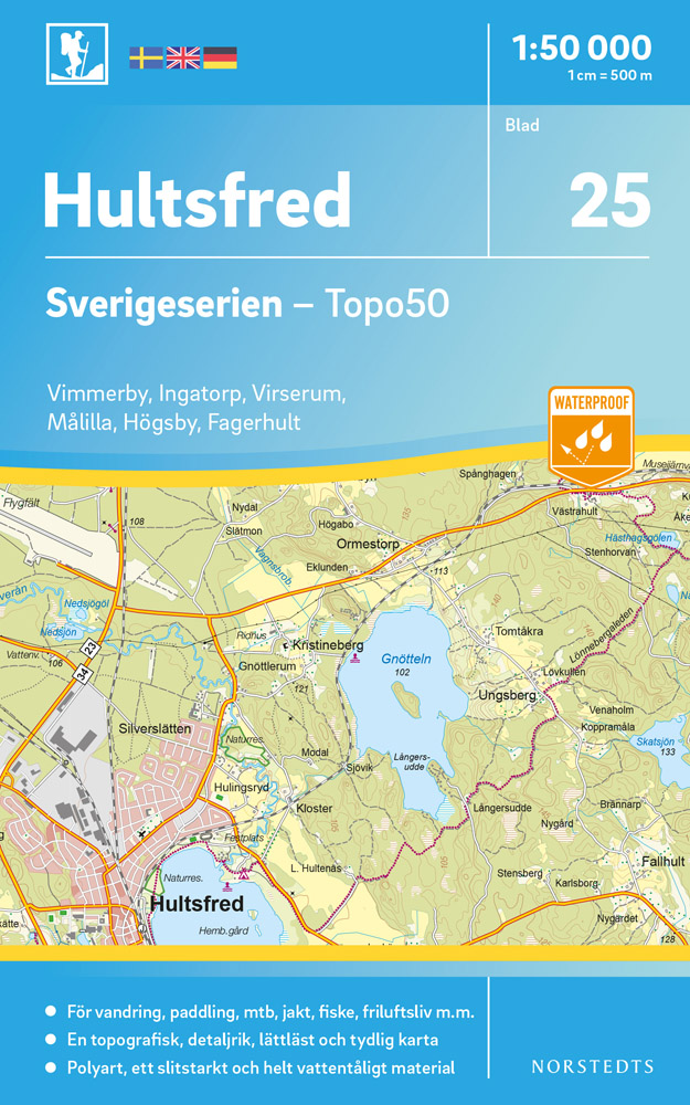
- Wandelkaart - Topografische kaart 25 Sverigeserien Hultsfred | Norstedts
- Sverigeserien is an outdoor map series consisting of 116 sheets with coverage of southern and central Sweden and the northern coastline. The map is suitable for outdoor activities such as hiking, excursions, trail running, hunting, fishing, riding, cycling, mountain biking, paddling, skating and much more. Every sheet covers an area of... Read more
De Zwerver
Netherlands
Netherlands