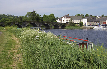
Barrow Way
Description
- Name Barrow Way (BW)
- Length of trail 113 km, 70 miles
- Length in days 5 days
- Start of trail Robertstown
- End of trail St. Mullins
- Traildino grading LW, Light walk, countryside walk


Barrow Way, Robertstown - St. Mullins, 113 km, 5 days
Theme of this trail is River Barrow. It flows from the Slieve Bloom Mountains in the midlands to the south, ending in the Celtic Sea at Waterford. In the 19th century, with the construction of the Barrow Line Canal, the river was made navigable for small boats, called barges.
It is still possible travel the river and its accompanying canal by boat. But more pleasant for us is the walk along its banks, following towpaths. Moreover, only 9% of the Barrow Way is made up of tarmac roads, which is very low for Irish standards.
This walk is for those who enjoy life around water, the birds, the historical buildings, harbours, locks associated with the traffic and trade. Parts run through beautiful woods, while the river gradually widens on its course to the sea. You will hit on two other trails, the South Leinster Way and the Grand Canal Way.
The trail is flat throughout. It’s easy to find accommodation in the villages.


