
London
Description
Capital of the United Kingdom. All sorts of walks. The Thames Path runs right through the city center and you can hop on the London Eye after being fooled at the ticket counter and view forward and backward on your trail.
Trails in this region
Links
Facts
Reports
Guides and maps
Lodging
Organisations
Tour operators
GPS
Other
Books

Stanfords
United Kingdom
United Kingdom
- Cruickshank`s London: A Portrait of a City in 13 Walks
- `The perfect guide to the hidden history of London`s streets.` BBC History MagazineIn Cruickshank`s London, Britain`s favourite architectural historian describes thirteen walks through one of the greatest cities on earth. From the mysterious Anglo-Saxon origins of Hampstead Heath, via Christopher Wren`s magisterial City churches, to the... Read more

Stanfords
United Kingdom
United Kingdom
- Walks in the London Borough of Enfield - Volume 1
- Walks in the London Borough of Enfield Volume 1 by John Merrill is a guidebook to walking in London’s most northerly borough. With some 40 miles of footpaths - including parts of the London Loop, River Lee Navigation path, Pymmes Brook Trail and the New River Path - the Borough of Enfield has much to offer the walker. This guide lists twelve... Read more

Stanfords
United Kingdom
United Kingdom
- Sherlock Holmes Walk
- Step back in time and explore the London of Sherlock Holmes and Dr Watson. It is 1895 — a time of Hansom cabs rattling along cobbled streets, foggy lanes and gas-lit alleys, a romantic yet sinister London at the height of her Imperial greatness. Each site that is visited on this Walk has a major literary connection with our two heroes and their... Read more

Stanfords
United Kingdom
United Kingdom
- A Historical Riverside London Pub Walk
- Discover London’s ancient Riverside pubs, set in an area that was for centuries home to pirates, smugglers, shipbuilders, pilgrims and the infamous Execution Dock. The pubs and the sites are in the Wapping and, across the Thames, the Rotherhithe area of east London, and where appropriate the guide provides information on opening hours and phone... Read more

Stanfords
United Kingdom
United Kingdom
- DK Eyewitness Great Britain
- Three unique nations interwoven into a rich cultural tapestry, this small island has huge character.Whether you want to tour elegant stately homes, marvel at prehistoric wonders or take a windswept walk along cliff-top paths, your DK Eyewitness travel guide makes sure you experience all that Great Britain has to offer.From the jagged peaks of... Read more

Stanfords
United Kingdom
United Kingdom
- Walking Haunted London
- Updated for the most intrepid London visitors and residents, “Walking Haunted London” is a spine-chilling guide that wends it way through eerie and, in many cases, long-forgotten parts of one of the world`s greatest cities.From ”Deadman`s Walk” and the ”Screaming Wood” to ”Dick Turpin” and ”Jack the Ripper”, professional tour guide and... Read more

Stanfords
United Kingdom
United Kingdom
- Londoners: The Days and Nights of London Now
- Londoners by Craig Taylor is a collection of approximately 80 short stories told by people who live in the capital. The result is a kaleidoscopic view of London through the experiences of people from all walks of life: from the taxi driver and the artist to the protester, the cruiser, the squatter, the police officer and the civil engineer.... Read more

Stanfords
United Kingdom
United Kingdom
- Sherlock Holmes Map of London
- A journey into the heart of Victorian London through words and places of literature’s most famous detective.On one side there is an 1891 replica map of central London with colour coded markers showing important places in the novels; A Study in Scarlet, The Sign of Four, The Hound of the Baskervilles and The Valley of Fear.This folded map comes... Read more

Stanfords
United Kingdom
United Kingdom
- An Historical Walk Through William Shakespeare`s London
- Handy pocket size guide to locations in London associated with Shakespeare and his times. Starting at the Blackfriars tube station and crossing over the Thames to the Bankside area and the Globe theatre, the guide takes in diverse range of sites including the George Inn, Clink Prison, the Golden Hinde ship of Sir Francis Drake, etc. Where... Read more
Stanfords
United Kingdom
United Kingdom
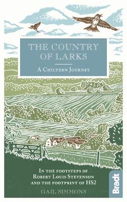
- Country of Larks: A Chiltern Journey: In the footsteps of Robert Louis Stevenson and the footprint of HS2
- Shortlisted for the 2020 Edward Stanford Travel Writing Award`s Lonely Planet Debut Travel Writer of the YearTravel writer and journalist Gail Simmons follows in the footsteps of Robert Louis Stevenson as she walks from High Wycombe in Buckinghamshire to Tring in Hertfordshire via Great Missenden and Wendover, tracing not only the changes in... Read more

Stanfords
United Kingdom
United Kingdom
- South Downs - 20 Country Walks For All The Family
- Batsford`s Walking Guides is an exciting new gift series of walking books, aimed at the weekend, family walker. These small-format, portable, hardback books have an attractive retro feel, with nostalgic line drawings and hand-drawn maps. Each of the 20 walks have been carefully selected to appeal to family walkers, most are circular and none... Read more

Stanfords
United Kingdom
United Kingdom
- Railway Walks: LMS
- Jeff Vinter, consultant to the BBC`s popular ”Railway Walks” series, here provides a detailed guide to ten of the best railway walks in the territory of the former London Midland and Scottish Railway. These range from the Midland Railway`s express line through the Peak District to the incredible Cromford and High Peak Railway, built before... Read more

Stanfords
United Kingdom
United Kingdom
- DK Eyewitness Travel Guide London
- Discover the spectacular sights of a truly historic and cosmopolitan city with the DK Eyewitness Travel Guide: London 2017. Now includes five free audio walking tours. The best places to visit in London, from Buckingham Palace to the world renowned British Museum, are showcased with fantastic photography, illustrations, floorplans and... Read more

Stanfords
United Kingdom
United Kingdom
- Middlesex and West London - Waterside Walks
- Waterside Walks in Middlesex and West London by David and Rosemary Hall presents a selection of twenty circular walks that take in some part of a local waterway. These include the rivers Thames and Colne, the Staines Reservoirs, Dollis Brook and the Grand Union Canal. The twenty routes in this book are all between 3 to 7 miles. Each walk is... Read more
More books…

Maps

Stanfords
United Kingdom
United Kingdom
- East London and Gonubie
- Street plan of East London at 1:20,000 from the South African travel publishers Map Studio, with an inset providing coverage of the nearby Gonubie. Coverage extends inland to include the city’s airport. The plan shows names of districts, indicates main traffic arteries, and highlights various facilities and important buildings. No street index... Read more
Stanfords
United Kingdom
United Kingdom
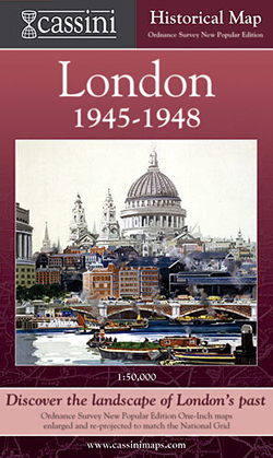
- London 1945-1948
- London in 1945-1948 in the Cassini Historical Series reproducing old Ordnance Survey mapping of England and Wales at 1:50,000. The four London maps cover roughly the area of the present day Greater London rather than following the format of rest of the series which is designed to correspond to the current Landranger maps. Mapping is identical... Read more

Stanfords
United Kingdom
United Kingdom
- Cycle Tours Chilterns, Hertfordshire & Essex
- This spiral-bound guide describes 20 wonderful bike rides in the countryside to the north and west of London. The area offers some excellent and varied cycling: from the challenges of the steep wooded escarpment of the Chilterns in the west to the gentle gradients on networks of quiet lanes in Hertfordshire and north Essex. The book contains 15... Read more

Stanfords
United Kingdom
United Kingdom
- London West 1805-1822
- Map No. 176, London West 1805-1822, in the Cassini Historical Series of old Ordnance Survey mapping of England and Wales at 1:50,000 in a format designed to offer a convenient comparison with the present day coverage from the OS, and most locations in three different editions. Old historical maps have been combined so that the sheet lines... Read more
Stanfords
United Kingdom
United Kingdom
- London West 1897-1909
- Map No. 176, London West 1897-1909, in the Cassini Historical Series of old Ordnance Survey mapping of England and Wales at 1:50,000 in a format designed to offer a convenient comparison with the present day coverage from the OS, and most locations in three different editions. Old historical maps have been combined so that the sheet lines... Read more
Stanfords
United Kingdom
United Kingdom
- London East 1805-1822
- Map No. 177, London East 1805-1822, in the Cassini Historical Series of old Ordnance Survey mapping of England and Wales at 1:50,000 in a format designed to offer a convenient comparison with the present day coverage from the OS, and most locations in three different editions. Old historical maps have been combined so that the sheet lines... Read more
Stanfords
United Kingdom
United Kingdom
- London East 1897-1902
- Map No. 177, London East 1897-1902, in the Cassini Historical Series of old Ordnance Survey mapping of England and Wales at 1:50,000 in a format designed to offer a convenient comparison with the present day coverage from the OS, and most locations in three different editions. Old historical maps have been combined so that the sheet lines... Read more

Stanfords
United Kingdom
United Kingdom
- Richmond and Ealing Past and Present
- London boroughs of Richmond and Ealing in the Cassini Past and Present map series which covers town and cities of England and Wales and offers a unique way of tracing their history and expansion by showing four different periods of their development using Ordnance Survey mapping from the mid-19th century, the late 19th century, the 1920s and... Read more

Stanfords
United Kingdom
United Kingdom
- London West 1920
- Map No. 176, London West 1920, in the Cassini Historical Series of old Ordnance Survey mapping of England and Wales at 1:50,000 in a format designed to offer a convenient comparison with the present day coverage from the OS, and most locations in three different editions. Old historical maps have been combined so that the sheet lines correspond... Read more

Stanfords
United Kingdom
United Kingdom
- London Historical Maps Box Set (5-map set)
- London Historical Set of five maps in the Cassini Historical Series reproducing old Ordnance Survey mapping of England and Wales at 1:50,000. The set consists of the four Cassini maps showing the capital between 1805 and 1948, and has as a bonus map a reproduction of Stanfords street plan London at six inches to one mile from 1891.The four... Read more

Stanfords
United Kingdom
United Kingdom
- London High 5 Edition Street Plan
- The first water-resistant “Comfort Map“ with direct access to useful additional information from the InternetLondon in a scale of 1:20,000 including tourist destinations (Hampstead Heath, Olympic Park and Greenwich) presented on a practical map; inclusive of the High 5 Edition app technology for calling up additional travel information and many... Read more

Stanfords
United Kingdom
United Kingdom
- London Greater London Street Finder PAPERBACK
- Detailed paperback street atlas covering the whole of Greater London at three different scales: 1:10,000 scale covers central London; 1:20,000 scale extends from Welwyn Garden City in the north to Gatwick Airport in the south and from Windsor in the west to Gravesend in the east; 1:63,360 scale extends from Highbury in the north to Clapham in... Read more
Stanfords
United Kingdom
United Kingdom
- London East 1920-1921
- Map No. 177, London East 1920-1921, in the Cassini Historical Series of old Ordnance Survey mapping of England and Wales at 1:50,000 in a format designed to offer a convenient comparison with the present day coverage from the OS, and most locations in three different editions. Old historical maps have been combined so that the sheet lines... Read more

Stanfords
United Kingdom
United Kingdom
- London
- London at 1:50,00 with mapping from the Ordnance Survey’s Landranger series published by Cassini to add to their extensive coverage of the city on historical maps reflecting different periods in its development. Unlike the Landranger series which splits the city east/west, the Cassini version is centred on Charing Cross and covers most of the... Read more