
Umbria
Description
Region in the center of Italy.
Links
Facts
Reports
Guides and maps
Lodging
Organisations
Tour operators
GPS
Other
Books

Stanfords
United Kingdom
United Kingdom
- DK Eyewitness Road Trips Northern & Central Italy
- With its snow-capped mountain ranges and beautiful hill towns, Italy is an ideal destination for a leisurely road trip. It`s yours to explore with Road Trips Northern and Central Italy, our redesigned and newly updated guide containing 25 drives across the region, from the dramatic coastline of the Cinque Terre to the lakes of Lombardy and the... Read more

Stanfords
United Kingdom
2005
United Kingdom
2005
- Walking and Eating in Tuscany & Umbria
- In Walking and Eating in Tuscany and Umbria, James Lasdun and Pia Davis offer forty walks through the spectacular countryside of both regions. Arranged for the utmost flexibility the guide includes half-day outings easily accessible from a city base to day walks that can be linked together in a series. These itineraries are designed to combine... Read more

Stanfords
United Kingdom
United Kingdom
- Parco Nazionale del Stelvio / NP Stilfser Joch Kompass 072
- Parco Nazionale del Stelvio (NP Stilfser Joch) on a GPS compatible hiking and recreational map at 1:50,000 from Kompass printed on durable, waterproof and tear-resistant synthetic paper.KOMPASS HIKING MAPS OF ITALY:This title is part of an extensive series of walking maps from Kompass covering selected areas of Italy at mainly 1:50,000, with a... Read more

Stanfords
United Kingdom
United Kingdom
- Sardinia North 4-Map Set Kompass 2497
- The northern part of Sardinia on a set of four double-sided, contoured and GPS compatible recreational maps at 1:50,000 from Kompass. Extensive overprint highlights hiking trails, cycle and selected mountain bike routes, and horse riding paths. Symbols indicate various types of accommodation including campsites, youth hostels, “Friends of... Read more

Stanfords
United Kingdom
United Kingdom
- Cortina d`Ampezzo Kompass 55
- Map No. 55, Cortina d`Ampezzo - with a panorama map on the reverse, from Kompass, printed on sturdy, waterproof and tear-resistant synthetic paper in their series of walking maps of selected areas of Italy at 1:50,000, with hiking routes on a topographic base, various types of accommodation, recreational facilities, places of interest, etc.... Read more

Stanfords
United Kingdom
2019
United Kingdom
2019
- Walking in Umbria: 40 walks in the `Green Heart` of Italy
- This guidebook by Italian walking expert Gillian Price describes 40 varied day walks in the region of Umbria, taking in the towns of Assisi, Perugia, Orvieto and Norcia. The walks range from 2.5km to 19km in length, the majority of the routes are circular, and several wonderful traverses have been included, with the return to the start point... Read more
- Also available from:
- The Book Depository, United Kingdom
- De Zwerver, Netherlands

The Book Depository
United Kingdom
2019
United Kingdom
2019
- Walking in Umbria
- 40 walks in the 'Green Heart' of Italy Read more

De Zwerver
Netherlands
2019
Netherlands
2019
- Wandelgids Walking in Umbria - Umbrië | Cicerone
- This guidebook describes 40 walks in Umbria, among the ancient towns of Assisi, Perugia, Orvieto and Norcia. Known as the 'green heart' of Italy, the region of Umbria is home to hills reaching up to the Apennines and Sibillini mountains, as well as ancient villages, Roman and Etruscan ruins, dense woodland and nature reserves. Read more

Stanfords
United Kingdom
2021
United Kingdom
2021
- Lonely Planet Best Day Walks Italy
- Lonely Planet`s Best Day Walks Italy is your passport to 60 easy escapes into nature. Stretch your legs outside the city by picking a hike that works for you, from just a couple of hours to a full day, from easy to hard. Hike the Dolomites, explore the Italian Lakes, and stroll Sardinia`s coast. Get to the heart of Italy and begin your journey... Read more
- Also available from:
- The Book Depository, United Kingdom
- De Zwerver, Netherlands


Stanfords
United Kingdom
2021
United Kingdom
2021
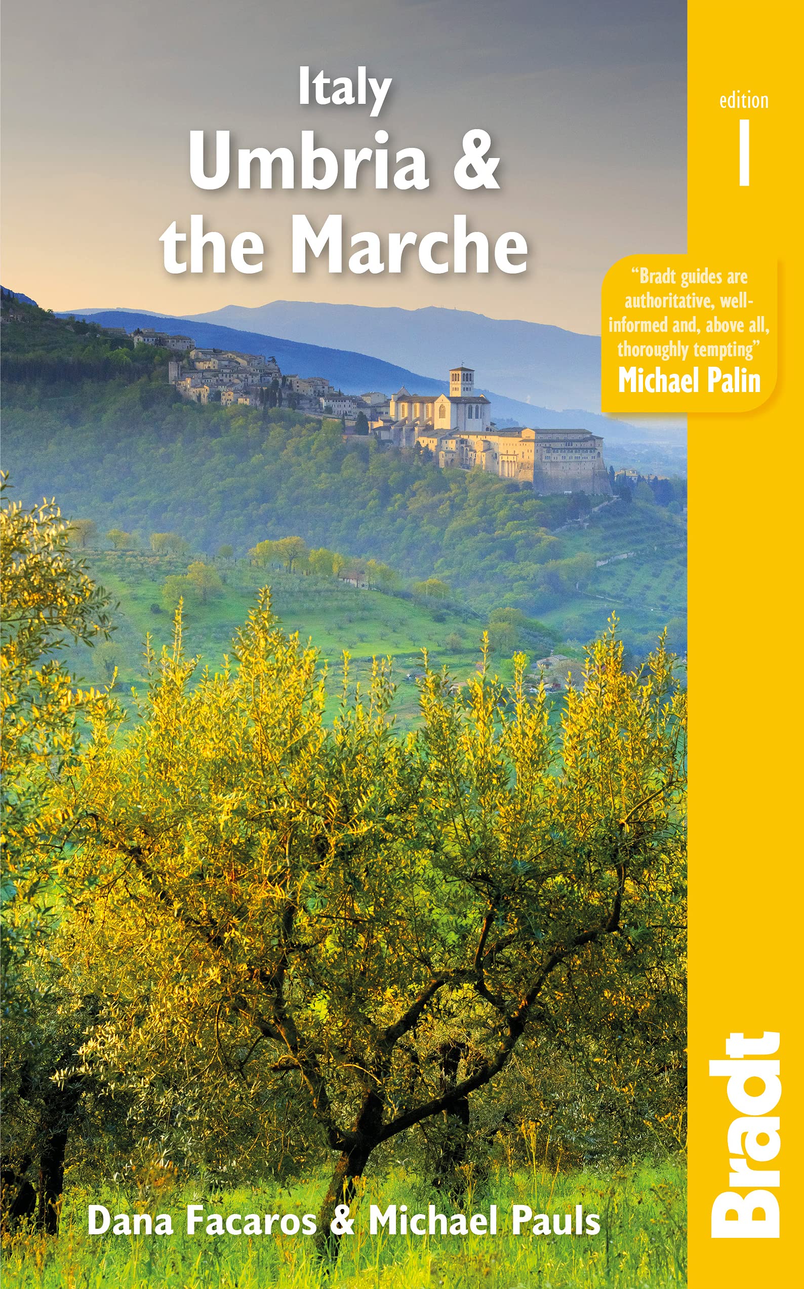
- Italy: Umbria & The Marches
- Bradt`s Umbria & the Marche is the most detailed guide to combine these two small central Italian regions, which offer all the beauty, history and culture of neighbouring Tuscany only without the crowds, the traffic or eye-popping prices. Dana Facaros and Michael Pauls (authors of the original Cadogan guide to the area) lived in Umbria in the... Read more
- Also available from:
- De Zwerver, Netherlands
De Zwerver
Netherlands
2021
Netherlands
2021
- Reisgids Italy: Umbria and the Marches | Bradt Travel Guides
- Bradt`s Umbria & the Marche is the most detailed guide to combine these two small central Italian regions, which offer all the beauty, history and culture of neighbouring Tuscany only without the crowds, the traffic or eye-popping prices. Dana Facaros and Michael Pauls (authors of the original Cadogan guide to the area) lived in Umbria in the... Read more
De Zwerver
Netherlands
2012
Netherlands
2012
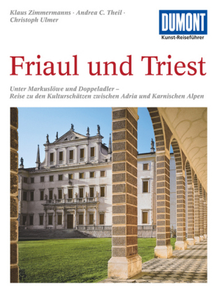
- Reisgids Kunstreiseführer Friaul und Triest | Dumont
- Das Thema dieses Kunst-Reiseführers ist die italienische Region Friaul- Julisch Venetien. Sie besteht aus zwei Provinzen, von denen das Friaul die weitaus größere ist. Julisch Venetien dagegen umfasst seit 1954 nur noch die Stadt Triest und einen kleinen Küstenstreifen bis Muggia. Wie ein Amphitheater liegt das Friaul im äußersten Nordosten... Read more
Bol.com
Netherlands
Netherlands
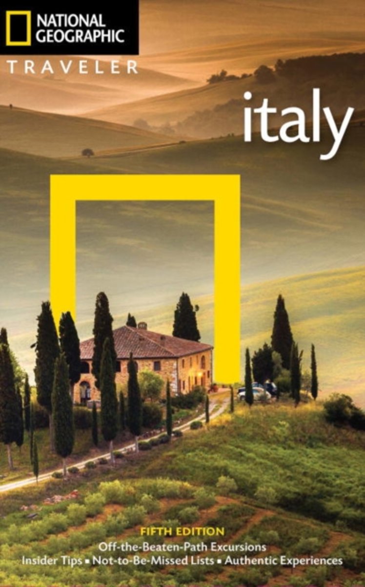
- NG Traveler
- Wherever you visitRome, Florence, Venice, Tuscany, Naples, Sicily, etc.you are in good hands with renowned Italy expert Tim Jepson. He ably guides readers through the storied capital of Rome, Northwest Italy, Lombardy & the Lakes, Venice, Northeast Italy, Emilia-Romagna & the Marche, Florence, Tuscany, Umbria, the South, and Sicily and... Read more
- Also available from:
- Bol.com, Belgium
Bol.com
Belgium
Belgium
- NG Traveler
- Wherever you visitRome, Florence, Venice, Tuscany, Naples, Sicily, etc.you are in good hands with renowned Italy expert Tim Jepson. He ably guides readers through the storied capital of Rome, Northwest Italy, Lombardy & the Lakes, Venice, Northeast Italy, Emilia-Romagna & the Marche, Florence, Tuscany, Umbria, the South, and Sicily and... Read more
De Zwerver
Netherlands
2018
Netherlands
2018
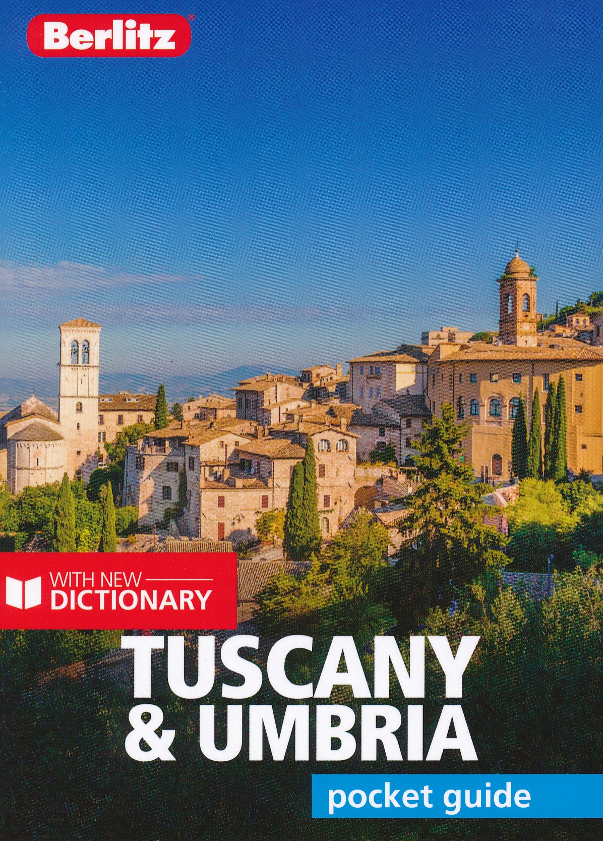
- Reisgids Pocket Guide Tuscany - Umbria, Toscane en Umbrie | Berlitz
- Toscane en Umbrie Pocket Guide Berlitz is een handzaam engelstalige reisgids met bezienswaardigheden, kaartjes, hotels en restaurants Berlitz Pocket Guide Tuscany and Umbria is a concise, full-colour travel guide that combines lively text with vivid photography to highlight the very best that this bountiful region has to offer, from its... Read more
De Zwerver
Netherlands
2014
Netherlands
2014
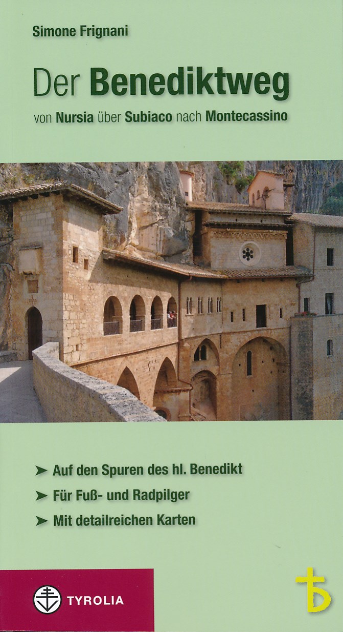
- Wandelgids - Pelgrimsroute Der Benediktweg - Lazio - Umbria | Tyrolia
- 300 km lange pelgrimstocht in de voetsporen van de heilige Benedictus - wandelgids en fietsgids over de pelgrimsroute, die de belangrijkste plekken waar Benedictus heeft geleefd met elkaar verbindt . De Benedictusweg voert door Lazio en Umbrië van Nursia via Subiaco naar Montecassino. Der Benediktweg von Nursia über Subiaco nach Montecassino.... Read more
Bol.com
Netherlands
Netherlands
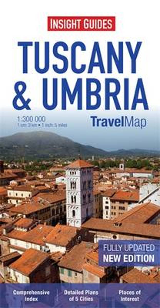
- Insight Guides Travel Map Tuscany & Umbria
- Travel Map Tuscany & Umbria is an indexed, road map at 1:300 000. It includes an overview map of Italy and detailed city plans of Florence, Lucca, Perugia, Pisa & Siena, each with its own separate index listing. Places of interest, including nature reserves, national parks, museums, monuments and religious site, are listed and depicted by a... Read more
- Also available from:
- Bol.com, Belgium
Bol.com
Belgium
Belgium
- Insight Guides Travel Map Tuscany & Umbria
- Travel Map Tuscany & Umbria is an indexed, road map at 1:300 000. It includes an overview map of Italy and detailed city plans of Florence, Lucca, Perugia, Pisa & Siena, each with its own separate index listing. Places of interest, including nature reserves, national parks, museums, monuments and religious site, are listed and depicted by a... Read more

Stanfords
United Kingdom
United Kingdom
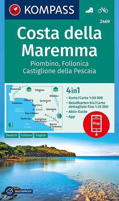
- Maremma Coast - Piombino - Follonica - Castiglione della Pascaia Kompass 2469
- The coast of Maremma at 1:50,000 from Kompass, on a map printed on durable, waterproof and tear-resistant synthetic paper. Coverage includes Piombino, Follonica, Castiglione della Pescaia, Marina di Grosseto, Wetulonia, Ribolla, Valpiana, Venturina, etc. Contours are at 40m intervals, with a 2-km UTM grid. Extensive overprint includes cycling... Read more
- Also available from:
- De Zwerver, Netherlands
De Zwerver
Netherlands
Netherlands
- Wandelkaart 2469 Costa della Maremma | Kompass
- Die GPS-genauen KOMPASS Karten sind ideal für Ihre nächste Tour! Der lesefreundliche Maßstab und nützliche Informationen über die Region erleichtern Ihre Planung.IT Read more
Maps

Stanfords
United Kingdom
United Kingdom
- Monte Carpegna - Sasso di Simone
- Map No. 16, Monte Carpegna - Sasso di Simone, in series of contoured, GPS compatible hiking maps at 1:25,000 from the Istituto Geografico Adriatico, covering mainly the spine of the Apennines along the borders of Tuscany, Emilia-Romagna, Umbria and the Marches.Map in this series have contours at 25m intervals with additional shading and... Read more

Stanfords
United Kingdom
United Kingdom
- Perugia - Assisi - Città di Castello - Gubbio Kompass 2464
- Perugia - Assisi - Città di Castello – Gubbio area in Umbria and the Marches on a double-sided, GPS compatible hiking and recreational map at 1:50,000 from Kompass on durable, waterproof and tear-resistant synthetic paper. Contours are at 40m intervals, with a 2-km UTM grid. In addition to the region’s numerous local hiking trails and several... Read more

Stanfords
United Kingdom
United Kingdom
- Sardinia Central 4-Map Set Kompass 2498
- The central part of Sardinia on a set of four double-sided, contoured and GPS compatible recreational maps at 1:50,000 from Kompass. Extensive overprint highlights hiking trails, cycle and selected mountain bike routes, and horse riding paths. Symbols indicate various types of accommodation including campsites, youth hostels, “Friends of... Read more

Stanfords
United Kingdom
United Kingdom
- Alpi di Ledro - Valli Giudicarie Kompass 071
- Map No. 071, Alpi di Ledro - Valli Giudicarie, from Kompass in a series of walking maps of selected areas of Italy at 1:50,000, with hiking routes on a topographic base, various types of accommodation, recreational facilities, places of interest, etc. Kompass are Europe’s largest publishers of walking maps, with extensive coverage of hiking... Read more

Stanfords
United Kingdom
United Kingdom
- Crete Senesi 2 - Crete Senesi 25K Ed. Multigraphic Map No. 518
- Crete Senesi 2 - Crete Senesi at 1:25,000 in a series of hiking maps from Edizioni Multigraphic covering Tuscany, parts of Umbria, and the adjoining areas. The cartography is rather old fashioned and sometimes not as clear as in the other map series but for many areas, especially for parts of Tuscany, these are the only hiking maps available.... Read more

Stanfords
United Kingdom
United Kingdom
- Parco della Maremma - Monti dell`e Uccellina Edizioni Multigraphic 504
- Parco della Maremma - Monti dell`e Uccellina at 1:25,000 in a series of hiking maps from Edizioni Multigraphic covering Tuscany, parts of Umbria, and the adjoining areas. The cartography is rather old fashioned and sometimes not as clear as in the other map series but for many areas, especially for parts of Tuscany, these are the only hiking... Read more

Stanfords
United Kingdom
United Kingdom
- Elba Kompass 2468
- Elba on a map at 1:25,000 from Kompass, with a street plan of Portoferraio and coverage of the nearby Capraia and Pianosa at 1:50,000. Contours are at 20m intervals, with relief shading and graphics/colouring to indicate different types of the terrain. An overprint highlights hiking trails, including the GTE – Grande Traversata Elbana,... Read more
Stanfords
United Kingdom
United Kingdom
- Monti Sibillini National Park Kompass 2474
- Monti Sibillini National Park in Umbria and the Marches on a GPS compatible hiking and recreational map at 1:50,000 from Kompass, printed on durable, waterproof and tear-resistant synthetic paper. Contours are at 40m intervals, with a 2-km UTM grid. In addition to the region’s numerous local hiking trails and several long-distance routes,... Read more

Stanfords
United Kingdom
United Kingdom
- Gran Sasso and Monti della Laga National Park Kompass 2476
- Gran Sasso and Monti della Laga National Park in Umbria, the Marches, Lazio and Abruzzo on a double-sided, GPS compatible hiking and recreational map at 1:50,000 from Kompass, printed on durable, waterproof and tear-resistant synthetic paper. Contours are at 40m intervals, with a 2-km UTM grid. In addition to the region’s numerous local hiking... Read more
Stanfords
United Kingdom
United Kingdom
- Alta Valle del Santerno 23
- Map No. 22, Alta Valle del Lamone: Alto Appennino Faentino – Anello di Marradi, in series of contoured, GPS compatible hiking maps at 1:25,000 from the Istituto Geografico Adriatico, covering mainly the spine of the Apennines along the borders of Tuscany, Emilia-Romagna, Umbria and the Marches.Map in this series have contours at 25m intervals... Read more

Stanfords
United Kingdom
United Kingdom
- Volterra and its Environs Edizioni Multigraphic 513
- Volterra and its environs at 1:25,000 in a series of hiking maps from Edizioni Multigraphic covering Tuscany, parts of Umbria, and the adjoining areas. The cartography is rather old fashioned and sometimes not as clear as in the other map series but for many areas, especially for parts of Tuscany, these are the only hiking maps available. Most... Read more

Stanfords
United Kingdom
United Kingdom
- S. Godenzo & the Surrounding Footpaths 25K Ed. Multigraphic Map No. 526
- S.Godenzo and the Surrounding Footpaths at 1:25,000 in a series of hiking maps from Edizioni Multigraphic covering Tuscany, parts of Umbria, and the adjoining areas. The cartography is rather old fashioned and sometimes not as clear as in the other map series but for many areas, especially for parts of Tuscany, these are the only hiking maps... Read more

Stanfords
United Kingdom
United Kingdom
- Lecco - Valle Brembane - Alpi Orobie Kompass 105
- Map No. 105, Lecco - Valle Brembane, from Kompass, now published on sturdy, waterproof and tear-resistant plastic paper, in a series providing detailed coverage of the Dolomites and Lake Garda area and supplementing their main series of walking maps of Italy at 1:50,000. Maps in this series have a more detailed base and smaller contour interval... Read more

Stanfords
United Kingdom
United Kingdom
- Lake Maggiore - Lake Varese Kompass 90
- recreational map at 1:50,000 from Kompass. Coverage extends from Locarno to Arona on the southern tip of Lake Maggiore, and from Lago di Mergozzo in the west to Lugano in the east, and includes part of Parco Nazionale delle Val Grande. Accompanying booklet has 33 pages in English, providing descriptions of best sights, suggestions for three... Read more

Stanfords
United Kingdom
United Kingdom
- Foreste Casentinesi NP Monti Editore 20
- Map No. 20, Foreste Casentinesi: Campigna, Camaldoli, Chiusi dell Verna, in series of contoured, GPS compatible hiking maps at 1:25,000 from the Istituto Geografico Adriatico, covering mainly the spine of the Apennines along the borders of Tuscany, Emilia-Romagna, Umbria and the Marches.Map in this series have contours at 25m intervals with... Read more