
Mont Blanc
Description

The Mont Blanc Massif is divided between the countries France, Italy and Switzerland. France gets the major part, including the summit of the Mont Blanc itself (4.810 m). The Tour du Mont Blanc is one of the most popular hikes in the Alps, attracting thousands of visitors worldwide every year.
Map


Trails in this region


Links
Facts
Reports
Guides and maps
Lodging
Organisations
Tour operators
GPS
Other
Books

Stanfords
United Kingdom
2019
United Kingdom
2019
- Haute-Savoie a Pied - 54 circuits dont 8 adaptés à la marche nordique
- But don`t be fooled: if Haute-Savoie is home to the Mecca of mountaineering, it is also a hiker`s paradise! Beyond the GR® trails (the prestigious GR® 5 and GR® Tour du Mont Blanc), discover the diversity of the landscapes of a department with dynamic demography and economy. Pure lake waters, freshness of deep forests, distant horizons of... Read more

Stanfords
United Kingdom
United Kingdom
- Mont-Blanc - A Walker`s Guide
- Mont Blanc, A Walker`s Guide covers the full range of hiking available in the Mont Blanc Massif. It covers 93 hikes in the French, Italian and Swiss regions of the area suitable for all abilities - from walks that involve less than 600m of ascent to those with over 1000m of ascent. Each route is fully described detailing approximate time,... Read more

Stanfords
United Kingdom
United Kingdom
- North York Moors Western OS Explorer Active Map OL26 (waterproof)
- The western part of the North York Moors National Park on a detailed topographic and GPS compatible map OL26, waterproof version, from the Ordnance Survey’s 1:25,000 Explorer series. Coverage extends from Ampleforth in the south northwards to Saltburn-by-the-Sea, and from Ingleby Arncliffe to Danby, Castleton and Hutton-le-Hole, and includes... Read more

Stanfords
United Kingdom
United Kingdom
- Cheviot Hills - Jedburgh & Wooler OS Explorer Map OL16 (paper)
- The Cheviot Hills on a detailed topographic and GPS compatible map OL16, paper version, from the Ordnance Survey’s 1:25,000 Explorer series. Coverage includes Jedburgh, Woolmer, part of the Northumberland National Park, the peaks of The Cheviot, Corby Pike, Cold Law, Scrathy Holes and Windy Gyle, Catcleugh Reservoir, sections of the Pennine Way... Read more
- Also available from:
- The Book Depository, United Kingdom
- De Zwerver, Netherlands


De Zwerver
Netherlands
Netherlands

- Also available from:
- De Zwerver, Netherlands
De Zwerver
Netherlands
2020
Netherlands
2020
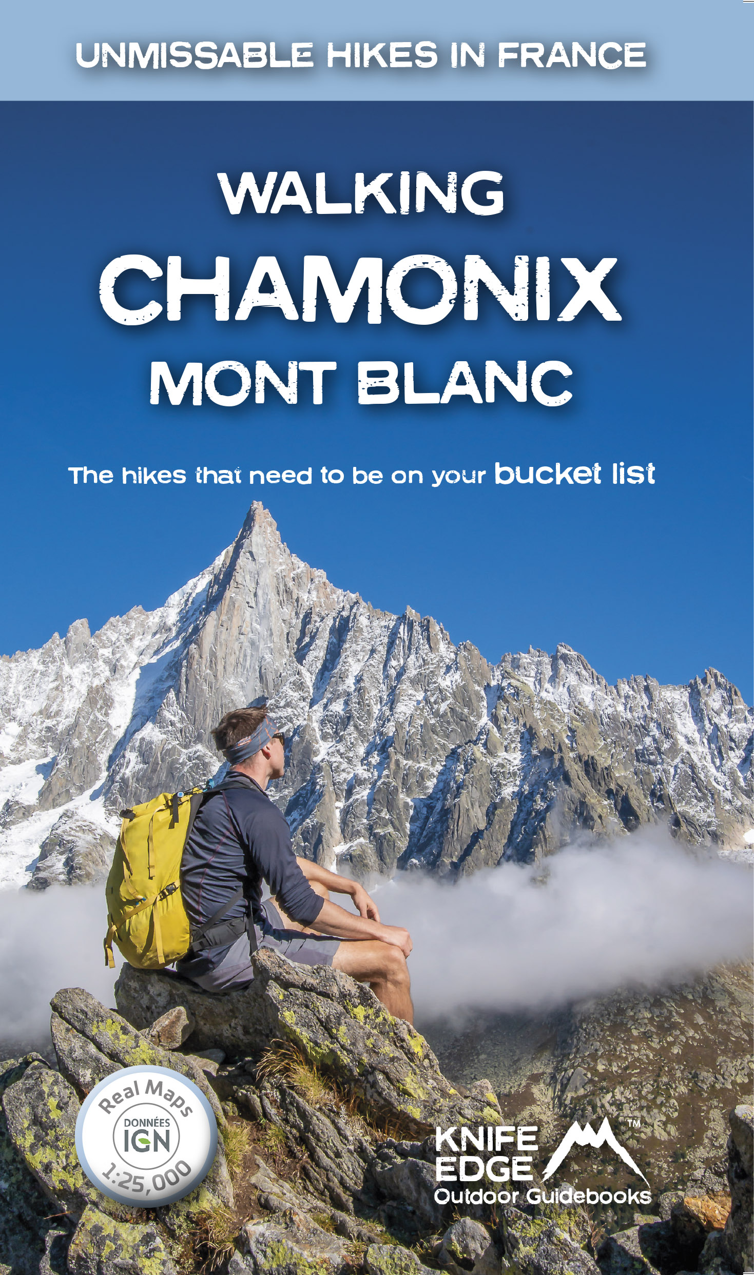
- Wandelgids Walking Chamonix Mont Blanc | Knife Edge Outdoor
- Real IGN Maps 1:25,000 Read more


- Also available from:
- De Zwerver, Netherlands


Stanfords
United Kingdom
2016
United Kingdom
2016
- North York Moors Western OS Explorer Map OL26 (paper)
- The western part of the North York Moors National Park on a detailed topographic and GPS compatible map OL26, paper version, from the Ordnance Survey’s 1:25,000 Explorer series. Coverage extends from Ampleforth in the south northwards to Saltburn-by-the-Sea, and from Ingleby Arncliffe to Danby, Castleton and Hutton-le-Hole, and includes... Read more
- Also available from:
- The Book Depository, United Kingdom
- De Zwerver, Netherlands


De Zwerver
Netherlands
2016
Netherlands
2016

- Also available from:
- De Zwerver, Netherlands


- Also available from:
- De Zwerver, Netherlands


Stanfords
United Kingdom
United Kingdom
- Cheviot Hills - Jedburgh & Wooler OS Explorer Active Map OL16 (waterproof)
- The Cheviot Hills on a detailed topographic and GPS compatible map OL16, waterproof version, from the Ordnance Survey’s 1:25,000 Explorer series. Coverage includes Jedburgh, Woolmer, part of the Northumberland National Park, the peaks of The Cheviot, Corby Pike, Cold Law, Scrathy Holes and Windy Gyle, Catcleugh Reservoir, sections of the... Read more
- Also available from:
- The Book Depository, United Kingdom


The Book Depository
United Kingdom
2020
United Kingdom
2020
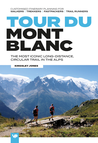
- Tour du Mont Blanc
- The most iconic long-distance, circular trail in the Alps with customised itinerary planning for walkers, trekkers, fastpackers and trail runners Read more
- Also available from:
- De Zwerver, Netherlands
De Zwerver
Netherlands
2020
Netherlands
2020
- Wandelgids Tour du Mont Blanc | Vertebrate Publishing
- The most iconic long-distance, circular trail in the Alps with customised itinerary planning for walkers, trekkers, fastpackers and trail runners Read more
Maps

Stanfords
United Kingdom
United Kingdom
- Luxembourg North
- One of two topographic survey maps of Luxembourg at 1:50,000, with contours at 10-metres intervals and additional relief shading. An overprint highlights long-distance footpaths, including the GR5 (E-2), cycle routes, and various places of interest, including campsites. The map covers an area of approximately 53 x 43 km / 33 x 27 miles. Map... Read more

Stanfords
United Kingdom
United Kingdom
- Chamonix-Mont-Blanc - Massif du Mont-Blanc IGN WATERPROOF 3630OTR
- Topographic survey of France at 1:25,000 in IGN`s excellent TOP25 / Série Bleue series. All the maps are GPS compatible, with a 1km UTM grid plus latitude and longitude lines at 5’ intervals. Contours are at 5m intervals except for mountainous areas where the maps have contours at 10m intervals, vividly enhanced by hill shading and graphics for... Read more

Stanfords
United Kingdom
United Kingdom
- Massif du Mont Blanc IGN Wall Map
- Massif du Mont Blanc presented on an encapsulated waterproof wall map, size 100 x 131cm (39.5” x 51.5”approx), with cartography of IGN’s excellent TOP25 series reduced slightly to 1:28,000, plus an additional enlargement for the glaciers between the Aiguille du Midi and the peak of Mont Blanc. The map combines sections from the two TOP25 Mont... Read more

Stanfords
United Kingdom
United Kingdom
- Luxembourg South
- One of two topographic survey maps of Luxembourg at 1:50,000, with contours at 10-metres intervals and additional relief shading. An overprint highlights long-distance footpaths, including the GR5 (E-2), cycle routes, and various places of interest, including campsites. The map covers an area of approximately 53 x 43 km / 33 x 27 miles. Map... Read more

Stanfords
United Kingdom
United Kingdom
- Autour du Thabor: Modane - Bardonecchia - Briançon
- Mont Thabor area at 1:50,000 on a contoured and GPS compatible map from Editions Didier Richard in their series of walking maps of French Alps and other popular hiking regions of south-eastern France. Coverage extends from Modane in the north to Briançon in the south-east, and west to Valloire.The base map with cartography from the IGN has... Read more

Stanfords
United Kingdom
United Kingdom
- Alsace - Mulhouse - Basel - Altkirch K+F Outdoor Map 2
- The southern part of Alsace around Mulhouse and Guebwiller on a GPS compatible, double-sided map at 1:50,000 from Kümmerly+Frey printed on sturdy, waterproof and tear-resistant synthetic paper; contoured, with hiking and cycling routes, sites for other recreational activities, various accommodation options, restaurants and ferme-auberge... Read more

- Also available from:
- De Zwerver, Netherlands


The Book Depository
United Kingdom
2020
United Kingdom
2020
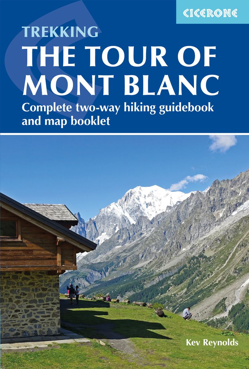
- Trekking the Tour of Mont Blanc
- Complete two-way hiking guidebook and map booklet Read more
- Also available from:
- De Zwerver, Netherlands
De Zwerver
Netherlands
2020
Netherlands
2020
- Wandelgids Tour of Mont Blanc | Cicerone
- The Tour of Mont Blanc is one of the world`s classic treks. This guidebook to hiking the 170km TMB contains in-depth route description and mapping for both the classic 11 day anti-clockwise circuit and an alternative 10 day clockwise circuit. This well-signed but demanding route, starting from Les Houches or Champex, is suitable for fit... Read more

The Book Depository
United Kingdom
United Kingdom
- Leman et Mont Blanc entre - Chablais Faucigny
- Selected tourist regions of the France on GPS compatible, contoured TOP 75 maps at 1:75,000 from the IGN, highlighting local and long-distance hiking paths, cycling routes and sites for other recreational activities. Each title includes five large panels with mapping at 1:25,000 to cover its most popular areas in greater detail. Cartography of... Read more
- Also available from:
- De Zwerver, Netherlands

De Zwerver
Netherlands
Netherlands
- Fietskaart - Wandelkaart 07 Entre Léman et Mont Blanc | IGN - Institut Géographique National
- Selected tourist regions of the France on GPS compatible, contoured TOP 75 maps at 1:75,000 from the IGN, highlighting local and long-distance hiking paths, cycling routes and sites for other recreational activities. Each title includes five large panels with mapping at 1:25,000 to cover its most popular areas in greater detail. Cartography of... Read more

Stanfords
United Kingdom
United Kingdom
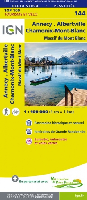
- Annecy - Albertville - Chamonix-Mont-Blanc - Massif du Mont Blanc IGN TOP100 144
- Discover the new double-sided laminated edition of TOP100 road maps of France from the Institut Géographique National (IGN); exceptionally detailed, contoured road maps which include the cycle paths and greenways of the AF3V (French Association for the Development of Cycle Paths and Greenways), ideal for exploring the French countryside by car,... Read more
- Also available from:
- The Book Depository, United Kingdom
- De Zwerver, Netherlands

De Zwerver
Netherlands
Netherlands

Stanfords
United Kingdom
United Kingdom
- Alsace - Strasbourg - Saverne - Barr - Offenburg K+F Outdoor Map 7
- The central part of Alsace around Strasbourg and Saverne on a GPS compatible, double-sided map at 1:50,000 from Kümmerly+Frey printed on sturdy, waterproof and tear-resistant synthetic paper; contoured, with hiking and cycling routes, sites for other recreational activities, various accommodation options, restaurants and ferme-auberge... Read more
- Also available from:
- De Zwerver, Netherlands

De Zwerver
Netherlands
Netherlands
- Wandelkaart 07 Outdoorkarte FR Elsass, Vogesen - Alsace, Strasbourg Elzas - Vogezen | Kümmerly & Frey
- The central part of Alsace around Strasbourg and Saverne on a GPS compatible, double-sided map at 1:50,000 from K Read more

Stanfords
United Kingdom
United Kingdom
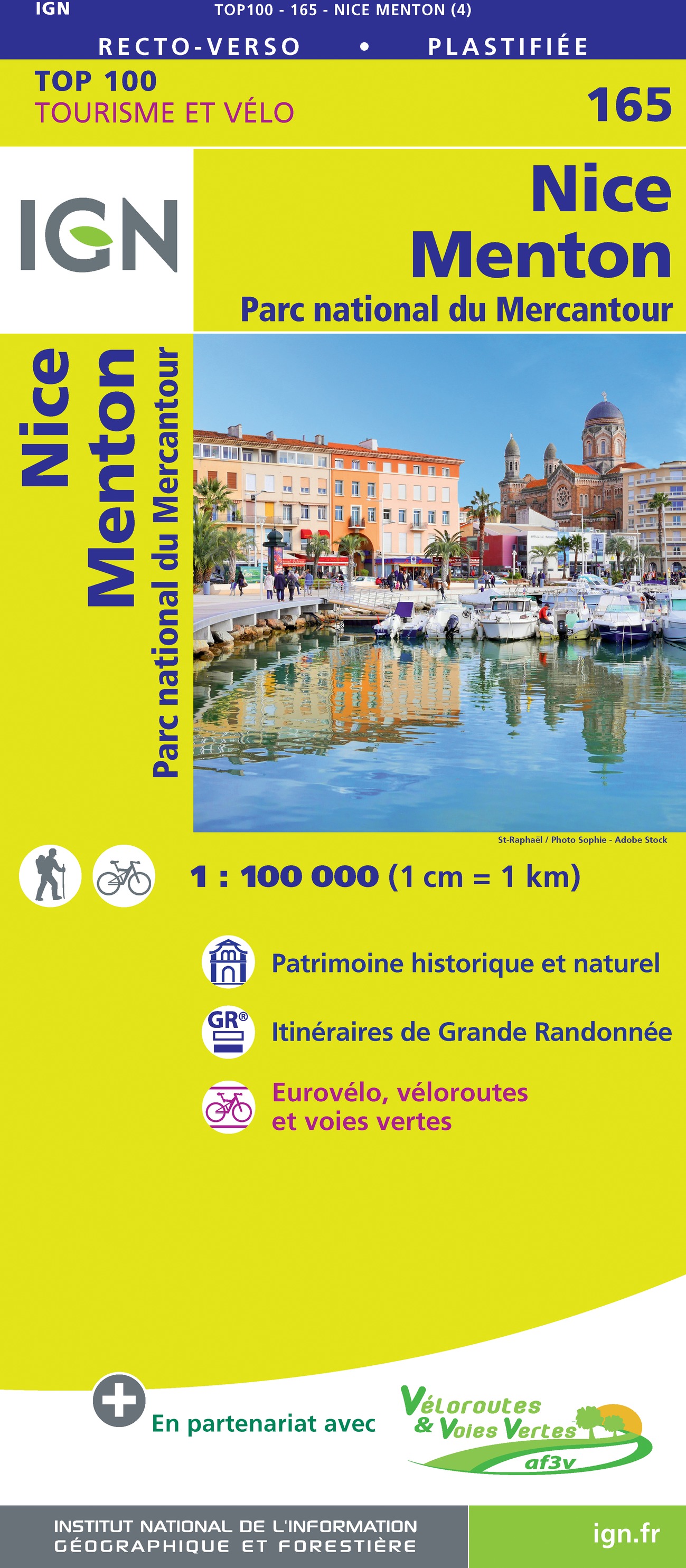
- Nice - Menton - PN du Mercantour IGN TOP100 165
- Discover the new double-sided laminated edition of TOP100 road maps of France from the Institut Géographique National (IGN); exceptionally detailed, contoured road maps which include the cycle paths and greenways of the AF3V (French Association for the Development of Cycle Paths and Greenways), ideal for exploring the French countryside by car,... Read more
- Also available from:
- De Zwerver, Netherlands
De Zwerver
Netherlands
2020
Netherlands
2020

Stanfords
United Kingdom
2015
United Kingdom
2015
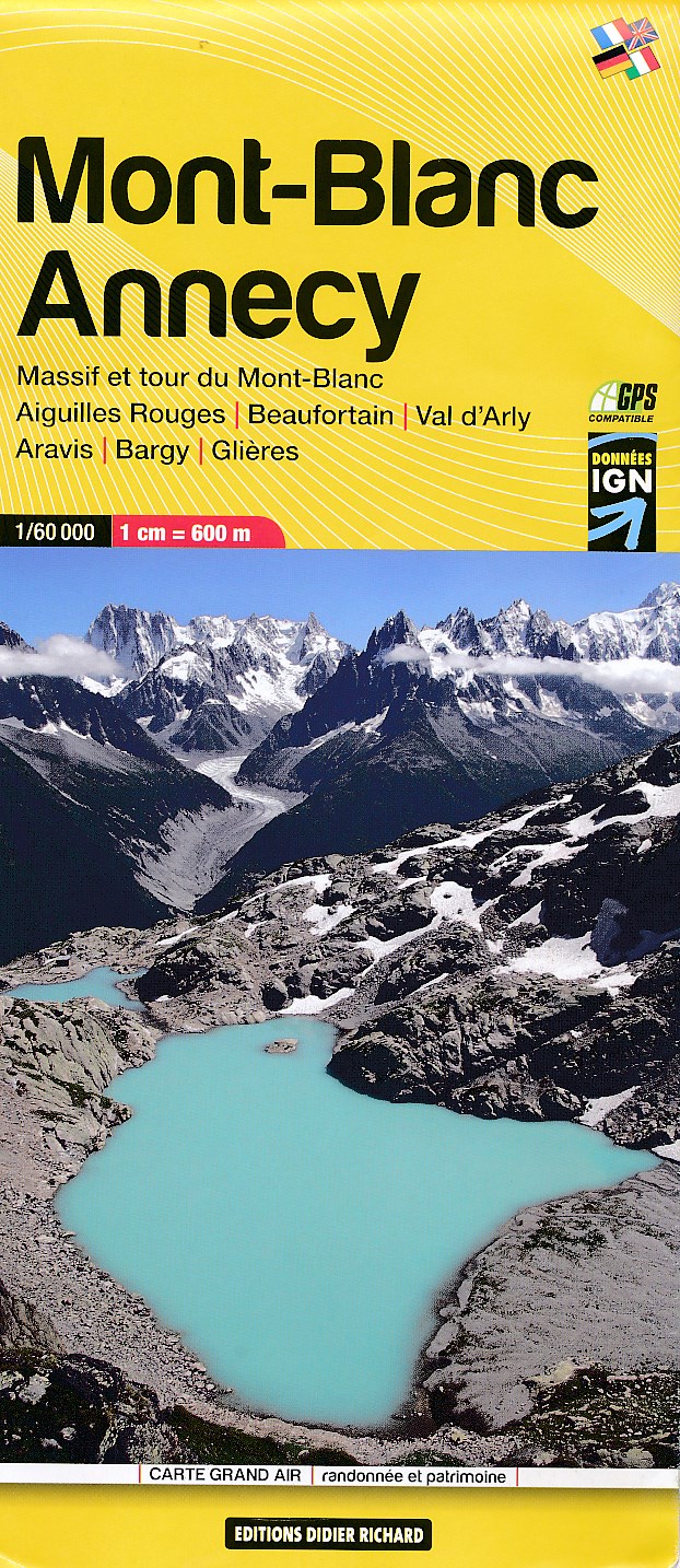
- Mont-Blanc - Annecy Didier Richard 02
- Mont Blanc Massif and the adjoining region of the French Alps at 1:60,000 on a contoured and GPS compatible map from Didier Richard with a base derived from IGN’s topographic survey, highlighting both local hiking routes and the GR network of long-distance paths, gîtes and mountain refuges, interesting natural and cultural sites, etc. The map... Read more
- Also available from:
- De Zwerver, Netherlands
De Zwerver
Netherlands
2015
Netherlands
2015
- Wandelkaart 02 Mont Blanc - Aiguilles Rouges - Aravis - Val d'Arly | Didier Richard
- Mont Blanc Massif and the adjoining region of the French Alps at 1:60,000 on a contoured and GPS compatible map from Didier Richard with a base derived from IGN Read more

Stanfords
United Kingdom
United Kingdom
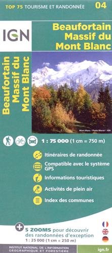
- Beaufortain - Massif du Mont Blanc IGN 75004
- Massif du Mont Blanc – Beaufortain region in a series of GPS compatible, contoured TOP 75 maps at 1:75,000 from the IGN, highlighting local and long-distance hiking paths, cycling routes and sites for other recreational activities. In this revised 2015 edition the main 75K map now covers the whole of the Tour of Mont Blanc (TMB) including its... Read more
- Also available from:
- De Zwerver, Netherlands
De Zwerver
Netherlands
Netherlands
- Wandelkaart - Fietskaart 04 Beaufortain - Massif du Mont Blanc | IGN - Institut Géographique National
- Une carte générale de très grande lisibilité au 1/75 000 + 5 extraits de TOP25 au 1/25 000 en une seule carte ! Read more