
England
Description
Map


Trails in this state
- A Dales Highway
- Allerdale RambleGPX
- Beacon WayGPX
- Borders Abbeys WayGPX
- Calderdale WayGPX
- Cheshire Ring Canal WalkGPX
- Cleveland WayGPX
- Coast to Coast WalkGPX
- Coleridge WayGPX
- Copper Trail
- Cotswold WayGPX
- Cumbria WayGPX
- Dales WayGPX
- Dartmoor WayGPX
- Downs LinkGPX
- E2GPX
- E8GPX
- Essex WayGPX
- Fen Rivers WayGPX
- Geopark WayGPX
- Greensand Ridge WalkGPX
- Greensand WayGPX
- Guernsey Coastal Path
- Hadrian's WallGPX
- Heart of England WayGPX
- Hereward WayGPX
- High Weald Landscape TrailGPX
- Icknield WayGPX
- Isle of Jersey Coastal Path
- Isle of Man Coastal PathGPX
- Isle of Wight Coastal PathGPX
- Lady Anne's WayGPX
- Lands End to John o'GroatsGPX
- Lea Valley WalkGPX
- Leland TrailGPX
- Liberty TrailGPX
- Limestone LinkGPX
- Limestone WayGPX
- Mendip WayGPX
- Minster WayGPX
- Monarch's WayGPX
- Nene WayGPX
- North Buckinghamshire WayGPX
- North Downs WayGPX
- North Sea TrailGPX
- Northumberland Coast PathGPX
- Offa's Dyke PathGPX
- Oxford Canal WalkGPX
- Oxfordshire WayGPX
- Peddars Way and Norfolk Coast PathGPX
- Pendle WayGPX
- Pennine BridlewayGPX
- Pennine WayGPX
- Quantock GreenwayGPX
- Reivers Way
- Ribble WayGPX
- RidgewayGPX
- Robin Hood WayGPX
- Saint Cuthbert's WayGPX
- Saint Oswald's Way
- Saints WayGPX
- Saxon Shore WayGPX
- Severn WayGPX
- Shakespeare's WayGPX
- Shropshire WayGPX
- Solent WayGPX
- South Downs WayGPX
- South West Coast PathGPX
- Staffordshire WayGPX
- Stour Valley PathGPX
- Suffolk Coast and Heaths Path
- Tamar Valley Discovery TrailGPX
- Tarka TrailGPX
- Teesdale WayGPX
- Thames PathGPX
- Trans Pennine TrailGPX
- Two Moors WayGPX
- Via FrancigenaGPX
- Viking WayGPX
- Wayfarer's WalkGPX
- WealdwayGPX
- Weavers WayGPX
- Windermere WayGPX
- Worcestershire WayGPX
- Wychavon WayGPX
- Yorkshire Wolds WayGPX
Links
Facts
Reports
Guides and maps
Lodging
Organisations
Tour operators
GPS
Other
Books

Stanfords
United Kingdom
United Kingdom
- A Journey Through South-East England: Lewes to Woolwich
- A Journey Through South-East England: Lewes to Woolwich follows on from Brian`s previous journey through South-East England from Broadstairs to Lewes. This journey of around 100 miles, being part two of a mammoth trek through Kent and East Sussex, was also achieved just before his 70th birthday. In this book, Brian shares his experiences of... Read more

Stanfords
United Kingdom
United Kingdom
- Walks Along The West Jurassic Coast
- From the Publisher of the highly acclaimed Jurassic Coast Official Guide, Coastal Publishing Limited is a fast growing publisher with an expanding list of books of regional interest and national appeal. Walks Along the East Jurassic Coast and its companion Walks Along the West Jurassic Coast Are the first two books in a series of 11 walking... Read more

Stanfords
United Kingdom
United Kingdom
- DK Eyewitness New England
- Discover New England - a region synonymous with fall foliage, seafood and historic sitesWhether you want to explore the rugged natural beauty of the Appalachian Mountains, follow the fascinating Freedom Trail through Boston, or indulge in fresh lobster from the coast of Cape Cod, your DK Eyewitness travel guide makes sure you experience all New... Read more

Stanfords
United Kingdom
United Kingdom
- The National Trust Book of the Countryside
- Explore the British countryside with the National Trust. No organisation knows more about the British countryside than the National Trust, the custodians of some of our most beautiful stretches of land and coastline. Drawing on their expertise, this stunningly illustrated book is a comprehensive guide to the country`s natural heritage. Part One... Read more

Stanfords
United Kingdom
United Kingdom
- Thames Valley - Pocket Pub Walks
- This work is a pocket-size collection of fifteen circular walks each based on a local pub serving good food. It includes routes at Dorchester, Goring, Reading, Wargrave, Cookham, Little Marlow and Eton. It includes maps and photographs. Read more

Stanfords
United Kingdom
2019
United Kingdom
2019
- Exmoor National Park (Slow Travel) Bradt Guide
- This new title in Bradt`s distinctive series of Slow travel guides to regions of Britain is the only general guide to focus exclusively on Exmoor, covering all of the national park plus towns and villages just outside the boundary. Written by expert resident author Hilary Bradt, coast and moorland, hiking, wildlife and birdwatching are all... Read more

Stanfords
United Kingdom
2020
United Kingdom
2020
- Hadrian`s Wall Path
- Trailblazer British Walking Guide, two-way edition with routes re-walked from Bowness-on-Solway to Wallsend (Newcastle) and Wallsend (Newcastle) to Bowness-on-Solway. All-in-one guide to walking Hadrian`s Wall Path National Trail. Hadrian`s Wall Path, 84 miles from end to end, follows the course of northern Europe`s largest surviving Roman... Read more

Stanfords
United Kingdom
2021
United Kingdom
2021
- The Rough Guide to Walks in & around London (Travel Guide with Free eBook)
- The Rough Guide to Walks in and Around LondonMake the most of your time on Earth with the ultimate travel guides.World-renowned `tell it like it is` guidebook available now with a free eBook Discover walks in and around London with this comprehensive, entertaining, `tell it like it is` Rough Guide, packed with our experts` honest and... Read more

Stanfords
United Kingdom
United Kingdom
- The Icknield Way Path: A Walkers` Guide
- The Icknield Way Path – 110 miles along the ‘oldest road in Britain’ linking the Ridgeway Path to the Peddars Way, following footpaths close to the ancient route and including a link into Thetford. Written walk directions are accompanied by sketch map extracts from Landranger OS maps customised with additional information, useful for walkers.... Read more

Stanfords
United Kingdom
United Kingdom
- Guide to East Sussex Pub Walks
- Discover the beautiful countryside around East Sussex with this guide to some of the best walks in the area. These 20 circular routes vary in length from 21/2 to 7 miles and are centred on a broad variety of pubs - all recommended for their good food and warm welcome.Explore the region`s diverse landscape, with walks ranging from the flatlands... Read more

Stanfords
United Kingdom
2022
United Kingdom
2022
- Rough Guide Staycations Oxford (Travel Guide with Free eBook)
- Rough Guides Staycations Oxford Make the most of your time on Earth with the ultimate travel guides.Inspirational and informative new pocket guide, with free eBook, making the most of holidaying at home in the UK through clearly laid-out walks and tours. Explore the best of Oxford with this unique travel guide, packed full of insider... Read more

Stanfords
United Kingdom
United Kingdom
- Hampshire & The New Forest Year Round Walks
- These 20 circular walks, varying in length from 2 to 7 miles, take in renowned beauty spots, hidden gems and must-sees from across Hampshire & the New Forest. The guide has been divided into seasons, so you`ll find a recommendation for every day of the year. Highlights include: * Spring: Hurstbourne Tarrant with its thatched cottages, and the... Read more

Stanfords
United Kingdom
United Kingdom
- The Big Walks of London
- The Big Walks of London by John Merrill is a guidebook to the capitals major walking routes. London has an incredible variety of walks and trails, and this guidebook presents more than twenty long walks through the city, ranging from 7 to 150 miles, and includes the Thames Path, the London Loop and the Capital Ring. Each walk section is... Read more

Stanfords
United Kingdom
United Kingdom
- Rick Steves Best of Europe (Third Edition)
- Hit Europe`s can`t-miss art, sights, and bites with Rick Steves Best of Europe!* Expert advice from Rick Steves on what`s worth your time and money* Itineraries for one to four days in the top destinations in England, France, Germany, Italy, the Netherlands, Spain, and Switzerland* Rick`s tips for beating the crowds, skipping lines, and... Read more

Stanfords
United Kingdom
2015
United Kingdom
2015
- Dartmoor Walking
- John Earle’s Cicerone guide to Walking on Dartmoor explores one of England’s favourite National Park walking destinations as well as its surrounding areas. Dartmoor has been referred to as one of the last great wildernesses in the country, where it is possible to get further away from civilisation than anywhere else. Its wild, lonely and remote... Read more
Maps
Stanfords
United Kingdom
United Kingdom
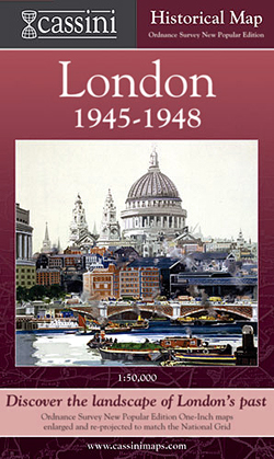
- London 1945-1948
- London in 1945-1948 in the Cassini Historical Series reproducing old Ordnance Survey mapping of England and Wales at 1:50,000. The four London maps cover roughly the area of the present day Greater London rather than following the format of rest of the series which is designed to correspond to the current Landranger maps. Mapping is identical... Read more

Stanfords
United Kingdom
United Kingdom
- Sheffield and Huddersfield 1923-1925
- Map No. 110, Sheffield and Huddersfield 1923-1925, in the Cassini Historical Series of old Ordnance Survey mapping of England and Wales at 1:50,000 in a format designed to offer a convenient comparison with the present day coverage from the OS, and most locations in three different editions. Old historical maps have been combined so that the... Read more
Stanfords
United Kingdom
United Kingdom
- Northampton and Milton Keynes 1833-1920 (3-map set)
- Map No. 152, Northampton and Milton Keynes 1833-1920 (3-map set), in the Cassini Historical Series of old Ordnance Survey mapping of England and Wales at 1:50,000 in a format designed to offer a convenient comparison with the present day coverage from the OS, and most locations in three different editions. Old historical maps have been combined... Read more

Stanfords
United Kingdom
United Kingdom
- Bristol Past and Present
- Bristol in the Cassini Past and Present map series which covers town and cities of England and Wales and offers a unique way of tracing their history and expansion by showing four different periods of their development using Ordnance Survey mapping from the mid-19th century, the late 19th century, the 1920s and the present day. Coverage... Read more
Stanfords
United Kingdom
United Kingdom
- Sheffield and Huddersfield 1840-1925 (3-map set)
- Map No. 110, Sheffield and Huddersfield 1840-1925 (3-map set), in the Cassini Historical Series of old Ordnance Survey mapping of England and Wales at 1:50,000 in a format designed to offer a convenient comparison with the present day coverage from the OS, and most locations in three different editions. Old historical maps have been combined so... Read more
Stanfords
United Kingdom
United Kingdom
- Stratford upon Avon 1828-1834
- Map No. 151, Stratford upon Avon 1828-1834, in the Cassini Historical Series of old Ordnance Survey mapping of England and Wales at 1:50,000 in a format designed to offer a convenient comparison with the present day coverage from the OS, and most locations in three different editions. Old historical maps have been combined so that the sheet... Read more
Stanfords
United Kingdom
United Kingdom
- The Black Mountains / Y Mynyddoedd Duon 1900
- Map No. 161, The Black Mountains / Y Mynyddoedd Duon 1900, in the Cassini Historical Series of old Ordnance Survey mapping of England and Wales at 1:50,000 in a format designed to offer a convenient comparison with the present day coverage from the OS, and most locations in three different editions. Old historical maps have been combined so... Read more
Stanfords
United Kingdom
United Kingdom
- London East 1897-1902
- Map No. 177, London East 1897-1902, in the Cassini Historical Series of old Ordnance Survey mapping of England and Wales at 1:50,000 in a format designed to offer a convenient comparison with the present day coverage from the OS, and most locations in three different editions. Old historical maps have been combined so that the sheet lines... Read more
Stanfords
United Kingdom
United Kingdom
- Haltwhistle and Brampton 1925
- Map No. 86, Haltwhistle and Brampton 1925, in the Cassini Historical Series of old Ordnance Survey mapping of England and Wales at 1:50,000 in a format designed to offer a convenient comparison with the present day coverage from the OS, and most locations in three different editions. Old historical maps have been combined so that the sheet... Read more

Stanfords
United Kingdom
United Kingdom
- Maidenhead, Marlow and Bourne End Past and Present
- Maidenhead, Marlow and Bourne End in the Cassini Past and Present map series which covers town and cities of England and Wales and offers a unique way of tracing their history and expansion by showing four different periods of their development using Ordnance Survey mapping from the mid-19th century, the late 19th century, the 1920s and the... Read more
Stanfords
United Kingdom
United Kingdom
- Buxton and Matlock 1837-1923 (3-map set)
- Map No. 119, Buxton and Matlock 1921-1923, in the Cassini Historical Series of old Ordnance Survey mapping of England and Wales at 1:50,000 in a format designed to offer a convenient comparison with the present day coverage from the OS, and most locations in three different editions. Old historical maps have been combined so that the sheet... Read more

Stanfords
United Kingdom
United Kingdom
- Transrhodopi - Long distance hiking and biking trail From Trigrad to Ivaylovgrad
- Western Rhodope Mountains at 1:100,000 on a contoured GPS compatible map from Domino extending from just west of the Pirin National Park to Asenovgrad in the north-east. The map is double-sided with a good overlap between the sides. Topography is shown by contours at 50m intervals with relief shading and spot heights, plus colouring for... Read more
Stanfords
United Kingdom
United Kingdom
- Aberystwyth and Machynlleth 1901-1903
- Map No. 135, Aberystwyth and Machynlleth 1901-1903, in the Cassini Historical Series of old Ordnance Survey mapping of England and Wales at 1:50,000 in a format designed to offer a convenient comparison with the present day coverage from the OS, and most locations in three different editions. Old historical maps have been combined so that the... Read more
Stanfords
United Kingdom
United Kingdom
- Brighton and Lewes 1898
- Map No. 198, Brighton and Lewes 1898, in the Cassini Historical Series of old Ordnance Survey mapping of England and Wales at 1:50,000 in a format designed to offer a convenient comparison with the present day coverage from the OS, and most locations in three different editions. Old historical maps have been combined so that the sheet lines... Read more
Stanfords
United Kingdom
United Kingdom
- Whitby and Esk Dale 1925
- Map No. 94, Whitby and Esk Dale 1925, in the Cassini Historical Series of old Ordnance Survey mapping of England and Wales at 1:50,000 in a format designed to offer a convenient comparison with the present day coverage from the OS, and most locations in three different editions. Old historical maps have been combined so that the sheet lines... Read more