
Georgia
Description
The north of Georgia is mountainous. The Appalachian Trail starts here. Also, the Benton Mackaye Trail has 75 miles in the Chattahooche National Forest in the north, before it enters the state of Tennessee.
Georgia shares the 250 mile Pinhote Trail with Alabama.
Three long distance trails (will) run through Georgia. The Eastern Continental Trail, The East Coast Greenway and the Great Eastern Trail.
Map

Trails in this state
Links
Facts
Reports
Guides and maps
Lodging
Organisations
Tour operators
GPS
Other
Books

Stanfords
United Kingdom
United Kingdom
- Frommer`s Vienna Day by Day
- Vienna, Austria is so rich with cultural treasures, so replete with sights and wonders, that visitors are often bewildered by the task of planning a visit. Which of nearly 100 museums to visit? Which of countless theatres and concert halls? With an endless number of celebrated restaurants, cafes, lively taverns, bakeries serving famous... Read more

Stanfords
United Kingdom
2015
United Kingdom
2015
- Madeira: Car Tours and Walks
- Madeira in the Sunflower Landscapes guide series; exploring the best walking and touring possibilities in the region or area. Detailed information about touring by hired car or public transport, as well as on foot, is provided, helping walkers to navigate and plan day-trips. Shorter strolls are also included as an alternative for each main... Read more

Stanfords
United Kingdom
United Kingdom
- Corfu
- Corfu is the Sunflower Landscape guide to exploring the best walking and touring possibilities on the island. The guide covers a range of routes including trips around Mt Pantokrator, Gouvia and Kavos. A double-sided, fold-out touring map of Corfu gives an overview of the island and the locations of each walk and tour. Detailed information... Read more

Stanfords
United Kingdom
United Kingdom
- DK Eyewitness Travel Guide New Orleans
- Your journey starts here. Featuring DK`s much-loved maps and illustrations, walks and information, plus all new, full-colour photography, this 100% updated guide to New Orleans brings you the best of this lively city in a brand-new, lightweight format.What`s inside?- full-colour photography, hand-drawnillustrations, and maps throughout-... Read more

Stanfords
United Kingdom
United Kingdom
- DK Eyewitness Top 10 Crete 14/5/20
- Picturesque Venetian ports, snow-capped mountains, awe-inspiring Minoan ruins, golden sands and glistening waters - Crete is an island paradise quite unlike any other. Your DK Eyewitness Top 10 travel guide ensures you`ll find your way around Crete with absolute ease.Our newly updated Top 10 travel guide breaks down the best of Crete into... Read more

Stanfords
United Kingdom
2015
United Kingdom
2015
- Algarve Sunflower Landscape Guide
- Algarve in the Sunflower Landscapes guide series; exploring the best walking and touring possibilities in the region or area. Detailed information about touring by hired car or public transport, as well as on foot is provided, helping walkers to navigate and plan day-trips. Shorter strolls are also included as an alternative for each main route... Read more

Stanfords
United Kingdom
United Kingdom
- DK Eyewitness USA
- Spectacular scenery, vibrant cities and captivating culture - welcome to the USA.Whether you want to hike in breathtaking Yosemite National Park, take a road trip from coast to coast or sample southern soul food in the Deep South, your DK Eyewitness travel guide makes sure you experience all that the USA has to offer.Dramatic and diverse, the... Read more

Stanfords
United Kingdom
United Kingdom
- DK Eyewitness Sicily
- Your journey starts here. Featuring DK`s much-loved maps and illustrations, walks and information, plus all new, full-colour photography, this 100% updated guide to Sicily brings you the best of this beautiful island in a brand-new, lightweight format.What`s inside?- full-colour photography, hand-drawn illustrations, and maps throughout-... Read more

Stanfords
United Kingdom
United Kingdom
- The Wild Atlantic Way Route Atlas - Ireland West
- The Wild Atlantic Way is a 25,000 kilometre coastal route along Ireland’s Atlantic coast that stretches between the southerly point of Kinsale, County Cork up to Derry. This route is favoured by many in its entirety or broken down into more manageable, day trip sections. This Xploreit handy sized spiral bound route atlas contains 30 easy-to-use... Read more

Stanfords
United Kingdom
United Kingdom
- New York Theatre Walks
- This outstanding volume provides readers with seven self-guided tours, not just of New York`s theatre district, but also the East and West Village, the Lower East Side, and the Upper West Side. ”New York Theatre Walks” abounds in amusing, and insightful Broadway anecdotes, as well as giving the reader a sense of the city`s own complex, rich... Read more

Stanfords
United Kingdom
United Kingdom
- Coast - The Walks
- Accompanying BBC2`s BAFTA award-winning television series, ”Coast: The Walks” will inspire you to explore the best that the coastline of the British Isles has to offer. With more than 50 fantastic walks around Great Britain and Ireland, this practical guidebook features a variety of town and rural routes that are designed to suit both... Read more

Stanfords
United Kingdom
United Kingdom
- Rick Steves Pocket Florence (fourth Edition)
- Make the most of every day and every dollar with Rick Steves! This colorful, compact guidebook is perfect for spending a week or less in Florence: City walks and tours: Five detailed tours and walks showcase Florence`s essential sights, including the Uffizi Gallery, the Duomo, and Michelangelo`s David at the Accademia, plus handy neighborhood... Read more

Stanfords
United Kingdom
United Kingdom
- DK Eyewitness San Francisco and the Bay Area
- Discover San Francisco and the Bay Area - a region renowned for its culture, history, natural beauty, and incredible food.Whether you want to get inspired by contemporary art at SFMOMA, weekend in the Wine Country, or hike through Muir Woods National Monument, your DK Eyewitness travel guide makes sure you experience all that San Francisco and... Read more

Stanfords
United Kingdom
United Kingdom
- Rick Steves Pocket Amsterdam (Third Edition)
- Make the most of every day and every dollar with Rick Steves! This colourful, compact guidebook is perfect for spending a week or less in Amsterdam:City walks and tours: Six detailed tours and walks showcase Amsterdam`s essential sights, including the Rijksmuseum, Van Gogh Museum, and the Anne Frank House, plus neighbourhood walks through the... Read more

Stanfords
United Kingdom
United Kingdom
- Beastly Journeys: Unusual Tales of Travel with Animals
- David Attenborough, Dion Leonard, Dervla Murphy and Brian Jackman are just four of the authors whose work features in this new anthology from Bradt focusing on true stories about travelling with animals. In Beastly Journeys, there are 46 tales of extraordinary animal travel experiences, from hilarious holidays with pets to journeys on which... Read more
Maps
Stanfords
United Kingdom
United Kingdom
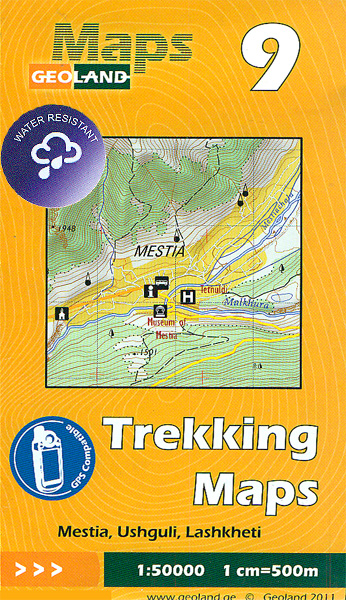
- Mestia - Ushguli - Lashkheti Geoland 9 WATERPROOF
- Mestia - Ushguli - Lashkheti area of the Caucasus Mountains in Georgia at 1:50,000 on a double-sided, contoured and GPS compatible map from Geoplan, with an overprint providing tourist information including local accommodation and sights. This is the WATERPROOF & TEAR-RESISTANT edition of the map, which is also available in a paper version.Maps... Read more

Stanfords
United Kingdom
United Kingdom
- Bahundada
- Bahundada, sheet no. 2884-10, in the topographic survey of Nepal at 1:50,000 published by the Nepali Government in the late 1990s and early 2000s and produced from remote sensing data by Finnish cartographers as part of that country’s international aid program. The maps cover 15’ x 15’ quadrangles.IMPORTANT – PLEASE NOTE BEFORE ORDERING:... Read more

Stanfords
United Kingdom
United Kingdom
- Busen Region - South Georgia BAS Wall Map
- South Georgia and its offshore islands in the South Atlantic presented by the British Antarctic Survey on a double-sided map combining topographic mapping of the whole island at 1:200,000 scale and detailed topographic mapping of the route of Shackleton’s crossing in May 1916 at 1:40,000 scale.On one side is a map presenting the topography by... Read more
Stanfords
United Kingdom
United Kingdom
- Nepal Survey 1:25,000 Sheet 2883 11D (Patichaur)
- Koban, sheet no. 2883-07, in the topographic survey of Nepal at 1:50,000 published by the Nepali Government in the late 1990s and early 2000s and produced from remote sensing data by Finnish cartographers as part of that country’s international aid program. The maps cover 15’ x 15’ quadrangles.IMPORTANT – PLEASE NOTE BEFORE ORDERING:... Read more
Stanfords
United Kingdom
United Kingdom
- Jomson
- Jomson, sheet no. 2883-03, in the topographic survey of Nepal at 1:50,000 published by the Nepali Government in the late 1990s and early 2000s and produced from remote sensing data by Finnish cartographers as part of that country’s international aid program. The maps cover 15’ x 15’ quadrangles.IMPORTANT – PLEASE NOTE BEFORE ORDERING:... Read more
Stanfords
United Kingdom
United Kingdom
- Salpa Bhanjyang - Baksila
- Salpa Bhanjyang - Baksila, sheet no. 2786-12, in the topographic survey of Nepal at 1:50,000 published by the Nepali Government in the late 1990s and early 2000s and produced from remote sensing data by Finnish cartographers as part of that country’s international aid program. The maps cover 15’ x 15’ quadrangles.IMPORTANT – PLEASE NOTE BEFORE... Read more
Stanfords
United Kingdom
United Kingdom
- Gurjakhani
- Gurjakhani, sheet no. 2883-05, in the topographic survey of Nepal at 1:50,000 published by the Nepali Government in the late 1990s and early 2000s and produced from remote sensing data by Finnish cartographers as part of that country’s international aid program. The maps cover 15’ x 15’ quadrangles.IMPORTANT – PLEASE NOTE BEFORE ORDERING:... Read more
Stanfords
United Kingdom
United Kingdom
- Lantan (2885 15)
- Upper Langtang Valley, sheet no. 2885-15, in the topographic survey of Nepal at 1:50,000 published by the Nepali Government in the late 1990s and early 2000s and produced from remote sensing data by Finnish cartographers as part of that country’s international aid program. The maps cover 15’ x 15’ quadrangles.IMPORTANT – PLEASE NOTE BEFORE... Read more
Stanfords
United Kingdom
United Kingdom
- Dhime
- Dhime, sheet no. 2882-01, in the topographic survey of Nepal at 1:50,000 published by the Nepali Government in the late 1990s and early 2000s and produced from remote sensing data by Finnish cartographers as part of that country’s international aid program. The maps cover 15’ x 15’ quadrangles.IMPORTANT – PLEASE NOTE BEFORE ORDERING:... Read more
Stanfords
United Kingdom
United Kingdom
- Arughat
- Arughat, sheet no. 2884-16, in the topographic survey of Nepal at 1:50,000 published by the Nepali Government in the late 1990s and early 2000s and produced from remote sensing data by Finnish cartographers as part of that country’s international aid program. The maps cover 15’ x 15’ quadrangles.IMPORTANT – PLEASE NOTE BEFORE ORDERING:... Read more
Stanfords
United Kingdom
United Kingdom
- Lapchegau
- Lapchgau, sheet no. 2886-13, in the topographic survey of Nepal at 1:50,000 published by the Nepali Government in the late 1990s and early 2000s and produced from remote sensing data by Finnish cartographers as part of that country’s international aid program. The maps cover 15’ x 15’ quadrangles.IMPORTANT – PLEASE NOTE BEFORE ORDERING:... Read more
Stanfords
United Kingdom
United Kingdom
- Khalanga Baja (Darchula)
- Khalanga Baja (Darchula), sheet no. 2980-03 / 3080-15, in the topographic survey of Nepal at 1:50,000 published by the Nepali Government in the late 1990s and early 2000s and produced from remote sensing data by Finnish cartographers as part of that country’s international aid program. The maps cover 15’ x 15’ quadrangles.IMPORTANT – PLEASE... Read more
Stanfords
United Kingdom
United Kingdom
- Nile
- Nile, sheet no. 2885-05, in the topographic survey of Nepal at 1:50,000 published by the Nepali Government in the late 1990s and early 2000s and produced from remote sensing data by Finnish cartographers as part of that country’s international aid program. The maps cover 15’ x 15’ quadrangles.IMPORTANT – PLEASE NOTE BEFORE ORDERING:... Read more
Stanfords
United Kingdom
United Kingdom
- Dattu
- Dattu, sheet no. 2980-02, in the topographic survey of Nepal at 1:50,000 published by the Nepali Government in the late 1990s and early 2000s and produced from remote sensing data by Finnish cartographers as part of that country’s international aid program. The maps cover 15’ x 15’ quadrangles.IMPORTANT – PLEASE NOTE BEFORE ORDERING:... Read more

Stanfords
United Kingdom
United Kingdom
- Barisakho - Roshka - Juta - Asa Gorge Geoland 3 WATERPROOF
- Barisakho - Roshka - Juta - Asa Gorge area of the Caucasus Mountains in Georgia at 1:50,000 on a double-sided, contoured and GPS compatible map from Geoplan, with an overprint providing tourist information including local accommodation and sights. This is the WATERPROOF & TEAR-RESISTANT edition of the map, which is also available in a paper... Read more