Turkmenistan
Description
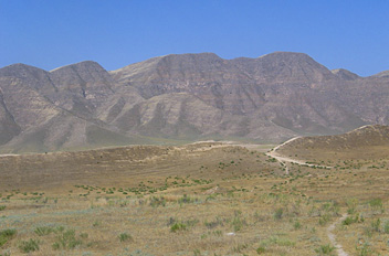
The Central-Asian country of Turkmenistan is largely covered by the dry, sandy, low-lying and sparsely populated Karakum desert, an expanse of low shifting sand hills and clay deposits. Summer temperatures here can rise well over 40 degrees centigrade, and dust storms are common. The country spreads out from the shores of the Caspian Sea in the west to Afghanistan in the east. Its northern and northeastern neighbours are Kazakhstan and Uzbekistan, and to the south lies Iran.
Not far to the south of the capital Ashgabat, straddling the border with Iran, is the Kopet Dag (or Turkmen-Khorasan) mountain range, characterized by dry and sandy slopes and foothills, mountain plateaus and deep ravines. The Kopet Dag runs for 650 km in a roughly east-west direction, and highest peak of the range in Turkmenistan is Mount Rizeh (2912 m). In the year 2000, at the initiative of Turkmenistan's first president, a 37 km long concrete footpath named Serdar Yoly ("Walk of Health") was built along the steep slopes of the Kopet Dag near Ashgabat. It is a popular local outing, and views of Ashgabat and surroundings are said to be great from the higher points of the path. For some true hiking in more remote parts, try Karakala Nature Reserve and the Nokhur region in the western reaches of the Kopet Dag range.
In Turkmenistan's western interior, not far from the Caspian Sea, you will find Mount Arlan (1880 m), highest peak of the Great Balkhan (or Balkan Daglary) Range, an area of moonlike landscapes like the Yangykala Canyon.
In the far southeastern corner of Turkmenistan, on the border with Uzbekistan, is the Koytendag (or Kugitangtau) Range, home to Turkmenistan's highest peak: Mount Ayrybaba (3139 m). This is a remote and naturally diverse mountain region, with karst caves, dinosaur footprints, deep canyons and the largest remaining population of Ibex.
In Turkmenistan, special permits are sometimes required to travel to remote areas. It is common to book a trekking or hiking tour with a local tour operator, and travel with a guide.
Trails
Regions
Mountains
Links
Facts
Reports
Guides and maps
Lodging
Organisations
Tour operators
GPS
Other
Books
Netherlands
2014
- Lonely Planet Central Asia
- Central Asia is Lonely Planet's heartland. Exploring Uzbekistan's blue-domed medressas, sleeping in felt yurts among Kyrgyzstan's mountains or selecting fruit in Kazakhstan's markets: we do it all with passion and expertise. Live your own Silk Road dream with this 5th edition as your guide.Lonely Planet guides are written by experts who get to... Read more
- Also available from:
- Bol.com, Belgium

Belgium
2014
- Lonely Planet Central Asia
- Central Asia is Lonely Planet's heartland. Exploring Uzbekistan's blue-domed medressas, sleeping in felt yurts among Kyrgyzstan's mountains or selecting fruit in Kazakhstan's markets: we do it all with passion and expertise. Live your own Silk Road dream with this 5th edition as your guide.Lonely Planet guides are written by experts who get to... Read more
Netherlands
2017
- Reisgids Turkmenistan | Far Flung Places
- Een van de weinige reisgidsen voor Turkmenistan. Vol met praktische informatie voor bijvoorbeeld overnachtingen, eten en bezienswaardigheden. Engelstalig The second edition of the bestselling Far Flung Places guide to Turkmenistan, with increased coverage of all major cities, and updated listings. Turkmenistan, a country once closed to visitors... Read more

Netherlands
- Out Of Steppe
- Central Asia is the general name for the landmass between Iran, China, Siberia and Afghanistan. An area of enormous diversity both geographically and ethnically, it has been shaped by trade and commerce (the Silk Road) and by many invaders, including Alexander the Great, Genghis Khan and Stalin. Today the area is divided into five 'stans:... Read more
- Also available from:
- Bol.com, Belgium

Belgium
- Out Of Steppe
- Central Asia is the general name for the landmass between Iran, China, Siberia and Afghanistan. An area of enormous diversity both geographically and ethnically, it has been shaped by trade and commerce (the Silk Road) and by many invaders, including Alexander the Great, Genghis Khan and Stalin. Today the area is divided into five 'stans:... Read more
Netherlands
2013
- Reisgids Kunstreiseführer Zentralasien Centraal Azië | Dumont
- Zentralasien - etwa so groß wie Westeuropa - ist eine Region voller Gegensätze: Mächtige Gebirgsketten, weit ausgedehnte Steppen- und Wüstenlandschaften aber auch fruchtbare, dicht besiedelte Oasen. Hier leben mehr als 55 Mio. Einwohner und mehr als 100 verschiedene Ethnien: Usbeken, Turkmenen, Kirgisen, Kasachen, Tataren, Tadschiken sowie... Read more
Netherlands
2019
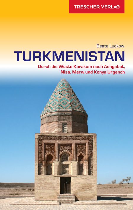
- Reisgids Turkmenistan | Trescher Verlag
- Goede Duitstalige reisgids met veel culturele beschrijvingen. Daarnaast ook aandacht voor praktische zaken als overnachten en rondreizen. Bijzondere duitse uitgever, vaak als eerste een boek over een bepaald gebied of land. Zeer uitgebreide reisgids van Turkmenistan. - Alle Regionen Turkmenistans auf 240 Seiten, ausführliche Reisetipps -... Read more
Maps

Netherlands
- Wegenkaart - landkaart Central Asia - Kazachstan, Uzbekistan, Kirgizië en Tajikistan | Gizi Map
- Central Asia Geographical 1 : 1 750 000 ab 11.95 EURO Kazakhstan (South), Kyrgyzstan, Tajikistan, Turkmenistan (East), Uzbekistan. With index. Relief with Gizi Map. new edition Read more


