GR3 - Vallée de la Loire
Description
- Name GR3 - Vallée de la Loire (GR3)
- Length of trail 1,243 km, 772 miles
- Length in days 62 days
- Start of trail Mont Gerbier-de-Jonc
- End of trail La Baule, Guérande
- Traildino grading EW, Easy walk, nature trail


3
 1243 km, Châteaux de la Loire
Did you know the GR3 is one of the first, if not the first, GR's that was marked all the way. Back in 1947 the trail got its direction posts and white-red blazes. The GR3 takes you along the River Loire, river known for its exuberant castles, beautiful forests and medieval cities like Nevers. River and trail end in the Atlantic Ocean, in the armpit of Bretagne.
Select some tracks
☐Les Coteaux du Layon, 57km
☐de Cosne-Cours-sur-Loire à la Charité-sur-Loire, 26km
☐De La Charité-sur-Loire à Nevers, 37km
☐La Loire sauvage à pied, 3.5km
☐GruBrìa Anello GR3 Desio, 15km
☐Eijsden-Margraten Gr3, 7.3km
☐De Lafarre à Apinac, 129km
☐De Néris-les-Bains à Chabanne, 141km
☐De Vendôme au Loire, Vendôme - Saint-Lubin, 49km
☐Du Gâtinais au Morvan, Lac des Settons - Signal de Mont, 101km
Map

Links
Facts
Reports
Guides and maps
Lodging
Organisations
Tour operators
GPS
Other
Books

Stanfords
United Kingdom
2007
United Kingdom
2007
- Le Centre: Val de Loire à pied FFRP Topo-guide No. RE11
- Le Centre: Val de Loire à pied, FFRP topo-guide ref. no. RE08, one of the titles in an extensive series of light, A5-size, high quality paperback guides published by the Fédération Française de la Randonnée Pédestre in association with local authorities, ramblers’ clubs, etc. The guides have *colour extracts from the French topographic survey... Read more

Stanfords
United Kingdom
United Kingdom
- GR3: Les Monts du Forez FFRP Topo-guide No. 334
- Les Monts du Forez, FFRP topoguide Ref. No. 334, covering in all 259kms along the GR3 and its variant, with additional descriptions of 21 day walks in the region. Current edition of this title was published in April 2016.ABOUT THE FFRP (Fédération française de la randonnée pédestre) TOPOGUIDES: published in a handy A5 paperback format, the... Read more

Stanfords
United Kingdom
2019
United Kingdom
2019
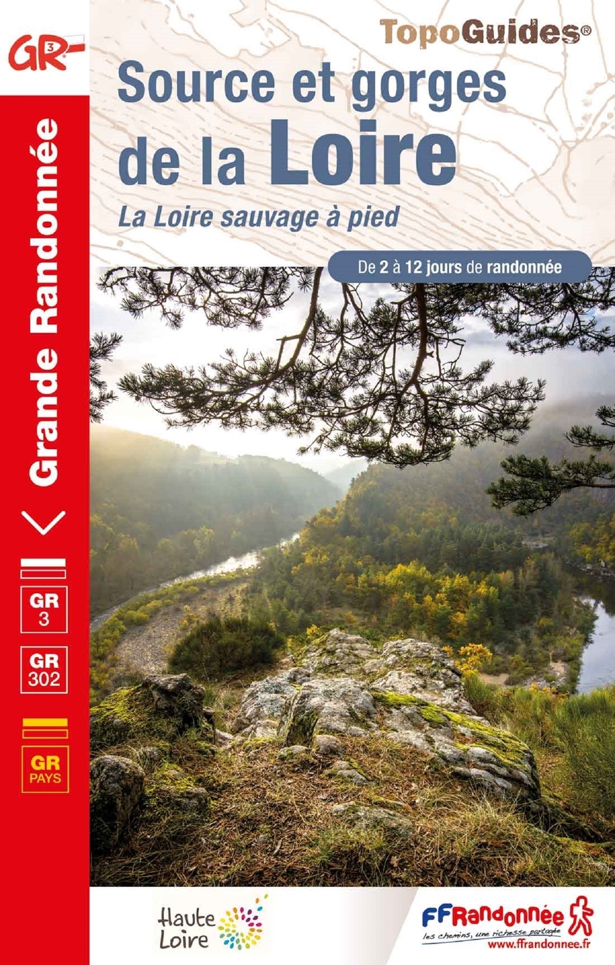
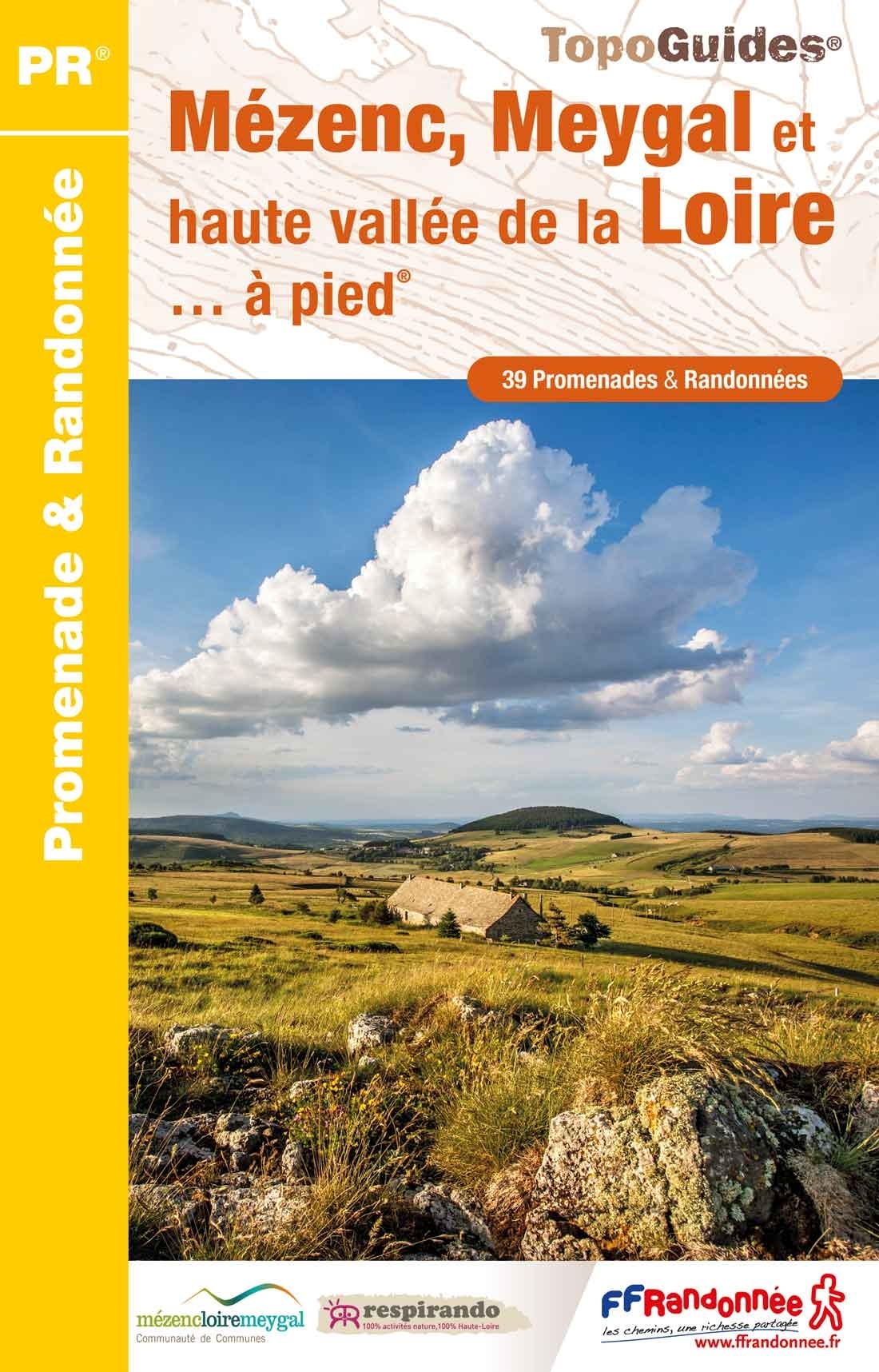
- Mézenc - meygal et haute vallee de le Loire
- Le Pays de la Loire Sauvage et du Mézenc à pied, FFRP topo-guide Ref. No.P435, with 26 day walks of varying length and difficulty in the region south-east of Le Puy-en-Velay. Each walk is presented on a separate colour extract from IGN’s topographic survey of France at 1:25,000, with its description cross-referenced to the map. Current edition... Read more

Stanfords
United Kingdom
2009
United Kingdom
2009
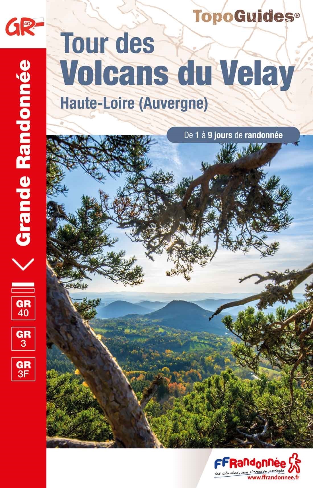
- GR40: Tour des Volcans du Velay FFRP Topo-guide No. 425
- GR40: Tour des Volcans du Velay, FFRP topo-guide ref. no. 425, one of the titles from an extensive series of light, high quality, A5 paperback guides to the Sentiers de Grande Randonnée, the GR routes, a dense network of long-distance footpaths across the French countryside. Each topo-guide covers either a circular route, or part of a longer... Read more

The Book Depository
United Kingdom
2021
United Kingdom
2021
- Also available from:
- De Zwerver, Netherlands
De Zwerver
Netherlands
2023
Netherlands
2023
More books…
Maps

Stanfords
United Kingdom
2021
United Kingdom
2021
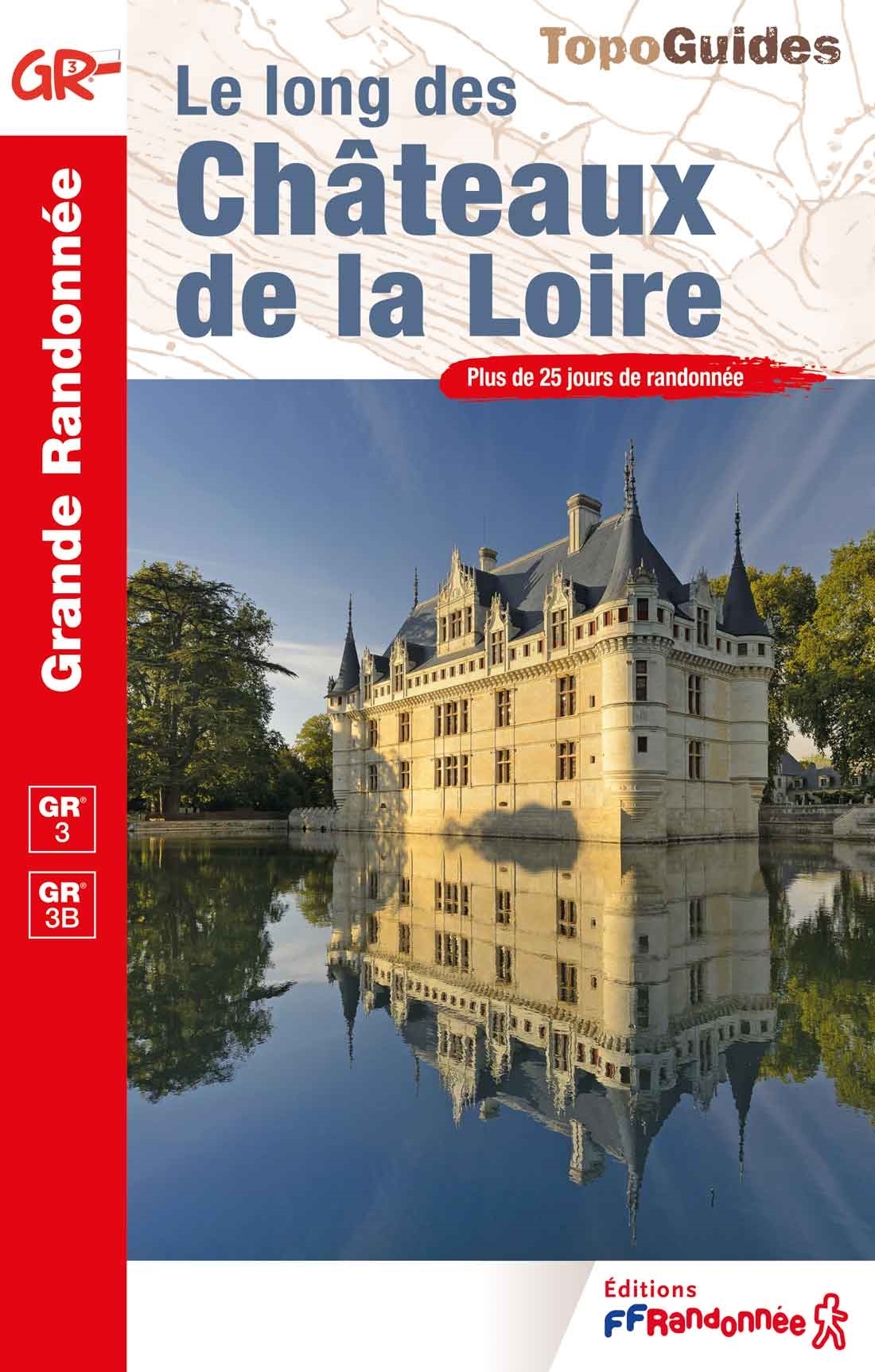
- Le long des Chateaux de la Loire GR3/GR3B
- Le long des Châteaux de la Loire, FFRP topoguide Ref. No. 333, covering 552km route along the Loire from Bonny-sur-Loire across Orléans, Blois and Tours to Angers. Current edition of this title was published in May 2018.The Loire is world famous for its castles and gardens, now classified as World Heritage by UNESCO. The site of the Loire... Read more
- Also available from:
- The Book Depository, United Kingdom

The Book Depository
United Kingdom
2021
United Kingdom
2021
- Le long des ch�teaux de la Loire GR3/GR3B
- Le long des Châteaux de la Loire, FFRP topoguide Ref. No. 333, covering 552km route along the Loire from Bonny-sur-Loire across Orléans, Blois and Tours to Angers. Current edition of this title was published in May 2018.The Loire is world famous for its castles and gardens, now classified as World Heritage by UNESCO. The site of the Loire... Read more

Stanfords
United Kingdom
United Kingdom
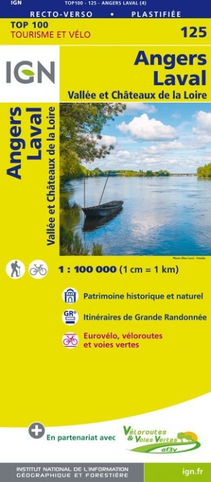
- Angers - Laval - Vallée et Châteaux de la Loire IGN TOP100 125
- Discover the new double-sided laminated edition of TOP100 road maps of France from the Institut Géographique National (IGN); exceptionally detailed, contoured road maps which include the cycle paths and greenways of the AF3V (French Association for the Development of Cycle Paths and Greenways), ideal for exploring the French countryside by car,... Read more
- Also available from:
- De Zwerver, Netherlands