
France
Description

France, country of contrasts, home to the inventors of the Topoguide, is a great walking destination all year round. An intricate network of long distance footpaths, the so-called Grands Randonnées, reaches out to the farthest corners of the country. At least 80 long distance trails and their countless variants are meticulously documented and waymarked. Mastering a bit of French will help you find your way, and a bottle of wine at that.
It may be difficult to find information or topo guides for many trails. The exact route - not only the name "GR" - of any hiking trail in France is copyrighted by the FFRP and cannot be published by others without their consent. The maps of IGN usually show all regional PR's and national GR's.
The French themselves are mad about walking, often in groups of about 20, recognisable by their non-stop rather loud conversations lasting from dawn till dusk and snacking on hard boiled eggs en route. So join the crowd and turn bon vivant. Walk the Provence in spring, pass through the wine regions coloured all red in late autumn. Enjoy the Atlantic coast and its birds in May, and the shimmering sun on the glaciers in summer. Explore the Loire in autumn, and the dark forests of the Morvan in winter. Or take a walk all the way from the Atlantic to the Mediterranean right across the Pyrenees along the GR10. Another popular trail is the GR5, from Luxembourg to Nice through the Vosges, the Elzas and the Alps. For those fearless and bursting with energy, the GR20 is a fine challenge. This trail following the highest ridges of the island of Corsica is for the surefooted only.
Another popular walk of course is the TMB, the Tour du Mont Blanc: eight days with views on the highest mountain of Europe, weather permitting. Drawback: crazy busy. Less known, but just as fine, is the Tour du Queyras (GR58), also in the Alps. Other best hikes in the Alps are the Tour de la Vanoise (GR55) or the Tour de l'Oisans (GR54). You can walk the Vallée des Merveilles (GR52). And a bit on the outside of the Alps is the Vercors (GR91 - GR95) and Mt Lubéron (GR97). There you are, now you know what the French themselves like most.
Along most GR's you will find huts or Gites d'Etappe at regular intervals. These are mostly just simple shelters, so bring food to prepare your own meals. Outside the main summer season, with most French back in Paris, the Gites are often closed. In such cases, bring your own tent. Most GR's can be tough but not dangerous, except the GR20.
Map


Trails
- Camino de BaztanGPX
- Chemin du Roi Dagobert
- E10GPX
- E12GPX
- E2GPX
- E3GPX
- E4GPX
- E5GPX
- E7GPX
- E9GPX
- GR1 - Tour de ParisGPX
- GR10 - Traversée des PyrénéesGPX
- GR101GPX
- GR107 - El Camí dels Bons HomesGPX
- GR11 - Grand Tour de ParisGPX
- GR111 - Sentier de l’EssonneGPX
- GR12 - Amsterdam - ParisGPX
- GR120 - Parc Régional BoulonnaisGPX
- GR121 - Wavre - BoulogneGPX
- GR122 - ScheldelandGPX
- GR123 - À travers la PicardieGPX
- GR124GPX
- GR125GPX
- GR126 (France)GPX
- GR127GPX
- GR128 - VlaanderenrouteGPX
- GR13 - Traversée du MorvanGPX
- GR130 - IJzerGPX
- GR131GPX
- GR137
- GR14 - Sentier de l'ArdenneGPX
- GR14a - Vallée de la MarneGPX
- GR16 - Sentier de la SemoisGPX
- GR2 - Vallée de la SeineGPX
- GR20 - La montagne CorseGPX
- GR21 - Côtes NormandesGPX
- GR211GPX
- GR212GPX
- GR22 - Sentier du Mont Saint-MichelGPX
- GR221GPX
- GR222GPX
- GR223GPX
- GR224GPX
- GR23GPX
- GR25
- GR26GPX
- GR3 - Vallée de la LoireGPX
- GR30 - Volcans et lacs d'AuvergneGPX
- GR300 - Voie du BourbonnaisGPX
- GR31GPX
- GR32GPX
- GR34 - Sentier des DoaniersGPX
- GR340 - Tour de Belle-Île-en-MerGPX
- GR341GPX
- GR347GPX
- GR34AGPX
- GR35GPX
- GR36 - Traversée du PérigordGPX
- GR360 - Tour de la SaintongeGPX
- GR364GPX
- GR37 - Sentier de l'ArgoatGPX
- GR38GPX
- GR380 - Monts d'ArréeGPX
- GR39GPX
- GR4GPX
- GR40 - Tour du VelayGPX
- GR400 - Volcans du CantalGPX
- GR41GPX
- GR412 - Gorges de l’AllierGPX
- GR42GPX
- GR420GPX
- GR427GPX
- GR43GPX
- GR430 - Chemin de Saint Régis
- GR44GPX
- GR440 - Grand tour du Limousin
- GR440B - Petit tour du Limousin
- GR441 - Chaîne des PuysGPX
- GR444
- GR46GPX
- GR461
- GR463GPX
- GR48GPX
- GR49GPX
- GR5GPX
- GR50 - Tour des ÉcrinsGPX
- GR51 - Balcons de la MéditerranéeGPX
- GR510 - Sentier des huit valléesGPX
- GR52 - Vallée des MerveillesGPX
- GR52A - Panoramique du MercantourGPX
- GR53 - Crête des VosgesGPX
- GR533GPX
- GR534GPX
- GR54 - Tour de l'Oisans et des ÉcrinsGPX
- GR541
- GR549
- GR55 - Tour de la VanoiseGPX
- GR559GPX
- GR56 - Tour de l'UbayeGPX
- GR570 - Pays des Trois FrontièresGPX
- GR58 - Tour du QueyrasGPX
- GR59 - Des Vosges au JuraGPX
- GR590
- GR595
- GR6GPX
- GR60 - Monts d'AubracGPX
- GR61GPX
- GR62GPX
- GR63GPX
- GR636
- GR64GPX
- GR646GPX
- GR646 - Traversée du PérigordGPX
- GR65 - Via PodiensisGPX
- GR651GPX
- GR652GPX
- GR653 - Via TolosanaGPX
- GR653A - Via AureliaGPX
- GR653D - Voie d’ArlesGPX
- GR654 - Via LemovicensisGPX
- GR655 - Via TuronensisGPX
- GR66 - Tour du Mont AigoualGPX
- GR67 - Tour du Pays CévenolGPX
- GR68 - Tour du Mont Lozère
- GR7GPX
- GR70 - Chemin de StevensonGPX
- GR700 - Chemin de RégordaneGPX
- GR703 - Sentier de Jeanne d'Arc
- GR71 - Traversée du Haute LanguedocGPX
- GR71CD - Tour du Larzac templier et hospitalier
- GR72GPX
- GR73
- GR74GPX
- GR76
- GR77GPX
- GR78 - Sentier de PiémontGPX
- GR8GPX
- GR83 - Camí del Nord o del CanigóGPX
- GR86GPX
- GR9GPX
- GR90GPX
- GR91 - Traversée du VercorsGPX
- GR92GPX
- GR93GPX
- GR94 - Tour des Hautes-AlpesGPX
- GR946
- GR95GPX
- GR96 - Traversée des BaugesGPX
- GR97 - Tour du LuberonGPX
- GR98 - Les CalanquesGPX
- GR99 - Gorges du VerdonGPX
- GR99AGPX
- GTJ - Grande Traversée du JuraGPX
- GTPA - Grande Traversée des PréalpesGPX
- GTV - Grande Traversée du VercorsGPX
- Haute Route Chamonix-ZermattGPX
- HeuvellandGPX
- HRP - Haute Randonnée PyrénéenneGPX
- Jakobsweg Breisach - Cluny
- Jakobsweg im Elsass
- Jakobsweg Waldshut-Vézelay
- Mare a Mare CentreGPX
- Mare a Mare NordGPX
- Mare a Mare SudGPX
- Mare e Monti SudGPX
- Rhine-Meuse Trail
- Route du Temps
- Santiago de Compostela Pilgrims WayGPX
- SeealpentourGPX
- Sentier CathareGPX
- Templar Trail
- TMB - Tour du Mont BlancGPX
- Tour des monts d'AubracGPX
- Tour du BeaufortainGPX
- Tour du LarzacGPX
- Tour du MorvanGPX
- Tour du Parc du Pilat
- Tra Mare e MontiGPX
- Via AlpinaGPX
- Via ArverniaGPX
- Via BrugensisGPX
- Via FrancigenaGPX
- Via Gallia BelgicaGPX
- Via GebennensisGPX
- Via Thiérache
- Voie Catalane - Roussillon
- Voie de Lourdes
- Voie des PlantagenêtsGPX
- Voie du PiémontGPX
- Voie LittoraleGPX
Regions
- Alps
- Alsace
- Ardèche
- Auvergne
- Écrins
- Bauges
- Bourgogne
- Bretagne
- Cévennes
- Côte d'Azur
- Chablais
- Champagne-Ardenne
- Charente-Maritime
- Chartreuse
- Corsica
- Dauphiné
- Dordogne
- Drôme
- Giffre
- Gorges du Tarn
- Haute Savoie
- Ile-de-France
- Jura
- Lac Léman
- Languedoc
- Les Landes
- Limousin
- Loire
- Luberon
- Massif Central
- Mercantour
- Mont Blanc
- Morvan
- Normandie
- Paris
- Pays Catalan
- Picardie
- Provence
- Pyrenees
- Queyras
- Seine
- Tarn
- Ubaye
- Vanoise
- Vendée
- Vercors
- Verdon
- Vosges


Links
Facts
Reports
Guides and maps
Lodging
Organisations
Tour operators
GPS
Other
Books

United Kingdom
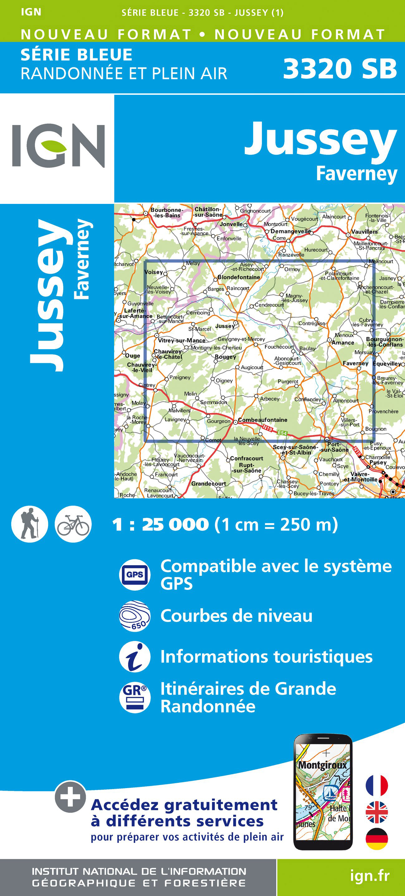
- Jussey - Faverney IGN 25K Série Bleue Map 3320SB
- Topographic survey of France at 1:25,000 in IGN`s excellent TOP25 / Série Bleue series. All the maps are GPS compatible, with a 1km UTM grid plus latitude and longitude lines at 5’ intervals. Contours are at 5m intervals except for mountainous areas where the maps have contours at 10m intervals, vividly enhanced by hill shading and graphics for... Read more
- Also available from:
- De Zwerver, Netherlands
Netherlands
- Wandelkaart - Topografische kaart 3320 SB - Serie Bleue Jussey - Faverney | IGN - Institut Géographique National
- L'indispensable carte de randonnée IGN aux alentours de Jussey - Faverney. A conserver dans son sac à dos. Read more

United Kingdom
- Ernée - Gorron IGN 1417SB
- Topographic survey of France at 1:25,000 in IGN`s excellent TOP25 / Série Bleue series. All the maps are GPS compatible, with a 1km UTM grid plus latitude and longitude lines at 5’ intervals. Contours are at 5m intervals except for mountainous areas where the maps have contours at 10m intervals, vividly enhanced by hill shading and graphics for... Read more

United Kingdom
- Bernay - Orbec IGN 1813SB
- Topographic survey of France at 1:25,000 in IGN`s excellent TOP25 / Série Bleue series. All the maps are GPS compatible, with a 1km UTM grid plus latitude and longitude lines at 5’ intervals. Contours are at 5m intervals except for mountainous areas where the maps have contours at 10m intervals, vividly enhanced by hill shading and graphics for... Read more

United Kingdom
- Salles-Curan - Lac de Pareloup - Cassagnes-Bégonhès IGN 25K Série Bleue Map 2440SB
- Topographic survey of France at 1:25,000 in IGN`s excellent TOP25 / Série Bleue series. All the maps are GPS compatible, with a 1km UTM grid plus latitude and longitude lines at 5’ intervals. Contours are at 5m intervals except for mountainous areas where the maps have contours at 10m intervals, vividly enhanced by hill shading and graphics for... Read more

United Kingdom
- Monthureux-sur-Saône - Voisey IGN 25K Série Bleue Map 3319SB
- Topographic survey of France at 1:25,000 in IGN`s excellent TOP25 / Série Bleue series. All the maps are GPS compatible, with a 1km UTM grid plus latitude and longitude lines at 5’ intervals. Contours are at 5m intervals except for mountainous areas where the maps have contours at 10m intervals, vividly enhanced by hill shading and graphics for... Read more

United Kingdom
- Dreux - Nonancour IGN 25K Série Bleue Map 2015SB
- Topographic survey of France at 1:25,000 in IGN`s excellent TOP25 / Série Bleue series. All the maps are GPS compatible, with a 1km UTM grid plus latitude and longitude lines at 5’ intervals. Contours are at 5m intervals except for mountainous areas where the maps have contours at 10m intervals, vividly enhanced by hill shading and graphics for... Read more

United Kingdom
- St-Martin-d`Auxigny - Foécy IGN 25K Série Bleue Map 2323SB
- Topographic survey of France at 1:25,000 in IGN`s excellent TOP25 / Série Bleue series. All the maps are GPS compatible, with a 1km UTM grid plus latitude and longitude lines at 5’ intervals. Contours are at 5m intervals except for mountainous areas where the maps have contours at 10m intervals, vividly enhanced by hill shading and graphics for... Read more

United Kingdom
2012
- Lot-et-Garonne à pied FFRP Topo-guide No. D047
- Lot-et-Garonne à pied, FFRP topo-guide Ref. No.D047, with 36 day walks of varying length and difficulty in the department of Lot-et-Garonne, near Agen and the confluence of the two rivers, the Lot and the Garonne. Each walk is presented on a separate colour extract from IGN’s topographic survey of France at 1:25,000, with its description... Read more

United Kingdom
- Le Pays de Charlieu-Belmont à pied P423
- Le Pays de Belmont-de-la-Loire à pied, FFRP topo-guide ref. no. P423, with 16 day walks of varying length and difficult near Belmont-de-la-Loire . Current edition of this title was published in May 2008.To see the list of other FFRP guides with day walks please click on the series link.ABOUT THE FFRP (Fédération française de la randonnée... Read more

United Kingdom
- Ploeuc-sur-Lié - Moncontour IGN 25K Série Bleue Map 0917SB
- Topographic survey of France at 1:25,000 in IGN`s excellent TOP25 / Série Bleue series. All the maps are GPS compatible, with a 1km UTM grid plus latitude and longitude lines at 5’ intervals. Contours are at 5m intervals except for mountainous areas where the maps have contours at 10m intervals, vividly enhanced by hill shading and graphics for... Read more

United Kingdom
- Nogent - Foulain IGN 25K Série Bleue Map 3119SB
- Topographic survey of France at 1:25,000 in IGN`s excellent TOP25 / Série Bleue series. All the maps are GPS compatible, with a 1km UTM grid plus latitude and longitude lines at 5’ intervals. Contours are at 5m intervals except for mountainous areas where the maps have contours at 10m intervals, vividly enhanced by hill shading and graphics for... Read more

United Kingdom
- Saint-Amand-Montrond - Lignieres IGN 25K Série Bleue Map 2326SB
- Topographic survey of France at 1:25,000 in IGN`s excellent TOP25 / Série Bleue series. All the maps are GPS compatible, with a 1km UTM grid plus latitude and longitude lines at 5’ intervals. Contours are at 5m intervals except for mountainous areas where the maps have contours at 10m intervals, vividly enhanced by hill shading and graphics for... Read more

United Kingdom
- Voiron - Tullins IGN 25K Série Bleue Map 3233SB
- Topographic survey of France at 1:25,000 in IGN`s excellent TOP25 / Série Bleue series. All the maps are GPS compatible, with a 1km UTM grid plus latitude and longitude lines at 5’ intervals. Contours are at 5m intervals except for mountainous areas where the maps have contours at 10m intervals, vividly enhanced by hill shading and graphics for... Read more

United Kingdom
- Bain-de-Bretagne - Rouge IGN 1220SB
- Topographic survey of France at 1:25,000 in IGN`s excellent TOP25 / Série Bleue series. All the maps are GPS compatible, with a 1km UTM grid plus latitude and longitude lines at 5’ intervals. Contours are at 5m intervals except for mountainous areas where the maps have contours at 10m intervals, vividly enhanced by hill shading and graphics for... Read more

United Kingdom
- Bourbon-l`Archambault - Buxieres-les-Mines IGN 2527SB
- L'indispensable carte de randonnée IGN aux alentours de Bourbon-l'Archambault / Buxières-les-Mines. A conserver dans son sac à dos Read more
Maps

United Kingdom
- St-Gaultier - Rosnay IGN 2026SB
- Topographic survey of France at 1:25,000 in IGN`s excellent TOP25 / Série Bleue series. All the maps are GPS compatible, with a 1km UTM grid plus latitude and longitude lines at 5’ intervals. Contours are at 5m intervals except for mountainous areas where the maps have contours at 10m intervals, vividly enhanced by hill shading and graphics for... Read more

United Kingdom
- Haute Siagne IGN 3543ET
- Topographic survey of France at 1:25,000 in IGN`s excellent TOP25 / Série Bleue series. All the maps are GPS compatible, with a 1km UTM grid plus latitude and longitude lines at 5’ intervals. Contours are at 5m intervals except for mountainous areas where the maps have contours at 10m intervals, vividly enhanced by hill shading and graphics for... Read more

United Kingdom
- Arcis-sur-Aube - Plancy-l`Abbaye IGN 2816SB
- Topographic survey of France at 1:25,000 in IGN`s excellent TOP25 / Série Bleue series. All the maps are GPS compatible, with a 1km UTM grid plus latitude and longitude lines at 5’ intervals. Contours are at 5m intervals except for mountainous areas where the maps have contours at 10m intervals, vividly enhanced by hill shading and graphics for... Read more

United Kingdom
- France IGN Geological Map 904
- France: Geological Curiosities Map from the IGN combines a road map highlighting numerous sites of special geological interest with, on the reverse, a geological map from the BRGM, the country’s geological survey organization.On one side a road map of the country is overprinted with symbols highlighting places of special geological interest:... Read more

United Kingdom
- Vezelise - Colombey-les-Belles IGN 3316SB
- Topographic survey of France at 1:25,000 in IGN`s excellent TOP25 / Série Bleue series. All the maps are GPS compatible, with a 1km UTM grid plus latitude and longitude lines at 5’ intervals. Contours are at 5m intervals except for mountainous areas where the maps have contours at 10m intervals, vividly enhanced by hill shading and graphics for... Read more
United Kingdom
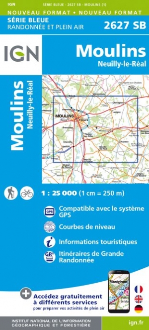
- Moulins - Neuilly-le-Real IGN 2627SB
- Topographic survey of France at 1:25,000 in IGN`s excellent TOP25 / Série Bleue series. All the maps are GPS compatible, with a 1km UTM grid plus latitude and longitude lines at 5’ intervals. Contours are at 5m intervals except for mountainous areas where the maps have contours at 10m intervals, vividly enhanced by hill shading and graphics for... Read more

United Kingdom
- Chaumont - Biesles IGN 3118SB
- Topographic survey of France at 1:25,000 in IGN`s excellent TOP25 / Série Bleue series. All the maps are GPS compatible, with a 1km UTM grid plus latitude and longitude lines at 5’ intervals. Contours are at 5m intervals except for mountainous areas where the maps have contours at 10m intervals, vividly enhanced by hill shading and graphics for... Read more

United Kingdom
- Fôrets d`Orléans: Massif d`Ingrannes IGN TOP25 Map 2319OT
- Topographic survey of France at 1:25,000 in IGN`s excellent TOP25 / Série Bleue series. All the maps are GPS compatible, with a 1km UTM grid plus latitude and longitude lines at 5’ intervals. Contours are at 5m intervals except for mountainous areas where the maps have contours at 10m intervals, vividly enhanced by hill shading and graphics for... Read more

United Kingdom
- Le Poire-sur-Vie - Aizenay - la Mothe-Achard IGN 1226SB
- Topographic survey of France at 1:25,000 in IGN`s excellent TOP25 / Série Bleue series. All the maps are GPS compatible, with a 1km UTM grid plus latitude and longitude lines at 5’ intervals. Contours are at 5m intervals except for mountainous areas where the maps have contours at 10m intervals, vividly enhanced by hill shading and graphics for... Read more

United Kingdom
- Bayonne - Biarritz - Anglet Blay-Foldex Street Plan
- This title is part of an extensive series of street plans of French towns from Blay-Foldex, the country’s largest, oldest and most experienced publisher of urban mapping.Blay plans include outer suburbs and, where appropriate, adjoining localities forming part of the urban agglomeration and provide brief descriptions of the town’s main sights,... Read more

United Kingdom
- Forêt de Fontainebleau - Forêt des Trois Pignons IGN 2417OT
- Topographic survey of France at 1:25,000 in IGN`s excellent TOP25 / Série Bleue series. All the maps are GPS compatible, with a 1km UTM grid plus latitude and longitude lines at 5’ intervals. Contours are at 5m intervals except for mountainous areas where the maps have contours at 10m intervals, vividly enhanced by hill shading and graphics for... Read more

United Kingdom
- Ile d`Oleron - Ile d`Aix IGN 1330OT
- Topographic survey of France at 1:25,000 in IGN`s excellent TOP25 / Série Bleue series. All the maps are GPS compatible, with a 1km UTM grid plus latitude and longitude lines at 5’ intervals. Contours are at 5m intervals except for mountainous areas where the maps have contours at 10m intervals, vividly enhanced by hill shading and graphics for... Read more

United Kingdom
- Mesley-du-Maine - Vaiges IGN 25K Série Bleue Map 1519SB
- Topographic survey of France at 1:25,000 in IGN`s excellent TOP25 / Série Bleue series. All the maps are GPS compatible, with a 1km UTM grid plus latitude and longitude lines at 5’ intervals. Contours are at 5m intervals except for mountainous areas where the maps have contours at 10m intervals, vividly enhanced by hill shading and graphics for... Read more

United Kingdom
- Neuville-de-Poitou - Vouille - Mirebeau IGN 1726SB
- Topographic survey of France at 1:25,000 in IGN`s excellent TOP25 / Série Bleue series. All the maps are GPS compatible, with a 1km UTM grid plus latitude and longitude lines at 5’ intervals. Contours are at 5m intervals except for mountainous areas where the maps have contours at 10m intervals, vividly enhanced by hill shading and graphics for... Read more
