Friese Kustpad
Description
- Name Friese Kustpad (LAW5-4)
- Length of trail 131 km, 81 miles
- Length in days 7 days
- Start of trail Stavoren
- End of trail Lauwersoog
- Traildino grading LW, Light walk, countryside walk
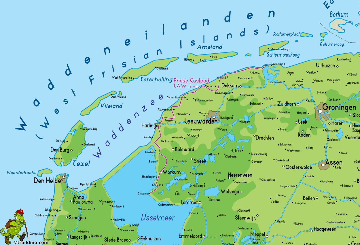
Friese Kustpad, LAW 5-4: Stavoren - Lauwersoog, 131 km
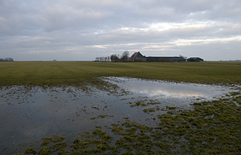
The Frisians cultivate an image of stubborn, independent minded people. They have their own breed of horses, strong, big and black. They have their own language, largely incomprehensible to the rest of the Dutch population. And they have a long coastline. The southern part of the Frisian coast was cut of from the Northsea by the construction of the Afsluitdijk in 1932. This trail bring you to a series of small towns along the coast wich used to prosper because of their relation to the sea. These days prosperity is linked more to tourism. The northern part of the coast is still connected to the open water of the Wadden sea, a unique landscape wich recently was added to the World Heritage list. So there is a lot of seascape to admire. The landscape on the other side of the dikes retains much of its traditional character. Even if farmers have started to use wind turbines as an additional source of income, and some keep their cattle inside on a permanent basis, on summer days the famous Frisian cows can still be seen grazing the green, green meadows. (DB)
Map
Links
Facts
Reports
Guides and maps
Lodging
Organisations
Tour operators
GPS
Other
Books

United Kingdom
- Purbeck & South Dorset - Poole, Dorchester - Weymouth & Swanage OS Explorer Active Map OL15 (waterproof)
- Purbeck and the southern part of Dorset on a detailed topographic and GPS compatible map OL15, waterproof version, from the Ordnance Survey’s 1:25,000 Explorer series. Coverage extends from Poole and Swanage in the east to Bridport in the west, and includes Dorchester, Tolpuddle, Bere Regis, Wareham, Weymouth, Chesil Beach, Portland Bill, the... Read more
- Also available from:
- The Book Depository, United Kingdom

United Kingdom
- Purbeck & South Dorset - Poole, Dorchester - Weymouth & Swanage OS Explorer Map OL15 (paper)
- Purbeck and the southern part of Dorset on a detailed topographic and GPS compatible map OL15, paper version, from the Ordnance Survey’s 1:25,000 Explorer series. Coverage extends from Poole and Swanage in the east to Bridport in the west, and includes Dorchester, Tolpuddle, Bere Regis, Wareham, Weymouth, Chesil Beach, Portland Bill, the final... Read more
- Also available from:
- The Book Depository, United Kingdom
- Bol.com, Netherlands
- Bol.com, Belgium
- De Zwerver, Netherlands

Netherlands
- Purbeck & South Dorset, Poole, Dorchester, Weymouth & Swanage
- OS Explorer is the Ordnance Survey's most detailed map and is recommended for anyone enjoying outdoor activities like walking, horse riding and off-road cycling. The OS Explorer range of OL maps now includes a digital version of the paper map, accessed through the OS smartphone app, OS Maps. Providing complete GB coverage the series details... Read more

Belgium
- Purbeck & South Dorset, Poole, Dorchester, Weymouth & Swanage
- OS Explorer is the Ordnance Survey's most detailed map and is recommended for anyone enjoying outdoor activities like walking, horse riding and off-road cycling. The OS Explorer range of OL maps now includes a digital version of the paper map, accessed through the OS smartphone app, OS Maps. Providing complete GB coverage the series details... Read more


