
Lake District
Description
The Lake District in northwestern England is one of the most popular hiking and holiday destinations of England. The contrast between the wild, sometimes rugged mountains, and the friendly valleys is striking. The lakes offer excellent holiday entertainment. Speaking about the Lake District, one should not forget to mention the romantic poet William Wordsworth. You may find copies of his writings in the villages.
Several long distance hikes traverse the region. The Coast to Coast Path chooses some of the best scenery. But there is much more to enjoy. The extended network of well marked trails is awaiting you.
Trails in this region
Links
Facts
Reports
Guides and maps
Lodging
Organisations
Tour operators
GPS
Other
Books

Stanfords
United Kingdom
United Kingdom
- A Cyclist`s Guide to the Pyrenees
- Where do you turn when you want to ride in the mountains, to follow in the wheeltracks of professional racers by climbing the famous passes of the Tour de France? There are several books and websites that highlight these renowned ascents, detailing their location, length and every little change in gradient. But how do you go about finding a... Read more

Stanfords
United Kingdom
United Kingdom
- Müritz National Park - Waren - Plauer See - Neusterlitz K+F Outdoor Map 16
- Müritz Lake - Neusterlitz area of eastern Germany’s lake district at 1:50,000 from Kümmerly+Frey in a series GPS compatible, double-sided maps printed on durable, waterproof and tear-resistant plastic paper; contoured, with hiking and cycle routes, other recreational activities, etc. An inset extends coverage to the Wolin Island in Poland.Maps... Read more

Stanfords
United Kingdom
United Kingdom
- Walks around Windermere & Kendal - Newby Bridge - Staveley & Grange-over-Sands
- Walks around Windermere, Kendal, Newby Bridge, Staveley and Grange-over-Sands in the Lake District in a series of maps from Footprint covering popular hiking areas of Britain. 16 mainly circular routes, from 1½ to 7 miles long, are presented on panels at 1:12,500 (5” to 1 mile) for shorter walks and 1:25,000 (2½” to 1 mile) for the longer ones.... Read more

Stanfords
United Kingdom
United Kingdom
- Walks Around Coniston
- Walks around Coniston, Hawkshead, Grizedale and Far Sawrey in the Lake District in a series of maps from Footprint covering popular hiking areas of Britain. 16 circular routes, from 1½ to 9 miles long, are presented on panels at 1:12,500 (5” to 1 mile) for shorter walks and 1:25,000 (2½” to 1 mile) for the longer ones. Also provided is a small... Read more

Stanfords
United Kingdom
United Kingdom
- Short Walks in the Lake District
- The Lake District contains some of the most spectacular landscapes in Britain with superb walking areas. These can be explored with these 20 walks, all are 5 miles or under in length and can easily be completed in less that 3 hours. This guide, produced in co-operation with the Ramblers and featuring Ordnance Survey mapping, is the perfect way... Read more

Stanfords
United Kingdom
United Kingdom
- English Lakes North Western - Keswick, Cockermouth & Wigton OS Explorer Active Map OL4 (waterproof)
- The north-western area of the Lake District on a detailed topographic and GPS compatible map OL4, waterproof version, from the Ordnance Survey’s 1:25,000 Explorer series. Coverage includes Keswick, Cockermouth, Buttermere, Ennerdale Bridge, Wigton, Bassenthwaite Lake, Derwent Water, Crummock Water, the Solway Coast between Maryport and... Read more

The Book Depository
United Kingdom
2021
United Kingdom
2021
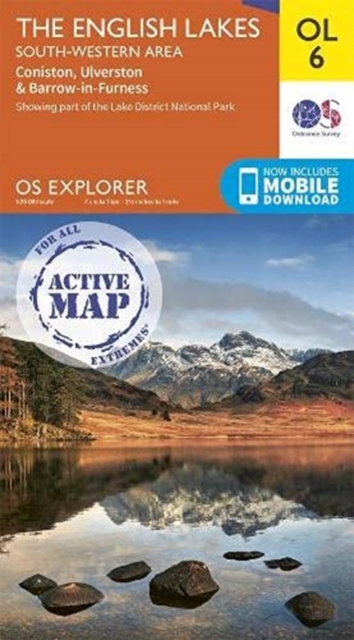
- The English Lakes South-Western Area
- Coniston, Ulverston & Barrow-in-Furness Read more
- Also available from:
- De Zwerver, Netherlands
De Zwerver
Netherlands
2021
Netherlands
2021
- Wandelkaart OL06 OS Explorer Map | Active The English Lakes South-Western Area | Ordnance Survey
- Coniston, Ulverston & Barrow-in-Furness Read more

The Book Depository
United Kingdom
United Kingdom
- O Joy for me!
- Samuel Taylor Coleridge and the Origins of Fell-Walking in the Lake District 1790-1802 Read more

- Also available from:
- De Zwerver, Netherlands

The Book Depository
United Kingdom
United Kingdom
- Lakeland Fells
- Lakeland Fells: Keswick & the North (25 walks) is the Hillside mini guide to walking shorter, concisely described routes of between 3 and 10 miles, through all corners of the Lake District including Keswick, Bassenthwaite Lake, Borrowdale, Caldbeck, Newlands, Thirlmere and Derwentwater.Hillside Great Britain Mini Walking Guides series is a... Read more

The Book Depository
United Kingdom
2011
United Kingdom
2011
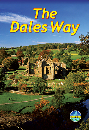
- The Dales Way
- This guidebook has all that a walker needs: concise, up-to-date directions for the main Way and Bradford Link background on geology, railway heritage, farming and wildlife side-trips to heritage centres and a feature on Bolton Priory contact details for accommodation and transport dropdown route map (1:110,000) over 70 glorious colour photos... Read more
- Also available from:
- De Zwerver, Netherlands
De Zwerver
Netherlands
2011
Netherlands
2011
- Wandelgids The Dales Way | Rucksack Readers
- This guidebook has all that a walker needs: concise, up-to-date directions for the main Way and Bradford Link background on geology, railway heritage, farming and wildlife side-trips to heritage centres and a feature on Bolton Priory contact details for accommodation and transport dropdown route map (1:110,000) over 70 glorious colour photos... Read more


Stanfords
United Kingdom
2020
United Kingdom
2020
- Coast to Coast Path (Trailblazer British Walking Guide): 109 Large-Scale Walking Maps & Guides to 33 Towns & Villages - Planning, Places to Stay, Places to Eat - St Bees to Robin Hood`s Bay
- All-in-one, practical guide to walking the Coast to Coast Path across northern England inspired by Alfred Wainwright, the most popular of the 18 long-distance UK paths. Fully revised 9th edition of this classic 191-mile walk from the Irish Sea to the North Sea. Crossing three national parks - the Lake District, the Yorkshire Dales, and the... Read more
- Also available from:
- The Book Depository, United Kingdom

The Book Depository
United Kingdom
2020
United Kingdom
2020
- Coast to Coast Path
- 109 Large-Scale Walking Maps & Guides to 33 Towns & Villages - Planning, Places to Stay, Places to Eat - St Bees to Robin Hood's Bay Read more

The Book Depository
United Kingdom
United Kingdom
- Walking the Lake District Fells - Buttermere
- High Stile, Grasmoor, Grisedale Pike and Haystacks Read more

The Book Depository
United Kingdom
United Kingdom
- Go Wild in the Lake District
- Outdoor Adventures for Family Fun Read more
Maps
Stanfords
United Kingdom
United Kingdom
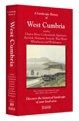
- West Cumbria 1864-1925 (3-map set)
- Map No. 89, West Cumbria 1864-1925 (3-map set), in the Cassini Historical Series of old Ordnance Survey mapping of England and Wales at 1:50,000 in a format designed to offer a convenient comparison with the present day coverage from the OS, and most locations in three different editions. Old historical maps have been combined so that the sheet... Read more

Stanfords
United Kingdom
United Kingdom
- Lakes Beldany and Mikolajskie
- Lakes Beldany and Mikolajskie in the Masurian Lake District at 1:20,000 on a waterproof and tear-resistant sailing map from the Warsaw-based Centrum Kartografii. On water, in addition to depths the map also indicates stone reef, shores lined with stones or vegetation, buoys and where appropriate the direction of sailing, prohibition of outdoor... Read more

Stanfords
United Kingdom
United Kingdom
- Scotland Michelin Regional 501
- Scotland at 1:400,000 on an indexed touring map from Michelin - paper version - particularly good for indentifying scenic routes. The whole country is shown on one side of the map, with coverage extending south to include Newcastle and most of the Lake District. Enlargement show the Glasgow area (1:200,000) and main roads across Edinburgh... Read more

Stanfords
United Kingdom
United Kingdom
- Lake Ros
- Lake Ros in the Masurian Lake District at 1:20,000 on a waterproof and tear-resistant sailing map from the Warsaw-based Centrum Kartografii. On water, in addition to depths the map also indicates stone reef, shores lined with stones or vegetation, buoys and where appropriate the direction of sailing, prohibition of outdoor motors, mooring... Read more

Stanfords
United Kingdom
United Kingdom
- Carlisle and Solway Firth 1868-1869
- Map No. 85, Carlisle and Solway Firth 1868-1869, in the Cassini Historical Series of old Ordnance Survey mapping of England and Wales at 1:50,000 in a format designed to offer a convenient comparison with the present day coverage from the OS, and most locations in three different editions. Old historical maps have been combined so that the... Read more

Stanfords
United Kingdom
United Kingdom
- Lake District - Wainwright Fells & Tick List GuideUs Wall Map SMALL
- The Wainwright Fells with a Tick List Wall Map from GuideUs, in a smaller size A2 poster version (42x59.5cm / 16.5”x23.5” approx), showing the Wainwright Fells divided into seven areas according to the classic series of guides by Alfred Wainwright: Eastern, Far Eastern, Central, Southern, Northern, North Western and Western Fells. Each area is... Read more
Stanfords
United Kingdom
United Kingdom
- Barrow-in-Furness and South Lakeland 1924-1925
- Map No. 96, Barrow-in-Furness and South Lakeland 1924-1925, in the Cassini Historical Series of old Ordnance Survey mapping of England and Wales at 1:50,000 in a format designed to offer a convenient comparison with the present day coverage from the OS, and most locations in three different editions. Old historical maps have been combined so... Read more

Stanfords
United Kingdom
United Kingdom
- Mecklenburg-Vorpommern Marco Polo Regional Map 2
- German state of Mecklenburg - Lower Pomerania on an indexed road map at 1:200,000 in the MairDumont’s Marco Polo series, prominently highlighting interesting locations and protected areas. A 79-page index booklet includes city centre street plans plus enlargements at 1:100,000 showing in greater detail the environs and road access to Rostock,... Read more
Stanfords
United Kingdom
United Kingdom
- Penrith and Keswick 1864-1925 (3-map set)
- Map No. 90, Penrith and Keswick 1864-1925 (3-map set), in the Cassini Historical Series of old Ordnance Survey mapping of England and Wales at 1:50,000 in a format designed to offer a convenient comparison with the present day coverage from the OS, and most locations in three different editions. Old historical maps have been combined so that... Read more

Stanfords
United Kingdom
United Kingdom
- Olsztyn Lake District: Western Part
- Olsztyn Lake District: Western Part (Pojezierze Olsztynskie) at 1:50,000 in a series of recreational maps from Poland’s Army Cartographic Service. The maps use as their base the military topographic survey, with contours at intervals varying from 5m to 20m according to the terrain and contoured depths shown on lakes. An overprint highlights... Read more
Stanfords
United Kingdom
United Kingdom
- Lakes Niegocin, Boczne and Wojnowo
- Lakes Niegocin, Boczne and Wojnowo in the Masurian Lake District at 1:25,000 on a waterproof and tear-resistant sailing map from the Warsaw-based Centrum Kartografii. On water, in addition to depths the map also indicates stone reef, shores lined with stones or vegetation, buoys and where appropriate the direction of sailing, prohibition of... Read more
Stanfords
United Kingdom
United Kingdom
- West Cumbria 1864-1869
- Map No. 89, West Cumbria 1864-1869, in the Cassini Historical Series of old Ordnance Survey mapping of England and Wales at 1:50,000 in a format designed to offer a convenient comparison with the present day coverage from the OS, and most locations in three different editions. Old historical maps have been combined so that the sheet lines... Read more
Stanfords
United Kingdom
United Kingdom
- Kendal and Morecambe 1924-1925
- Map No. 97, Kendal and Morecambe 1924-1925, in the Cassini Historical Series of old Ordnance Survey mapping of England and Wales at 1:50,000 in a format designed to offer a convenient comparison with the present day coverage from the OS, and most locations in three different editions. Old historical maps have been combined so that the sheet... Read more

Stanfords
United Kingdom
United Kingdom
- Salzburg Lake District - Kobernausserwald
- Kobernasserwald area of the Salzburg Lake District , including Salzburg itself, on a detailed, GPS compatible map at 1:50,000 from Kompass with local and long-distance footpaths, cycling routes, accommodation, etc, printed on durable, waterproof and tear-resistant synthetic paper.KOMPASS HIKING & RECREATIONAL MAPS: this title is part of an... Read more
Stanfords
United Kingdom
United Kingdom
- Barrow-in-Furness and South Lakeland 1852-1925 (3-map set)
- Map No. 96, Barrow-in-Furness and South Lakeland 1852-1925 (3-map set), in the Cassini Historical Series of old Ordnance Survey mapping of England and Wales at 1:50,000 in a format designed to offer a convenient comparison with the present day coverage from the OS, and most locations in three different editions. Old historical maps have been... Read more