
London
Description
Capital of the United Kingdom. All sorts of walks. The Thames Path runs right through the city center and you can hop on the London Eye after being fooled at the ticket counter and view forward and backward on your trail.
Trails in this region
Links
Facts
Reports
Guides and maps
Lodging
Organisations
Tour operators
GPS
Other
Books

Stanfords
United Kingdom
United Kingdom
- Eat, Gay, Love: `You`ve never read a travel memoir like this before` (SUNDAY TIMES `Pride Culture Guide`)
- `You`ve never read a travel memoir like this before` The Sunday Times, `Pride Culture Guide`Sweet and fun, with real emotional depth and a rousing, feisty spirit`Matt Cain***In the spring of 2012, Calum finds himself single again after his relationship of six years comes to an end. Heartbroken, unhappy and unsure of what to do next, he leaves... Read more

Stanfords
United Kingdom
United Kingdom
- Thames Valley - 20 Country Walks For All The Family
- An exciting new gift series of walking guides, aimed at the weekend, family walker. These small-format, portable hardback books have an attractive retro feel, with nostalgic line drawings and hand-drawn maps. Each of the 20 walks have been carefully selected to appeal to family walkers, most are circular and none are too strenuous. Each walk... Read more

Stanfords
United Kingdom
United Kingdom
- Railway Walks: LNER
- In ”Railway Walks: LNER”, Jeff Vinter, consultant to the BBC`s ”Railway Walks” series, provides an indispensable guide to ten carefully selected railway paths converted from lines once owned by the London and North Eastern Railway. From the quiet byways of East Anglia to the dramatic scenery of the North Yorkshire coast and the moorlands of... Read more

Stanfords
United Kingdom
United Kingdom
- The Big Walks of London
- The Big Walks of London by John Merrill is a guidebook to the capitals major walking routes. London has an incredible variety of walks and trails, and this guidebook presents more than twenty long walks through the city, ranging from 7 to 150 miles, and includes the Thames Path, the London Loop and the Capital Ring. Each walk section is... Read more

Stanfords
United Kingdom
United Kingdom
- Ten Best of Everything 2nd ed
- ”The 10 Best of Everything: An Ultimate Guide for Travelers, Second Edition”, offers a wealth of information for the high-end traveler or anyone who aspires to be. The top-ten lists in 60 categories showcase the experience and savvy of such luminaries as Prince Charles on architecture, Arnold Palmer on favorite golf courses, Luciano Pavarotti... Read more

Stanfords
United Kingdom
United Kingdom
- The Beatles in London Walk
- “The Beatles in London Walk” is the most literal way you can take a Magical Mystery Tour about arguably the greatest band of all time; John, Paul, George and Ringo lived in the centre of London in the sixties, at the height of Beatlemania.This guide will let you capture some of the excitement of the Beatles’ time in London, with places such as... Read more
Stanfords
United Kingdom
United Kingdom
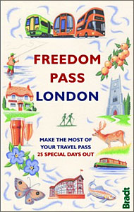
- Freedom Pass London
- Since its creation over 40 years ago, London`s Freedom Pass concessionary travel scheme has continued to grow in popularity and there are now over 1 million registered holders. Whether a fruit picker or forager, a rambler or angler, or simply someone who enjoys the quirky charm of a local pub, Bradt`s new Freedom Pass is the perfect read to... Read more

Stanfords
United Kingdom
United Kingdom
- London Bensons MapGuides Street Map
- London Street Map - with the most detailed mapping, highly recommended for exploring London on foot - from Bensons MapGuides in their range of street plans of central London. On one side is the publishers’ standard mapping, presented here at 1:9,700 approx, plus a bus map and an index of places of interest with grading. Coverage extends,... Read more

Stanfords
United Kingdom
United Kingdom
- Peaceful London
- London is one of the world`s most exciting cities, but it`s also one of the noisiest; a bustling, chaotic, frenetic, over-crowded, manic metropolis of over 8 million people, where it can be difficult to find somewhere to grab a little peace and quiet. Nevertheless, if you know where to look London has a wealth of peaceful places – places to... Read more

Stanfords
United Kingdom
United Kingdom
- London National Park City - Greenwich Map
- Printed on the same press as Ordnance Survey maps, it is a large-format (952mm x 1270mm), folded map – custom drawn to highlight all the places to explore and printed with a special Pantone ink.It shows Greenwich and the surrounding areas in detail as part of the London National Park City. The massive map includes all the parks, woodlands,... Read more

Stanfords
United Kingdom
United Kingdom
- London A-Z Visitor`s Atlas & Guide
- A-Z Visitors’ Atlas and Guide of London in a pocket size, spiral-bound format, with a 55-page tourist guide section which grades the described sights and includes interesting locations outside the coverage by the atlas. The guide also recommends sightseeing walks and provides much other useful tourist information. The atlas has the publishers’... Read more

Stanfords
United Kingdom
United Kingdom
- Walker`s Britain in a Box: Third Expanded Edition
- WALKS FOR EVERYONEMost are easy half-day circular routes, but a few are more challenging. Some are two-day walks on folding four-page cards, ideal for a short walking break.TRANSPARENT SLEEVE PROVIDEDIf it rains, read the card through the transparent plastic sleeve.CHARMING PLACES TO STAYWalks near charming places to stay, some offering onward... Read more

Stanfords
United Kingdom
United Kingdom
- Rick Steves Pocket London (Fourth Edition)
- Make the most of every day and every dollar with Rick Steves! This colorful, compact guidebook is perfect for spending a week or less in London: City walks and tours: Six detailed tours and walks showcase London`s essential sights, including the National Gallery, the Tower of London, and Westminster Abbey, plus handy neighborhood breakdowns... Read more
Stanfords
United Kingdom
United Kingdom
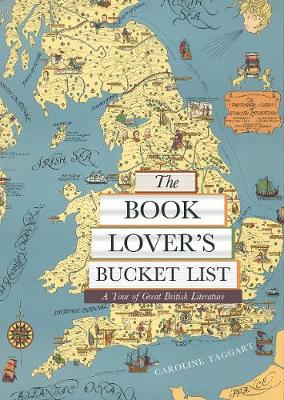
- The Book Lover`s Bucket List: A Tour of Great British Literature
- Exploring the gardens, monuments, museums, and churches with walks both urban and rural, from the Bronte parsonage in Haworth to Zadie Smith`s North London and Shakespeare`s Stratford, `The Book Lover`s Bucket List` takes you through some 100 wonderfully described literary sites and landscapes, complete with colour destination photographs and... Read more

Stanfords
United Kingdom
United Kingdom
- London`s Houses
- From the remains of the Roman amphitheatre to the soaring glass structures of the 21st century city, London offers a unique architectural experience. This revised and expanded, authoritative guide takes the reader through almost 2.000 years of architectural achievement in the capital. Each chapter contains readily accessible examples of... Read more
Maps
Stanfords
United Kingdom
United Kingdom
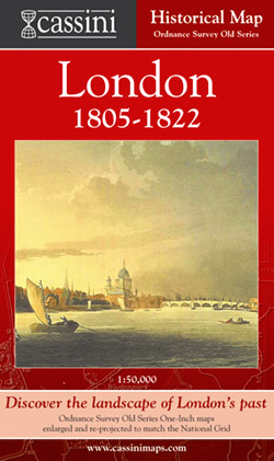
- London 1805-1822
- London in 1805-1822 in the Cassini Historical Series reproducing old Ordnance Survey mapping of England and Wales at 1:50,000. The four London maps cover roughly the area of the present day Greater London rather than following the format of rest of the series which is designed to correspond to the current Landranger maps. Mapping is identical... Read more

Stanfords
United Kingdom
United Kingdom
- London West 1805-1920 (3-map set)
- Map No. 176, London West 1805-1920 (3-map set), in the Cassini Historical Series of old Ordnance Survey mapping of England and Wales at 1:50,000 in a format designed to offer a convenient comparison with the present day coverage from the OS, and most locations in three different editions. Old historical maps have been combined so that the sheet... Read more

Stanfords
United Kingdom
United Kingdom
- Luxembourg North
- One of two topographic survey maps of Luxembourg at 1:50,000, with contours at 10-metres intervals and additional relief shading. An overprint highlights long-distance footpaths, including the GR5 (E-2), cycle routes, and various places of interest, including campsites. The map covers an area of approximately 53 x 43 km / 33 x 27 miles. Map... Read more
Stanfords
United Kingdom
United Kingdom
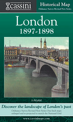
- London 1897-1898
- London in 1897-1898 in the Cassini Historical Series reproducing old Ordnance Survey mapping of England and Wales at 1:50,000. The four London maps cover roughly the area of the present day Greater London rather than following the format of rest of the series which is designed to correspond to the current Landranger maps. Mapping is identical... Read more
Stanfords
United Kingdom
United Kingdom
- London East 1805-1922 (3-map set)
- Map No. 177, London East 1805-1922 (3-map set), in the Cassini Historical Series of old Ordnance Survey mapping of England and Wales at 1:50,000 in a format designed to offer a convenient comparison with the present day coverage from the OS, and most locations in three different editions. Old historical maps have been combined so that the sheet... Read more

Stanfords
United Kingdom
United Kingdom
- Luxembourg South
- One of two topographic survey maps of Luxembourg at 1:50,000, with contours at 10-metres intervals and additional relief shading. An overprint highlights long-distance footpaths, including the GR5 (E-2), cycle routes, and various places of interest, including campsites. The map covers an area of approximately 53 x 43 km / 33 x 27 miles. Map... Read more

Stanfords
United Kingdom
United Kingdom
- Ontario MapArt Pocket Road Atlas
- Pocket road atlas of Ontario presenting the southern part of the province at 1:700,000 with the northern part at 1:1,500,000, plus enlargements showing in greater detail 25 municipal areas and downtown street plans for 21 locations, a map showing Highway Service Centres, etc..The atlas presents the southern part of the province at 1:700,000,... Read more
Stanfords
United Kingdom
United Kingdom
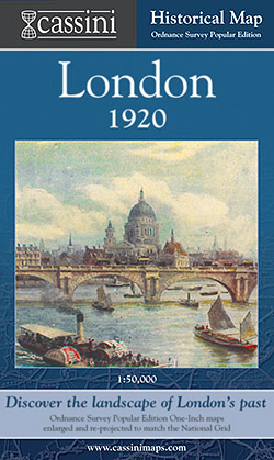
- London 1920
- London in 1920 in the Cassini Historical Series reproducing old Ordnance Survey mapping of England and Wales at 1:50,000. The four London maps cover roughly the area of the present day Greater London rather than following the format of rest of the series which is designed to correspond to the current Landranger maps. Mapping is identical to the... Read more

Stanfords
United Kingdom
United Kingdom
- Sonoma Valley Biking and Hiking Trails
- Sonoma Valley on a contoured hiking and biking map from Map Adventures showing local conservations areas, detailed classification of recreational trails, wineries, etc. On one side a map at 1:30,000 covers the northern part of the valley along the Sonoma Highway from Glen Ellen to Santa Rosa, including the Taylor Mountain Regional Park, Annadel... Read more

Stanfords
United Kingdom
United Kingdom
- England Coast Path Adventure Map - Minehead to Brean Down
- The A-Z Adventure Series of maps combines the best of OS and A-Z, creating the perfect companion for walkers, off-road cyclists, horse riders and anyone wishing to explore the great outdoors.This official Minehead to Brean Down Adventure Map covers a 58 mile (93km) section of the England Coast Path, a new National Trail around England`s coast.... Read more

Stanfords
United Kingdom
United Kingdom
- East London and Gonubie
- Street plan of East London at 1:20,000 from the South African travel publishers Map Studio, with an inset providing coverage of the nearby Gonubie. Coverage extends inland to include the city’s airport. The plan shows names of districts, indicates main traffic arteries, and highlights various facilities and important buildings. No street index... Read more
Stanfords
United Kingdom
United Kingdom
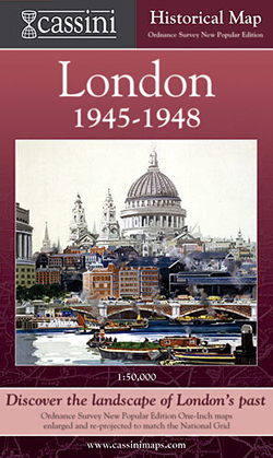
- London 1945-1948
- London in 1945-1948 in the Cassini Historical Series reproducing old Ordnance Survey mapping of England and Wales at 1:50,000. The four London maps cover roughly the area of the present day Greater London rather than following the format of rest of the series which is designed to correspond to the current Landranger maps. Mapping is identical... Read more

Stanfords
United Kingdom
United Kingdom
- Cycle Tours Chilterns, Hertfordshire & Essex
- This spiral-bound guide describes 20 wonderful bike rides in the countryside to the north and west of London. The area offers some excellent and varied cycling: from the challenges of the steep wooded escarpment of the Chilterns in the west to the gentle gradients on networks of quiet lanes in Hertfordshire and north Essex. The book contains 15... Read more
Stanfords
United Kingdom
United Kingdom
- London West 1805-1822
- Map No. 176, London West 1805-1822, in the Cassini Historical Series of old Ordnance Survey mapping of England and Wales at 1:50,000 in a format designed to offer a convenient comparison with the present day coverage from the OS, and most locations in three different editions. Old historical maps have been combined so that the sheet lines... Read more
Stanfords
United Kingdom
United Kingdom
- London West 1897-1909
- Map No. 176, London West 1897-1909, in the Cassini Historical Series of old Ordnance Survey mapping of England and Wales at 1:50,000 in a format designed to offer a convenient comparison with the present day coverage from the OS, and most locations in three different editions. Old historical maps have been combined so that the sheet lines... Read more