
England
Description
Map


Trails in this state
- A Dales Highway
- Allerdale RambleGPX
- Beacon WayGPX
- Borders Abbeys WayGPX
- Calderdale WayGPX
- Cheshire Ring Canal WalkGPX
- Cleveland WayGPX
- Coast to Coast WalkGPX
- Coleridge WayGPX
- Copper Trail
- Cotswold WayGPX
- Cumbria WayGPX
- Dales WayGPX
- Dartmoor WayGPX
- Downs LinkGPX
- E2GPX
- E8GPX
- Essex WayGPX
- Fen Rivers WayGPX
- Geopark WayGPX
- Greensand Ridge WalkGPX
- Greensand WayGPX
- Guernsey Coastal Path
- Hadrian's WallGPX
- Heart of England WayGPX
- Hereward WayGPX
- High Weald Landscape TrailGPX
- Icknield WayGPX
- Isle of Jersey Coastal Path
- Isle of Man Coastal PathGPX
- Isle of Wight Coastal PathGPX
- Lady Anne's WayGPX
- Lands End to John o'GroatsGPX
- Lea Valley WalkGPX
- Leland TrailGPX
- Liberty TrailGPX
- Limestone LinkGPX
- Limestone WayGPX
- Mendip WayGPX
- Minster WayGPX
- Monarch's WayGPX
- Nene WayGPX
- North Buckinghamshire WayGPX
- North Downs WayGPX
- North Sea TrailGPX
- Northumberland Coast PathGPX
- Offa's Dyke PathGPX
- Oxford Canal WalkGPX
- Oxfordshire WayGPX
- Peddars Way and Norfolk Coast PathGPX
- Pendle WayGPX
- Pennine BridlewayGPX
- Pennine WayGPX
- Quantock GreenwayGPX
- Reivers Way
- Ribble WayGPX
- RidgewayGPX
- Robin Hood WayGPX
- Saint Cuthbert's WayGPX
- Saint Oswald's Way
- Saints WayGPX
- Saxon Shore WayGPX
- Severn WayGPX
- Shakespeare's WayGPX
- Shropshire WayGPX
- Solent WayGPX
- South Downs WayGPX
- South West Coast PathGPX
- Staffordshire WayGPX
- Stour Valley PathGPX
- Suffolk Coast and Heaths Path
- Tamar Valley Discovery TrailGPX
- Tarka TrailGPX
- Teesdale WayGPX
- Thames PathGPX
- Trans Pennine TrailGPX
- Two Moors WayGPX
- Via FrancigenaGPX
- Viking WayGPX
- Wayfarer's WalkGPX
- WealdwayGPX
- Weavers WayGPX
- Windermere WayGPX
- Worcestershire WayGPX
- Wychavon WayGPX
- Yorkshire Wolds WayGPX
Links
Facts
Reports
Guides and maps
Lodging
Organisations
Tour operators
GPS
Other
Books

Stanfords
United Kingdom
United Kingdom
- River Thames & Thames Path Heron Map
- This tourist map of the River Thames and Thames Path covers from its source, just outside Kemble in Gloucestershire, to the Thames Barrier at 1:55,000, with detailed town plans of Lechlade, Oxford, Abingdon, Wallingford, Henley-on-Thames, central Reading, Windsor and Eton, Marlow and Kingston upon Thames at 1:12,500. The Thames and Severn Canal... Read more

Stanfords
United Kingdom
United Kingdom
- New Forest - Southampton, Ringwood, Ferndown, Lymington, Christchurch & Bournemouth OS Explorer Active Map OL22 (waterproof)
- The New Forest on a detailed topographic and GPS compatible map OL22, waterproof version, from the Ordnance Survey’s 1:25,000 Explorer series. Coverage along the coast extends from Southampton with Southampton Water to Bournemouth, and includes Eastleigh, Totton, Lymington with the ferry link to the Isle of Wight, Christchurch, Ringwood, the... Read more

Stanfords
United Kingdom
2019
United Kingdom
2019
- Two Moors Way Cicerone Map Booklet
- All the mapping you need to complete the Two Moors Way, Devon`s coast to coast route between Wembury Bay and Lynmouth, including a section of the Erme-Plym Trail. NOTE: An accompanying Cicerone guidebook - The Two Moors Way - describes the route south to north, with summary directions for walking north to south. It includes lots of other... Read more

Stanfords
United Kingdom
United Kingdom
- Cheltenham, Cirencester & Stow-on-the-Wold OS Landranger Active Map 163 (waterproof)
- Cheltenham and Cirencester area, including sections of the Thames Path, the Cotswold Way and the E2 European Long-distance Path, on a waterproof and tear-resistant OS Active version of map No. 163 from the Ordnance Survey’s Landranger series at 1:50,000, with contoured and GPS compatible topographic mapping plus tourist information.MOBILE... Read more

Stanfords
United Kingdom
United Kingdom
- Bury St Edmunds, Sudbury & Stowmarket OS Landranger Active Map 155 (waterproof)
- Suffolk around Bury St Edmunds, Sudbury and Stowmarket, including part of the E2 European Long-distance path, on a waterproof and tear-resistant OS Active version of map No. 155 from the Ordnance Survey’s Landranger series at 1:50,000, with contoured and GPS compatible topographic mapping plus tourist information.MOBILE DOWNLOADS: As well as... Read more

Stanfords
United Kingdom
2020
United Kingdom
2020
- Hadrian`s Wall Path
- Trailblazer British Walking Guide, two-way edition with routes re-walked from Bowness-on-Solway to Wallsend (Newcastle) and Wallsend (Newcastle) to Bowness-on-Solway. All-in-one guide to walking Hadrian`s Wall Path National Trail. Hadrian`s Wall Path, 84 miles from end to end, follows the course of northern Europe`s largest surviving Roman... Read more

Stanfords
United Kingdom
United Kingdom
- Ely, Wisbech & Downham Market OS Landranger Active Map 143 (waterproof)
- Cambridgeshire around Ely, Wisbech and Downham Market, including part of the E2 European Long-distance Path, on a waterproof and tear-resistant OS Active version of map No. 143 from the Ordnance Survey’s Landranger series at 1:50,000, with contoured and GPS compatible topographic mapping plus tourist information.MOBILE DOWNLOADS: As well as the... Read more

Stanfords
United Kingdom
United Kingdom
- Oxford, Chipping Norton & Bicester OS Landranger Active Map 164 (waterproof)
- Oxford area, including sections of the Thames Path and the E2 European Long-distance Path, on a waterproof and tear-resistant OS Active version of map No. 164 from the Ordnance Survey’s Landranger series at 1:50,000, with contoured and GPS compatible topographic mapping plus tourist information.MOBILE DOWNLOADS: As well as the physical edition... Read more

Stanfords
United Kingdom
United Kingdom
- Barnstaple, Ilfracombe, Lynton & Bideford OS Landranger Active Map 180 (waterproof)
- Barnstaple and Ilfracombe area, including the western part of the Exmoor National Park and a section of the South West Coast Path, on a waterproof and tear-resistant OS Active version of map No. 180 from the Ordnance Survey’s Landranger series at 1:50,000, with contoured and GPS compatible topographic mapping plus tourist information.MOBILE... Read more

Stanfords
United Kingdom
United Kingdom
- Newquay, Bodmin, Camelford & St Austell OS Landranger Active Map 200 (waterproof)
- Newquay and Bodmin area, including a section of the South West Coast Path National Trail, on a waterproof and tear-resistant OS Active version of map No. 200 from the Ordnance Survey’s Landranger series at 1:50,000, with contoured and GPS compatible topographic mapping plus tourist information.MOBILE DOWNLOADS: As well as the physical edition... Read more

Stanfords
United Kingdom
United Kingdom
- North York Moors Western OS Explorer Active Map OL26 (waterproof)
- The western part of the North York Moors National Park on a detailed topographic and GPS compatible map OL26, waterproof version, from the Ordnance Survey’s 1:25,000 Explorer series. Coverage extends from Ampleforth in the south northwards to Saltburn-by-the-Sea, and from Ingleby Arncliffe to Danby, Castleton and Hutton-le-Hole, and includes... Read more

Stanfords
United Kingdom
United Kingdom
- Bournemouth, Purbeck, Wimborne Minster & Ringwood OS Landranger Active Map 195 (waterproof)
- Bournemouth and the Isle of Purbeck area, including part of the New Forest National Park and a section of the South West Coast Path / E9 European Long-distance Path, on a waterproof and tear-resistant OS Active version of map No. 195 from the Ordnance Survey’s Landranger series at 1:50,000, with contoured and GPS compatible topographic mapping... Read more

Stanfords
United Kingdom
United Kingdom
- Wye Valley & Forest of Dean OS Explorer Active Map OL14 (waterproof)
- The Wye Valley and the Forest of Dean on a detailed topographic and GPS compatible map OL14, waterproof version, from the Ordnance Survey’s 1:25,000 Explorer series. Coverage extends from Chepstow in the south to beyond Ross-on-Wye and includes Monmouth, the Wye Valley Area of Outstanding Natural Beauty, sections of the Offa’s Dyke National... Read more

Stanfords
United Kingdom
United Kingdom
- Ipswich, The Naze & Clacton-on-Sea OS Landranger Active Map 169 (waterproof)
- Ipswich with Harwich and The Naze area, including part of the E2 European Long-distance Path, on a waterproof and tear-resistant OS Active version of map No. 169 from the Ordnance Survey’s Landranger series at 1:50,000, with contoured and GPS compatible topographic mapping plus tourist information.MOBILE DOWNLOADS: As well as the physical... Read more

Stanfords
United Kingdom
United Kingdom
- Maidstone, Royal Tunbridge Wells, Sevenoaks & Tonbridge OS Landranger Active Map 188 (waterproof)
- Maidstone, Tunbridge Wells and the High Weald area, including a section of the North Downs Way / E2 European Long-distance Path, on a waterproof and tear-resistant OS Active version of map No. 188 from the Ordnance Survey’s Landranger series at 1:50,000, with contoured and GPS compatible topographic mapping plus tourist information.MOBILE... Read more
Maps

Stanfords
United Kingdom
United Kingdom
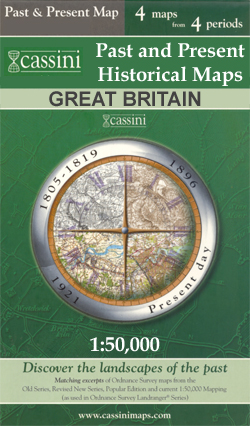
- Bradford Past and Present
- Bradford in the Cassini Past and Present map series which covers town and cities of England and Wales and offers a unique way of tracing their history and expansion by showing four different periods of their development using Ordnance Survey mapping from the mid-19th century, the late 19th century, the 1920s and the present day. Coverage... Read more

Stanfords
United Kingdom
United Kingdom
- Shrewsbury and Oswestry / Amwythig a Chroesoswallt 1902
- Map No. 126, Shrewsbury and Oswestry / Amwythig a Chroesoswallt 1902, in the Cassini Historical Series of old Ordnance Survey mapping of England and Wales at 1:50,000 in a format designed to offer a convenient comparison with the present day coverage from the OS, and most locations in three different editions. Old historical maps have been... Read more
Stanfords
United Kingdom
United Kingdom
- Southampton and Totton Past and Present
- Southampton and Totton in the Cassini Past and Present map series which covers town and cities of England and Wales and offers a unique way of tracing their history and expansion by showing four different periods of their development using Ordnance Survey mapping from the mid-19th century, the late 19th century, the 1920s and the present day.... Read more

Stanfords
United Kingdom
United Kingdom
- Lago di Bolsena - Acquapendente - Orvieto - Pitigliano - Sorano Kompass 2471
- Lago di Bolsena – Orvieto area at 1:50,000 from Kompass on a map printed on durable, waterproof and tear-resistant synthetic paper. Coverage includes Acquapendente, Ficulle, Santa Flora, Valentano, Montefiascone, Selva del Lamone, etc. Contours are at 40m intervals, with a 2-km UTM grid. Extensive overprint includes cycling and selected... Read more
Stanfords
United Kingdom
United Kingdom
- St Helens and Wigan Past and Present
- St Helens and Wigan in the Cassini Past and Present map series which covers town and cities of England and Wales and offers a unique way of tracing their history and expansion by showing four different periods of their development using Ordnance Survey mapping from the mid-19th century, the late 19th century, the 1920s and the present day.... Read more
Stanfords
United Kingdom
United Kingdom
- Worcester and The Malverns 1899-1901
- Map No. 150, Worcester and The Malverns 1899-1901, in the Cassini Historical Series of old Ordnance Survey mapping of England and Wales at 1:50,000 in a format designed to offer a convenient comparison with the present day coverage from the OS, and most locations in three different editions. Old historical maps have been combined so that the... Read more
Stanfords
United Kingdom
United Kingdom
- Plymouth and Launceston 1899-1900
- Map No. 201, Plymouth and Launceston 1899-1900, in the Cassini Historical Series of old Ordnance Survey mapping of England and Wales at 1:50,000 in a format designed to offer a convenient comparison with the present day coverage from the OS, and most locations in three different editions. Old historical maps have been combined so that the sheet... Read more

Stanfords
United Kingdom
United Kingdom
- Nuneaton, Hinckley and Bedworth Past and Present
- Nuneaton, Hinckley and Bedworth in the Cassini Past and Present map series which covers town and cities of England and Wales and offers a unique way of tracing their history and expansion by showing four different periods of their development using Ordnance Survey mapping from the mid-19th century, the late 19th century, the 1920s and the... Read more
Stanfords
United Kingdom
United Kingdom
- Leeds and Bradford 1903-1904
- Map No. 104, Leeds and Bradford 1903-1904, in the Cassini Historical Series of old Ordnance Survey mapping of England and Wales at 1:50,000 in a format designed to offer a convenient comparison with the present day coverage from the OS, and most locations in three different editions. Old historical maps have been combined so that the sheet... Read more
Stanfords
United Kingdom
United Kingdom
- Bude & Clovelly 1900 - 190
- Map No. 190, Bude and Clovelly 1900, in the Cassini Historical Series of old Ordnance Survey mapping of England and Wales at 1:50,000 in a format designed to offer a convenient comparison with the present day coverage from the OS, and most locations in three different editions. Old historical maps have been combined so that the sheet lines... Read more

Stanfords
United Kingdom
United Kingdom
- Cannock & Rugeley Past and Present
- Cannock and Rugeley in the Cassini Past and Present map series which covers town and cities of England and Wales and offers a unique way of tracing their history and expansion by showing four different periods of their development using Ordnance Survey mapping from the mid-19th century, the late 19th century, the 1920s and the present day.... Read more
Stanfords
United Kingdom
United Kingdom
- Scunthorpe and Gainsborough 1903
- Map No. 112, Scunthorpe and Gainsborough 1903, in the Cassini Historical Series of old Ordnance Survey mapping of England and Wales at 1:50,000 in a format designed to offer a convenient comparison with the present day coverage from the OS, and most locations in three different editions. Old historical maps have been combined so that the sheet... Read more

Stanfords
United Kingdom
United Kingdom
- Kidderminster and Stourport-on-Severn Past and Present
- Kiddermister and Stourport-on-Severn in the Cassini Past and Present map series which covers town and cities of England and Wales and offers a unique way of tracing their history and expansion by showing four different periods of their development using Ordnance Survey mapping from the mid-19th century, the late 19th century, the 1920s and the... Read more
Stanfords
United Kingdom
United Kingdom
- Kettering & Corby 1901-1902
- Map No. 141, Kettering and Corby 1901-1902, in the Cassini Historical Series of old Ordnance Survey mapping of England and Wales at 1:50,000 in a format designed to offer a convenient comparison with the present day coverage from the OS, and most locations in three different editions. Old historical maps have been combined so that the sheet... Read more

Stanfords
United Kingdom
United Kingdom
- Ely, Haddenham and Littleport Past and Present
- Ely, Haddenham and Littleport in the Cassini Past and Present map series which covers town and cities of England and Wales and offers a unique way of tracing their history and expansion by showing four different periods of their development using Ordnance Survey mapping from the mid-19th century, the late 19th century, the 1920s and the present... Read more