
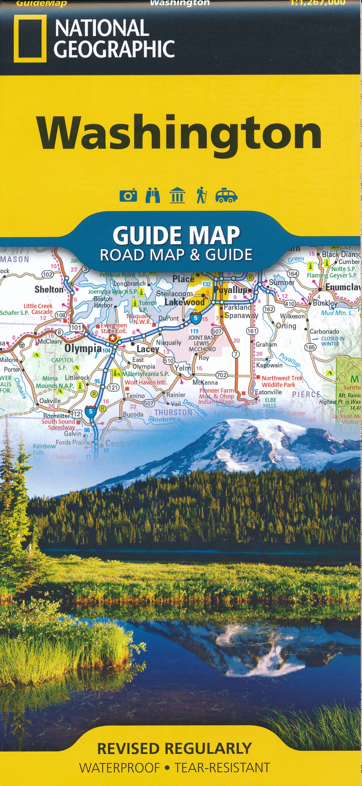
Washington
Description
Washington, bordering on Canada and the Pacific Ocean, is very scenic. The Cascades run from north to south, and are covered by the long and strenuous Pacific Crest Trail.
This wilderness counts a string of national forests and parks, with many thousands of miles of trails. Best are Wenatchee National Forest, Mount Baker-Snoqualmie National Forest. Okanogan National Forest, Gifford Pinchot National Forest, Mount Rainier National Park with its 93 mile circular Wonderland Trail, North Cascades National Park and Colville National Forest.
A different and very scenic part of Washington is the Olympic Peninsula, with its National Park and National Forest.
Finally, we should mention the American Discovery Trail and Pacific Northwest Trail.
Map

Trails in this state
Links
Facts
Reports
Guides and maps
Lodging
Organisations
Tour operators
GPS
Other
Books

Stanfords
United Kingdom
United Kingdom
- DK Eyewitness Washington DC
- Discover Washington, DC - a compact city that makes an impact.Whether you want to stroll beneath the cherry blossoms, visit the iconic domed Capitol, or tour the magnificent White House, your DK Eyewitness travel guide makes sure you experience all that Washington, DC has to offer.Washington, DC delights at every turn. Wherever you go, there is... Read more

Stanfords
United Kingdom
United Kingdom
- DK Eyewitness Travel Guide Washington DC
- Whether you want to stroll beneath the cherry blossoms, visit the iconic domed Capitol, or tour the magnificent White House, your DK Eyewitness travel guide makes sure you experience all that Washington, DC has to offer.Washington, DC delights at every turn. Wherever you go, there is a marvel of architecture to be discovered, a scenic view to... Read more

Stanfords
United Kingdom
United Kingdom
- Lily and the Octopus
- `Intelligently written, finely observed and surprisingly moving, this is a book you`ll find hard to put down` GRAEME SIMSION, author of The Rosie Project Companions come in all shapes and sizes. Companionship lasts forever. Ted and Lily - Enjoy long walks. Watch films together. Have been known to share a pizza. Love each other fiercely.... Read more

Stanfords
United Kingdom
2020
United Kingdom
2020
- DK Eyewitness Pacific Northwest: Oregon, Washington and British Columbia
- Follow the call of the wild to the pristine Pacific NorthwestWhether you want to hike through the spellbinding landscape of the Rockies, unwind with homebrewed beer in Portland or venture to Vancouver for immersive galleries and innovative dining, your DK Eyewitness travel guide makes sure you experience all that the Pacific Northwest has to... Read more

Stanfords
United Kingdom
United Kingdom
- Going into Town: A Love Letter to New York
- ”10 Best Graphic Novels of the Year” The Washington Post”The Year`s Most Giftable Coffee-Table Books” New York magazine”Best Fall Books” Newsday”10 Best Comics of the Year” The Verge”Best Graphic Novels of the Year” OklahomanWinner of the New York City Book AwardFrom the #1 NYT bestselling author of `Can`t We Talk About Something More... Read more

The Book Depository
United Kingdom
United Kingdom
- Best Rail Trails Pacific Northwest
- More Than 60 Rail Trails in Washington, Oregon, and Idaho Read more

The Book Depository
United Kingdom
United Kingdom
- Trail Angels
- Tales of Generosity and Kindness On the Pacific Crest Trail Read more

The Book Depository
United Kingdom
United Kingdom
- Pacific Crest Trail: Southern California
- From the Mexican Border to Tuolumne Meadows Read more

The Book Depository
United Kingdom
2020
United Kingdom
2020
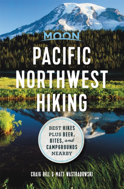
- Moon Pacific Northwest Hiking (First Edition)
- Best Hikes plus Beer, Bites, and Campgrounds Nearby Read more
- Also available from:
- De Zwerver, Netherlands
De Zwerver
Netherlands
2020
Netherlands
2020
- Wandelgids Pacific Northwest Hiking | Moon Travel Guides
- Best Hikes plus Beer, Bites, and Campgrounds Nearby Read more


The Book Depository
United Kingdom
United Kingdom
- Day Hike Washington: Olympic Peninsula, 5th Edition
- More than 70 Trails You Can Hike in a Day Read more


- Also available from:
- De Zwerver, Netherlands
De Zwerver
Netherlands
2020
Netherlands
2020
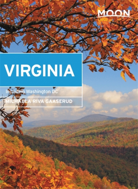
- Reisgids Virginia including Washington DC | Moon Travel Guides
- With Washington DC Read more

The Book Depository
United Kingdom
United Kingdom
- Pacific Crest Trail: Northern California
- From Tuolumne Meadows to the Oregon Border Read more

The Book Depository
United Kingdom
United Kingdom
- Day Hikes in Washington State
- 90 Favorite Trails, Loops, and Summit Scrambles Read more
Maps

Stanfords
United Kingdom
United Kingdom
- Newcastle upon Tyne 1862-1867
- Map No. 88, Newcastle upon Tyne 1862-1867, in the Cassini Historical Series of old Ordnance Survey mapping of England and Wales at 1:50,000 in a format designed to offer a convenient comparison with the present day coverage from the OS, and most locations in three different editions. Old historical maps have been combined so that the sheet... Read more
Stanfords
United Kingdom
United Kingdom
- Newcastle upon Tyne 1925
- Map No. 88, Newcastle upon Tyne 1925, in the Cassini Historical Series of old Ordnance Survey mapping of England and Wales at 1:50,000 in a format designed to offer a convenient comparison with the present day coverage from the OS, and most locations in three different editions. Old historical maps have been combined so that the sheet lines... Read more
Stanfords
United Kingdom
United Kingdom
- Newcastle upon Tyne 1901-1904
- Map No. 88, Newcastle upon Tyne 1901-1904, in the Cassini Historical Series of old Ordnance Survey mapping of England and Wales at 1:50,000 in a format designed to offer a convenient comparison with the present day coverage from the OS, and most locations in three different editions. Old historical maps have been combined so that the sheet... Read more
Stanfords
United Kingdom
United Kingdom
- Newcastle upon Tyne 1862-1925 (3-map set)
- Map No. 88, Newcastle upon Tyne 1862-1925 (3-map set), in the Cassini Historical Series of old Ordnance Survey mapping of England and Wales at 1:50,000 in a format designed to offer a convenient comparison with the present day coverage from the OS, and most locations in three different editions. Old historical maps have been combined so that... Read more

Stanfords
United Kingdom
United Kingdom
- Vancouver to Calgary MapArt Back Road Atlas
- The main Trans-Canada Highway from Vancouver to Calgary, including the adjoining Okanagan and Crowsnest Highways and the Seattle area of north-west Washington State, presented at 1:250,000 in an A4 paperback road atlas with additional street plans, listing of local events and wineries, etc.Mapping at 1:250,000 covers the areas indicated on our... Read more

Stanfords
United Kingdom
United Kingdom
- Washington DC Borch
- Clear, indexed, laminated and waterproof street plan of Washington DC, combining a plan of the central part of the city with an enlargement for the Mall area, a map of the capital’s environs, and a list of 30 top sights. The main plan at 1:15,000 covers the city from the Arlington Cemetery to the RFK Stadium, and from Columbia Heights district... Read more

Stanfords
United Kingdom
United Kingdom
- Mount Rainier National Park WA
- Mount Rainier National Park in Washington State at 1:50,000 a series of detailed, contoured maps from Earthwalk Press with cartography based on the USGS topographic survey of the country plus additional information for visitors, printed on light, waterproof and tear-resistant synthetic paper. Enlargements show in greater detail enlarged... Read more

Stanfords
United Kingdom
United Kingdom
- Many Glacier - Glacier and Waterton Lakes National Parks MT
- Map No. 313, Glacier National Park: North Fork, MT, in an extensive series of GPS compatible, contoured hiking maps of USA’s national and state parks or forests and other popular recreational areas. Cartography based on the national topographic survey, with additional tourist information.The maps, with most titles now printed on light,... Read more
- Also available from:
- Bol.com, Netherlands
- Bol.com, Belgium
- De Zwerver, Netherlands

Bol.com
Netherlands
Netherlands
- Many Glacier, Glacier National Park
- Waterproof Tear-Resistant Topographic MapLocated just north of Kalispell in Montana's northwest corner, Glacier National contains an abundance of recreational opportunities for outdoor enthusiasts of all interests.This detailed topographic recreation map contains carefully researched trails, campsites, forest service roads, and... Read more
Bol.com
Belgium
Belgium
- Many Glacier, Glacier National Park
- Waterproof Tear-Resistant Topographic MapLocated just north of Kalispell in Montana's northwest corner, Glacier National contains an abundance of recreational opportunities for outdoor enthusiasts of all interests.This detailed topographic recreation map contains carefully researched trails, campsites, forest service roads, and... Read more

De Zwerver
Netherlands
Netherlands
- Wandelkaart - Topografische kaart 314 Many Glacier - Glacier and Waterton Lakes National Parks | National Geographic
- Prachtige geplastificeerde kaart van het bekende nationaal park. Met alle recreatieve voorzieningen als campsites, maar ook met topografische details en wandelroutes ed. Door uitgekiend kleurgebruik zeer prettig in gebruik. Scheur en watervast! Located just north of Kalispell in Montana's northwest corner, Glacier National contains an... Read more

Stanfords
United Kingdom
United Kingdom
- Glacier - Waterton Lakes National Park MT
- Map No. 215, Glacier/Waterton Lakes National Park, MT, in an extensive series of GPS compatible, contoured hiking maps of USA’s national and state parks or forests and other popular recreational areas. Cartography based on the national topographic survey, with additional tourist information.The maps, with most titles now printed on light,... Read more
- Also available from:
- Bol.com, Netherlands
- Bol.com, Belgium
- De Zwerver, Netherlands

Bol.com
Netherlands
Netherlands
- Glacier/waterton Lakes National Parks
- Waterproof Tear-Resistant Topographic MapNational Geographic's Trails Illustrated map of Glacier and Waterton Lakes National Parks offers unparalleled detail for outdoor enthusiasts exploring the pristine landscape of forests, mountains, lakes, and meadows within these two spectacular parks. Created in partnership with local land... Read more
Bol.com
Belgium
Belgium
- Glacier/waterton Lakes National Parks
- Waterproof Tear-Resistant Topographic MapNational Geographic's Trails Illustrated map of Glacier and Waterton Lakes National Parks offers unparalleled detail for outdoor enthusiasts exploring the pristine landscape of forests, mountains, lakes, and meadows within these two spectacular parks. Created in partnership with local land... Read more

De Zwerver
Netherlands
Netherlands
- Wandelkaart - Topografische kaart 215 Glacier - Waterton Lakes National Park | National Geographic
- Prachtige geplastificeerde kaart van het bekende nationaal park. Met alle recreatieve voorzieningen als campsites, maar ook met topografische details en wandelroutes ed. Door uitgekiend kleurgebruik zeer prettig in gebruik. Scheur en watervast! Waterton Lakes National Park, Canada includes Waterton Park, Upper and Middle Waterton Lakes, The... Read more
De Zwerver
Netherlands
Netherlands
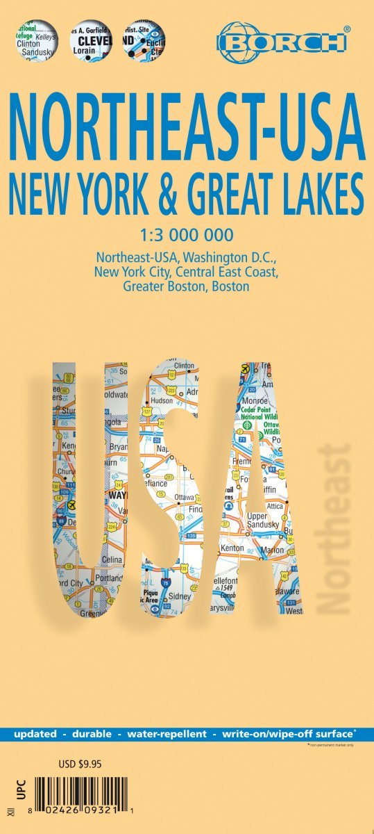
- Wegenkaart - landkaart Noordoost USA - Northeast USA | Borch
- Northeast-USA 5. New York & the Great Lakes 1 : 3 000 000 + City Maps ab 9.9 EURO Washington DC, New York City, Central East Coast, Greater Boston, Boston Borch Map. 13. Auflage Read more

Stanfords
United Kingdom
United Kingdom
- Goat Rocks - Norse Peak William O. Douglas Wilderness Area WA
- Map No. 823, Goat Rocks and Norse Peak Wilderness Area - Gifford-Pinchot and Okanogan-Wenatchee National Forests, WA, in an extensive series of GPS compatible, contoured hiking maps of USA’s national and state parks or forests and other popular recreational areas. Cartography based on the national topographic survey, with additional tourist... Read more
- Also available from:
- Bol.com, Netherlands
- Bol.com, Belgium

Bol.com
Netherlands
Netherlands
- Goat Rocks & Norse Peak Wilderness Area, Gifford-pinchot & Okanogan-wenatchee National Forests
- Waterproof Tear-Resistant Topographic MapGifford-Pinchot and Okanogan-Wenatchee National Forests Washington, USAOne of five new Trails Illustrated maps for the Washington Cascades region offers the most detailed and up-to-date map for the forest, carefully researched and developed in co-operation with local land managers and agencies.... Read more
Bol.com
Belgium
Belgium
- Goat Rocks & Norse Peak Wilderness Area, Gifford-pinchot & Okanogan-wenatchee National Forests
- Waterproof Tear-Resistant Topographic MapGifford-Pinchot and Okanogan-Wenatchee National Forests Washington, USAOne of five new Trails Illustrated maps for the Washington Cascades region offers the most detailed and up-to-date map for the forest, carefully researched and developed in co-operation with local land managers and agencies.... Read more

Stanfords
United Kingdom
United Kingdom
- Mammoth Lakes - Mono Divide CA
- Map No. 809, Mammoth Lakes / Mono Divide, CA, in an extensive series of GPS compatible, contoured hiking maps of USA’s national and state parks or forests and other popular recreational areas. Cartography based on the national topographic survey, with additional tourist information.The maps, with most titles now printed on light, waterproof and... Read more
- Also available from:
- Bol.com, Netherlands
- Bol.com, Belgium
- De Zwerver, Netherlands

Bol.com
Netherlands
Netherlands
- Mammoth Lakes/mono Divide
- Waterproof Tear-Resistant Topographic MapTrails Illustrated Mammoth Lakes / Mono Divide is the first of five exciting new maps for the California Sierra Nevadas that will combine to form seamless coverage of the high-use National Forest areas between Sequoia / Kings Canyon National Parks and Lake Tahoe. This region contains some of the... Read more
Bol.com
Belgium
Belgium
- Mammoth Lakes/mono Divide
- Waterproof Tear-Resistant Topographic MapTrails Illustrated Mammoth Lakes / Mono Divide is the first of five exciting new maps for the California Sierra Nevadas that will combine to form seamless coverage of the high-use National Forest areas between Sequoia / Kings Canyon National Parks and Lake Tahoe. This region contains some of the... Read more

De Zwerver
Netherlands
Netherlands
- Wandelkaart - Topografische kaart 809 Mammoth Lakes - Mono Divide - Inyo and Sierra National Forests | National Geographic
- Prachtige geplastificeerde kaart van het bekende nationaal park. Met alle recreatieve voorzieningen als campsites, maar ook met topografische details en wandelroutes ed. Door uitgekiend kleurgebruik zeer prettig in gebruik. Scheur en watervast! Trails Illustrated Mammoth Lakes / Mono Divide is the first of five exciting new maps for the... Read more

Stanfords
United Kingdom
United Kingdom
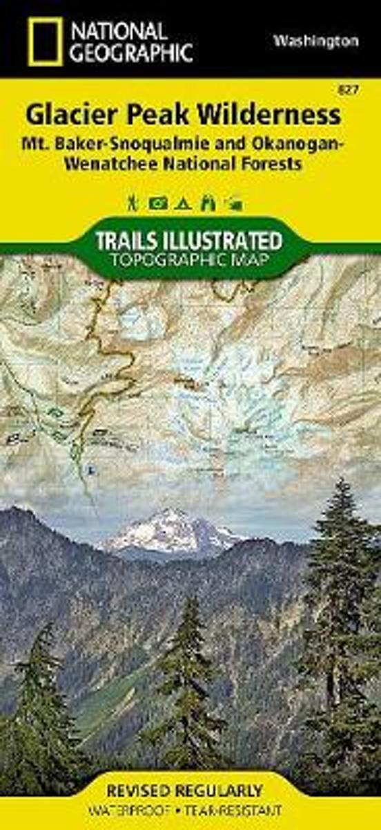
- Glacier Peak Wilderness - Mt Baker-Snoqualmie and Okanogan-Wenatchee National Forests WA
- Map No. 827, Glacier Peak Wilderness Area - Mount Baker-SnoqualmieWilderness Areas and Okanogan-Wenatchee National Forests, WA, in an extensive series of GPS compatible, contoured hiking maps of USA’s national and state parks or forests and other popular recreational areas. Cartography based on the national topographic survey, with additional... Read more
- Also available from:
- Bol.com, Netherlands
- Bol.com, Belgium
Bol.com
Netherlands
Netherlands
- Glacier Peak Wilderness (mt. Baker-snoqualmie And Okanogan-wenatchee National Forests)
- Waterproof Tear-Resistant Topographic MapOkanogan-Wenatchee National Forests Washington, USAOne of five new Trails Illustrated maps for the Washington Cascades region offering the most detailed and up-to-date map for the forest, carefully researched and developed in co-operation with local land managers and agencies. Each map contains... Read more
Bol.com
Belgium
Belgium
- Glacier Peak Wilderness (mt. Baker-snoqualmie And Okanogan-wenatchee National Forests)
- Waterproof Tear-Resistant Topographic MapOkanogan-Wenatchee National Forests Washington, USAOne of five new Trails Illustrated maps for the Washington Cascades region offering the most detailed and up-to-date map for the forest, carefully researched and developed in co-operation with local land managers and agencies. Each map contains... Read more

Stanfords
United Kingdom
United Kingdom
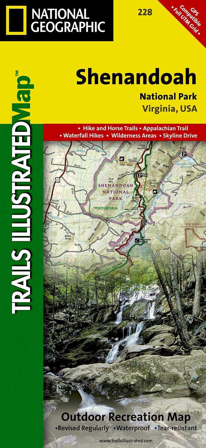
- Shenandoah National Park VA NGS Trails Illustrated Map 228
- Map No. 228, Shenandoah National Park, VA, in an extensive series of GPS compatible, contoured hiking maps of USA’s national and state parks or forests and other popular recreational areas. Cartography based on the national topographic survey, with additional tourist information.The maps, with most titles now printed on light, waterproof and... Read more
- Also available from:
- The Book Depository, United Kingdom
- Bol.com, Netherlands
- Bol.com, Belgium
- De Zwerver, Netherlands

The Book Depository
United Kingdom
United Kingdom
- Shenandoah National Park
- Trails Illustrated National Parks Read more

Bol.com
Netherlands
Netherlands
- Shenandoah National Park
- Waterproof Tear-Resistant Topographic MapExpertly researched and created in partnership with local land management agencies, National Geographic's Trails Illustrated map of Shenandoah National Park provides an unparalleled tool for exploring this beautiful park. Particular attention is shown to camping, hiking, fishing, ranger programs,... Read more
Bol.com
Belgium
Belgium
- Shenandoah National Park
- Waterproof Tear-Resistant Topographic MapExpertly researched and created in partnership with local land management agencies, National Geographic's Trails Illustrated map of Shenandoah National Park provides an unparalleled tool for exploring this beautiful park. Particular attention is shown to camping, hiking, fishing, ranger programs,... Read more
De Zwerver
Netherlands
Netherlands
- Wandelkaart - Topografische kaart 228 Shenandoah National Park | National Geographic
- Prachtige geplastificeerde kaart van het nationaal park. Met alle recreatieve voorzieningen als campsites, maar ook met topografische details en wandelroutes ed. Door uitgekiend kleurgebruik zeer prettig in gebruik. Scheur en watervast! The map includes Shenandoah National Park in its entirety, wilderness areas, Rapidian Wildlife Management... Read more