
World
Description
Links
Facts
Reports
Guides and maps
Lodging
Organisations
Tour operators
GPS
Other
Books

Stanfords
United Kingdom
2019
United Kingdom
2019
- Autour du Bassin d`Arcachon à pied
- Autour du Bassin d`Arcachon à pied, FFRP topoguide Ref. no. P331, with six local walks of varying length and difficulty, plus an 85km route around the basin. Each walk is presented on a separate colour extract from IGN’s topographic survey of France at 1:25,000, with its description cross-referenced to the map. Current edition of this title was... Read more

The Book Depository
United Kingdom
United Kingdom
- The Secret World of Weather
- How to Read Signs in Every Cloud, Breeze, Hill, Street, Plant, Animal, and Dewdrop Read more

The Book Depository
United Kingdom
United Kingdom
- Moon Tokyo Walks (First Edition)
- See the City Like a Local Read more

The Book Depository
United Kingdom
United Kingdom
- Resilient Hope
- 100 Devotions for Building Endurance in an Unpredictable World Read more

The Book Depository
United Kingdom
2013
United Kingdom
2013
- A Walk in the Clouds
- 75 short stories of adventures among the mountains of the world Read more

The Book Depository
United Kingdom
United Kingdom
- Running Wild
- Inspirational Trails from Around the World - With a foreword by Dean Karnazes Read more

The Book Depository
United Kingdom
United Kingdom
- Great Hiking Trails of the World
- 80 Trails, 75,000 Miles, 38 Countries, 6 Continents Read more

Stanfords
United Kingdom
2020
United Kingdom
2020
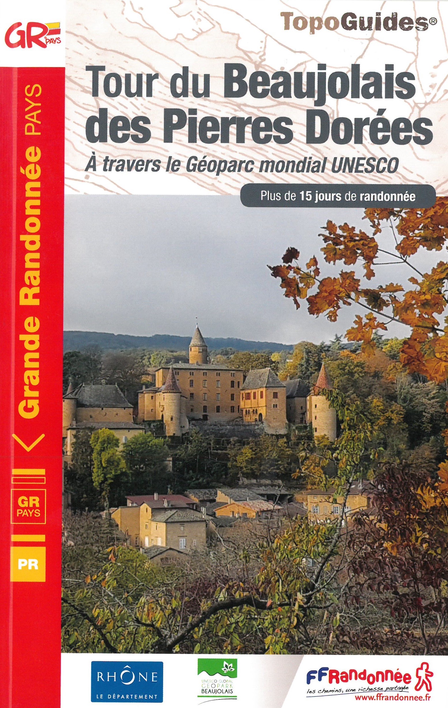
- Le tour du Beaujolais des Pierres Dorées - UNESCO Geopark World Heritage Site
- The Beaujolais tour of Pierres Dorées walking guide in frenchThis GR ®de Pays crosses the Beaujolais Geopark (UNESCO Global Geopark since 2018), which is characterized by the presence of limestone rocks that were used for the construction of the villages of Beaujolais, Lyonnais as well as in Switzerland.This soil gave this yellow ocher stone... Read more
- Also available from:
- The Book Depository, United Kingdom
- De Zwerver, Netherlands

The Book Depository
United Kingdom
2020
United Kingdom
2020
- Tour du Beaujolais des Pierres Dor�es +15j. rand.,12PR
- The Beaujolais tour of Pierres Dorées walking guide in frenchThis GR ®de Pays crosses the Beaujolais Geopark (UNESCO Global Geopark since 2018), which is characterized by the presence of limestone rocks that were used for the construction of the villages of Beaujolais, Lyonnais as well as in Switzerland.This soil gave this yellow ocher stone... Read more
De Zwerver
Netherlands
2020
Netherlands
2020
- Wandelgids 6900 Tour du Beaujolais des Pierres Dorées | FFRP
- The Beaujolais tour of Pierres Dorées walking guide in frenchThis GR ®de Pays crosses the Beaujolais Geopark (UNESCO Global Geopark since 2018), which is characterized by the presence of limestone rocks that were used for the construction of the villages of Beaujolais, Lyonnais as well as in Switzerland.This soil gave this yellow ocher stone... Read more

The Book Depository
United Kingdom
United Kingdom
- City Walks Edinburgh
- 15 short, fun and informative city walks bringing Edinburgh to life Read more


The Book Depository
United Kingdom
United Kingdom
- Wild Signs and Star Paths
- 52 keys that will open your eyes, ears and mind to the world around you Read more
More books…

Maps

Stanfords
United Kingdom
United Kingdom
- Kontich NGI Topo 15/7-8
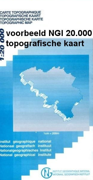
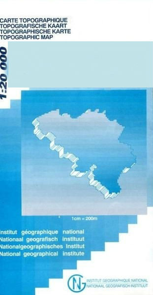
- Topographical survey of Belgium at 1:20,000 from Nationaal Geografisch Instituut / Institut Géographique National, the country’s national survey organization. Each 20K map covers one quarter of the corresponding 1:50,000 map (with adjustments in the border and coastal areas). The maps provide all the information expected of topographic mapping... Read more
Stanfords
United Kingdom
United Kingdom
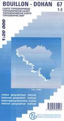
- Bouillon - Dohan
- Topographical survey of Belgium at 1:20,000 from Nationaal Geografisch Instituut / Institut Géographique National, the country’s national survey organization. Each 20K map covers one quarter of the corresponding 1:50,000 map (with adjustments in the border and coastal areas). The maps provide all the information expected of topographic mapping... Read more
Stanfords
United Kingdom
United Kingdom
- Geraardsbergen - Galmaarden
- Topographical survey of Belgium at 1:20,000 from Nationaal Geografisch Instituut / Institut Géographique National, the country’s national survey organization. Each 20K map covers one quarter of the corresponding 1:50,000 map (with adjustments in the border and coastal areas). The maps provide all the information expected of topographic mapping... Read more
Stanfords
United Kingdom
United Kingdom
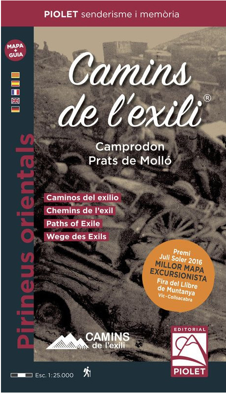
- Paths of Exile - Camprodon - Prats de Molló Editorial Piolet Map + Travel Notebook
- The republican exile at the end of the Spanish Civil War and the Jewish exodus during World War II are the main thread of this cross-border circular trek.They are 60 km of half a mountain that follow the paths used by the Republican exiles (1939) and the Jews fleeing from Nazi barbarism (1940-1945) and where the author (Carlos Treviño) tries to... Read more

Stanfords
United Kingdom
United Kingdom
- Waremme NGI Topo 41/3-4
- Topographical survey of Belgium at 1:20,000 from Nationaal Geografisch Instituut / Institut Géographique National, the country’s national survey organization. Each 20K map covers one quarter of the corresponding 1:50,000 map (with adjustments in the border and coastal areas). The maps provide all the information expected of topographic mapping... Read more

Stanfords
United Kingdom
United Kingdom
- Borgloon NGI Topo 33/7-8
- Topographical survey of Belgium at 1:20,000 from Nationaal Geografisch Instituut / Institut Géographique National, the country’s national survey organization. Each 20K map covers one quarter of the corresponding 1:50,000 map (with adjustments in the border and coastal areas). The maps provide all the information expected of topographic mapping... Read more

Stanfords
United Kingdom
United Kingdom
- Cuba Wall Map
- Wall map of Cuba from Gizi with excellent topographic information, a street plan of Old Havana, enlargements for the Varadero Peninsula, Valle de Viñales and the environs of the capital, plus a distance table and an extensive index.Vivid altitude colouring with graphics for mangrove and swamps, plus plenty of names of geographical features:... Read more
Stanfords
United Kingdom
United Kingdom
- Jurbise - Obourg
- Topographical survey of Belgium at 1:20,000 from Nationaal Geografisch Instituut / Institut Géographique National, the country’s national survey organization. Each 20K map covers one quarter of the corresponding 1:50,000 map (with adjustments in the border and coastal areas). The maps provide all the information expected of topographic mapping... Read more
Stanfords
United Kingdom
United Kingdom
- Saint-Hubert NGI Topo 59/7-8
- Topographical survey of Belgium at 1:20,000 from Nationaal Geografisch Instituut / Institut Géographique National, the country’s national survey organization. Each 20K map covers one quarter of the corresponding 1:50,000 map (with adjustments in the border and coastal areas). The maps provide all the information expected of topographic mapping... Read more
- Also available from:
- De Zwerver, Netherlands

Stanfords
United Kingdom
United Kingdom
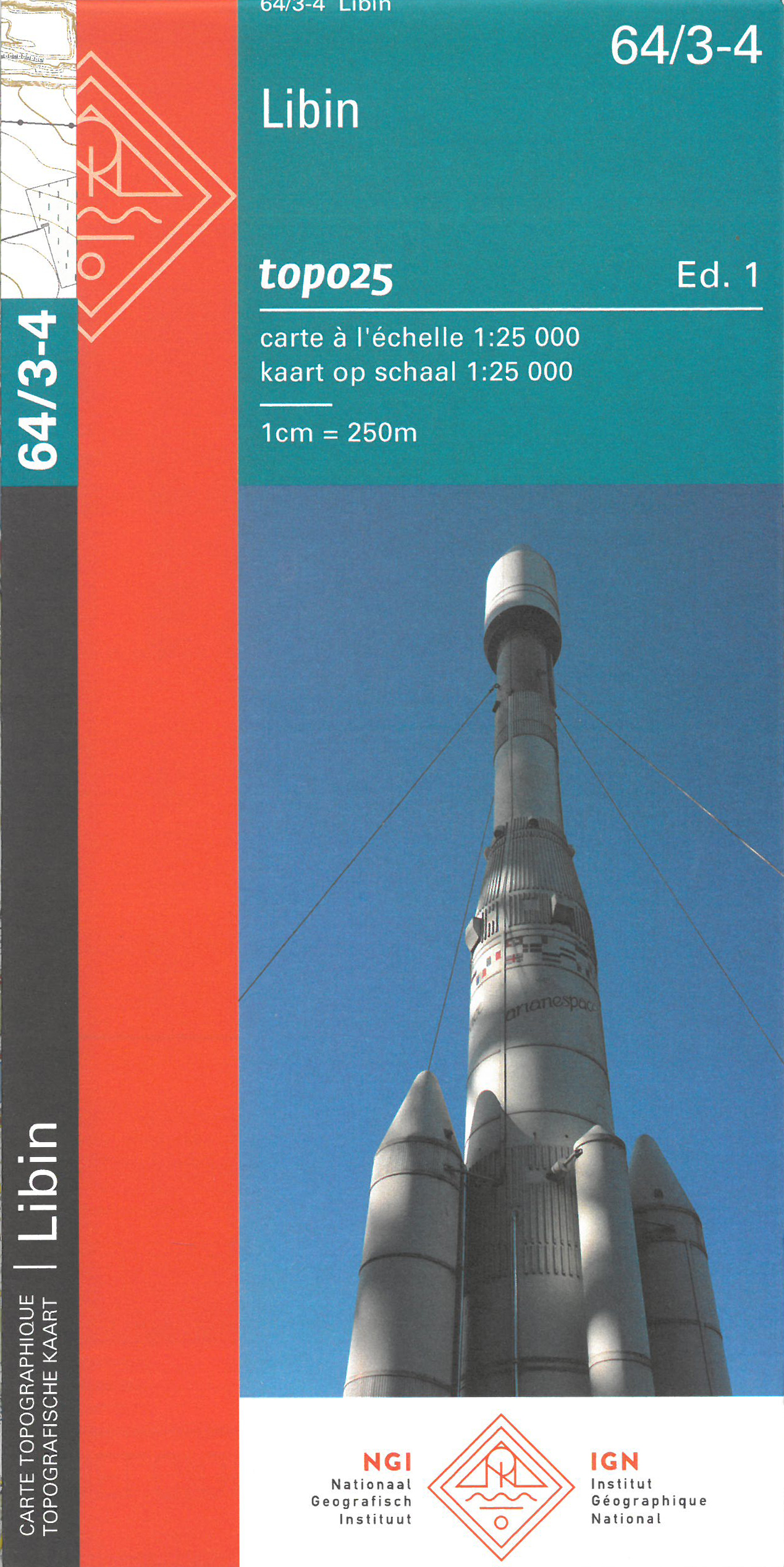
- Libin NGI Topo 64/3-4
- Topographical survey of Belgium at 1:20,000 from Nationaal Geografisch Instituut / Institut Géographique National, the country’s national survey organization. Each 20K map covers one quarter of the corresponding 1:50,000 map (with adjustments in the border and coastal areas). The maps provide all the information expected of topographic mapping... Read more
- Also available from:
- De Zwerver, Netherlands

Stanfords
United Kingdom
United Kingdom
- Ham-Sur-Heure-Nalinnes NGI Topo 52/3-4
- Topographical survey of Belgium at 1:20,000 from Nationaal Geografisch Instituut / Institut Géographique National, the country’s national survey organization. Each 20K map covers one quarter of the corresponding 1:50,000 map (with adjustments in the border and coastal areas). The maps provide all the information expected of topographic mapping... Read more
- Also available from:
- De Zwerver, Netherlands

De Zwerver
Netherlands
Netherlands
- Wandelkaart - Topografische kaart 52/3-4 Topo25 Nalinnes - Ham sur Heure | NGI - Nationaal Geografisch Instituut
- Topographical survey of Belgium at 1:20,000 from Nationaal Geografisch Instituut / Institut Géographique National, the country’s national survey organization. Each 20K map covers one quarter of the corresponding 1:50,000 map (with adjustments in the border and coastal areas). The maps provide all the information expected of topographic mapping... Read more

Stanfords
United Kingdom
United Kingdom
- Philippeville NGI Topo 53/5-6
- Topographical survey of Belgium at 1:20,000 from Nationaal Geografisch Instituut / Institut Géographique National, the country’s national survey organization. Each 20K map covers one quarter of the corresponding 1:50,000 map (with adjustments in the border and coastal areas). The maps provide all the information expected of topographic mapping... Read more
- Also available from:
- De Zwerver, Netherlands

De Zwerver
Netherlands
Netherlands
- Topografische kaart - Wandelkaart 53/5-6 Topo25 Philippeville - Rosée - Florennes | NGI - Nationaal Geografisch Instituut
- Topographical survey of Belgium at 1:20,000 from Nationaal Geografisch Instituut / Institut Géographique National, the country’s national survey organization. Each 20K map covers one quarter of the corresponding 1:50,000 map (with adjustments in the border and coastal areas). The maps provide all the information expected of topographic mapping... Read more
Stanfords
United Kingdom
United Kingdom
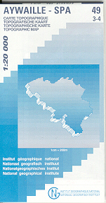
- Aywaille - Spa NGI Belgium Survey Map No. 49/3-4
- Topographical survey of Belgium at 1:20,000 from Nationaal Geografisch Instituut / Institut Géographique National, the country’s national survey organization. Each 20K map covers one quarter of the corresponding 1:50,000 map (with adjustments in the border and coastal areas). The maps provide all the information expected of topographic mapping... Read more
Stanfords
United Kingdom
United Kingdom
- Estaimpuis NGI Topo 37/1-2
- Topographical survey of Belgium at 1:20,000 from Nationaal Geografisch Instituut / Institut Géographique National, the country’s national survey organization. Each 20K map covers one quarter of the corresponding 1:50,000 map (with adjustments in the border and coastal areas). The maps provide all the information expected of topographic mapping... Read more
Stanfords
United Kingdom
United Kingdom
- Aarschot NGI Topo 24/7-8
- Topographical survey of Belgium at 1:20,000 from Nationaal Geografisch Instituut / Institut Géographique National, the country’s national survey organization. Each 20K map covers one quarter of the corresponding 1:50,000 map (with adjustments in the border and coastal areas). The maps provide all the information expected of topographic mapping... Read more