
Jura
Description

The Jura is the mountain range west and north of the Lake of Geneva, roughly situated between Mulhouse and Lyon, shared by France and Switzerland. The Jurassic period of our geoglogical timescale derives its name of this mountain range. The mountains are much older than the Alps. Large forests, long worn ridges, rich grounds: it is a very good area for hiking. The GR5 - E2 traverses the northern part of the Jura. GR9 - E4 lie in the southern part.
Map


Trails in this region
Links
Facts
Reports
Guides and maps
Lodging
Organisations
Tour operators
GPS
Other
Books

Stanfords
United Kingdom
2012
United Kingdom
2012
- Le Massif Glières-Parmelan à pied FFRP Topo-guide No. P473
- Le Massif Glières-Parmelan à pied, FFRP topo-guide Ref. No. P743, with 20 day walks of varying length and difficulty in the French Alps, north-east of Lake Annecy between Thônes and La Roche-sur-Foron. Each walk is presented on a separate colour extract from IGN’s topographic survey of France at 1:25,000, with its description cross-referenced... Read more

Stanfords
United Kingdom
2019
United Kingdom
2019
- Sentiers de Saint-Jacques-de-Compostelle - Via Le Puy - Geneve - Le Puy GR65
- Chemins de St-Jacques: Geneva - Le Puy-en-Velay, FFRP topoguide Ref. No. 650, covering a 360km section of the GR65 along one of the routes of the Way of St. James across France. Current edition of this title was published in March 2016.ABOUT THE FFRP (Fédération française de la randonnée pédestre) TOPOGUIDES: published in a handy A5 paperback... Read more

Stanfords
United Kingdom
2012
United Kingdom
2012
- GR62B/GR36/GR46 Le Chemin de Conques à Toulouse FFRP Topo-guide No. 3646
- Le Chemin de Conques à Toulouse, FFRP topoguide Ref. no. 3646, covering 563kms of various GR routes in the region of Quercy and the Gorges of the Aveyron between Conques and Cahors in the north and Toulouse and Albi in the south: le Chemin de Conques à Toulouse along the GR62B, 36 and 46; GR 36 from Cahors to Albi; GR46 along the Gorges of the... Read more

Stanfords
United Kingdom
United Kingdom
- Stratford-upon-Avon, Warwick & Banbury OS Landranger Active Map 151 (waterproof)
- The area between Stratford-upon-Avon, Warwick and Banbury, including the northern part of the Cotswold Hills and part of the Cotswold Way / E2 European Long-distance Path, on a waterproof and tear-resistant OS Active version of map No. 151 from the Ordnance Survey’s Landranger series at 1:50,000, with contoured and GPS compatible topographic... Read more

Stanfords
United Kingdom
United Kingdom
- Val de Travers
- Val de Travers area in the central part of the Swiss Jura from Ste-Croix and Yverdon-les-Bains to Neuchâtel, including most of the Lake Neuchâtel, at 1:50,000 in a series from Hallwag covering Switzerland’s popular hiking regions on light, waterproof and tear-resistant maps highlighting long-distance paths: the nine national routes plus special... Read more

Stanfords
United Kingdom
United Kingdom
- Randonnées en Franche-Comté de gare en gare FFRP Topo-guide No. RE18
- Randonnées en Franche-Comté de gare en gare, FFRP topo-guide Ref. No. RE18, with 28 day walks of varying length and difficulty in the French Jura between Belfort and St-Claude. Each walk links two SNCF stations and is presented on a separate colour extract from IGN’s topographic survey of France at 1:25,000, with its description... Read more

Stanfords
United Kingdom
2019
United Kingdom
2019
- Du Léman à la Vanoise - par le Mont Blanc et le Beaufortain GR5
- The first, 206-km long Alpine section of the GR5 from Lake Geneva, past Mont Blanc and across the Col de la Croix-du-Bonhomme, to Landry north of the Vanoise Massif, FFRP topo-guide ref. no. 504, with colour maps from the IGN TOP25 series at 1:25,000. Also included is a tour of the Dents du Midi. Current edition of this title was published in... Read more

Stanfords
United Kingdom
2020
United Kingdom
2020
- L`Ain à pied D001
- L`Ain à pied, FFRP topo-guide Ref. No. D001, with 46 day walks in the department of Ain in the southern part of the French Jura Mountains, including the Crête de la Neige, Grand Colombier, etc. Each day walk is presented on a separate colour extract from IGN’s topographic survey of France at 1:25,000, with its description cross-referenced to... Read more

Stanfords
United Kingdom
United Kingdom
- Le Tarn à pied FFRP Topo-guide No. SP02
- Le Tarn à pied, FFRP topo-guide Ref. No. SP02, with 25 day walks of varying length and difficulty in the department of Tarn, including walks in the historic towns of Castres and Albi. Country walks are presented on a separate colour extract from IGN’s topographic survey of France at 1:25,000, city walks are shown on detailed street plans, and... Read more
Stanfords
United Kingdom
2018
United Kingdom
2018
- Sentiers de St-Jacques via le Puy - Le Puy to Figeac GR65
- Chemins de St-Jacques: Le Puy - Figeac, FFRP topoguide Ref. no. 651, covering a 252km section of the Way of St. James across the Massif Central from Le Puy-en-Velay to Figeac along the GR 65. Current edition of this title was published in August 2014.ABOUT THE FFRP (Fédération française de la randonnée pédestre) TOPOGUIDES: published in a handy... Read more

Stanfords
United Kingdom
United Kingdom
- Cambridge, Newmarket & Saffron Walden OS Landranger Active Map 154 (waterproof)
- Parts of Cambridgeshire, Suffolk and Essex with Cambridge, Newmarket and Saffron Walden, including part of the E2 European Long-distance path, on a waterproof and tear-resistant OS Active version of map No. 154 from the Ordnance Survey’s Landranger series at 1:50,000, with contoured and GPS compatible topographic mapping plus tourist... Read more

Stanfords
United Kingdom
United Kingdom
- Les Sentiers des Patrimoines dans le Jura FFRP Topo-guide No. SP03
- Les Sentiers des Patrimoines dans le Jura, FFRP topo-guide Ref. No. SP03, with 25 day walks of varying length and difficulty in the French Jura Mountains between Dole, Lons-le-Saunier and St. Claude. Each walk is presented on a separate colour extract from IGN’s topographic survey of France at 1:25,000, with its description cross-referenced to... Read more

Stanfords
United Kingdom
2019
United Kingdom
2019
- La Traversée des Alpes de la Maurienne a l`Ubaye GR5/GR56
- 9 days from Modane to Larche by the GR5, as much for the tour of Ubaye.Grande Traversée des Alpes: de la Maurienne a l`Ubaye, FFRP topoguide Ref. No. 531, covering the third stage of the GR5 in the French Alps from Modane to Larche, plus the Tour de l`Ubaye at its southern end, in all 272km for hiking routes. Current edition of this title was... Read more

Stanfords
United Kingdom
United Kingdom
- Maidstone, Royal Tunbridge Wells, Sevenoaks & Tonbridge OS Landranger Active Map 188 (waterproof)
- Maidstone, Tunbridge Wells and the High Weald area, including a section of the North Downs Way / E2 European Long-distance Path, on a waterproof and tear-resistant OS Active version of map No. 188 from the Ordnance Survey’s Landranger series at 1:50,000, with contoured and GPS compatible topographic mapping plus tourist information.MOBILE... Read more

Stanfords
United Kingdom
2015
United Kingdom
2015
- GR9/GR96/GRP: Tours et Traversées de Chartreuse FFRP Topo-guide No. 903
- Tours et Traversées de Chartreuse, FFRP topoguide Ref. no. 903, covering 385kms of routes along the GR9 and GR96 in the northern part of the French Alps between Culoz, Chambéry and Grenoble. Current edition of this title was published in May 2015.ABOUT THE FFRP (Fédération française de la randonnée pédestre) TOPOGUIDES: published in a handy A5... Read more
Maps
Stanfords
United Kingdom
United Kingdom
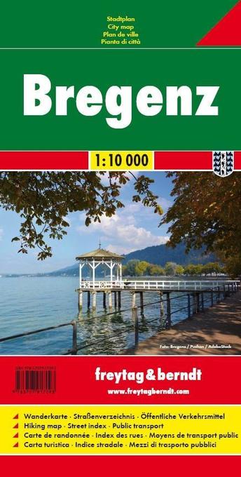
- Bregenz F&B
- Indexed street plan of Bregenz extending north along the Bodensee coast to Lochau and Unter Hochsteg. Detail includes pedestrianised areas, railways, bus routes and cycle paths. Notable buildings are highlighted in red, and symbols indicate post offices, hostels, campsites and car parks.On the reverse is a 1:50,000 contoured map of the... Read more

Stanfords
United Kingdom
United Kingdom
- Swabian Jura: Münsinger Alb 35K Kümmerly + Frey Map No. 42
- Swabian Jura: Münsinger Alb area at 1:35,000 from Kümmerly+Frey in a series GPS compatible, double-sided maps printed on durable, waterproof and tear-resistant plastic paper; contoured, with hiking and cycle routes, other recreational activities, etc. Maps in this series are at a scale of either 1:50,000 or 1:35,000. Contour interval varies... Read more


Stanfords
United Kingdom
United Kingdom
- Taygetos - North Taygetos Anavasi 8.1
- The Taygetos range between Sparta and Kalamata at 1:50,000 on a contoured, GPS compatible map from Anavasi with on the reverse a special map highlighting the region’s numerous hiking trails, including the course of the E4 European long-distance path.On one side is the main map of the area with excellent presentation of its topography by... Read more

Stanfords
United Kingdom
United Kingdom
- Alsace Bikeline Cycling Atlas (1550km)
- Alsace Cycle Atlas, offering a total of over 1550km of cycle paths including routes on the German side of the Rhine, presented by the Verlag Esterbauer in guide with maps at 1:75,000 showing the routes and their variants. Extensive information is conveyed by symbols, indicating road surface, campsites and other accommodation, repair workshops,... Read more

Stanfords
United Kingdom
United Kingdom
- Greece: Attika and Central Greece Road Atlas
- Road Atlas of Attika, the region around Athens, and Central Greece from Anavasi, in an A4 paperback format, with contoured mapping at 1:50,000, a 2km UTM grid for GPS users, very detailed road classification, hiking paths, and place names in both Greek and Latin alphabets.The main section of the atlas has 219 pages of detailed maps with... Read more

Stanfords
United Kingdom
2016
United Kingdom
2016
- Vanoise National Park - Beaufortain Didier Richard 04
- Vanoise National Park and the Beaufortain Massif in the French Alps at 1:60,000 on a contoured and GPS compatible map from Didier Richard with a base derived from IGN’s topographic survey, highlighting both local hiking routes and the GR network of long-distance paths, gîtes and mountain refuges, interesting natural and cultural sites, etc. The... Read more

Stanfords
United Kingdom
United Kingdom
- 2800 Kintyre to Ardnamurchan Chart Pack - 2021 edition
- This edition consists of 11 extra chart sheets, twice the coverage of the previous edition, and incorporates all the latest official bathymetric surveys.Created in association with the Clyde Cruising Club for use alongside their sailing directions, coverage includes detail of this delightful area of Scotland and there is reference to the... Read more

Stanfords
United Kingdom
2017
United Kingdom
2017
- Le Chemin du Piemont Pyreneen - vers Saint-Jacques-de-Compostell
- Le Chemin du Piémont Pyrénéen, FFRP topoguide, Ref. No. 780, covering the GR78 - the Way of St. James along the northern side of the Pyrenees from Carcassonne to Roncesvalles on the Spanish side, with an alternative variant to cross the mountains along the Col du Somport. Current edition of this title was published in May 2017.The route, the... Read more

Stanfords
United Kingdom
United Kingdom
- Lake Trasimeno - Val d`Orcia - Montepulciano - Monte Amiata Kompass 2463
- Lake Trasimeno - Val d`Orcia - Montepulciano - Monte Amiata area on a double-sided map at 1:50,000 from Kompass, printed on durable, waterproof and tear-resistant synthetic paper. Coverage includes Val di Chiana, Cortona, Montalcino, Asciano, Arcidosso, Fabro, Magione, etc. Contours are at 40m intervals, with a 2-km UTM grid. Extensive... Read more

Stanfords
United Kingdom
United Kingdom
- Franconian Switzerland - Wiesenttal - Pottenstein K+F Outdoor Map 37
- Fränkische Schweiz region of the Franconian Jura in northern Bavaria at 1:35,000 from Kümmerly+Frey in a series GPS compatible, double-sided maps printed on durable, waterproof and tear-resistant plastic paper; contoured, with hiking and cycle routes, other recreational activities, etc.Maps in this series are at a scale of either 1:50,000 or... Read more

Stanfords
United Kingdom
United Kingdom
- Transrhodopi - Long distance hiking and biking trail From Trigrad to Ivaylovgrad
- Western Rhodope Mountains at 1:100,000 on a contoured GPS compatible map from Domino extending from just west of the Pirin National Park to Asenovgrad in the north-east. The map is double-sided with a good overlap between the sides. Topography is shown by contours at 50m intervals with relief shading and spot heights, plus colouring for... Read more

Stanfords
United Kingdom
United Kingdom
- Siena - Volterra - Massa Marittima - Roccastrada Kompass 2462
- Siena - Volterra - Massa Marittima - Rocca Strada map at 1:50,000 from Kompass, printed on durable, waterproof and tear-resistant synthetic paper. Coverage includes Colle di Va d’Elsa, Casole d’Elsa, Metallifere hills, etc. Contours are at 40m intervals, with a 2-km UTM grid. Extensive overprint includes GEA - Grande Escursione Appenninica,... Read more

Stanfords
United Kingdom
United Kingdom
- Autour du Thabor: Modane - Bardonecchia - Briançon
- Mont Thabor area at 1:50,000 on a contoured and GPS compatible map from Editions Didier Richard in their series of walking maps of French Alps and other popular hiking regions of south-eastern France. Coverage extends from Modane in the north to Briançon in the south-east, and west to Valloire.The base map with cartography from the IGN has... Read more

Stanfords
United Kingdom
United Kingdom
- Hungarian National Long-distance Blue Trail (E4): Visegrad to Irott-ko
- Hiking guide to the north-western section of Hungary’s National Blue Trail which forms part of the E4 European long-distance footpath. The guide covers the route from the historic town of Visegrád on the Danube, across the Buda Hills on the outskirts of Budapest and the Bakony Hills along the north-eastern shore of Lake Balaton, to Írott-ko in... Read more