
Baden-Württemberg
Description
Trails in this state
- AlemannenwegGPX
- Badener Weg
- Bodensee RundwegGPX
- Breisgauer WeinwegGPX
- Burgenweg Bergstrasse
- Burgundenweg
- Donau-ZollernalbwegGPX
- DonauberglandwegGPX
- DreiländerwegGPX
- E1GPX
- E8GPX
- Frankenweg (Schwäbischer Albverein)GPX
- Frankenweg Odenwald
- Fränkischer Rotwein WanderwegGPX
- GäurandwegGPX
- Gernsbacher RundeGPX
- Hansjakobweg I (Kleiner Hansjakobweg)GPX
- Hansjakobweg II (Großer Hansjakobweg)GPX
- Heuberg-AllgäuwegGPX
- Hochrhein HöhenwegGPX
- Hotzenwald QuerwegGPX
- Jagtsteig
- Jakobsweg Breisach - Cluny
- Jakobsweg Waldshut-Vézelay
- Jubiläumsweg BodenseekreisGPX
- Kandel HöhenwegGPX
- Kocher Jagst Trail
- Limes WanderwegGPX
- Main-Donau-BodenseewegGPX
- Main-Neckar-RheinwegGPX
- Markgräfler Wiwegli
- MittelwegGPX
- MurgleiterGPX
- NibelungensteigGPX
- NibelungenwegGPX
- Ortenauer WeinpfadGPX
- OstwegGPX
- Panoramaweg Baden-BadenGPX
- Panoramaweg TaubertalGPX
- Querweg Freiburg-BodenseeGPX
- Querweg Gengenbach-Alpirsbach
- Querweg Lahr-RottweilGPX
- Querweg Schwarzwald-Kaiserstuhl-RheinGPX
- Remstal HöhenwegGPX
- RenchtalsteigGPX
- RheinauenwegGPX
- SchluchtensteigGPX
- Schwarzwald Nordrand WegGPX
- Schwarzwald-Jura-Bodensee-WegGPX
- Schwarzwald-Schwäbische Alb-Allgäu-WegGPX
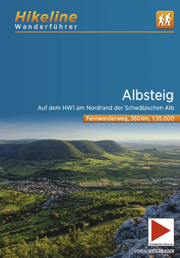
- Schwäbische Alb Hauptwanderweg 5
- Schwäbische Alb-Südrand-WegGPX
- Schwäbische-Alb-Nordrand-WegGPX
- Schwäbische-Alb-Oberschwaben-WegGPX
- SeensteigGPX
- Stromberg-Schwäbischer Waldweg
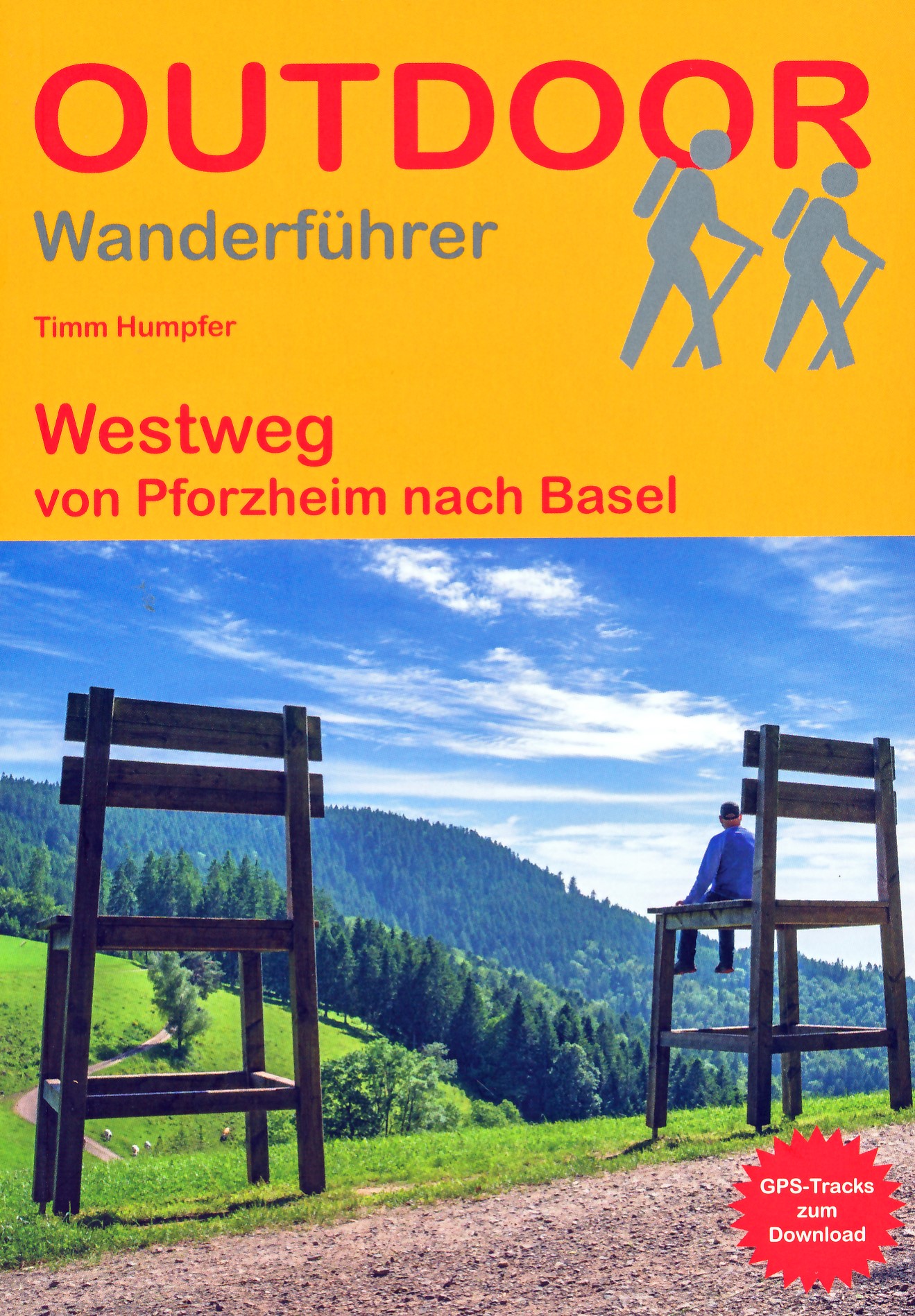
- WestwegGPX
- ZweitälersteigGPX
Links
Facts
Reports
Guides and maps
Lodging
Organisations
Tour operators
GPS
Other
Books

Stanfords
United Kingdom
United Kingdom
- Württemberg Winelands Cycle Route (360km) Bikeline Map/Guide
- Württemberg Winelands Cycle Route, a 360-km long cycle trail from Rottenburg on the Neckar across the Tauber Valley to Niederstetten, presented by the Verlag Esterbauer in guide with maps at 1:50,000 showing the route and its variants. Extensive information is conveyed by symbols, indicating road surface, campsites and other accommodation,... Read more

The Book Depository
United Kingdom
2019
United Kingdom
2019
- Also available from:
- De Zwerver, Netherlands


The Book Depository
United Kingdom
United Kingdom
- Hiking and Cycling in the Black Forest
- Walks, treks and cycle rides in southern Germany Read more


De Zwerver
Netherlands
2015
Netherlands
2015
- Wandelgids Nibelungensteig | Conrad Stein Verlag
- OutdoorHandbuch. 1. Auflage. Read more
Bol.com
Netherlands
2019
Netherlands
2019
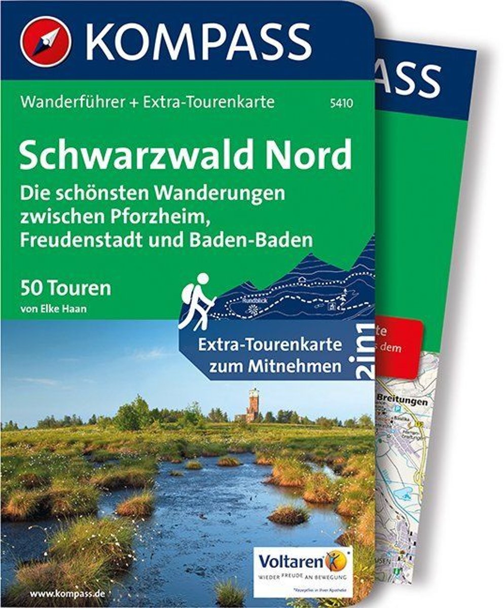
- WF5410 Zwarte Woud Noord Kompass
- De Kompass wandelgids + kaart geeft een overzicht van alle wandelroutes in het gebied met nauwkeurige routeaanwijzingen en hoogteaanduidingen, De extra grote kaart, schaal 1:35 000, is ideaal om van te voren uw route uit te stippelen en om onderweg te gebruiken • naast de bekende bestemmingen, worden ook de minder bekende vermeld • openbaar... Read more
- Also available from:
- Bol.com, Belgium
Bol.com
Belgium
2019
Belgium
2019
- WF5410 Zwarte Woud Noord Kompass
- De Kompass wandelgids + kaart geeft een overzicht van alle wandelroutes in het gebied met nauwkeurige routeaanwijzingen en hoogteaanduidingen, De extra grote kaart, schaal 1:35 000, is ideaal om van te voren uw route uit te stippelen en om onderweg te gebruiken • naast de bekende bestemmingen, worden ook de minder bekende vermeld • openbaar... Read more
De Zwerver
Netherlands
2022
Netherlands
2022
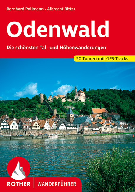
- Wandelgids Odenwald | Rother Bergverlag
- Uitstekende wandelgids met een groot aantal dagtochten in dal en hooggebergte. Met praktische informatie en beperkt kaartmateriaal! Wandelingen in verschillende zwaarte weergegeven in rood/blauw/zwart. Der Odenwald, der von der Bergstraße, dem Neckar und dem Main begrenzt wird, bietet einen reichen Schatz an Natur und Kultur. Neben den... Read more
Bol.com
Netherlands
Netherlands
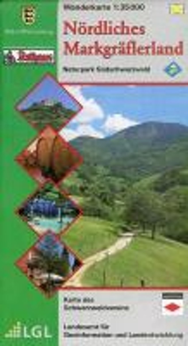
- LGL BW 35 000 Wander N rdliches Markgräflerland
- Naturpark Südschwarzwald LGL Baden-Württemberg 1 : 35 000 Wanderkarte. 1. Auflage, Nachdruck. Read more
- Also available from:
- Bol.com, Belgium
Bol.com
Belgium
Belgium
- LGL BW 35 000 Wander N rdliches Markgräflerland
- Naturpark Südschwarzwald LGL Baden-Württemberg 1 : 35 000 Wanderkarte. 1. Auflage, Nachdruck. Read more
Bol.com
Netherlands
Netherlands
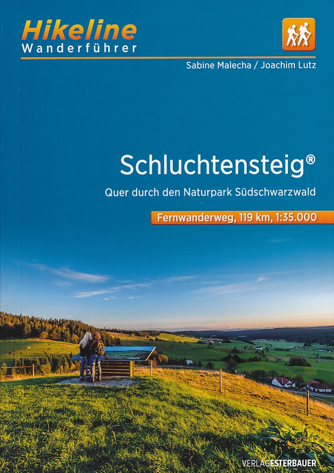
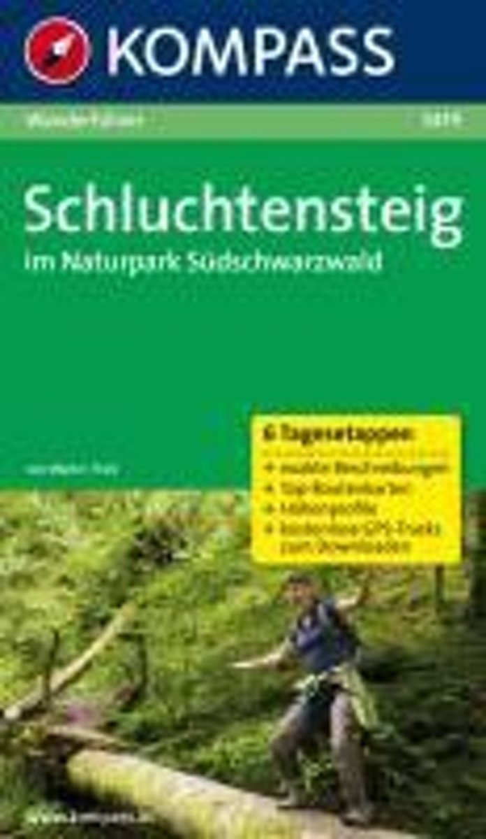
- WF5419 Schluchtensteig im Naturpark Südschwarzwald Kompass
- De Kompass wandelgids + kaart geeft een overzicht van alle wandelroutes in het gebied met nauwkeurige routeaanwijzingen en hoogteaanduidingen, De extra grote kaart, schaal 1:35 000, is ideaal om van te voren uw route uit te stippelen en om onderweg te gebruiken • naast de bekende bestemmingen, worden ook de minder bekende vermeld • openbaar... Read more
- Also available from:
- Bol.com, Belgium
Bol.com
Belgium
Belgium
- WF5419 Schluchtensteig im Naturpark Südschwarzwald Kompass
- De Kompass wandelgids + kaart geeft een overzicht van alle wandelroutes in het gebied met nauwkeurige routeaanwijzingen en hoogteaanduidingen, De extra grote kaart, schaal 1:35 000, is ideaal om van te voren uw route uit te stippelen en om onderweg te gebruiken • naast de bekende bestemmingen, worden ook de minder bekende vermeld • openbaar... Read more

De Zwerver
Netherlands
2017
Netherlands
2017
- Wandelgids 411 Kautokeino - Nordkap E1 | Conrad Stein Verlag
- Handzaam boekje met de routebeschrijving inclusief een heleboel praktische informatie. De beschrijving is uitstekend, maar kaarten zijn wat beperkt. Duits. Die 330 km lange Wanderung auf dem E1 von Kautokeino zum Nordkap ist ein unvergessliches Wanderabenteuer. In 15 Etappen laufen Sie durch die Wildnis Nordnorwegens und überqueren die... Read more

De Zwerver
Netherlands
2022
Netherlands
2022
More books…
Maps

Stanfords
United Kingdom
United Kingdom
- Foreste Casentinesi NP Monti Editore 20
- Map No. 20, Foreste Casentinesi: Campigna, Camaldoli, Chiusi dell Verna, in series of contoured, GPS compatible hiking maps at 1:25,000 from the Istituto Geografico Adriatico, covering mainly the spine of the Apennines along the borders of Tuscany, Emilia-Romagna, Umbria and the Marches.Map in this series have contours at 25m intervals with... Read more

Stanfords
United Kingdom
United Kingdom
- Upper Danube Regional Park: Albstadt - Tuttlingen - Sigmaringen
- Upper Danube Regional Park: Albstadt - Tuttlingen - Sigmaringen area of Baden-Württemberg on a detailed, GPS compatible map at 1:50,000 from Kompass with local and long-distance footpaths, cycling routes, accommodation, etc, printed on durable, waterproof and tear-resistant synthetic paper.KOMPASS HIKING & RECREATIONAL MAPS: this title is part... Read more

Stanfords
United Kingdom
United Kingdom
- Alta Valle del Lamone 22
- Map No. 22, Alta Valle del Lamone: Alto Appennino Faentino – Anello di Marradi, in series of contoured, GPS compatible hiking maps at 1:25,000 from the Istituto Geografico Adriatico, covering mainly the spine of the Apennines along the borders of Tuscany, Emilia-Romagna, Umbria and the Marches.Map in this series have contours at 25m intervals... Read more

Stanfords
United Kingdom
United Kingdom
- Appennino Tosco-Romagnolo East
- Map No. 135, Appennino Tosco-Romagnolo East, in a series of GPS compatible hiking maps at 1:50,000 from the Istituto Geografico Adriatico, covering parts of central Italy: eastern Tuscany, with northern Umbria and the Marches, plus the south-eastern of part of Emilia-Romagna.The maps have contours at 50m intervals with additional shading and... Read more
Stanfords
United Kingdom
United Kingdom
- Colline di Rimini
- Map No. 124, Colline di Rimini, in a series of GPS compatible hiking maps at 1:50,000 from the Istituto Geografico Adriatico, covering parts of central Italy: eastern Tuscany, with northern Umbria and the Marches, plus the south-eastern of part of Emilia-Romagna. This title covers the holiday resorts on the Adriatic coast around Rimini,... Read more

Stanfords
United Kingdom
United Kingdom
- Lahr –Rheinauen – Taubergießen - Kinzigtal
- Lahr –Rheinauen – Taubergießen – Kinzigtal area of central Black Forest on a detailed, GPS compatible map at 1:25,000 from Kompass with local and long-distance footpaths, cycling routes, accommodation, etc, printed on durable, waterproof and tear-resistant synthetic paper.KOMPASS HIKING & RECREATIONAL MAPS: this title is part of an extensive... Read more
Stanfords
United Kingdom
United Kingdom
- Alta Val Tiberina
- Map No. 125, Alta Val Tiberina, in a series of GPS compatible hiking maps at 1:50,000 from the Istituto Geografico Adriatico, covering parts of central Italy: eastern Tuscany, with northern Umbria and the Marches, plus the south-eastern of part of Emilia-Romagna.The maps have contours at 50m intervals with additional shading and numerous spot... Read more

Stanfords
United Kingdom
United Kingdom
- Basel and Environs
- Basel - Olten area at 1:50,000 in a series from Hallwag covering Switzerland’s popular hiking regions on light, waterproof and tear-resistant maps highlighting long-distance paths: the nine national routes plus special regional routes, as well as other local hiking trails.Cartography is similar to that used both in Hallwag’s hiking atlases and... Read more
Stanfords
United Kingdom
United Kingdom
- Riviera Cesenate - San Marino
- Map No. 128, Riviera Cesenate - San Marino, in a series of GPS compatible hiking maps at 1:50,000 from the Istituto Geografico Adriatico, covering parts of central Italy: eastern Tuscany, with northern Umbria and the Marches, plus the south-eastern of part of Emilia-Romagna.The maps have contours at 50m intervals with additional shading and... Read more

Stanfords
United Kingdom
United Kingdom
- Transrhodopi - Long distance hiking and biking trail From Trigrad to Ivaylovgrad
- Western Rhodope Mountains at 1:100,000 on a contoured GPS compatible map from Domino extending from just west of the Pirin National Park to Asenovgrad in the north-east. The map is double-sided with a good overlap between the sides. Topography is shown by contours at 50m intervals with relief shading and spot heights, plus colouring for... Read more
Stanfords
United Kingdom
United Kingdom
- Alta Val Marecchia
- Map No. 126, Alta Val Marecchia, in a series of GPS compatible hiking maps at 1:50,000 from the Istituto Geografico Adriatico, covering parts of central Italy: eastern Tuscany, with northern Umbria and the Marches, plus the south-eastern of part of Emilia-Romagna.The maps have contours at 50m intervals with additional shading and numerous spot... Read more

Stanfords
United Kingdom
United Kingdom
- Alta Valle del Santerno 23
- Map No. 22, Alta Valle del Lamone: Alto Appennino Faentino – Anello di Marradi, in series of contoured, GPS compatible hiking maps at 1:25,000 from the Istituto Geografico Adriatico, covering mainly the spine of the Apennines along the borders of Tuscany, Emilia-Romagna, Umbria and the Marches.Map in this series have contours at 25m intervals... Read more

Stanfords
United Kingdom
United Kingdom
- Baden-Württemberg Official Road Map
- German state of Baden-Württemberg at 1:250,000 on a GPS compatible road map from its survey organization, showing the road network with its official numbers at all levels, railways, airports and internal administrative divisions.The map presents the state’s road network in colours indicating the official classification and all the sections, as... Read more
Stanfords
United Kingdom
United Kingdom
- Alta Valle del Metauro: Valle del Candigliano, Monte Nerone, Monte Catria
- Map No. 122, Alta Valle del Metauro: Valle del Candigliano, Monte Nerone, Monte Catria, in a series of GPS compatible hiking maps at 1:50,000 from the Istituto Geografico Adriatico, covering parts of central Italy: eastern Tuscany, with northern Umbria and the Marches, plus the south-eastern of part of Emilia-Romagna.The maps have contours at... Read more
Stanfords
United Kingdom
United Kingdom
- Colline di Forlí
- Map No. 127, Colline di Forlí, in a series of GPS compatible hiking maps at 1:50,000 from the Istituto Geografico Adriatico, covering parts of central Italy: eastern Tuscany, with northern Umbria and the Marches, plus the south-eastern of part of Emilia-Romagna.The maps have contours at 50m intervals with additional shading and numerous spot... Read more