
Germany
Description

If ever any country takes pride in its romantic legacy, it must be Germany. Put on your hiking boots and headphones and enter the realm of Wagner, Brahms and Schumann, walking through the land of Rhine and Danube, of traditional half-timbered houses, mighty castles and ancient taverns serving excellent food and wine. Most popular hiking destinations are the Black Forest in the southwest, Alsace-Lorraine on the border with France, Bavaria in the south, and forested Thüringen and Harz in central Germany. But there is more to explore. Try an autumn clad Swabian Alb for instance, or spring on the northern island of Rügen.
Not surprisingly, Germany counts over 200 long distance hiking trails, all waymarked and well documented. Walk any European long distance trail, except E2 and E7, and you will pass through Germany! Even if not spectacular in terms of altitude, the varying landscapes can be truly wild and offer wonderful panorama's.
On the negative side, bear in mind that Germany is a modern country. Forests and farmland are exploited efficiently and can be pretty boring.
There are no real difficulties and you can go any time of the year, but higher up snow can make walking difficult in wintertime (and create good opportunities for cross country skiing). Finding food and lodging is never an issue, as mountain huts, hotels, inns and private rooms (Zimmer frei) abound, as do campsites.
Interesting is the current tendency in the country to "certify" trails if they comply to a list of standards. The effect is that some trails get much more attention than other trails. They get the predicate "Premiumweg" or get elected the most beautiful trail of the country. Of course, this does NOT mean that other trails are less interesting. The effect, however, is that while new trails are created, old trails gradually disappear.
Map

Trails
- 66 Seen RegionalparkrouteGPX
- Aar HöhenwegGPX
- AhornwegGPX
- Ahr-Venn-WegGPX
- AhrtalwegGPX
- AlemannenwegGPX
- Alpen Weitwanderweg
- Alsenztal Wanderweg
- Alsterwanderweg GPX
- Altmühltal PanoramawegGPX
- ArminiuswegGPX
- AusoniuswegGPX
- Badener Weg
- BaierwegGPX
- Barbarossaweg GPX
- BöhmwegGPX
- Bückebergweg
- Bodensee RundwegGPX
- BonifatiuswegGPX
- BorgmannwegGPX
- Breisgauer WeinwegGPX
- Burgen WanderwegGPX
- BurgensteigGPX
- BurgenwegGPX
- Burgenweg Bergstrasse
- Burgenweg Kulturhistorische Wanderweg
- Burgundenweg
- BurgwaldpfadGPX
- ButjadingerwegGPX
- Christine Kochweg GPX
- Deutsche WeinstrasseGPX
- Dichter Musiker MalerwegGPX
- Diemelsteig
- Donau-ZollernalbwegGPX
- DonauberglandwegGPX
- DonausteigGPX
- DreiländerwegGPX
- E1GPX
- E10GPX
- E11GPX
- E3GPX
- E4GPX
- E5GPX
- E6GPX
- E8GPX
- E9GPX
- Eder HöhenwegGPX
- EggewegGPX
- EhmsenwegGPX
- EifelsteigGPX
- Elb Höhenweg
- Elbe-Weser-WanderwegGPX
- ElisabethpfadGPX
- EmmerwegGPX
- Ems-Hase-Hunte-ElsewegGPX
- Ems-HuntewegGPX
- Ems-JadewegGPX
- EmswegGPX
- Erft-Lieser-Mosel-Weg GPX
- ErzwegGPX
- EselswegGPX
- Europäische Wasserscheideweg
- FörsterwegGPX
- Feengrotten-KyffhäuserwegGPX
- FrankenwegGPX
- Frankenweg (Schwäbischer Albverein)GPX
- Frankenweg Odenwald
- Frankfurter GrünGürtel Rundwanderweg
- Frau HollepfadGPX
- Fränkischer GebirgswegGPX
- Fränkischer Rotwein WanderwegGPX
- FreudenthalwegGPX
- FuldahöhenwegGPX
- GäurandwegGPX
- Görlitz-Greiz
- GeestwegGPX
- Gernsbacher RundeGPX
- GlasschleifererwegGPX
- GoethewegGPX
- GoldsteigGPX
- GR128 - VlaanderenrouteGPX
- GR15 - AE - Ardennes-EifelGPX
- GR5GPX
- GR56 - Hautes Fagnes - EifelGPX
- Graf EngelbertwegGPX
- GunthersteigGPX
- Hainleite-WanderwegGPX
- Handelsweg
- HansawegGPX
- HanseatenwegGPX
- Hansjakobweg I (Kleiner Hansjakobweg)GPX
- Hansjakobweg II (Großer Hansjakobweg)GPX
- Harzer BaudensteigGPX
- Harzer HexenstiegGPX
- Hærvejen - OchsenwegGPX
- Höhenweg Fichtelgebirge
- Höhenweg Steinwaldweg
- HünenwegGPX
- Heilbronner HöhenwegGPX
- HerkuluswegGPX
- HermannshöhenGPX
- HermannswegGPX
- Hessenweg 1GPX
- Hessenweg 10GPX
- Hessenweg 11GPX
- Hessenweg 2GPX
- Hessenweg 3GPX
- Hessenweg 4GPX
- Hessenweg 5GPX
- Hessenweg 6GPX
- Hessenweg 7GPX
- Hessenweg 8GPX
- Hessenweg 9GPX
- Heuberg-AllgäuwegGPX
- HochrhönerGPX
- Hochrhein HöhenwegGPX
- HohenzollernwegGPX
- Hotzenwald QuerwegGPX
- Hunsrück Höhenweg
- Jacobspad LimburgGPX
- JadewegGPX
- Jagtsteig
- JakobswegGPX
- Jakobsweg Breisach - Cluny
- Jakobsweg im Elsass
- Jakobsweg Waldshut-Vézelay
- Josef-Schramm-Weg GPX
- Jubiläumsweg BodenseekreisGPX
- JurasteigGPX
- Kaiser OttowegGPX
- KaiserwegGPX
- Kammweg Erzgebirge-VogtlandGPX
- Kandel HöhenwegGPX
- Karl-Kaufmann-WegGPX
- KarolingerwegGPX
- KarstwanderwegGPX
- KölnpfadGPX
- König LudwigwegGPX
- KellerwaldsteigGPX
- Kelten ErlebniswegGPX
- KlötziestiegGPX
- Kocher Jagst Trail
- KrönungswegGPX
- KunigundenwegGPX
- KyffhäuserwegGPX
- Lahn Dill BerglandpfadGPX
- Lahn WanderwegGPX
- LahnhöhenwegGPX
- Lausitzer SchlangeGPX
- LönspfadGPX
- LöwenwegGPX
- Lech Höhenweg
- LechwegGPX
- LieserpfadGPX
- Limes WanderwegGPX
- LulluspfadGPX
- LutherwegGPX
- Maas-NiederrheinpadGPX
- Main-Donau-BodenseewegGPX
- Main-Neckar-RheinwegGPX
- Main-WerrawegGPX
- Maintal Höhenringweg
- MalerwegGPX
- Markgräfler Wiwegli
- MarskramerpadGPX
- MatthiaswegGPX
- MaximilianswegGPX
- MärchenlandwegGPX
- Mühlen WanderwegGPX
- MühlensteigGPX
- MühlenwegGPX
- Mühlenweg am WiehengebirgeGPX
- Müritz NationalparkwegGPX
- Medebacher BergwegGPX
- MittelwegGPX
- Mosel-OurwegGPX
- MoselhöhenwegGPX
- MoselsteigGPX
- Muldental WanderwegGPX
- MurgleiterGPX
- Nahe HöhenwegGPX
- NaturparkwegGPX
- Natursteig SiegGPX
- NibelungensteigGPX
- NibelungenwegGPX
- NiederrheinwegGPX
- NoaberpadGPX
- Nord-Ostsee-WanderwegGPX
- NordwaldkammwegGPX
- North Sea TrailGPX
- NurtschwegGPX
- Oberallgäuer RundwanderwegGPX
- Oberlausitzer BergwegGPX
- Ortenauer WeinpfadGPX
- Ostfriesland WanderwegGPX
- Ostsee-SaaletalsperrenGPX
- OstwegGPX
- Oude IJssel-Rijnpad
- PandurensteigGPX
- PankewegGPX
- Panoramaweg Baden-BadenGPX
- Panoramaweg SchwarzatalGPX
- Panoramaweg TaubertalGPX
- Pfälzer WeinsteigGPX
- Pickerweg
- PlackwegGPX
- PrälatenwegGPX
- Querweg Freiburg-BodenseeGPX
- Querweg Gengenbach-Alpirsbach
- Querweg Lahr-RottweilGPX
- Querweg Schwarzwald-Kaiserstuhl-RheinGPX
- Römerkanal WanderwegGPX
- Rügen Rundwanderweg
- Rügener Küsten Streckentour
- Remstal HöhenwegGPX
- RenchtalsteigGPX
- RennsteigGPX
- RennwegGPX
- Rhön HöhenwegGPX
- Rhein-Kyll-WegGPX
- Rhein-Rureifel-Weg GPX
- RheinauenwegGPX
- RheinburgenwegGPX
- Rheingauer Riesling Routen
- RheinhöhenwegGPX
- RheinsteigGPX
- Rhine-Meuse Trail
- Romantische StrasseGPX
- RothaarsteigGPX
- RothaarwegGPX
- Rotwein WanderwegGPX
- Ruhr HöhenwegGPX
- Rund um MagdeburgGPX
- RunenwegGPX
- Ruppiner Land-Rundwanderweg
- Saale-Orla-WegGPX
- Saar-HunsrücksteigGPX
- Saarland RundwanderwegGPX
- Santiago de Compostela Pilgrims WayGPX
- Sauerland WaldrouteGPX
- Sächsischer Wein WanderwegGPX
- SchinderhannespfadGPX
- Schlei-Eider-ElbeGPX
- SchluchtensteigGPX
- SchusterachtGPX
- Schwarzwald Nordrand WegGPX
- Schwarzwald-Jura-Bodensee-WegGPX
- Schwarzwald-Schwäbische Alb-Allgäu-WegGPX
- Schwäbisch Allgäuer WanderwegGPX
- Schwäbische Alb Hauptwanderweg 5
- Schwäbische Alb-Südrand-WegGPX
- Schwäbische-Alb-Nordrand-WegGPX
- Schwäbische-Alb-Oberschwaben-WegGPX
- Schweriner See Rundtour
- SeensteigGPX
- Selketalstieg
- Siegerland HöhenringGPX
- SigwardswegGPX
- Sintfeld HöhenwegGPX
- SironawegGPX
- SoonwaldsteigGPX
- SpessartwegGPX
- SponheimerwegGPX
- StörtebekerwegGPX
- Steigerwald PanoramawegGPX
- StormarnwegGPX
- Strandvogt-Törn
- Stromberg-Schwäbischer Waldweg
- StudentenpfadGPX
- TalsperrenwegGPX
- Talsperrenweg Zeulenroda
- Taunus HöhenwegGPX
- Taunus-Rhön-WegGPX
- TöddenwegGPX
- Templar Trail
- ThüringenwegGPX
- Traumpfad München-VenedigGPX
- UplandsteigGPX
- Urwaldsteig EderseeGPX
- Via AlpinaGPX
- Via BalticaGPX
- Via Claudia AugustaGPX
- Via Colonensis
- Vogelsberger Vulkansteig
- Vogtland PanoramawegGPX
- Vulkanring VogelsbergGPX
- VulkanwegGPX
- Wanderweg der Deutschen EinheitGPX
- Weg der FreundschaftGPX
- Weinwanderweg Rhein-NaheGPX
- Wendland RundwegGPX
- WeserberglandwegGPX
- WesergebirgswegGPX
- WesterwaldsteigGPX
- Westfalen WanderwegGPX
- Westpfalz WanderwegGPX
- WestwegGPX
- Westweg FichtelgebirgeGPX
- WildbahnGPX
- Wildnis TrailGPX
- WillibrorduswegGPX
- Winterberger HochtourGPX
- WittekindswegGPX
- WupperwegGPX
- ZeugenbergrundeGPX
- Zittau-WernigerodeGPX
- Zschopautal WanderwegGPX
- ZweitälersteigGPX
Regions
- Alfelder Bergland
- Allgäuer Alpen
- Alps
- Ammergauer Alpen
- Arnsberger Wald
- Bayerische Voralpen
- Bayerischer Wald
- Berchtesgadener Alpen
- Bergisches land
- Bodensee
- Bregenzerwald
- Burgwald
- Chiemgauer Alpen
- Eifel
- Elbsandsteingebirge
- Elstergebirge
- Erzgebirge
- Estergebirge
- Fichtelgebirge
- Frankenwald
- Fränkische Alb
- Fränkische Schweiz
- Gladenbacher Bergland
- Haardt
- Habichtswald
- Harz
- Hautes Fagnes
- Hohenloher Ebene
- Hoher Meissner
- Hunsrück
- Kaiserstuhl
- Karwendel
- Kaufunger Wald
- Kellerwald
- Knüll
- Kyffhäuser
- Lausitzer Bergland
- Lüneburger Heide
- Leinebergland
- Lennegebirge
- Lipper Bergland
- Mangfallgebirge
- München
- Mecklenburgische Seenplatte
- Mosel
- Munsterland
- Naturpark Rheinland
- Nordpfälzer Bergland
- Oberpfälzer Wald
- Odenwald
- Ostfriesland
- Pfälzerwald
- Rügen
- Rhön
- Rheingau
- Rothaargebirge
- Ruhrgebiet
- Saalhauser Berge
- Sauerland
- Sächsische Schweiz
- Schwarzwald
- Schwäbische Alb
- Siebengebirge
- Solling
- Soonwald
- Spessart
- Spreewald
- Steigerwald
- Steinernes Meer
- Sylt
- Tannheimer Bergen
- Taunus
- Teutoburgerwald
- Thüringer Schiefergebirge
- Thüringer Wald
- Vogelsberg
- Vogtland
- Welzheimer Wald
- Wesergebirge
- Westerwald
- Wetterstein
- Wiehengebirge
- Zittauer Gebirge
States
Mountains


Links
Facts
Reports
Guides and maps
Lodging
Organisations
Tour operators
GPS
Other
Books

United Kingdom
- Württemberg Winelands Cycle Route (360km) Bikeline Map/Guide
- Württemberg Winelands Cycle Route, a 360-km long cycle trail from Rottenburg on the Neckar across the Tauber Valley to Niederstetten, presented by the Verlag Esterbauer in guide with maps at 1:50,000 showing the route and its variants. Extensive information is conveyed by symbols, indicating road surface, campsites and other accommodation,... Read more

United Kingdom
- Erzegebirge - Klingenthal - Altenberg - Fichtelberg - Oberwiesenthal - Seiffen 50K Kümmerly + Frey Map No. 48
- Erzegebirge - Klingenthal - Altenberg - Fichtelberg – Oberwiesenthal - Seiffen region of Germany at 1:50,000 from Kümmerly+Frey in a series GPS compatible, double-sided maps printed on durable, waterproof and tear-resistant plastic paper; contoured, with hiking and cycle routes, other recreational activities, etc.Maps in this series are at a... Read more

United Kingdom
- Fischland - Darß - Kühlungsborn 50K Kümmerly + Frey Map No. 13
- Fischland - Darß - Kühlungsborn area along the Baltic coast of Germany at 1:50,000 from Kümmerly+Frey in a series GPS compatible, double-sided maps printed on durable, waterproof and tear-resistant plastic paper; contoured, with hiking and cycle routes, other recreational activities, etc.Maps in this series are at a scale of either 1:50,000 or... Read more

United Kingdom
- Müritz National Park - Waren - Plauer See - Neusterlitz K+F Outdoor Map 16
- Müritz Lake - Neusterlitz area of eastern Germany’s lake district at 1:50,000 from Kümmerly+Frey in a series GPS compatible, double-sided maps printed on durable, waterproof and tear-resistant plastic paper; contoured, with hiking and cycle routes, other recreational activities, etc. An inset extends coverage to the Wolin Island in Poland.Maps... Read more

United Kingdom
- Ausseerland - Ennstal - Tauplitz Kompass 68
- Map No. 68, Ausseerland, from Kompass, printed on waterproof and tear-resistant synthetic paper in a series of walking maps of selected areas of Germany at 1:50,000, with hiking routes on a topographic base, various types of accommodation, recreational facilities, places of interest, etc. Kompass are Europe’s largest publishers of walking maps,... Read more

United Kingdom
- Pfälzerwald (Palatinate Forest) 50K Kümmerly + Frey Map No. 24
- Pfälzerwald, the Palatinate Forest south of Kaiserslautern, at 1:35,000 from Kümmerly+Frey in a series GPS compatible, double-sided maps printed on durable, waterproof and tear-resistant plastic paper; contoured, with hiking and cycle routes, other recreational activities, etc. Maps in this series are at a scale of either 1:50,000 or 1:35,000.... Read more

United Kingdom
- Turning to Nature in Germany
- Hiking, Nudism, and Conservation, 1900-1940 Read more

United Kingdom
- Germany Munich Travel Guide 2023
- Your 7-Day Guide to the City's Best Attractions Read more

Netherlands
2021
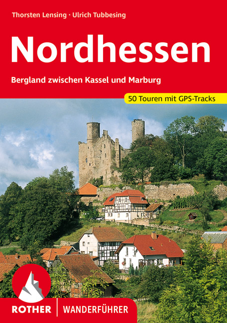
- Wandelgids Nordhessen | Rother Bergverlag
- Uitstekende wandelgids met een groot aantal dagtochten in dal en hooggebergte. Met praktische informatie en beperkt kaartmateriaal! Wandelingen in verschillende zwaarte weergegeven in rood/blauw/zwart. Im Herzen Deutschlands gelegen bildet das nordhessische Bergland zwischen Kassel und Marburg auf dem historischen Territorium des ehemaligen... Read more
Netherlands
2021
Netherlands
2015
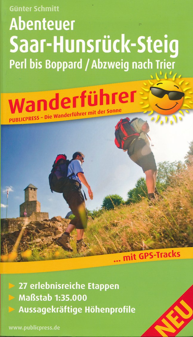
- Wandelgids Abenteuer Saar-Hunsrück-Steig | Publicpress
- Wanderführer mit 27 erlebnisreichen Etappen, Maßstab 1:35 000, aussagekräftigen Höhenprofilen und GPS-Tracks Read more
Netherlands
- City Maps Prenzlauer Berg Bezirk Germany
- City Maps Prenzlauer Berg Bezirk Germany is an easy to use small pocket book filled with all you need for your stay in the big city. Attractions, pubs, bars, restaurants, museums, convenience stores, clothing stores, shopping centers, marketplaces, police, emergency facilities are only some of the places you will find in this map. This... Read more
- Also available from:
- Bol.com, Belgium
Belgium
- City Maps Prenzlauer Berg Bezirk Germany
- City Maps Prenzlauer Berg Bezirk Germany is an easy to use small pocket book filled with all you need for your stay in the big city. Attractions, pubs, bars, restaurants, museums, convenience stores, clothing stores, shopping centers, marketplaces, police, emergency facilities are only some of the places you will find in this map. This... Read more
Netherlands
2019
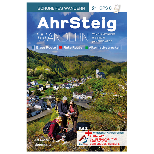
- Wandelgids Ahrsteig - von Blankenheim bis Sinzig | IdeeMedia
- Von Blankenheim bis Sinzig. Blaue Route. Verbindungswege. Rote Route. Rotweinwanderweg. Sahrbachtal. Dörflerblick-Schleife Read more
Maps

United Kingdom
- Pfalzerwald Mountainbike Park
- Pfalzerwald Mountainbike Park on a GPS compatible, topographic recreational map at 1:50,000 from the survey organization of Rhineland-Palatinate with cartography identical to the standard topographic survey of Germany but with additional extensive overprint highlighting local and long-distance hiking trails, cycle routes, sightseeing touring... Read more

United Kingdom
- Rhine Cycle Route 4 - Cologne to Hoek van Holland Bikeline Map-Guide
- The Rhine Cycle Route Part 4 – a 442-km long section from Cologne to the North Sea presented by Verlag Esterbauer in a guide with maps at 1:75,000 showing the route and its variants. Extensive information is conveyed by symbols, indicating road surface, campsites and other accommodation, repair workshops, recreational facilities, places of... Read more

United Kingdom
- Lower Middle Rhine: Bonn to Koblenz 35K Kümmerly + Frey Map No. 31
- Lower Middle Rhine: Bonn to Koblenz at 1:35,000 from Kümmerly+Frey in a series GPS compatible, double-sided maps printed on durable, waterproof and tear-resistant plastic paper; contoured, with hiking and cycle routes, other recreational activities, etc.Maps in this series are at a scale of either 1:50,000 or 1:35,000. Contour interval varies... Read more
United Kingdom
- Baltic Coast Cycle Route Part 3: Usedom - Gdansk (480km) Bikeline Map/Guide
- The Baltic Coast Cycle Route Part 3 – a 480-km long section from the island of Usedom and the Polish/German along the coast of Polish Pomerania to Gdansk presented by Verlag Esterbauer in a German language guide with maps at 1:75,000 showing the route and its variants. Extensive information is conveyed by symbols, indicating road surface,... Read more
United Kingdom
- Naturpark Mass - Schwalm - Nette 50K Kümmerly + Frey Map No. 62
- Naturpark Mass - Schwalm – Nette in Germany at 1:50,000 from Kümmerly+Frey in a series GPS compatible, double-sided maps printed on durable, waterproof and tear-resistant plastic paper; contoured, with hiking and cycle routes, other recreational activities, etc.Maps in this series are at a scale of either 1:50,000 or 1:35,000. Contour interval... Read more

United Kingdom
- EuroVelo 9 Cycle Route: Brno - Vienna - Maribor (550km) Bikeline Map/Guide
- A 550km section of the EuroVelo 9 from Brno in the Czech Republic, across eastern Austria including Vienna, to Maribor in north-eastern Slovenia presented by the Verlag Esterbauer in guide with maps at 1:75,000 showing the route and its variants. Extensive information is conveyed by symbols, indicating road surface, campsites and other... Read more

United Kingdom
- East Westphalia - Lippe - Bielefeld - Detmold - Gütersloh - Minden - Paderborn ADAC Street Atlas
- Eastern Westphalia - Lippe Region Street Atlas in a series of detailed atlases covering the whole of Germany at 1:20,000 with UTM coordinates for GPS navigation, postal codes and public transport, published by ADAC, the country’s largest motoring organization. The plans name all the individual streets and indicate all the main landmarks and... Read more

United Kingdom
- North Sea Coast Cycle Route 1 - Rotterdam to Leer Bikeline Map-Guide
- The North Sea Cycle Route Part 1 – a 455-km long section from Rotterdam to Lear presented by Verlag Esterbauer in a guide with maps at 1:75,000 showing the route and its variants. Extensive information is conveyed by symbols, indicating road surface, campsites and other accommodation, repair workshops, recreational facilities, places of... Read more

United Kingdom
- Werse - Ems Cycle Tour (202km) Bikeline Map/Guide
- Werse - Ems Cycle Tour, a 202-km long circuit in the area east of Münster and Hamm, between the Werse and the Ems, presented by the Verlag Esterbauer in guide with maps at 1:50,000 showing the route and its variants. Extensive information is conveyed by symbols, indicating road surface, campsites and other accommodation, repair workshops,... Read more

United Kingdom
- Stromberg-Murrtal Cycle Route - Idyllic Route
- Stromberg-Murrtal Cycle Route, presented by the Verlag Esterbauer in a guide with maps at 1:50,000 showing the route and its variants. Extensive information is conveyed by symbols, indicating road surface, campsites and other accommodation, repair workshops, recreational facilities, places of interest, etc. A list of various types of... Read more

United Kingdom
- Kurhessisches Bergland
- Kurhessisches Bergland area the German state of Hesse, stretching across both sides of the Fulda River between Kassel and Amöneburg, on a contoured, GPS compatible recreational map at 1:50,000 with cartography identical to the standard topographic survey of Germany and extensive additional overprint highlighting numerous local and long-distance... Read more

United Kingdom
- Südliches Märkisches Oderland
- Südliches Märkisches Oderland (No. 746), a detailed, GPS compatible map at 1:50,000 from Kompass with local and long-distance footpaths, cycling routes, accommodation, etc, printed on durable, waterproof and tear-resistant synthetic paper.KOMPASS HIKING & RECREATIONAL MAPS:This title is part of an extensive series covering Austria, much of... Read more

United Kingdom
- Rhine-Ruhr - Bochum - Dortmund - Duisburg - Essen - Münster ADAC Street Atlas
- Rhein-Ruhr Region Street Atlas in a series of detailed atlases covering the whole of Germany at 1:20,000 with UTM coordinates for GPS navigation, postal codes and public transport, published by ADAC, the country’s largest motoring organization. The plans name all the individual streets and indicate all the main landmarks and public buildings.... Read more

United Kingdom
- Rhine Cycle Route 3 - Mainz to Duisburg Bikeline Map-Guide
- The Rhine Cycle Route Part 3 – a 302-km long section from Mainz to Duisburg presented by Verlag Esterbauer in a guide with maps at 1:75,000 showing the route and its variants. Extensive information is conveyed by symbols, indicating road surface, campsites and other accommodation, repair workshops, recreational facilities, places of interest,... Read more

United Kingdom
- Lahn Valley Cycle Route - from Source to Rhine Bikeline Map-Guide
- Lahn Valley Cycle Route, a 247km long cycle route from the source to the Rhine presented by the Verlag Esterbauer in a guide with maps at 1:50,000 showing the route and its variants. Extensive information is conveyed by symbols, indicating road surface, campsites and other accommodation, repair workshops, recreational facilities, places of... Read more