
Italy
Description

Italy is a country of enormous diversity and contrast. Most famous are the Alps. Coming from the efficient neatness of Switzerland or Austria, the Italian Alps are wilder and at the same time more tranquil, like stepping back in time. The most beautiful and popular areas are Gran Paradiso, Val Grande, Stelvio and the Dolomites.
In addition there are countless national parks, all very much worth hiking through. A series of mountain ranges runs from north to south like a backbone, starting from the hills of Tuscany, to the Apennines and Abruzzo to Italy's toe, Calabria. Southern Italy, too far for many tourists, has several attractive hiking regions, like Pollino and Aspromonte.
In the Alps you can walk from hut to hut, elsewhere you can do day hikes, such is the rule in general. However some genuine long distance hiking trails are under construction. European long distance trail E10 in the Alps, which coincides with the 1000km long Grande Alpine Trail and the international Via Alpina. The second large project is the E1, which coincides with the Grand Apennine Mountains Trail and the Ligurian Mountains High Trail. If this trail is ever completed, you can start from Como passing Genova and continue all the way to Reggio di Calabria and Palermo or Siracuse on Sicily. The third large project means to join all these trails into one 6000km long Sentiero Italia. Last but not least, there is the Alta Via in the Dolomites: splendid walking.
Mountain huts abound in the Alps. Hiking can be done all summer, from June until well into October. Further south spring is the best hiking season. In April you will still get stuck in the snow up in the mountains. Autumn is supposed to be fine as well, but alas, as one hiker put it: "you wake up to the sounds of church bells and gunfire". As hunters, Italians are best avoided.
Map


Trails
- Alta Via dei GigantiGPX
- Alta Via dei Monti LiguriGPX
- Alta Via Della Valle d'Aosta No 1
- Alta Via Della Valle d'Aosta No 2
- Alta Via Dolomiti 1GPX
- Alta Via Dolomiti 10
- Alta Via Dolomiti 2GPX
- Alta Via Dolomiti 3GPX
- Alta Via Dolomiti 4GPX
- Alta Via Dolomiti 5
- Alta Via Dolomiti 6GPX
- Alta Via Dolomiti 7
- Alta Via Dolomiti 8
- Alta Via Dolomiti 9
- Bassa Via del GardaGPX
- Cinque Terre
- E1GPX
- E10GPX
- E12GPX
- E5GPX
- E7GPX
- Florence - Siena
- GoethewegGPX
- GR58 - Tour du QueyrasGPX
- Grande Escursione AppenninicaGPX
- Grande Traversata del Gran Paradiso
- Grande Traversata delle AlpiGPX
- Meraner HöhenwegGPX
- Pfunderer HöhenwegGPX
- Santiago de Compostela Pilgrims WayGPX
- Südalpenweg - 3GPX
- SeealpentourGPX
- Sentiero della PaceGPX
- Sentiero ItaliaGPX
- Sentiero Roma
- Tiroler Höhenweg
- TMB - Tour du Mont BlancGPX
- Tour des CombinsGPX
- Tour des Grands Barrages
- Tour du MatterhornGPX
- Tour Monte RosaGPX
- Traumpfad München-VenedigGPX
- Via AlpinaGPX
- Via FrancigenaGPX
- Via SacraGPX
- Via SbrinzGPX
- Via SplugaGPX
- Via ValtellinaGPX
Regions
- Abruzzi
- Adamello
- Aeolian Islands
- Alpi Biellesi e Cusiane
- Alpi di Livigno
- Alpi Liguri
- Alpi Marittime
- Alpi Oróbie e Bergamasche
- Alpi Sarentini
- Alpi Vicentine
- Alps
- Amalfi Coast
- Appennini
- Apulia
- Ötztal
- Bernina
- Brenta
- Calabria
- Cilento
- Defereggengebirge
- Dolomiti
- Dolomiti di Fiemme
- Elba
- Friuli
- Garda
- Gran Paradiso
- Grand Combin
- Julische Alpen
- Karawanken
- Karnischer Alpen
- Lago di Como
- Lago Maggiore
- Liguria
- Lombardia
- Matterhorn
- Moncenisio
- Monginevro
- Mont Blanc
- Monte Leone
- Monte Rosa
- Monti Sibillini
- Monviso
- Nonstaler Alpen
- Ortler
- Paganella
- Platta Gruppe
- Presanella
- Rieserfernergruppe
- Sardinia
- Südtirol
- Sesvenna Gruppe
- Sicilia
- Sobretta
- Stelvio
- Stubai
- Texelgruppe
- Tirol
- Toscana
- Trentino
- Umbria
- Val d'Aosta
- Val Grande
- Val Venosta
- Valle d'Aosta
- Veneto
- Vinschgau
- Zillertal
Mountains


Links
Facts
Reports
Guides and maps
Lodging
Organisations
Tour operators
GPS
Other
Books

United Kingdom
- Maremma Coast - Piombino - Follonica - Castiglione della Pascaia Kompass 2469
- The coast of Maremma at 1:50,000 from Kompass, on a map printed on durable, waterproof and tear-resistant synthetic paper. Coverage includes Piombino, Follonica, Castiglione della Pescaia, Marina di Grosseto, Wetulonia, Ribolla, Valpiana, Venturina, etc. Contours are at 40m intervals, with a 2-km UTM grid. Extensive overprint includes cycling... Read more

United Kingdom
- Pale di San Martino - Primiero San Martino di Castrozza - Paneveggio - Valle del Vanoi Kompass 622
- Pale di S.Martino - Fiera di Primiero - Panaveggio - Valle del Vanoi area at 1:25,000 on a durable, waterproof and tear-resistant map from Kompass in their series of detailed maps of the Dolomites.CARTOGRAPHY: Kompass maps of the Dolomites at 1:25,000 have contours at 25-m intervals. An overprint shows local and long-distance footpaths,... Read more

United Kingdom
- Bolzano and Environs Kompass 54
- Map No. 54, Bolzano and Environs, from Kompass, printed on waterproof and tear-resistant synthetic paper in a series of walking maps of selected areas of Italy at 1:50,000, with hiking routes on a topographic base, various types of accommodation, recreational facilities, places of interest, etc. Kompass are Europe’s largest publishers of... Read more

United Kingdom
2018
- Italian Sunflower Landscape Guide
- This new 3rd edition of Italian Lakes has been carefully revised just a few months prior to publication. The topo maps now show waypoints, and free downloadable GPS tracks are available for all the walks. Colour coding on the Contents page enables you to see at a glance the grading of various walks. These great expanses of water, bound to the... Read more

United Kingdom
- Cortina d`Ampezzo Kompass 55
- Map No. 55, Cortina d`Ampezzo - with a panorama map on the reverse, from Kompass, printed on sturdy, waterproof and tear-resistant synthetic paper in their series of walking maps of selected areas of Italy at 1:50,000, with hiking routes on a topographic base, various types of accommodation, recreational facilities, places of interest, etc.... Read more

- Also available from:
- De Zwerver, Netherlands


United Kingdom
2015
- The Way of St Francis
- Via di Francesco: From Florence to Assisi and Rome Read more
- Also available from:
- De Zwerver, Netherlands

Netherlands
2015
- Wandelgids - Pelgrimsroute The Way of St Francis - Via Francigena | Cicerone
- Guidebook to walking the Way of St Francis, Via di Francesco. 550km pilgrimage from Florence, through Assisi to Rome through Central Italy visiting key sites from the saint's life. Described in 28 stages, the guide to the month-long route includes detailed maps, profiles and information about all the shrines, churches and towns along the way. Read more


- Also available from:
- De Zwerver, Netherlands

Netherlands
2017
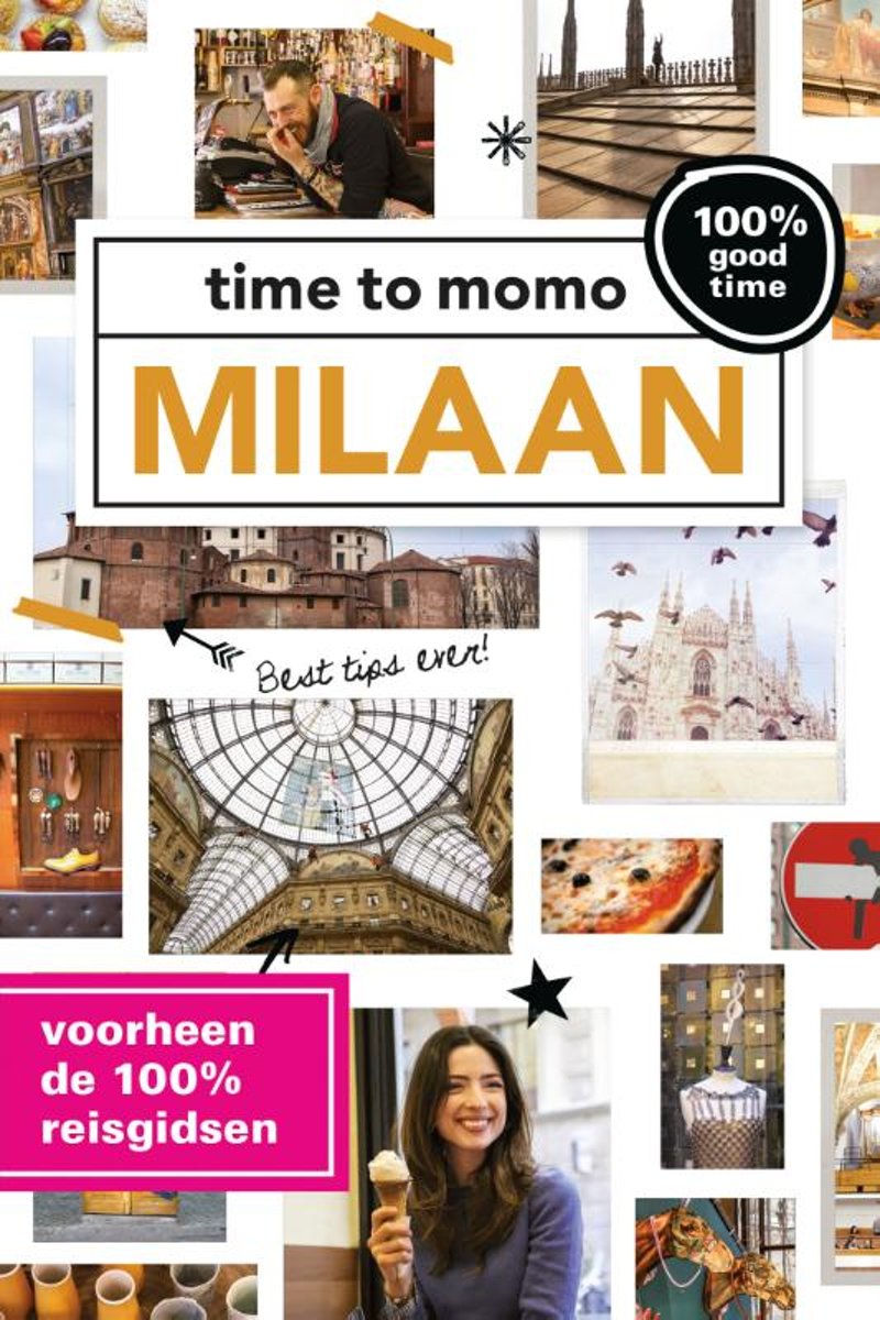
- Time to momo - Milaan
- Dit is de vernieuwde versie van de 100% Milaan reisgids! Jij gaat Milaan ontdekken! De mode- en designstad van Europa is een van de beter bewaarde geheimen. Gevoelsmatig is het misschien niet de meest aantrekkelijke stad, maar niets is minder waar. Milaan is de meest dynamische stad van Italië waar cultuur, shoppen, design en aperitivo-tentjes... Read more
- Also available from:
- Bol.com, Belgium
Belgium
2017
- Time to momo - Milaan
- Dit is de vernieuwde versie van de 100% Milaan reisgids! Jij gaat Milaan ontdekken! De mode- en designstad van Europa is een van de beter bewaarde geheimen. Gevoelsmatig is het misschien niet de meest aantrekkelijke stad, maar niets is minder waar. Milaan is de meest dynamische stad van Italië waar cultuur, shoppen, design en aperitivo-tentjes... Read more

Netherlands
- Let's Trail Caravaggio
- Caravaggio was the most famous painter of his time- a celebrity who could not keep out of trouble and whose travels through Italy and Malta make a gripping, exhilarating and ultimately uplifting trail for you to follow."Let's trail..." is the travel book series which takes you in the footsteps of remarkable people, taking you to places you... Read more
- Also available from:
- Bol.com, Belgium
Belgium
- Let's Trail Caravaggio
- Caravaggio was the most famous painter of his time- a celebrity who could not keep out of trouble and whose travels through Italy and Malta make a gripping, exhilarating and ultimately uplifting trail for you to follow."Let's trail..." is the travel book series which takes you in the footsteps of remarkable people, taking you to places you... Read more
Netherlands
2015
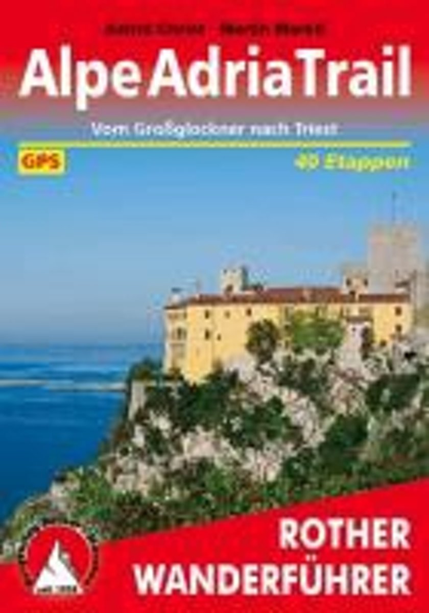
- Alpe-Adria-Trail
- Lange afstandswandelpad van 700km, onderverdeeld in 40 etappes van de Grossglockner in Karinthië door Slovenië en Friuli-Venezia Giulia naar Trieste. Deze handzame wandelgids bevat de routebeschrijving met wandelroutekaarten, hoogteprofielen en praktische informatie.Duitstalig 40 Höhenprofile, 40 Wanderkärtchen im Maßstab 1:75.000, eine... Read more
- Also available from:
- Bol.com, Belgium
Belgium
2015
- Alpe-Adria-Trail
- Lange afstandswandelpad van 700km, onderverdeeld in 40 etappes van de Grossglockner in Karinthië door Slovenië en Friuli-Venezia Giulia naar Trieste. Deze handzame wandelgids bevat de routebeschrijving met wandelroutekaarten, hoogteprofielen en praktische informatie.Duitstalig 40 Höhenprofile, 40 Wanderkärtchen im Maßstab 1:75.000, eine... Read more
Netherlands
2017
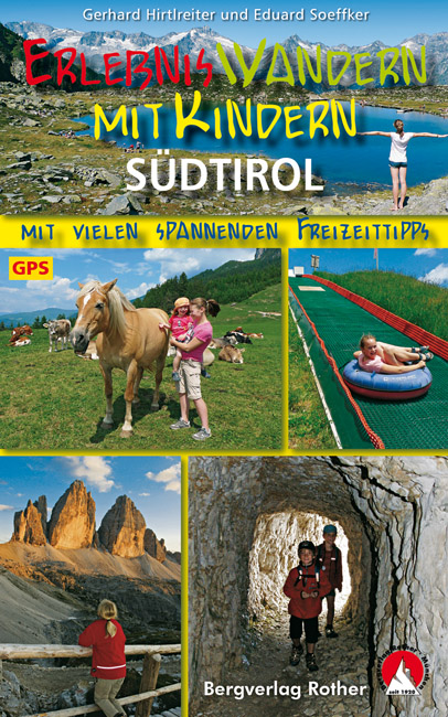
- Wandelgids Südtirol mit Kindern | Rother Bergverlag
- In Südtirol gibt es für Kinder viel zu erleben: Zwischen dem fast viertausend Meter hohen Ortler und den spektakulären Felszinnen der Dolomiten locken wilde Gebirgslandschaften mit Schluchten und Wasserfällen; die nicht nur die Kleinen zum Staunen bringen. Abenteuerparks und rasante Sommerrodelbahnen bieten Action, Erlebnisbäder und kleine Seen... Read more
Netherlands
2013
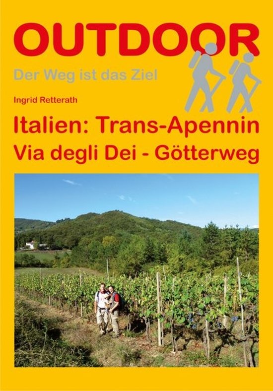
- Wandelgids - Pelgrimsroute Trans-Apennin, Via degli Dei - Gotterweg - Godenweg | Conrad Stein Verlag
- Der Weg ist das Ziel. 1. Auflage. Read more
Netherlands
- Zur Bedeutung Von Korper Und Medien in Ammanitis L'Ultimo Capodanno Dell'umanita Und Noves Il Mondo Dell'amore
- Studienarbeit aus dem Jahr 2013 im Fachbereich Romanistik - Italienische u. Sardische Sprache, Literatur, Landeskunde, Note: 1,7, Martin-Luther-Universitat Halle-Wittenberg, Sprache: Deutsch, Abstract: Lange Zeit war das staatliche Fernsehen in Italien gegenuber anderen Landern Europas im Ruckstand. Als jedoch 1976 der erste landesweit zu... Read more
- Also available from:
- Bol.com, Belgium
Belgium
- Zur Bedeutung Von Korper Und Medien in Ammanitis L'Ultimo Capodanno Dell'umanita Und Noves Il Mondo Dell'amore
- Studienarbeit aus dem Jahr 2013 im Fachbereich Romanistik - Italienische u. Sardische Sprache, Literatur, Landeskunde, Note: 1,7, Martin-Luther-Universitat Halle-Wittenberg, Sprache: Deutsch, Abstract: Lange Zeit war das staatliche Fernsehen in Italien gegenuber anderen Landern Europas im Ruckstand. Als jedoch 1976 der erste landesweit zu... Read more
Maps

United Kingdom
- Strada del Vino / Sudtiroler Weinstrasse Tabacco 049
- Strada del Vino/Sudtiroler Weinstrasse area in a series of Tabacco maps at 1:25,000 covering the Dolomites and the mountains of north-eastern Italy - Stanfords’ most popular coverage for this region, with excellent cartography and extensive overprint for hiking routes and other recreational activities, local bus stops, etc.To see the list of... Read more
- Also available from:
- De Zwerver, Netherlands

Netherlands
- Wandelkaart 049 Südtiroler Weinstrasse - Strada del Vino | Tabacco Editrice
- Strada del Vino/Sudtiroler Weinstrasse area in a series of Tabacco maps at 1:25,000 covering the Dolomites and the mountains of north-eastern Italy - Stanfords Read more

United Kingdom
- Urzulei
- Urzulei area at 1:25,000 in a series of contoured maps from Ed. Abies. Overprint highlights 19 hiking paths from three hours long to a two-day route. Symbols show viewpoints, caves, archaeological sites, exceptional trees and other landscape features of particular interest. This title has no UTM grid.*Main series at 1:60,000 (Nos. 1 to 12)*The... Read more

United Kingdom
- Marsala Global Map Street Plan
- Marsala on an indexed street plan at 1:6,000 from Litografia Artistica Cartografica in their Global Map edition. 34 monuments including historic buildings and churches, cultural or educational institutions, and important municipal buildings or facilities are numbered and listed next to the plan. An inset covers Isola di San Pantaleo (Mozia)... Read more

United Kingdom
2016
- Mondovì - Val Ellero - Val Maudagna - Val Corsaglia - Val Casotto Fraternali Editore 22
- Val Vermenagna - Valle Pesio - Alta Valle Ellero area of the Italian Alps presented at 1:25,000 in a series of large, contoured and GPS compatible walking maps from Fraternali Editore, printed on light, waterproof and tear-resistant synthetic paper. Maps in this series have topography shown by contour lines at 5m intervals with relief shading,... Read more

United Kingdom
2010
- Turin - Pinerolo - Lower Susa Valley 50K IGC Map No. 17
- Turin - Pinerolo - Lower Susa Valley area of Piedmont in a series contoured hiking maps at 1:50,000 with local trails, long-distance footpaths, mountain accommodation, etc. from the Turin based Istituto Geografico Centrale.Maps in this series have contours at 50m intervals, enhanced by shading and graphic relief. An overprint highlights local... Read more

United Kingdom
- Lana - Val d`Adige / Etschtal Tabacco 046
- Lana - Val d`Adige/Etschtal area in a series of Tabacco maps at 1:25,000 covering the Dolomites and the mountains of north-eastern Italy - Stanfords’ most popular coverage for this region, with excellent cartography and extensive overprint for hiking routes and other recreational activities, local bus stops, etc. Additional overprint in this... Read more
- Also available from:
- De Zwerver, Netherlands

Netherlands
- Wandelkaart 046 Lana - Etschtal - Lana - Val d'Adige | Tabacco Editrice
- Lana - Val d'Adige/Etschtal area in a series of Tabacco maps at 1:25,000 covering the Dolomites and the mountains of north-eastern Italy - Stanfords Read more

United Kingdom
- Valpelline Swisstopo 293
- Valpelline, map No. 293, in the standard topographic survey of Switzerland at 1:50,000 from Swisstopo, i.e. without the special overprint highlighting walking trails, local bus stops, etc, presented in Swisstopo’s hiking editions of the 50K survey. The map covers mainly the Italian side of the border, with only a small part of Switzerland shown... Read more

United Kingdom
2015
- Susa, Chisone & Germanasca Valleys: Sestiere - Sauze d`Oulx - Bardonecia 50K IGC Map No. 1
- Susa, Chisone and Germanasca Valleys, with coverage including Sestiere, Sauze d`Oulx and Bardonecia, in a series of contoured hiking maps at 1:50,000 with local trails, long-distance footpaths, mountain accommodation, etc. from the Turin based Istituto Geografico Centrale.Maps in this series have contours at 50m intervals, enhanced by shading... Read more

United Kingdom
- Laces / Latsch - Val Martello / Martell - Silandro / Schlanders Tabacco 045
- Laces/Latsch - Val Martello/Martell - Silandro/Schlanders area in a series of Tabacco maps at 1:25,000 covering the Dolomites and the mountains of north-eastern Italy - Stanfords’ most popular coverage for this region, with excellent cartography and extensive overprint for hiking routes and other recreational activities, local bus stops, etc.... Read more

United Kingdom
2018
- Alta Valle Maira
- Alta Valle Maira in the Italian Alps presented at 1:25,000 in a series of large, contoured and GPS compatible walking maps from Fraternali Editore, printed on light, waterproof and tear-resistant synthetic paper. Maps in this series have topography shown by contour lines at 5m intervals with relief shading, spot heights, and colouring and/or... Read more

United Kingdom
- Forni di Sopra - Ampezzo - Sàuris - Alta Val Taglimento Tabacco 02
- Forni di Sopra - Ampezzo - Sàuris - Alta Val Taglimento area in a series of Tabacco maps at 1:25,000 covering the Dolomites and the mountains of north-eastern Italy - Stanfords’ most popular coverage for this region, with excellent cartography and extensive overprint for hiking routes and other recreational activities, local bus stops, etc.... Read more
- Also available from:
- De Zwerver, Netherlands

Netherlands
- Wandelkaart 02 Forni di Sopra - Ampezzo - Sauris - Alta Val Tagliamento | Tabacco Editrice
- De beste wandelkaarten voor de Dolomieten. Zeer veel topografische details met secure hoogtelijnen (25 meter interval), helder kleurgebruik en bijna alle Tabacco kaarten hebben een UTM grid (voor GPS toepasbaar). Daarnaast zijn op deze wandelkaarten wandelroutes ingetekend met nummering gelijk aan markering onderweg aangebracht door de lokale... Read more

United Kingdom
- Lake Bracciano - Monti della Tolfa - Civitavecchia Global Map Tourist Map
- Lake Bracciano - Monti della Tolfa – Civitavecchia area of Lazio north-west of Rome presented at 1:50,000 on a double-sided, detailed, contoured map from LAC in their GlobalMap imprint, highlighting sightseeing itineraries and various places of interest.Topography is shown by contours and relief shading, plus numerous spot heights and colouring... Read more

United Kingdom
- Valsesia - Val Mastallone - Boccioleto - Rossa - Varallo Geo4Map 3
- 1:25,000 hiking map to the north east of Valsesia centred on Fobello including Rimella, Varallo, Rossa and Boccioleto.Published in association with the CAI, the Italian Alpine Club, who are responsible for the trails. Trails are marked on the map. The key information and more detailed information on the rear of the sheet are in Italian, German... Read more

United Kingdom
2019
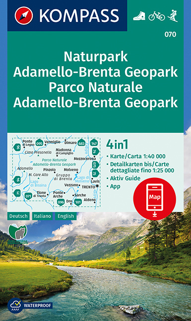
- Adamello-Brenta Geopark NP Kompass 070
- Map No. 070, Adamello-Brenta NP, from Kompass in a series providing detailed coverage of the Dolomites and Lake Garda area and supplementing their main series of walking maps of Italy at 1:50,000. Maps in this series have a more detailed base and smaller contour interval than coverage at 1:50,000.*Cartography:* maps at 1:25,000 have contours at... Read more
- Also available from:
- De Zwerver, Netherlands
Netherlands
2019
- Wandelkaart 070 Naturpark Adamello-Brenta Geopark - Parco Naturale Adamello-Brenta Geopark | Kompass
- Goede wandelkaart met vrijwel alle topografische details en ingetekende routes. Ook met symbolen voor toeristische bezienswaardigheden, register. Berghutten duidelijk weergegeven. Gevaarlijke wandelroutes zijn goed herkenbaar. Inclusief een Duitstalig boekje met informatie en routesuggesties. KOMPASS Karten enthalten alles Wissenswerte f�r den... Read more

United Kingdom
- Val Tramontina - Val Cosa - Val d`Arzino Tabacco 028
- Val Tramontina - Val Cosa - Val d`Arzino area in a series of Tabacco maps at 1:25,000 covering the Dolomites and the mountains of north-eastern Italy - Stanfords’ most popular coverage for this region, with excellent cartography and extensive overprint for hiking routes and other recreational activities, local bus stops, etc. To see the list of... Read more
- Also available from:
- De Zwerver, Netherlands

Netherlands
- Wandelkaart 028 Val Tramontina - Val Cosa - Val Meduna- Val d' Arzino | Tabacco Editrice
- Val Tramontina - Val Cosa - Val d`Arzino area in a series of Tabacco maps at 1:25,000 covering the Dolomites and the mountains of north-eastern Italy - Stanfords’ most popular coverage for this region, with excellent cartography and extensive overprint for hiking routes and other recreational activities, local bus stops, etc. To see the list of... Read more